March 12th, 2025
We crossed the state line from the NT to Queensland in the late morning, stopping for petrol in the first little town of Camooweal ($2.26 – first opportunity since last night. Then it was on the bigger city Mount Isa with cheaper petrol at $1.96 and a Woollies to stock up. Fran was still feeling crappy but walking around seems to keep the coughing to a minimum.
We grabbed some food for lunch and ate while driving as we’d decided to push on to McKinlay for the night. We’d already done 450 km / 280 mi but Doug felt he had another 250 km / 155 mi of driving left in him. That may have been a mistake as we had to stop for breaks a lot and we’ve decided not to push that far again.
Today we saw a bustard, a roo who stood in the middle of the road and then took off.
We arrived a the “Walkabout Creek Hotel” which was closed till 5 so we parked up in behind in their caravan park. We got set up and walked over at 5 and the door was open. We paid $35 for the night, had a couple of beers, bought a bar mat:


and then settled in for the night.
Thursday and Friday were driving days; other then petrol and campgrounds (Hughenden Thursday night and Atherton Friday night), we didn’t do much. The scenery was pretty flat, lots of cattle and it was mostly sunny. We did see 3 more bustards, lots of ibis and cattle, 1 cat and the never ending flies! This was our last dip into the outback – now we got northwest.
At one point on Thursday, a huge truck carrying stacked hay passed us by and a lot of debris hit Matilda. We didn’t think too much of it as nothing visible appeared by Friday morning, Doug saw a running crack in the windshield starting below the wiper; we’ve marked the spot on the inside of the window and we’ll monitor it.
We arrived in Atherton on Friday afternoon after 525 km / 326 mi – today was saw plenty of cattle, a wild dog, 2 bustards and 2 roos. We noticed upon leaving that the temperature was cooler this morning and there’s no flies!
We entered the tablelands of Queensland – a lush green area with lots and lots of fields of sugar cane, bananas, avocados and so much more.


We passed over “water on the road” three times:

For more pics of the above, check this out.
We reached altitudes along “the Great Inland Road” (Hwy 62) of over 1100 m at one point. It’s much hilly here, a lot more trees, the roads as windy like the old Sooke Road used to be back in the day. It’s becoming a rainforest, literally, as it clouded over by late morning and we had on and off sprinkles and by the time we got to Atherton it was out and out raining which lasted most of the night.
Saturday, we headed north for the last time in Australia – our destination today is the Daintree National Park – what they claim is the world oldest tropical rainforest.
The Daintree National Park is located in far north of the state of Queensland, Australia about 100 km / 62 mi northwest of the city of Cairns. It was founded in 1981 and is part of the Wet Tropics of Queensland. In 1988, it became a UNESCO World Heritage site.
The most spectacular and oldest part of the Daintree Rainforest is north of the Daintree River. After crossing the river on an old fashioned cable ferry there is a range of boardwalks and untouched beaches to explore, and the endangered cassowary can be encountered anywhere.
Daintree National Park is valued because of its exceptional biodiversity. It contains significant habitat for rare species and prolific birdlife.
Cape Tribulation lies in the park. Originally the cape belonged to Cape Tribulation National Park from 1981 but was amalgamated into Daintree National Park in 1983. This section covers 17,000 ha (42,000 acres) including coastal ranges and contains Australia’s last extensive stands of lowland rainforest. It has extensive (and relatively) unspoiled beaches fringed with the increasingly rare (beachside) rainforest. Much of the coastal flatlands, especially to the south of the Alexandra range, and in Cow Bay, were cleared for agriculture in the late 1800s with a major clearing push in the 1970s. A lot of this has since recovered or has been settled.
The Daintree National Park’s traditional owners are the Eastern Kukyu Yalanji Aboriginal people.
Much of the national park is covered by tropical rainforest., The Greater Daintree Rainforest has existed continuously for more than 130 million years, making it possibly the oldest existing rainforest. The persistence of this rainforest is believed to be a product of a fortuitous continental drift; after the breakup of its parent supercontinent a portion drifted toward the pole to become Antarctica, disturbing ocean currents and becoming quite chilly, while other portions were moved to hotter and drier locations. The rainforests of the parent continent preserved its climate, and so also its original trees. Tree species, once thought to be long extinct, have only relatively recently been discovered here.
It’s still raining off and on, sometimes quite hard and it’s quite socked in. It took us about an hour along the windy, hilly road to reach the Daintree River where you take the ferry across into the main part of the park. It’s about a five minute crossing and the cost is $47 AUD return – there is no park entrance fee.


The road in the park is paved and goes all the way up to Cape Tribulation and turns to 4×4 if you so choose to continue along the road – in this weather, we’re not even thinking about it. Besides, the part we wanted to see was at Cape Tribulation.


Now this park is known for cassowary sightings which we hoped we’d lucky enough to see. We’d first seen these strange birds on a David Attenborough special about Australia.
We stopped at the Discovery Centre to get information about the park in case there was something we weren’t aware of and did learn a little. The Centre is a set of ground and canopy boardwalks that take you to a tower you can climb to be above the trees. We’ve done this before and in this weather we opted not to pay the $36 to walk in the rain!

We drove the 35 km / 22 mi road which is super windy, very narrow and had a few construction zones on it. In December of 2023, the park was hit by a cyclone followed by flooding the following year so it’s been difficult keeping up with roadwork.
Our first stop was at a Lookout where we saw this:

Then we turned off on the road to Cow Bay where the fellow at the Centre told us he’s seen the birds several times but had not luck.
Here’s what Cow Bay Beach looks like but you DON’T want to swim there:


 and about ten minutes later the rain stopped and held off for a couple hours. We made it to Cape Tribulation all the while watching for cassowaries.
Many times there was water over bridges at overflowing creeks and lots of temporary waterfalls:


At Cape Tribulation we took the very nicely made boardwalk through the rainforest to Myall beach on the “Coral Sea”.


By now it’s lunchtime, so upon returning to the parking lot, we went up the road a bit into the built up area and found the Turtle Rock Cafe for lunch.
We’d seen enough of the rainforest (we’ve really seen SO many in our travels) and decided to just head back to the ferry and maybe try and see a beach or two enroute; this did not pan out as the parking areas next to the beaches seemed to have the beach accesses blocked off. Also, no luck with cassowary sightings – darn.
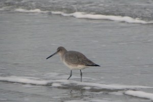
The photo at the top of this post is a cassowary.
We took the ferry back south and opted not to drive much further and Fran found a municipal campground in Mossman which we drove to and for the seniors rate of $45 we got a powered site (the rain had begun again and it was forecast through the night so although it’s not hot, its super muggy), with bathrooms, camp kitchen, dump site and Wi-Fi. It’s a grass site with a concrete slab and she put us in a “higher” site so we wouldn’t get flooded out if the rain was heavy all night.
Note: the park on the north side of the river was closed for a few days starting the next day – too much rain and roads were flooded so even though we didn’t get sunshine, we were darn lucky for it to be dry and that we did not get here a day later!
Although it did rain all night, it was not heavy and we were safe come morning, despite neither of us sleeping that well. Fran is on the downside of her cold, more of a dry cough now than wet, but Doug appears to be at the drowsy stage and did not feel like doing his long run today (or yesterday). We’ve decided to not drive too far today and then find a place for two nights.
Drive into Mossman:

We took more photos than the above, and you can see them here.
We left after Doug went for a walk in the rain, then drove to Palm Cove to an NRMA campground for $79 for two nights with all amenities. It’s right off the beach and there’s a jetty just outside the campground to go for a walk on. The drive from Mossman is along the Captain Cook Highway and it feels like driving on Vancouver Island. Sometimes you see the sea, sometimes you are in the forest with mountains on one side.
Enroute we pulled into Port Douglas at the Flagstaff Hill lookout to see the town’s Four Mile beach from up above. This coast of Australia, especially in Queensland, has beaches that are not all that safe for swimming; between the stinger rays from November to May, there are the crocs. If you look closely at the beach photo, you can see a large white rectangle – this is a “protected” zone with a stinger/croc fence for safe swimming.


 This town is a very upscale holiday town with fancy homes, condos, golf courses and upscale shops but has very pretty palm lined streets.
Further down the Captain Cook Highway, we drove along the shore at times and more beach driving albeit a short one as there are too many trees.
then stopped at Rex Lookout
 We reached Palm Cove just after 10 and this was probably the busiest campground we’ve been at in a few weeks. There were spaces but actually it’s not that large; she gave us a choice of six, we picked one and settled in under the palm trees. It’s quite a lovely park.
 Doug went to lie down right away to try and rest and after working a bit Fran went to the camp kitchen to make some hot breakfast. It was another day of on and off rain; hard at times but we are in a level spot and feel comfortable.
It rained for the rest of the day, all night and all day on Monday – the wettest we’ve had it in this country! Feels like Vancouver in November but warmer of course.
Fran now feels about 85% well (slept pretty good with no huge coughing fits) and Doug has a wet cough now but nowhere as deep as Fran’s – he’ll probably recover faster.
We both went for walks in the morning using umbrellas and spent the afternoon in the rig after borrowing the camp kitchen’s toaster for brekkie.
Here’s some shots Fran took along the beach boardwalk:


Fran got a lot of “work” done on the website and feels not so far behind anymore.
We figure we have maybe 4-6 weeks left before we’re done Australia and have begun looking at our route back to North America – we don’t want to do the direct flight and have to deal with the time change so we’ve narrowed it down to going to Fiji, then Samoa, then Kauai before hitting the mainland. Doug has been investigating flights and how we’ll travel on the islands in the South Pacific. Naturally we want to do some snorkeling too, at least in Fiji which is famous for its Rainbow Reef.
It stopped raining for about two hours in the late afternoon but started up again and was still raining in the morning. We left on Tuesday at 7:40 as Doug had made a dentist appointment in town. He’s been experiencing some pain at the site of the root canal he had done in Vietnam and was concerned the tooth might be cracked. It wasn’t luckily and the dentist said root canal pain sometimes last months so not to worry (this happened to him back in Brazil too).
Views along the road southbound as the rain continues:


This link will take you to more photos of the part of the journey.
We drove into Cairns hoping to walk the beach and see the views but it was still raining quite hard and not pleasant looking at all. We found diesel at $1.76 and filled up. So we didn’t really see much of Cairns.
Our mission today was to find a cassowary. We are headed to South Mission Beach where the highest concentration of them in the country are found. The highway here is called the Cassowary Road along the Cassowary Coast.
Shortly after Innisfail, Doug began to feel sudden sharp chest pain. It wasn’t going away so we turned around and headed towards the hospital just in case. One minute before arriving there, the pain subsided and we figured it was a pinched nerve as there were no other symptoms.
Fran had googled best places to see the birds and there are three spots in South Mission Beach so we headed that way; this was at the entrance to town:

we headed toward the first lodge they are often seen at, and lo and behold, at the first lodge, we spotted one outside the lodge about 3m from the vehicle.
Cassowaries are flightless birds are native to the tropical forests of New Guinea (and surrounding islands and northeastern Australia. Three cassowary species exist: the most common, the southern cassowary is the third-tallest and second-heaviest living bird, smaller only than the ostrich and emu and is the species found in Australia. The other two species are the northern cassowary and dwarf or pygmy cassowary found in New Guinea’s regions.

Cassowaries are very wary of humans, but if provoked, they are capable of inflicting serious, even fatal, injuries. They are known to attack both dogs and people. The cassowary has often been labeled “the world’s most dangerous bird”, although in terms of recorded statistics, it pales in comparison to the ostrich, which kills two to three humans per year in South Africa.
Typically, all cassowaries are shy birds that are found in the deep forest. They are adept at disappearing long before a human knows they are there. The southern cassowary is not well studied, and the northern and dwarf cassowaries even less so. Females are larger and more brightly coloured than the males. Adult southern cassowaries are 1.5-8 m / 4-6’ tall, although some females may reach 2 m / 6’, and weigh 58-70 kg / 130-50 lbs.
Unlike the majority of birds, cassowaries lack a tongue. Their beaks are pointed, sharp and robust but not serrated, which allows them to pick up fruit more easily than the short bills of an emu or an ostrich. Cassowaries have three-toed feet with sharp claws. The inner (first) toe has a dagger-like claw that may be 125 mm /5” long. This claw is particularly fearsome, since cassowaries will sometimes kick humans or other animals with their powerful legs. Cassowaries can run at up to 50 kph / 30 mph through the dense forest and can jump up to 1.5m / 5’. They are good swimmers, crossing wide rivers and swimming in the sea.

All three species have a keratinous, skin-covered casque on their heads that grows with age. The casque’s shape and size, up to 18 cm / 7”, is species-dependent. Several functions for the casque have been proposed. One is that they are a secondary sexual characteristic. Other suggested functions include batting through the underbrush, as a weapon in dominance disputes, or pushing aside leaf litter during foraging or another suggests that the casque amplifies deep sounds. Recent study suggests that casque acts as a thermal radiator, offloading heat at high temperatures and restricting heat loss at low temperatures. The average lifespan of wild cassowaries is approximately 18–20 years, with those held in captivity living up to 40 years.
We continued south to the other two spots after grocery shopping but had no luck. Really, we were probably pushing it, having seen one. We are very happy.
So we decided to push on and try and get close to Townsville today to have a shorter drive tomorrow as we have to be in Airlie Beach on Thursday. However, the weather gods were not with us as the highway south of Cardwell all the way to Ingham (54 km) was closed due to a river overflowing! We stopped for petrol right after we saw the sign as we once again saw diesel at $1.76 and we were told it might open at 7pm otherwise, hopefully, tomorrow. We hope so too! Luckily, there was a caravan park 200m back on the highway and we checked in there. For $45 we got a spot with a slab; it’s an older park but still functional; there’s the usual plus a pool and Wi-Fi. We got settled, Fran put a bunch of wet/damp clothes in the dryer and we stayed indoors the rest of the afternoon hoping for the weather to clear. It rained on and off most of the night, at times quite hard and when we woke up on Wednesday the road was still closed.

Thomas and Sandra reached out and asked how we were and said everything they read said the road wouldn’t open today and maybe we should reschedule. Fran found a huge detour route that added 800 km / 500 mi to the route but first she called the Boat Tour company and we were within the 48 hour non cancellation period so unless we wanted to pay a $10 surcharge each, we would lose our spot. In the meantime, Doug went to talk to some of the truckers parked along the highway here in Cardwell and they too were pessimistic and one showed Doug a photo that showed the flooding was quite extensive and you couldn’t even see the other side of the river as it flooded the road. This did not sound good, so wanting to be in control of our own fate, we opted to do the detour – we could easily do it in two days.
So instead of a 500 km / 300 mi drive to Airlie Beach, we now had nearly 1300 km / 800 mi but once we got going Fran found an alternate route that cut off over 200 km so now we only have a 1000 km / 600 mile drive. When we left at 8am it was not raining but within a half it began and was on and off for a couple of hours, then once we were further west when we finally felt like we were out of the rainforest, it stopped but never cleared and then again after 1pm it began again on and off, sometimes quite hard. As we passed by the Mission Beach area we saw cassowary crossing signs again, but none showed up.
About 100 km / 60 mi from the place we’d decided to stay the night we began to see these strange blue UFO patches in the sky – WTH were they?!
They were only visible for about twenty minutes and they were gone. We arrived at a caravan park outside Charters Towers just after three and for $43 we got a powered site with the usual amenities including a pool and Wi-Fi. It continued to rain lightly off and on most of the night and we woke up to the same.

Before going to bed Fran checked the highway report and the road that was closed was open again but only one lane with long delays. Next morning she checked again and it was closed – she heard later that they had opened the road for a few hours at low tide.
The above part of the drive is covered in photos here.
So tomorrow we have less than 400 km / 250 mi to go and that SHOULD be no problem. Doug went for his run in the morning, Fran did her yoga, we did our chores and left around 8 again. The route was slightly longer as a different minor road we had hoped to take was closed due to flooding so that added 45 km to the route.
Before getting to the campground we stopped for lunch and Subway and then at a windshield place to see about repairing the crack – they wouldn’t do it – only replace it so we’ll wait a little longer. Our insurance will cover it with a $200 deductible up to $500 so we’d rather repair it than replace it IF we can.
We got to Airlie Beach just before two, managed to get the campsite beside Thomas and Sandra and got set up; of course it was still raining! At 5pm we had happy hour with them and managed to stay dry while sitting on the concrete slab at our site. We made plans to leave together tomorrow morning for our boat cruise to Whitehaven beach on Whitsunday Island and had a quiet night.
Fran’s body is so used to waking up around 2am to cough, she seems to be waking up then without even coughing a good night’s sleeps is still to be had! She feels about 95% now but is still quite tired..
Note: Queensland is nicknamed “The Sunshine State” but we’ve not see much of it since a week ago; just the wet sunshine like BC!