

January 13thth, 2025
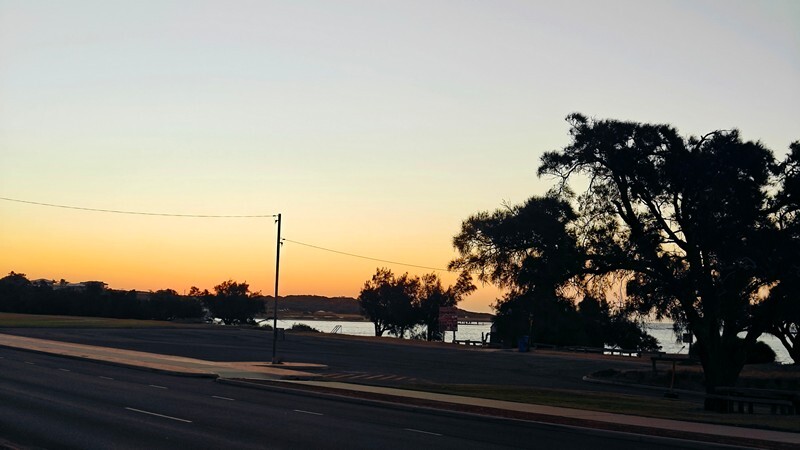
After leaving Perth, we found a dump point in a rest area (didn’t want to dump the tank in our friends’ toilet!) and only went as far as Lancelin where the Lancelin Holiday Park gave us power, water, Wi-Fi, ablutions, a swimming pool with a spa (not very hot though and full of kids!) as well as games rooms, playground and laundry for $63 a night – a bit pricey but pickings are slim for spots with power around here. After parking, we grabbed a couple of beers in our new cozies and walked over to check out the beach.

We are now at the start of the “Turquoise Coast” – if you been following along, you might recall that we did the “Sapphire Coast” back in November in New South Wales on the east coast.
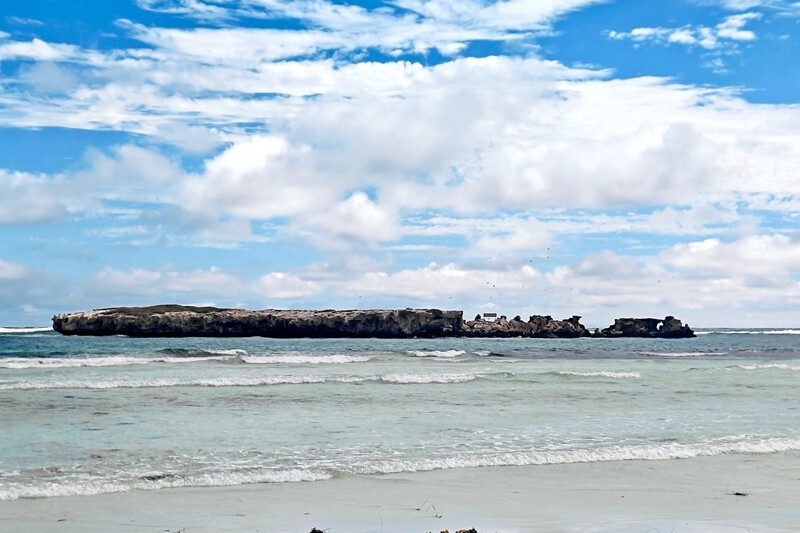
While the sand was a lovely white colour, there was way too much sea grass and kelp on shore for our liking. There was a lovely view though and white dunes. We could see a ship wreck in the distance as well as Edwards Island:
We walked back to our site and sat and read sitting outside while it became overcast. Had we made a mistake getting a campground because it seemed to be cooling off? However, the forecast still said it wouldn’t cool off much over night. The wind picked up, it rained a bit and then the sky mostly cleared up. We did use the AC overnight as it was a little muggy as well. We both slept quite well too.
For link to more photos, click here. (this album includes some of Perth as well.)
Tuesday, we awoke to clearing skies and warming temperatures. We left the caravan park just before ten and continued on the Indian Ocean Road to Jurien Bay where we arrived around noon. Enroute we saw this sign several times:

but other than one dead roo, we saw nothing – considering the area had lots of burned out looking trees, it was not surprising. The first part of the road was not too close to the shore but there was definitely sand, sand and more sand with lots of dunes with and without vegetation in view as well as forests that had probably been burned in the past couple of years.


We did stop at the “Wedge” lookout and saw the ocean in the distance and burnt forests in the foreground:


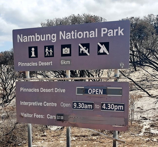
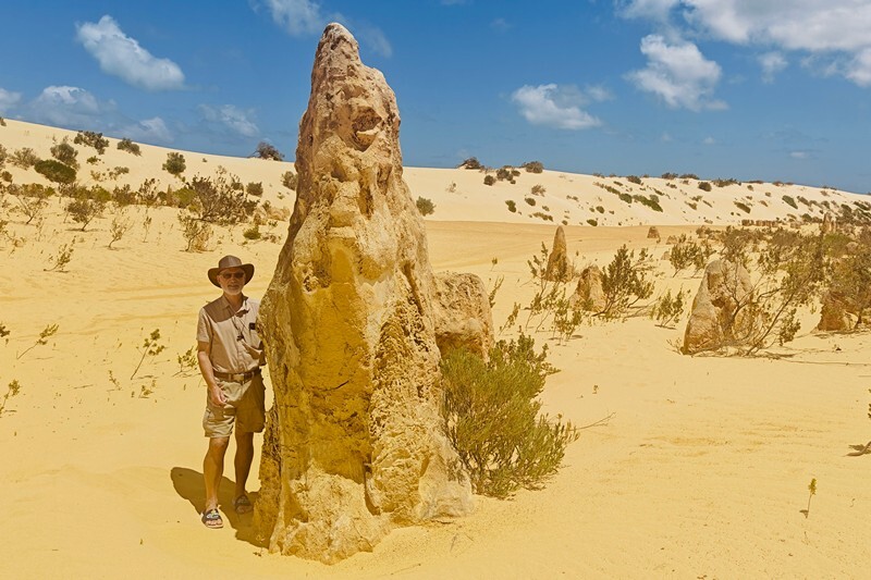
We had long ago pinged on our Australian list of things to see, the Nambung National Park to see the “pinnacles desert”. This was a worthy stop.
We paid nothing because we had the park pass and after parking went into the Visitor’s Centre.
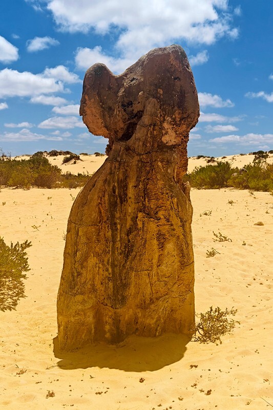
The Pinnacles Desert contains thousands of limestone pillars. The pillars are the weathered and eroded fragments of limestone beds composed of deposited marine organisms such as coral and mollusks. Some of the tallest pinnacles reach heights of up to 3.5m above the yellow sand base. The different types of formations include ones which are much taller than they are wide and resemble columns—suggesting the name of Pinnacles—while others are only a metre or so in height and width resembling short tombstones. A cross-bedding structure can be observed in many pinnacles where the angle of deposited sand changed suddenly due to changes in prevailing winds during formation of the limestone beds. Pinnacles with tops similar to mushrooms are created when the calcrete capping is harder than the limestone layer below it. The relatively softer lower layers weather and erode at a faster rate than the top layer leaving behind more material at the top of the pinnacle.
Afterwards we took the Pinnacles Circle Drive and also drove the out and back north road as well as making a few stops for photo ops. 


In case you want to see more, here’s a link to more photos of the park.
Jurien Bay used to have a “snorkel trail” and we’d found it on the map but only today we learned it was closed – destroyed in a cyclone in 2012. We went to check out the beach anyway – there is a jetty to walk out on and it was was quite lovely but not that deep of a beach and it was super windy (although today it was supposed to be super windy everywhere along this part of the coast). Since it was still early, we made the decision not to stay there and move on further to Port Denison to a campground there.


The Indian Ocean Road was closed a little ways past Leeman so we had to detour and miss 49 km / 29 mi of it which was a bummer because that the was the part of the road closest to the coast!

The drive inland 33 km / 20 mi took us through green landscapes and then into farmland before reaching the Brand Highway (the A1 – which is the “Big Lap” highway around the country). It veered inland again to Port Denison, where we got diesel for $1.75 a litre – again as we head into more remote areas, the prices will jump.
Along today’s drive as on a couple of other days, we saw these weird trees:
Turns out they are called Xanthorrhoea aka “Grass Trees”.
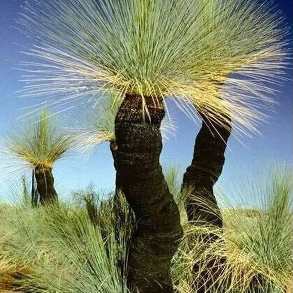
They are a type of succulent that are perennials. Many, but not all, species develop an above ground stem. The stem may take up to twenty years to emerge. The main stem or branches continue to develop beneath the crown. This is rough-surfaced, built from accumulated leaf-bases around the secondarily thickened trunk. The trunk is sometimes unbranched, some species will branch if the growing point is damaged, and others naturally grow numerous branches.
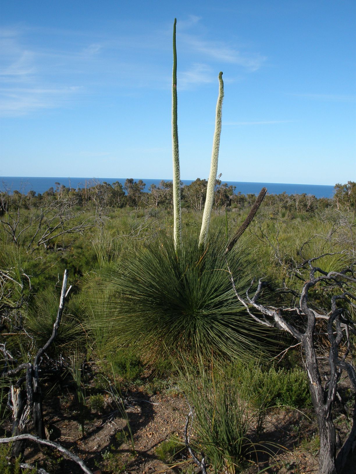
Flowers are born on a long spike above a bare section called a “scape”; the total length can be over three to four metres long in some species. Flowering occurs in a distinct period, which varies for each species, and often stimulated by bush fire. Fires will burn the leaves and blacken the trunk, but the plant survives as the dead leaves around the stem serve as insulation against the heat of a wildfire. Many Xanthorrhoeas bloom for the first time when they are one-hundred or more years of age.
We have some video as we drove by a large number of them:
We first saw these back in the Stirling Range National Park but forgot to research them.
We got to the Dongara Denison Tourist Park around 3 and after parking, went to check out the beach (of course!). It was quite a lovely colour – more a sea foam green but it was not easy to access, was so windy our hats could not stay on our heads and the there was plenty of sea grass at this end.


We returned to Matilda and read for a while under the awning before Doug installed a new light in the kitchen. We had another great quiet night with a good sleep.
We left the campground in Port Denison before 8 the next morning, stopped in the larger city of Geraldton to stock up a bit more before heading quite north (Monique had advised us to do this) and then made our way to the Kalbarri National Park to check out the Sky Walk and the Nature’s Window sites.
It was very sunny and getting warmer as we move north, as was expected. Today hit 31F / 88F but at least it’s still a dry heat.
The park is quite large with many different landscapes centered at the coast and at the Murchison River Gorge. This really reminded us of Canyonlands National park in Utah with the red rocks and the meandering river. Such beautiful views!
First we went to Nature’s Window with these views enroute:


It was a 700 m walk in the sun and we were glad it wasn’t much further although it was totally worth it.


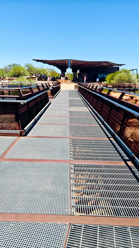
Then we drove to the other parking lot on the other side of the winding river to see the Kalbarri Sky Walks – there are two of them. They are 25m / 82′ and 27m / 89mm long and extend over the cliff edge with a metal mesh flooring so you can see the river below. We had to check out both of course.


Click here for more photos of this beautiful red rock national park.
Then we returned to Matilda and made our way into the town of Kalbarri where we’d booked another campground as tonight it will not drop below 23F / 78F so we’ll need AC for sure. On the way back we spotted one lone emu.

Tasman Holiday Park offered us power, water, Wi-Fi, some shade, bathroom blocks and more that we didn’t use. It’s across the road from the beach where the Murchison River meets the ocean. Doug went looking for a hardware store, and Fran took a walk on the beach:


After setting up and making brekkie, Doug began working on installing a switch for the fans he’d installed on the back of the fridge (so when it’s cooler we don’t need to run them all the time).
Tonight we actually saw a bit of a sunset over at the beach:
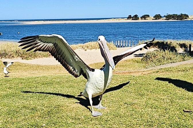
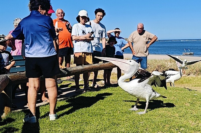
After our morning routine on Thursday, we headed across the road from the campground to the “Pelican Feeding”. This apparently has been going on for fifty years. They don’t always get the same pelicans or in the same numbers, but some show up everyday. Volunteers run the program (there’s a donation bucket) and every morning at 8:45 am for about a half hour, you can come over and learn about pelicans and feed them. There is a semicircular seating area in the park on the beach.

Did you know that pelicans, gulls, penguins, albatross and puffins can drink salt water and have their own glands to desalinate it?
How it works:
- The birds drink seawater
- The salt is absorbed into their bloodstream
- The salt is transported to the salt glands above their eyes
- The salt glands remove the salt from the blood
- The excess salt is excreted from the nostrils
- The salt can be seen as drops on the tip of the bird’s bill
We took some video, Doug joined in with the kids feeding the birds and it was a fun little visit.


We left Kalbarri around 9:15 and began the drive back out the main Big Lap highway to head north. No stops today except for petrol at Billabong Roadhouse and then brekkie at the Overlander Roadhouse.

Today we spotted a single emu along the roadside. The countryside continued to be somewhat rolling hills and sometimes fields and of course, lots of sand.
This is the link to more photos.
Our destination for a few days is Shark Bay.
Shark Bay is a World Heritage Site in Western Australia. The 23,000-square-kilometer (8,900 sq mi) area is located approximately 800 km / 500 mi north of Perth, on the westernmost point of the Australian continent. The bay features Australia’s most abundant marine ecosystems.
There are 28 species of sharks in this bay! The most impressive is the Tiger Shark and the most common one to spot is the Nervous Shark. None of these species are a danger to humans.
UNESCO’s listing of Shark Bay as a World Heritage Site reads:
Shark Bay’s waters, islands and peninsulas….have a number of exceptional natural features, including one of the largest and most diverse seagrass beds in the world. However, it is for its stromatolites (colonies of microbial mats that form hard, dome-shaped deposits which are said to be the oldest life forms on earth), that the property is most renowned. The property is also famous for its rich marine life including a large population of dugongs, and provides a refuge for a number of other globally threatened species.
Note: this isthmus has had one of the worst extinction rate in the world due to feral dogs and cats, rabbits and foxes. When visited by explorers in 1801, there were 23 species of mammals. By 1990, less than half remained. “Project Eden” was launched in 1995 to reverse this ecological destruction and has largely succeeded; all foxes and feral dogs, the majority of the cats have been removed. Some rabbits persist but a new bait program began in 2017 which is to reverse this. A fence was built near Shell Beach to stop these animals from entering the area and the removal of 15,000 sheep and cattle and about 12,500 goats helped the vegetation and habitat to recover. Acacia shrubs grew much more densely with seedlings able to grow and foods favoured by stock – delicate annuals, creepers and grasses – also returned. Captive breeding pens were established to supply native animals for reintroduction to the peninsula. While a number of native animals were reintroduced, only two were successful – the bilby and mallefowl.

Here’s a map showing Shark Bay and the location of the resort:

At the turnoff at the town of Denham to get to Monkey Mia, we spotted a few emus under a tree:

We made it to Monkey Mia Resort around 2:30 – we planned to stay for 3 nights. This is resort is right on the World Heritage Shark Bay and is famed for its pristine waters and dolphins. We expected it to be quite pricey but being NRMA members we got the RAC (auto club) discount and as well as their “double dip” summer special (most people don’t travel in summer up here). We paid $105 AUD for three nights in a powered site. The campground/resort has everything: power, water, Wi-Fi, two pools, laundry, a restaurant, entertainment room, a bar, lots of beach and boat tours around Shark Bay.
Upon checking in, we booked a boat tour for tomorrow morning (receptionist checked the weather and it will be the less windy day). This cost $125 each. We got settled before going to check out the beach and the pools. It’s really hot today, over 40C / 104F and not too much wind (until later in the day) and the humidity has begun to set in. The sand was burning hot!

Why is it called Monkey Mia?

The Mia part comes from an Aboriginal term for home. Many believe that the Monkey refers to the name of a ship which visited the area, while others believe it refers to pet monkeys that Malaysian pearl farmers (who worked in the area during the 1850s) would have.
Since by now it was well after 3:30 we opted to just got over to the pool that had shade cover and cool off – boy was that nice.
When the music started at the bar next door, we went over for a drink (a margarita and a Corona) before returning to the rig for dinner. Around 7:15 we returned to the bar to see the bit of sunset we could see from the bar over the water (we are facing east here) and enjoyed another Corona each. What a nice place we are in.

Here at Monkey Mia, there is a resident group of dolphins – dolphins live in “ranges” and there are 30 or so that live near the beach here at the resort. Every morning there are up to three “dolphin experiences” between 8 and noon. People gather at the beach behind the ropes and once there are dolphins at the beach, they let everyone in who has purchased a pass and you line up along the water’s edge with your feet just in the beginning shallows. They feed only two of the dolphins (always the same two) up to three times a day and only about 10% of their daily needs so as not to discourage their normal behaviour so they get three fish each time.
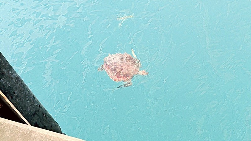
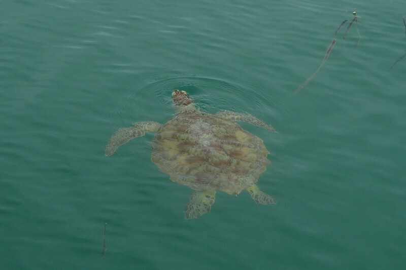
We went out on Friday morning for the 8am experience but no dolphins came into the beach but we did see a turtle at the jetty.
We returned to Matilda and did chores until we had to leave for our boat tour. There is only one boat licensed in Shark Bay; the Aristocat 2 is the only boat allowed to cross into the sea grasses ranges of the dugongs (more about that later). The boat is a catamaran and there were about 40 people on board. The trip is 2.5 hours long and partly done by sail, partly by motor.
We took off on time and right away we saw dolphins – about a dozen or so playing around the boat and swimming alongside at the bow.


There was a pretty good (but not always audible) commentary as we sailed along with information about Shark Bay, dolphins, dugongs, tiger sharks and birds. 10% of the world’s dugongs live here in Shark Bay. There are three types of seagrass here spanning 4000 sq km, that they live on and this also attracts a lot of turtles to the bay.
We reached the sea grass zones and overall we saw about 9 dugongs but mostly just their backs as they only come up briefly for air, do not jump out of the water like dolphins and never come on land. The captain tried to find us a mom and calf but we had no luck.


The dugong is a marine animal. It is a relative of the manatee. The dugong can be found in the waters of some 40 countries and territories throughout the Indo-West Pacific. The dugong is largely dependent on seagrass communities for subsistence with the largest dugong concentrations typically occurring in wide, shallow, protected areas such as bays, mangrove channels, the waters of large inshore islands and inter-reefal waters. The northern waters of Australia between Shark Bay and Moreton Bay are believed to be the dugong’s contemporary stronghold with over 10,000 dugongs residing here.
The dugong has a fusiform body with no dorsal fin or hind limbs. Its forelimbs or flippers are paddle-like. The dugong is easily distinguishable from the manatees by its fluked, dolphin-like tail; moreover, it possesses a unique skull and teeth. Its snout is sharply downturned, an adaptation for feeding in the seagrass. The molar teeth are simple and peg-like, unlike the more elaborate molar dentition of manatees.
The dugong has been hunted for thousands of years for its meat and oil. Traditional hunting still has great cultural significance in several countries in its modern range, particularly northern Australia and the Pacific Islands. The dugong as a species is vulnerable to extinction, and there are limits or bans the trade of derived products. With its long lifespan of 70 years or more and slow rate of reproduction, the dugong is especially vulnerable to extinction.
It might seem strange to confuse a slow-moving, blubbery sea cow with a beautiful, fish-tailed maiden. Yet it’s a common enough mistake that the scientific name for manatees and dugongs is Sirenia, a name reminiscent of mythical mermaids. Even today there are false mermaid sightings.

When we turned around we saw a loggerhead turtle for about 5 seconds so didn’t snap a photo but here’s one we found online:

On the way back to the resort, guests were invited to ride the “rope net” at the back of the boat in groups of about six.

Doug decided it try it too:


We were back at the resort by one and made a late brekkie before sunscreening up and heading to the beach.
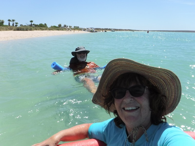
Today was the first time we’d been in water calm enough to float on our new pool noodles:


The water was a lovely temperature; the sand has a lot of sea shells in it so it’s a bit hard on the feet but not unbearable. However, there was a bit a wind and it kept blowing us further away!
While sitting under our umbrella a bit later, we spotted a ray in the water moving quickly, then one dolphin by followed by a few more as well as a pelican came by:

That was SO cool! After a while the wind was getting stronger and we called it quits before our new brollie suffered damage.
We went over to the beach at sunset again but it wasn’t a great one: (we are facing east after all)

Next morning while Doug was out on his long run, Fran went over to the dolphin beach and it seems they had visitors today. Fran got down to the water where everywhere had their feet in the water and saw a total of 5 dolphins; two of which got fed and only three fish each.
For more than 50 years, large groups of wild Indo-Pacific bottlenose dolphins have visited the shallows at Monkey Mia. It is estimated that their population is about 3,000 in packs of 30-35). The “Dolphin Encounter” here is one of the world’s great wildlife experiences and attracts more than 100,000 visitors a year. Today the dolphins are only fed according to strict guidelines and under supervision of Parks and Wildlife Service officers to ensure the dolphins continue to hunt and behave naturally. Only a select group of mature females (two) are offered fish (less than 10% of the daily intake). If they visit more than three times or after 12 noon they will not be fed.
Although a group of dolphins is usually called a pod, they are more like packs or families because unlike whales, they do not stay together for life; they move amoungst themselves and do not always stay with the same dolphins.

The Indo-Pacific bottlenose dolphin is a species of bottlenose dolphins. It lives in the waters around India and northern Australia, South China, the Red Sea and the eastern coast of Africa. Its back is dark grey and its belly is lighter grey or nearly white with grey spots. The Indo-Pacific bottlenose dolphin is listed as “near threatened”.
Common bottlenose dolphins have a reasonably strong body, moderate-length beak, and tall, curved dorsal fins; whereas Indo-Pacific bottlenose dolphins have a more slender body build and their beak is longer and more slender. The most obvious distinction can be made with the presence of black spots or flecks on the bellies of adults of Indo-Pacific bottlenose dolphins, which are very rare in common bottlenose dolphins. Their teeth can number between 23 and 29 in each upper and lower jaw, and are more slender than those of common bottlenose dolphins. Size of Indo-Pacific bottlenose dolphins can vary based on geographic location; however, its average length is 2.6 m / 8.5’ long, and it weighs up to 230 kg / 510 lb. The length at birth is between 0.84-1.5m / 2.8-4.9’.
Doug had just finished his run and saw the some of the experience too. He returned to the rig to stretch and shower and Fran went for a walk on the mud flats before returning to the beach for the second experience and this time she watched from the jetty above. Below is a combination of the dolphin pics we took at all the “experiences” we attended.


The most we had at an experience was eight in total over our five days there. The above pics are from all the “experiences” we had during our stay.
We’ve been watching the weather lately because while at Monique & Paul’s, we were told there was a threat of a cyclone in the northwest. Monique gave us contact info for their friends in Exmouth and we reached out to them and they too are watching and waiting and have to leave for a week next week anyway.
Today we learned that the cyclone is no longer expect to cross over on to land but that there will be heavy rain and wind and the national parks in the area will be closed till Wednesday. Since we intend to hit a couple of them, we’re going to slow our roll and opted to stay here at Monkey Mia another two nights for an additional $76 with the special auto club discount – not bad at all for such a great resort. We looked at moving to Denham instead but it’s more than $10 more a night and there’s no beach at the campground there.
We spent the afternoon at the beach again; dolphins came by as did a turtle. The wind was not as bad as in the campground as it’s coming from inland not the water but the current in the water takes you south pretty quick!


Sunday, we did a load of laundry that all dried in the sun/wind in less than 90 minutes; Fran over to see the dolphin feeding at 10 but none came in for it. You could see them out past the boats though.
That afternoon we opted for the covered pool since it was SO hot and that makes the beach sand too hot to walk on. It hit 44C / 111F today with a low of 32C overnight! There was some wind but not as bad as it’s been; supposed to lessen over the next couple of days as the cyclone passes by and the temperature goes back to the low 30’s C.
Don’t think we’ve mentioned this but there are wild emus that wander around the campground. We’ve seen them everyday.


There are signs everywhere about not feeding them and we see them checking out campsites looking for food. There’s one family with five little ones too!

Monday morning after exercising, Fran went back over to see if there were any dolphins; they were out far but at the jetty were three green turtles to watch. They came in later.
Afterwards as she was walking back two emus were walking on the beach:

Today it’s not supposed to be as hot, mid 30’s C but it’s much more humid. The sun tried to come out mid-afternoon but never quite made it. The humidity did reduce some and the temps dropped to around 32C. We enjoyed a few dips in the sea, sitting on the beach reading and chillin’. Have to say the cloud cover makes it a bit easier to leave tomorrow. We have really enjoyed this past five days.
There are LOTS more photos here.
Upon returning to Matilda, we spent time rinsing everything off to get put away when we leave tomorrow (including ourselves!). Now the cyclone missed Exmouth but the people we were “introduced” to in Exmouth say they’ve had 70kmph winds and sideways rain. So we’ll have to continue to monitor the situation.


