June 11th, 2024
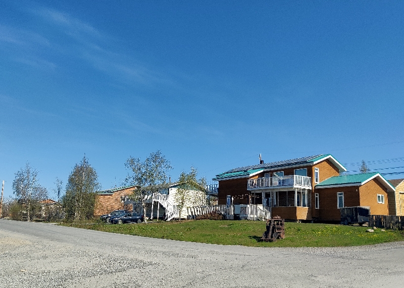
Our hotel room was quite warm in Dawson City and neither of us slept well (no AC) so we were up early and after exercising and showers, we hit the road just before 7 and went 36 km / xx mi back down the Klondike to the Dempster Highway turn off. It was quite foggy but not that cool.

The Dempster Highway is a bucket list journey from Dawson City, Yukon to Inuvik, Northwest Territories offering incredible scenery, wide open spaces and remote beauty. If your ideal road trip involves getting way off the beaten track then this is the drive for you.
No stoplights. No traffic jams. No road rage.
The road is built on a gravel berm that insulates the permafrost below, slowing down melt, which would cause the road to sink. The Dempster Highway begins 40 km/25 miles east of Dawson City in the Yukon and ends in Inuvik in the Northwest Territories. Since November 2017, Dempster Highway travelers can drive an additional 148 km / 91 mi of highway from Inuvik to Tuktoyaktuk, NT. NWT Highway 10 from Inuvik to Tuktoyaktuk was previously a seasonal ice road, only accessible in winter; the extension ensures visitors can travel to Tuktoyaktuk all year round.
The Dempster Highway stretches 740 km/460 miles through the Tombstone, Ogilvie and Richardson mountain ranges and three ecological areas, providing the opportunity to view wildlife and enjoy some of the most beautiful wilderness scenery in the world. Completed in 1978, the Dempster is the only public highway in Canada to cross the Arctic Circle. It was named for Sgt. W.J.D. Dempster of the Northwest Mounted Police who, was sent to search for the “Lost Patrol”. Construction started under Canada’s “Roads to Resources” program in the late 1950s, but only 117 km/72.7 miles were completed at that time. In the 1970s, work began again as an overland supply route to Inuvik was needed to serve the largescale oil exploration taking place in the Beaufort Sea. Since then, visitors from around the world have discovered the phenomenal beauty of this highway and make this journey a major focus of their vacation.
(The map below shows the road going all the way to Tuk, but the Dempster itself, only goes to Inuvik.)

Today we wanted to get as far as Eagle Plains about 400km northeast towards the arctic circle. It’s about the half way point of the Dempster and it’s before the border with the NWT (see map above). There is a lodge there that offers rooms, gas, a restaurant and RV park. Fran had booked us a room for tonight and Sunday night when we head back to Whitehorse.


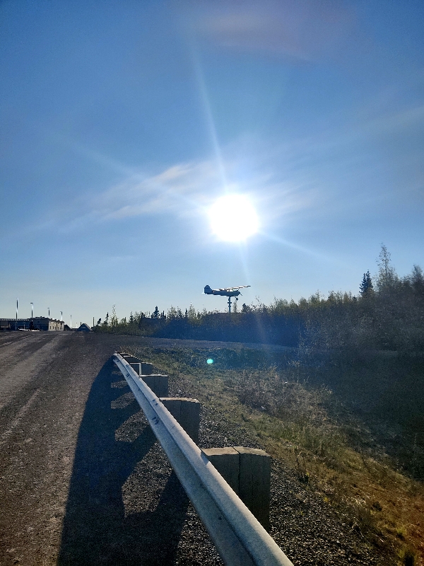
Shortly after you gt on the Dempster (Highway 5), it turns to dirt and remains that way. It was a better road than we’d driven after Yellowknife and was only a little wet from last night’s rain and we had odd misty rain for about an hour. The Dempster Highway cuts through Tombstone Territorial Park for about 75 km / 46 mi – it was so beautiful even with the cloudy skies.


 The Tombstone Range is around the Klondike River Valley. Molten syenite squeezing through the layers of sedimentary rock formed the jagged peaks. Glacial ice carved out the rounded slopes, dumping mounds of gravel and rocks as it melted, leaving a landscape of rolling hills. Caribou migrate through here in the early spring and fall; sheep move through on their seasonal rounds and tundra birds fly north to breed and south for winter.
We stopped at the Interpretive Centre but it was going to open for another 30 minutes and with the type of drive we had today, we opted to hit it on the way back on Monday. Next stop was the park overlook:
The landscape changed often; there were mountains, streams, grazing lands for caribou, lakes, rocks and hills of many varieties. A photo really doesn’t do it justice but we tried:


After the park we saw this Civic in the ditch and hoped we would not be joining it!

About 45 minutes later, the sky began to clear and the road was dry and had a truly spectacular drive today. There were landscapes of mountains, forest and tundra with NO trees.


At one point we crossed Red Creek – you can actually see the red colour in the rocks and water from the iron in the rock:

We made a pit stop at Ogilvie Ridge for the views and saw the signs about the Lost Patrol:


From 1904 to 1921, it was an annual Royal Northwest Mounted Police tradition to make a trip from Dawson City, Yukon to Fort McPherson, Northwest Territories, approximately 620 miles, to deliver mail and dispatches. In December 1910, the Commissioner of the Force, Aylesworth Bowen Perry, asked instead that the trip be made from Fort McPherson to Dawson. The trip was to be led by Inspector Francis Joseph Fitzgerald. Accompanying him were Constable Richard O’Hara Taylor, Constable George Francis Kinney and their guide, Special Constable Sam Carter. The four set out from McPherson on December 21, 1910 but they never made it to Dawson. The trip became known as “The Lost Patrol.”
Fitzgerald and his men left Fort McPherson, with fifteen dogs, three sleds and enough food for thirty days. The men felt no need to question whether they would reach their destination or not. They successfully completed the first leg of the journey and hired native Esau George to lead them through the next section. When he had completed his part of the trip, Fitzgerald let George go, trusting in Carter to lead them successfully to their destination. Unfortunately, Carter had been on only one patrol, in the opposite direction, and would soon prove to be an inefficient guide. By January 12, 1911, the patrol was lost for Carter was unable to find Forrest Creek which would lead them to Dawson. The team unsuccessfully travelled up and down several streams in search of the correct one. With only four days of regular rations remaining, Fitzgerald made a notation in his journal: “My last hope is gone…I should not have taken Carter’s word that he knew the way from the Little Wind River.” The following day, the patrol reversed their trail in the hopes of returning to Fort McPherson.
The trip back to McPherson proved to be difficult. Weak from lack of food and exhaustion, the team were able to walk only a few miles a day, sometimes not at all due to inclement weather conditions. Starving, frostbitten and ill, the patrol trekked on. Between January 19 and February 5, ten of the dogs were killed for food. February 5, 1911, day 47 of this fatal patrol, was the date of the last entry in Inspector Fitzgerald’s diary.
In Dawson, the Fitzgerald patrol was more than a month late in reaching their destination. Anxiously, a relief patrol was sent to locate the Mounties. Accompanying Corporal William John Dempster were ex-Constable Frederick Turner, Constable Jerry Fyfe, and Charles Stewart, a Métis from Fort McPherson. They left Dawson on February 28, 1911. On March 21, the lost patrol was found, apparently on their way back to Fort McPherson. Kinney and Taylor were dead, side by side at an open camp, Kinney of starvation and Taylor of a fatal, self-inflicted bullet wound in his head. The next day, Fitzgerald and Carter were found. Having left the other two in search of help, they finally succumbed to the cold and hunger, just 40 kilometres away from Fort McPherson. They would never find help.
Why did this patrol fail? Although no single, conclusive answer can be given, several factors contributed. Although Carter had made the trip once, and convinced himself and Fitzgerald he was competent, he did not in fact know the route from Fort McPherson to Dawson. After becoming lost, the team spent much time attempting to find the proper stream to follow. With temperatures that winter between -45 and -62 degrees Fahrenheit, and food sources of limited supply and nutritional value, the patrol was doomed to fail. By the time they were missed at Dawson City, and a search party was sent out, it was too late.
Patrols were still made annually until 1921, but because of the fatal trip of 1910-11, measures were taken to ensure that this tragedy never occurred again. Future patrols always hired an aboriginal guide. Cabins and regular caches were established along the trail in case of food shortages. Most importantly, the Forrest Creek Trail was clearly marked so that it would not be missed again. These measures proved successful.
All four men were buried at Fort McPherson on March 28, 1911. In 1938, the graves were cemented over into one large tomb, with cement posts at the four corners connected by a chain. In the centre is a memorial to the Royal Northwest Mounted Police Patrol of 1910.
About 30 minutes before reaching our hotel, we saw a moose come out of the bush, and immediately turn around and head back in when he saw the car! Darn!


We got to the Eagle Plains Lodge (66º N just shy of the Arctic Circle) around 2pm, and after some confusion got some gas (enough to get us to Inuvik) at $2.49 CAD per litre! We then checked in and even though we are literally in the middle of nowhere, thanks to StarLink, we had Wi-Fi and did some catching up.

Later a fellow told Fran that the price in Inuvik was $2.90 a litre and as she told Doug this, the couple he was chatting with said it was $2.30 in Fort McPherson up ahead. Phew! They had driven from Inuvik to Tuk and back the day before and said the road was in pretty good shape with a few soft spots. They also advised that the Dempster improved once you crossed into THE NWT.
It was about 15 C / 59F when we arrived but there is a wind which makes it feel cooler. We had seen many pockets of snow in the park and a few snow covered lakes. The highway took us up to 1000 m / 3000’ and then up several times more but never as high. This area is permafrost and there’s supposed to be a lot of wildlife on this drive but we only saw a few ducks in the ponds and a couple of mosquitoes. It is, however, the wrong time of year for caribou so we won’t see any of the giant herds that graze here.
This place is called “an oasis in the winter” but it’s not fancy nor is it cheap. We paid $236 CAD for a room with two beds and private bath. No fridge but they did have ice and also allowed us to put our ice packs in their kitchen freezer to get in the morning. There is also a restaurant, bar, mechanic shop and an RV park.
In the parking lot there were a few “disabled” rigs; one was from Luxembourg and he’d broken down due to a gear box oil hose breaking (garage here didn’t have any gear box oil so he was waiting for some to be delivered) and the two others (on from Australia) were awaiting a flatbeds to take their vehicles to Whitehorse. We’re pretty luck (so far) that we’ve had no issues.
Behind the hotel there is a sign about the Arctic Circle as we are very close:

There is also an elevated viewing platform so we took a peek.

Wildlife tally: 1 moose – no photo – two herons: one in the marsh, one flew by.
We awoke to a glorious sunny day on Thursday and after getting our ice pack out of the restaurant’s freezer and Fran managing to get boiled water for her tea (there was no coffee maker in the room), we headed out to continue along the Dempster.
Our first stop about 36 km / 22 mi up the road was the actual Arctic Circle at 66.37º N. There was a sign board there and we took some photos and were visited by a hoary marmot:


We crossed the territorial border into the THE NWT a little while later through the Wright Pass at an altitude of 1375 m / 4511 ‘ and it was all downhill from there – well, up and down rolling hills. We’ve now lost an hour as it’s Mountain Time here in THE NWT.
The road improved here – it’s wider and much fewer potholes but it continues to be quite dusty as it’s very dry. The road maintenance is better and there are actual guard rails at many of the creek crossings!
Then we reached an area of more boreal forests and then stunning landscapes of mountains.


We had to cross the Peele river and the ferry was about a ten minute wait. It just goes back and forth on no schedule. They seemed to be fixing the ferry landing docks as there was equipment working on both sides with lots of piles of dirt. This crossing took less than five minutes.
![]()
After the Peele crossing we took the short turn off into Fort MacPherson to fill up and to our surprise the gas price was $2.18 not $2.30. We filled up and went into the village to see the graves of the Lost Patrol.


Then we carried on to the Mackenzie River crossing. This ferry we just drove right onto without a wait and met a fellow who’d driven the Tuk road the day before and said it was in great shape – stick to the middle and you can do 70 kmph no problem. Good news.
This crossing took about 15 minutes as it first made a stop on the same side of the river at a little village where one vehicle left and then crossed the river completely.

Onboard there are several swallows’ nests in the archway on the ferry. They fly in and out of their nests, fly around outside and return.


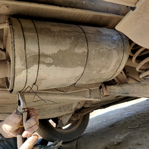
Then the drive was mostly just dusty trees along a dusty road with view vistas. We stopped for some lunch at a large pullout at Rengleng River and afterwards as we went to drive away, we could hear a strange “scraping” sound coming for the back of the car. Uh oh!
We got out and then Doug took several looks underneath. First he discovered a large hole in the muffler then a few small ones but that wasn’t making the sound. Fran drove back and forth short distances while he listened and looked and we figured it was in the wheel well and we could only hear it at low speeds. The car was still drivable and we were in the middle of nowhere so we chose to carry on. We hoped it was just a rock in a weird place and we’d get it looked at in Inuvik.
We continued on and about 30 minutes later we slowed down, stopped and checked it out. The scraping was gone but there was still the sound of what could be a rock. Doug found a mechanic on iOverlander and after dropping Fran off at the hotel in Inuvik, he will check it out.
Just before reaching Inuvik Airport, the road was paved again – ahhhhh. We stopped at an overlook for a few minutes which we climbed and took pictures of the area.


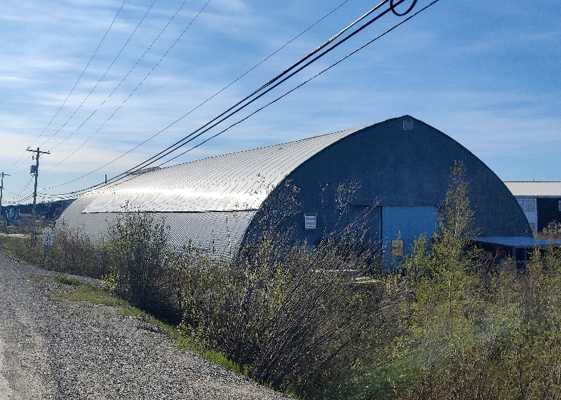
We drove to our hotel, checked in, unloaded and Doug went to the mechanic he’d found. Here at the Nova Inn, we have a third floor room with fridge, fireplace, portable AC, TV and Wi-Fi. We inquired if they had a guest laundry and it was being replaced today so maybe we can get laundry done on Saturday as we are here three nights.
Seems the rock had lodged itself out of the wheel so the only issue left was the holes in the muffler. Doug went to see “Crazy Tim” who said he could tape it up but to come back in an hour after he’d had a toke! He also wasn’t going to get under the filthy car for less than $50 – sold!
Doug returned to the hotel for an hour to get some things done and upon return to Tim’s, it was decided tape wouldn’t do the trick, but sheet metal would. After assisting in the repair, Doug was back in about 30 minutes and the whole thing cost $69 (CAD) and the Civic was good to go.

We made dinner in our room and watched the extremely disappointing Game 3 of the Stanley Cup Finals. Edmonton lost AGAIN and if they don’t win the next game, it’s over.
We are now at latitude just over 69ºN and the sun doesn’t really set. As in most hotels, the curtains never really block out the light very well so we are wearing night shades to sleep. Despite having our window open for air, the room did get too warm and Fran turned on the AC around 2am.
Wildlife tally: 2 marmots (one at Arctic Circle sign and one later on the road who wasn’t too frightened of us):

And then one rock ptarmigan on the road:

5 rabbits who take off too fast to take photos! We later learned they are called snowshoe hares. Here’s a pic from online:

Sidebar: Cell reception in the territories: When we were in the THE NWT the first time, we had it near Enterprise, the first town not far from the Alberta border. Then nothing until we actually got into Yellowknife. When we left Yellowknife we had no reception for quite a while until we got near the Fort Simpson turn off and then again at Fort Liard.
Upon entering BC we had it on but mostly off along the Alcan Highway. In the Yukon it was only near cities or sometimes a small town had it for a couple of kilometres. We had none along the Dempster the first day; even Eagle Plains had none but the hotel had StarLink.
On the second day along the Dempster, we had it near towns again like Fort MacPherson and of course in Inuvik.
So finally the day arrived which was the main point of this trip – we are heading to the Arctic Ocean in Tuktoyaktuk! It was a Friday morning and we awoke to foggy/cloudy skies that appeared to be burning off. Doug went for his long run early.
Turned out our hotel also included breakfast so we took advantage and ate around 9:30 before leaving for Tuk.
First we stopped at the local stationery store which has souvenirs – we are looking for an Arctic Ocean or Tuk one. It had a potential one but we wanted to wait to see what was available at the Arctic Ocean before buying one.

About 40 km down the (also dirt road), the skies began to clear and we could see sunshine on the horizon.

The 140 km / 86 mi drive was quite scenic and eventually the trees all disappeared and we only saw bushes, then they disappeared too and it was all tundra, lakes (some still frozen) and patches of snow. The road was decent till about 60km / 40 mi and then it was gravel, a little deeper than our Civic liked but it pushed on through. We continue to be amazed at how well this car runs and how it’s taking the beating we are giving it.


As we get further north there are more and more frozen or partially frozen lakes and the sky is a bit overcast:

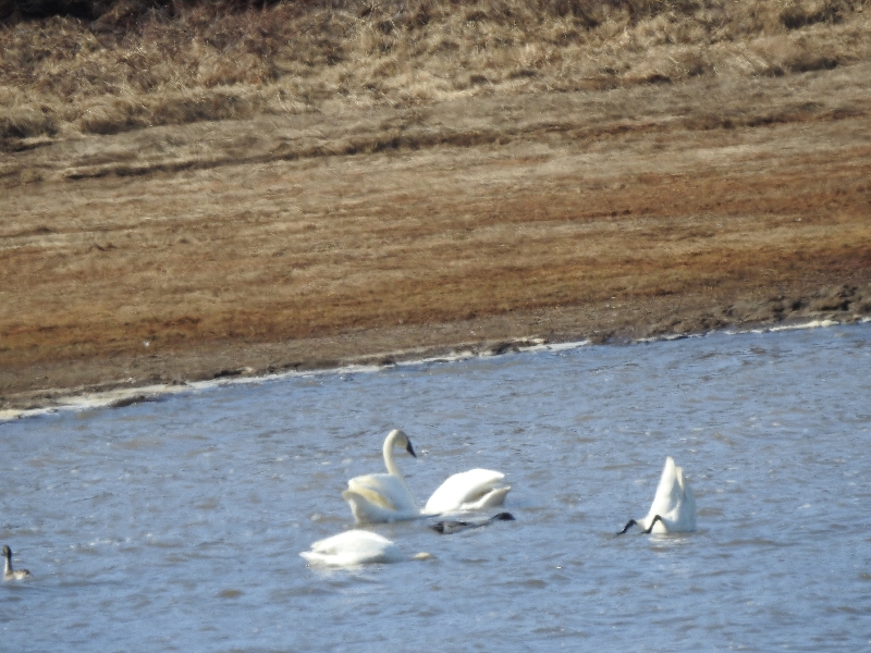
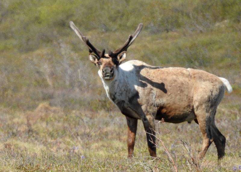
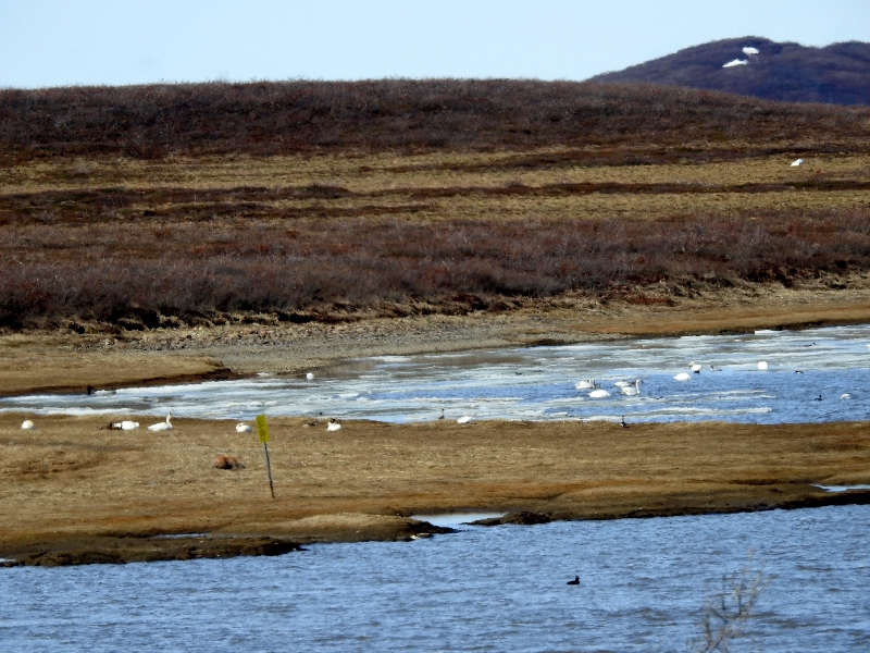
Enroute we were disappointed by the lack of wildlife; we did see 3 caribou at one point and then two more later on. Later we saw a lake with red throated loons and sandpipers as well as Brant ducks. Closer to the village, we saw about 100 tundra swans on a lake.

Here’s a better closer up pic from the web:

Before reaching the village of Tuktoyaktuk, we stopped at the Parks Canada lookout to see the world’s second largest pingo and its neighbour. It was very windy and pretty cold for us here despite the sunshine – strong wind off the Arctic Ocean. It was a few degrees about freezing but the wind was the kicker – made it feel so much colder. We pulled out our down jackets and felt better!


Pingos are intrapermafrost ice-cored hills, 3–70 m / 10–230’ high and 30–1,000 m / 98–3,281’ in diameter. They are typically conical in shape and grow and persist only in permafrost environments, such as the Arctic and subarctic. A pingo is a periglacial landform, which is defined as a non-glacial landform or process linked to colder climates. It is estimated that there are more than 11,000 pingos on Earth, with the Tuktoyaktuk peninsula area having the greatest concentration at a total of 1,350. Pingos can collapse due to the melting of the supporting ice and give rise to a depression in the landscape showing an inverse shape (horizontal mirror).There is currently remarkably limited data on pingos
The peninsula at Tuktoyaktuk is covered in thick permafrost, which is known to be more than 50,000 years old. There are many pingos within the Pingo Canadian Landmark area, all ranging in size and diameter. The most well known pingo in this area is Ibyuk Pingo, which is the tallest pingo in Canada. The height of this pingo is 50 m / 160’ above sea level, but the pingo is still increasing in height by a few centimetres every year. This pingo is one of the younger pingos in the area, estimated at around 1,000 years old. Since about 1990, several larger pingos have started to melt out as the injection ice of the core is exposed.
In 1825, John Franklin made the earliest description of a pingo when he climbed a small pingo on Ellice Island in the Mackenzie Delta. However, it was in 1938 that the term pingo was first borrowed from the Inuvialuit by the Arctic botanist Alf Erling Porsild in his paper on Earth mounds of the western Arctic coast of Canada and Alaska. Porsild Pingo in Tuktoyaktuk is named in his honour. The term pingo, which in Inuvialuktun means conical hill, has now been accepted as a scientific term in English-language literature.
Then we stopped at the Tuktoyaktuk sign:


Tuktoyaktuk is the anglicized form of the native Inuvialuit place-name, meaning “resembling a caribou”.
Next we drove towards town and stopped at the visitor info centre for a map and some information. The kind lady in there was very helpful and recommended where we could have lunch as well.
Then we drove around Tuk stopping at the General Store – no luck on souvenirs; they said try the other shop, The Northern. They did have a few but not better than in Inuvik. However there was a post office here and Doug went to the hamlet office to buy a postcard to mail to ourselves like we did in Antarctica. Done!
We stopped to see the sod house and it’s rickety log neighbour:
This type of structure provided a home where people slept, ate, raised their children, told stories and entertained. The floor is dug into the ground and the dwelling is built from driftwood, covered by blocks of sod and earth. Oil burning lamps kept these houses warm during the cold days of winter. Sod houses built by early inhabitants were often shaped like a cross, with a central room, three alcoves for sleeping and a long, covered entrance passage.


Then saw the small shack with a locked door into the town’s community ice house.
Once families began living year-round in Tuktoyaktuk, extended families built their own ice houses. These ice houses were built into the permafrost in a similar fashion to how settlers built root cellars on the Prairies. As Tuktoyaktuk became more of a permanent settlement, a communal underground freezer became a necessity. The construction of the ice house began in 1963.Digging into the permafrost to construct the underground freezer was done using pickaxes, shovels and chisels. To enter it today, a hatch in the floor of a small shed leads to a 1x1m shaft deep into the ground. A ladder descends 9m down into the permafrost to the ice house, comprising 3 corridors and 19 rooms. One corridor runs east, another south and the third west, all dug away from the harbour into the higher ground. Each room is assigned to an individual and their extended family, and is accessed through a numbered door and a narrow passageway. Rooms measure about three-by-three metres, ranging from 1.5 to two metres high.

Pic from google of an inside corridor

Our Lady of Lourdes ship

For more than 20 years the schooner Our Lady of Lourdes braved pounding storms and shifting ice floes to deliver supplies to far-flung Catholic missions from Tuktoyaktuk to Cambridge Bay. In 1982 the ship was moved to Tuk’s Catholic mission, and there it has sat, high and dry, for three and a half decades. The ship had a facelift in 2008, but still battles the ravages of weather and time.
The northern most arm of the TransCanada Trail is here in Tuk:
![]()
Then it was the big finale: THE ARCTIC OCEAN!


We were told if this week’s warm temps continue, the ice flows will be gone within the week.
Fran stepped into the Arctic Ocean (she did a polar dip in Antarctica but the water was much cleaner there and it was a group activity):


We also had to take a photo of the Civic beside the sign to have proof it made it all the way here!

Near the Arctic Ocean sign is a sign post with distances on it:

Now it’s around 3 and we’re ready for lunch and went to the canteen/shack called “Grandma’s Kitchen”. It is supposed to have local foods like Muskox burgers and beluga whale. Well we parked and found the shack around the corner but the sign said “no local foods today”. We were both quite hungry and decided to order burgers here anyway. After ordering, you go sit in a little windowed building on the beach nearby. There is a wood stove in there which Grandma’s husband, John, has lit and there were already two other Canadian couples there, as well as a biker from Phoenix and a young Japanese woman who is currently working in Whitehorse.
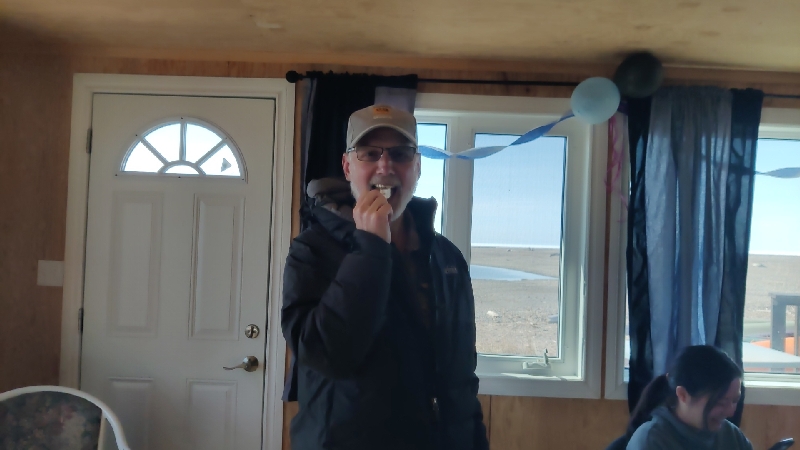
John said they couldn’t sell beluga or muskox at this time as their annual permit had not come through as yet BUT he could “share” some of the beluga with us. He returned with a plate with a dozen or so pieces on it with a bit of salt on the side. He talked about the meat and then we each got to try it. It had been boiled after slaughter and cleaning and was tasty and very fishy tasting; apparently it is less if you can cook it again. This was very kind of him to let us try some local delicacy.


View from the restaurant: (All the logs that get washed up here in this treeless tundra get collected and used for firewood.) It took a while for our burgers to come but they were tasty. After this we were ready to go home. In case it’s not been mentioned, Fran has been doing all the driving on this trip (she couldn’t drive in Europe and loves to drive) but on the drive up to Tuk she found road’s heavy gravel stressful so Doug drove us on this piece back to Tuk.
Again we saw little wildlife: one marmot and a few swans in the distance. But really, we came up here to go to the ocean and any wildlife is a bonus.


We were back at the hotel by 7:30 and tonight’s plan was to stay up for the midnight sun. When you check your weather app here it shows “no data available” for sunset and sunrise!
Here are pics of the sun’s place in the sky at 8:30, 10:30 and midnight:


Tonight was Game 4 of the Stanley Cup but since we think Doug jinxes the games when he watches, Fran didn’t let him watch; instead she watched the Pin Score on her phone and lo and behold, they won 8-1! So there will be a Game five on Tuesday. Not sure if we (Doug) should watch though…..
Wildlife today:
Caribou: first we saw three and then two before Tuk


Tundra Swans

From google we show you an arctic tern:

A red throated loon:

We went off to bed with our eye shades and did not sleep enough or that great but we experienced 24 hour day light a week before the solstice.
We had booked a third night so Saturday we had a day without driving. Fran did laundry, we took a walk bought our souvenir and strolled the town.
We saw the igloo shaped Catholic church:

The bush pilot monument:

The Community Garden Greenhouse:
Farming is difficult in this frozen terrain and importing fresh fruits and vegetables is an expensive endeavor. In 1988, the Community Garden Society of Inuvik launched an initiative to circumvent their produce predicament: They converted a hockey arena into a commercial greenhouse.
The giant greenhouse is divided into two distinct sections. A 4,000-square-foot commercial greenhouse takes up half of it, while the rest of the space is filled with nearly 180 individual plots that members of the community maintain. Some of the raised beds are allocated for vulnerable groups like town elders, children’s groups, and local charities.
 Enroute to the greenhouse, a fellow began to speak with us and he invited us into his home to purchase the fresh made whole wheat donuts he’d made. We chatted for a bit with Donald and bought 15 of his donuts which were quite tasty – especially when hot.


We returned to the hotel and spent an afternoon planning out our next couple of weeks.
No wildlife today.
We checked out of our hotel in Inuvik by 8am and hit the road for our sixth leg of dirt roads. We are sure getting tired of a dusty car! It’s everywhere!
We only had one stop enroute today (other than gas) to do a short walk out to a viewpoint that we didn’t do last week. This was the Territorial Viewpoint over a lake. It was a short 5 min walk and while the view was nice, there were too many trees!


We then stopped at Fort MacPherson to gas up. We arrived at 11:05 am – sign on the door said it opened at 11 on Sundays; sign in the window said 10; there was no “pay at the pump option” here. A fellow walking by said someone should be there soon; another fellow said they don’t open until lunch time. Well, we need gas so we’ll wait so we don’t have to pay 30 cents a litre more at Eagle Plains where we are staying again tonight. About 30 minutes later the second guy returned and said he’d check with the hotel manager abut when the station would open; he never came back. Then an Austrian fellow on a motorbike showed up and he too waited with us as he also couldn’t get to his destination without some. Next a truck and trailer showed up from Washington State who said they’d tried the other station in town (which we read opened at 1) and they said it didn’t look like it was still in operation, so they too, joined in the wait.

At 12:25 a young man showed up and turned on the pumps. When Doug went in to pay, he told him he’d been “called in” to work (maybe the regular guy didn’t show up?). Anyway we filled up and should be good to get us to Dawson City tomorrow.


A funny thing happened before we reached Eagle Plains (it also happened when we left Eagle Plains last week). The Garmin GPS went into dark mode near the Arctic Circle! It thought it was night time and we had to really turn up the brightness to see. Guess it was confused by the latitude!
Fun Facts about THE NWT (don’t usually do them for North America, but this is a pretty off the beaten path place):
- The Northwest Territories is home to 44,000 people.
- According to meteorologists, Yellowknife – the capital of the NWT, enjoys more sunshine than any other city in Canada.
- The Northwest Territories has 11 official languages.
- The Dehcho region is home to a total of 19 known hot springs, some of which can get over 30 degrees.
- The Thomsen River in the NWT is considered the farthest-north navigable river on the planet.
- Move over, Finland, the Northwest Territories is the world’s northern lights mecca! Here, people can view the shining northern lights, also known as aurora borealis, on an average of 200 nights per year.
- There are over 2,000 km / xx mi of ice roads linking over a dozen communities in winter only.
- The name Yellowknife comes from a Dene band, the Yellowknives.
- Yellowknife is called the “diamond capital of North America”. There are three operating diamond mines nearby.
We crossed the border back into the Yukon and arrived at Eagle Plains back in the Yukon just before 3, had to wait ten minutes to check in and then chilled for the evening. The time has once again changed to Pacific Time so we’ve gained back our hour.

We were given a room on the other side of the motel this time that didn’t have the sun shining in it all day and into the night so it was much cooler as there’s no AC. It’s basically the same room as last time: 2 double beds, private bath, no fridge – just an ice machine – but decent Wi-Fi. This place is quite dated but it’s the only choice around. They do have a restaurant and a bar but both are on the pricy side given where we are and we just made our own dinner in the room.
One more dirt road leg left – let’s hope the Civic is up for it; it does need an oil change soon, so we may do that in Whitehorse as after that, there are no big enough towns for many miles on the route we’re taking.
Wildlife tally today: 10 rabbits, 1 beaver, 2 loons – no photos.
We were both awake early today with the time change and we were excited to finish the Dempster Highway (really, just finish the dirt road!). This has been a great bucket list adventure. The dust is getting to us and there was no point washing the car when we still have over 375 km of it left!
We hit the road by 7 and really didn’t have any real stops to make as we’d seen everything on the way up. We made stops for pee breaks, brekkie and photos and made it to the pavement around noon.
The scenery continued to amaze us especially when we approached the mountains at Tombstone park from this end.


Today was super disappointing wildlife wise but as we said and continue to stand by, we didn’t come here for that, it was to see the NWT and to get to the Arctic Ocean!
We pulled up next to the sign where we’d started, grabbed a cold Corona and took another selfie!

There – that’s done and we’re happy we did it with little damage to the Civic. We carried on to Dawson City where we’d booked the same motel as last week and pulled in to the car wash next door. It’s just a pressure washer with no soap or foaming brush but it got rid of the excess dust and dirt that was so annoying and got the wheel wells all cleaned out (told have to tell us twice!).
We pulled up to the hotel around 1 and asked if it was possible to check in early; our room wasn’t ready but they kindly switched rooms for us and we got it. They gave us a ground floor room this time and it was much cooler as there’s no AC here either. Last time we were too warm up on the second floor even though there was a fan. The temps were around 20C / 70F today and not cooling off much at night.
We completely emptied the car and then drove into town to try and find microfiber cloths to clean the inside. Fran had found a huge pack for sale at the office where the carwash was located but we didn’t need thirty….Well, there was nothing in town so we went and bought the thirty pack anyway. It’s not like they can’t be useful, just way more than we needed today. We returned to the car wash and used the vacuum there and Fran spent a good hour dusting down and cleaning the inside of the car while Doug took the floor mats over to the car wash and got them cleaned up. The windows and mirrors are all nice and clean and tomorrow when we get back to Whitehorse, we’ll try to go to a proper car wash and get the entire car done including the underside.
Doug also took a look at the muffler and tightened up the metal sheeting and we’ll get that replaced in the States. The car does need an oil change (it’s been over 8000 miles…) so we’ll try and get that done on Whitehorse too.
We both showered off and it was nice and cool in our room for the night.
Wildlife tally on final day of the Dempster: 2 swans, 1rabbit and 1 squirrel – again no photos
We both slept pretty darn well as it stayed cool and the room was darker than most and we were on the road by 6:50 under partly cloudy skies with temps to reach mid 20’sC / mid 70’s F today. We wanted to get to Whitehorse, get some errands done and Fran was going to meet up with her cousin, Susan for a coffee.
No sooner had we left the gas station where we topped the tank and got maybe 15 minutes down the road when we saw a moose! Fran turned the car around and he didn’t’ run away! He looked at us for a bit and then strolled across the road, stopping to pose midway!


Then about a half hour later a red fox come trotting down the roadside in the same direction as us but on the other side of the highway.

About two hours later, didn’t we see a moose and a calve headed in the same direction as we were!

We made one real stop (i.e. not a bathroom break) back at Braeburn to see if their oven was operating again so we could get one of their plate size cinnamon buns. We were in luck, there was ONE in the glass case. It cost us $20 but it sure filled us up and we had such a sugar high! We were so hungry and ate it so fast, we forgot to take a photo.
Then it was a pretty uneventful until we came across a small grizzly bear on the side of the road eating. We were able to watch him for about a minute until he raised his snout, took a sniff and ran away.

 We arrived in Whitehorse before 1:30 and drove directly to a car wash that Fran’s cousin Mike, recommended but it was a not a drive thru car wash and we wanted the underside done so that was a bust. Next it was Canadian Tire to return the unused spare tire on the rim and a few tools we’d purchased just in case. We were not sure if they would take the tire back but they did minus $45 for restocking! Doug also returned all the unopened tools he didn’t want to keep so that netted us about $50 so we’re ahead; not a bad price to pay for “insurance” on the Dempster!
While Doug was doing all that Fran went to Walmart to get a few things The Walmart here is not very good; it has no produce but things like soda and cereal are cheaper here than the regular grocery stores.
Then we filled the tank and drove over to the Jiffy Lube which was near where Fran was going to meet her cousin, Susan, and got in line. Fran then walked over to the Real Canadian Superstore to get some produce and while paying Susan walked up behind her! Susan has lived in the north in both territories for many years.
They walked over to Timmy’s, got cold drinks, and then walked to the riverside park to sit and chat for about an hour.

Doug got the oil change done but they had none of the correct filters, so he first went to get a tire rotation and then back to Canadian Tire to get the filters needed. He then went to a tire shop and had the tires rotated. He picked up Fran and we went to Mickey D’s for fountain drinks and then went to the hotel. Enroute we discovered that Jiffy Lube had not reset the oil counter so Doug will have to attend to that too!
Fran checked us in and Doug began doing the filter work only to find he had the wrong one. So he went back to Canadian Tire to return it and had to get a refund as they did not have the correct one. He then went to a NAPA shop and got the correct one and installed it. In total it cost us about $260 CAD for the service needed (synthetic oil change, filters and tire rotation). Pricey but we want to continue taking care of this trusty car.
We had a quiet but warm night at the Town and Mountain Hotel – all we had was a fan despite the app advising that there was AC. We watched Game 5 of the Stanley Cup Finals – a super exciting game which the Oilers won so now it’s back to Edmonton from Florida for Game 6.
Wildlife today was exciting: 1 bull moose, a fox, a female moose and calve, a grizzly bear, a rabbit, a couple of marmots, a squirrel, a lemming run across the road …..
We left early on Wednesday again to continue the drive south. We made one scheduled stop outside Whitehorse to see the Mule Canyon and it’s suspension bridge.
Originally referred to as Grand Canyon, Fredrick Schwatka renamed it in July of 1883 Miles Canyon after General Nelson Miles. Schwatka wrote, “Through this narrow chute of corrugated rock the wild waters of the great river rush in a perfect mass of milk-like foam, with a reverberation that is audible for a considerable distance.” Although accounts differ as to the ferocity of the rapids, there is no question that they were very dangerous. During the Gold Rush, hundreds of boats loaded with precious supplies were lost (as well as several lives) before the Northwest Mounted Police arrived to regulate traffic. Eventually a wooden rail system around the canyon eliminated the need to battle this hazard. The hydroelectric dam constructed to provide power to Whitehorse has tamed Miles Canyon, but drifting through its 50-foot high basaltic walls is still a thrill.


Then it was just a beautiful sunny drive southeast (temps reached a nice 22C / 75F today. We reached the turn off to the Highway 37 aka the Cassiar Highway around 11, topped up the gas tank at the station at the intersection and crossed the border into the province of British Columbia.
We drove 5998 km / 3727 mi in the two territories (including a couple of dips into as that’s the way the Alaska Highway is routed.