
October 16th, 2019
The ferry from Paraguay took about fifteen minutes to get to Argentina. We unloaded and then did the immigration/ customs entry stuff in Argentina.
Here we had a bit of a kerfuffle: we exited Paraguay with our Canadian passports and entered Argentina on our US ones; we did this as Fran is running out of pages in her Canadian passport (the officials are notorious for not filling up pages and seem reluctant to go back and use up the empty spots!) and we did not to have issues in that regard. Argentina immigration did not ask to see the “exit” stamp from Paraguay as they sometimes can.
But a different issue arose when we tried to get Tigger’s TIP; for some reason, Tigger was registered as a Canadian vehicle last time we entered the country not American as stated on our registration (it has South Dakota plates); this combined with our change in passports really did not please the Customs Official. Finally after about fifteen minutes, he changed the info in the computer, issued the new TIP and after a brief inspection of the inside of Tigger for fresh produce, we left.
First stop was the three borders lookout here in Argentina and we brought Nina and Stefan (the backpackers we met on the ferry) with us.


We dropped off Nina and Stefan at their hostel in town and drove to a campsite a little further away after stopping for some produce.
El Coati camping is cheap campsite but not that nice; rather muddy and under trees but good for a night. It rained a bit tonight and it was hot so we were again, SO happy to have power to run our air conditioning – the tree was a good sound blocker too!
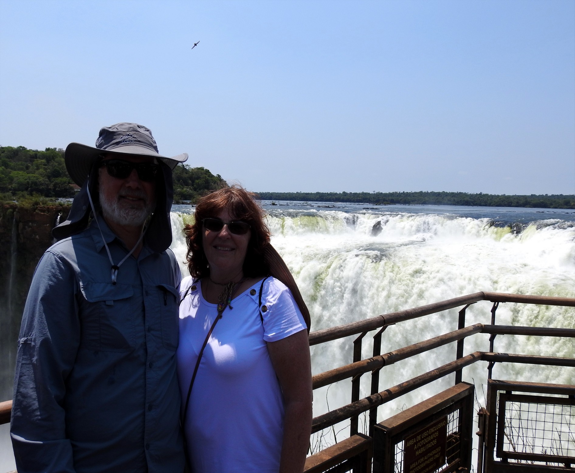
Wednesday looked like the best weather day all week so we took the opportunity to head to a place we’ve been talking about for so long: Iguazú Falls.
Iguazú Falls are located on the border of Brazil and Argentina and can be viewed from both sides. The falls are made up of approximately 257 individual water falls over a 2.7 km length; combined they make the largest water falls system in the world.

Aerial view from Google:

Fun facts about Iguazú Falls:
- Height: ranges from 60 to 82 m (197 to 269’)
- Length: 2.7 km / 8858′
- Average flow rate: 1756 m3/s
- Name comes from the Guarani word for “big water”
- Legend: A deity planned to marry a woman named Naipi, who fled with her mortal lover Tarobá in a canoe. In a rage the deity sliced the river, creating the waterfalls and condemned the lovers to an eternal fall.
- Area became a national park in 1934
- Became a UNESCO World Heritage site in 1984
- There is a large protected area around the falls with a large variety of flora (Atlantic Forest) and fauna including jaguars, tapirs, monkeys and more
- First European record of the falls: 1541 by the Spaniards
- Are the 6th greatest average annual flow falls in the world (right after Niagara and before Victoria)
- They were chosen as one of the new natural wonders of the world in a contest where people voted via text message.
- Comparisons to other falls:
- Three times the height of Niagara Falls
- Victoria Falls is considered to be a larger “curtain” of water as Iguazú is a number of small falls; it is 1600 m wide (5249’) and over 100m (328’) tall.
After parking and paying our entry fee (about $14) we walked two of the three trails to view the park and see some falls before embarking on the train that takes you to the best part: the Devil’s Throat.
The lower hike was about 1200 m and fortunately for us, there were hardly any people! It took us along boardwalks through jungle to a few viewing spots:


From the Upper Trail (on which there were signs that say “keep moving no stopping” – it can get super crowded here in high season) we saw the falls from the top instead of the bottom and we also had almost to ourselves:

We managed to catch close up views of the Great Dusky Swift birds – these birds live behind the falls in the cliffs. You see them flying in and behind the falls. They love to perch on the vertical cliff faces and nest in the nooks and crannies.


and then a long walk over the water and through more forest back to the central area where we had some empanadas for an early lunch before catching the train.

After disembarking from the train, there is a long boardwalk to the Devil’s Throat with spectacular views:


The Garganta del Diablo is the reason you come here – it’s magnificent and a wonderful way to finish our visit here – we kept walking back and forth taking it all in. This was the only part of the day with crowds. Some of the tour companies that bring people here only take them to this point!


At many points along the trails you can see the Brazil side which we understand it costlier and offers fewer viewpoints nor does it get as close to the Throat. While the trail to get here from the train was not busy, this lookout point was “bumper to bumper” people.
We have more or less decided not to do the Brazilian side to save the time on our visas and not to diminish the memories from this side; being right at the ‘throat’ couldn’t be topped in our minds.
We were VERY fortunate on our visit for a few different reasons:
- Parking was easy and the closest lot was open
- It’s low season so not crowded; at times we had the two trails to ourselves
- The weather cooperated; was cloudy in the morning but the forecast called from a sunny afternoon and it happened
- The wait for the train can be long and we only waited about a half hour for the train out and not at all on the way back
We encountered a bit of wildlife:


 We left the park in the early afternoon more than happy and decided we needed a better camping spot then El Coati so we could chill a few days.
Camping Ma-Ri offers bathrooms, hot showers, WiFi and a pool so we decided this would be a good spot. We pretty much got the last spot as it’s not large and there were already four other RV’s here; one Argentinian travel trailer, a Swiss RV, a German larger RV and a Chilean plated truck camper with an older Swiss couple in it. We did meet all these people but they kinda kept to themselves.
We spent a quiet Wednesday afternoon by the pool and a quiet night in our air conditioned “home”.
Thursday we did chores and the like in the morning including Doug installing the two new USB parts in the coach and doing some grocery shopping.

In the afternoon we chilled again by the pool. Today a small group was having a birthday party in the shelter by the pool with a bunch of kids enjoying the pool – it was a bit noisy with a boom box but they left by dark.

Friday we tackled the microwave – what a job! The old one came out easy but the new one was a bit smaller and Doug had to change the plug. It took some maneuvering and adjusting but we got it in and it’s working!


For lunch we wandered down the road to a roadside vendor who was barbecuing sausages and buns (“choripan”) – it was yummy and a nice reward for four hours work in the morning. It began to rain around that time and we spent the afternoon at the picnic tables under cover online getting stuff done.
Saturday, we decided to spend one more night here so after exercising, getting online and having our brunch, we headed over to “La Casa de Las Botellas” – the bottle house.
This is a very interesting place and it turns out there are few similar places elsewhere in the country and one in Paraguay.
This project makes houses of out plastic bottles and other reusable items like: tetra packs, bottle caps and aluminum cans to make the house and the things inside the house.


They showed us the process of building panels of walls which can then be plastered with clay and covered with tile.

They have a small souvenir shop that sells items made with this recyclable items as well.


We returned to our camp spot and that afternoon and most of the evening, the internet was down so we read and chilled. That evening, late, a young German family arrived in a van and we met them the next morning.
Monday morning the internet was down again, so we left Puerto Iguazú and made our way a bit southeast to a national park where tapirs are more easily spotted (so we’d been told). It was a very humid day with on and off rain showers. We were greeted at the parking lot by a park ranger named Luis and he told us about two walking trails in the jungle (Atlantic forest) and where the tapir viewing platform was; he suggested going over to it around 7:30 pm. There are NO facilities here despite there being an actual campground. We opted to stay in the parking lot beside it as getting level could have proved challenging and the ground was quite wet.
We got settled, had lunch and then went to check out where the platform was and walk that trail which was about 2.4 km long. The platform is not that far in from the road and you can see the mud pond/salt pan where there were many, many footprints from the animals. Hopefully, we’ll see them tonight.

We walked the trail and heard lots of birds, saw spider webs and lots of variety of mushrooms


but nothing else. We were hot sticky messes by the time we were done so when we got to Tigger, we ran the gennie and turned on the AC to get cooled off. Decided to leave the other trail to maybe do in the cooler morning. We had some heavy rain late in the afternoon. We think there was a wasp nest nearby as they continuously tried to get inside our “home”.
After dinner, around 7:25 we walked across the highway to the platform. The lightning began and we could hear thunder getting closer. We hung around about 30 minutes until it started to rain and called it. We’d left windows and vents open and figured the weather might scare off the tapirs. Too bad.
We didn’t get a great night’s sleep despite a reasonable cool down of the temperature thanks to the rain and the sky did not promise much sunshine to get our hopes up that our chances for wildlife viewing would be better if we hung around another night. We also figured the other trail would be too muddy to walk after all of yesterday’s rain.
We are finding this part of Argentina SO green; in southern Argentina, Patagonia was mostly brown grassland and the northern part was dry semi dessert so this is a treat for us; granted it is spring but there are many trees including coniferous and deciduous as well as palm trees and lots of bamboo.

We returned westward about 50 km /30 mi to the main highway and the town of Wanda. Here there are four mines of semi precious stones and you can tour them.
In 1976 a layer of gemstones was discovered in the town of Wanda, Argentina. The mines are a gemstone site containing quartz, amethyst, agates and topazes to name a few. The base was formed 150 million years ago during the Cenozoic Era and it went through several instances of lava coming from the core of the earth. When the lava cooled, gas bubbles were trapped and gave shape to basalt which is “mother rock” that produces gemstones.
We got to the town and were flagged down at the entrance to the road to the mine we were headed to. The woman advised that this road was all mud and pointed us to a paved way to get in. She gave us some info and suggested we stop in the shop right there to check out some of the larger finds.
We did that and bought a few gifts before heading to the mine for a tour.


Sebastian took us on an English tour lasting about a half hour. We walked through the openings in the hills (there are about a dozen that are all connected) and he showed us various types of semiprecious finds:


Afterwards, we wandered through their pricey shop admiring but not buying and then drove into town to a campground. Camping Panimba offers all services and we were the only ones there. The weather is still cooler than normal and we won’t need AC again for a couple of days. Sadly the internet was very slow and barely reached out spot. Then in the evening the water supply seemed to be diminishing so we decided to move on tomorrow after a shower – well that didn’t pan out as Tuesday morning there was no water!
After Doug went for a short walk, we found the owner and she said their tank does not automatically turn off when full and they had it off. She turned it back on and we had showers before leaving.
Today we had a longish drive ahead of us; our destination was the Salto Moconá. These falls were recommended to us by some overlanders we met in Brazil (who’d also recommended Salto Monday in Paraguay) so we added them to our agenda. No mention of them is made in ANY of our three guide books and after visiting them, we do not understand why (more on that later).
The drive here was pretty uneventful until we were about 70 km / 43 mi way – now we took a turn off down the Ruta 21 which was a 60 km / 40 mi dirt road. After first it was rocky and hard pack but then it turned to a red clay like dirt. As it had rained two days before, parts of it were still damp and at times it felt like we were slipping! We could discern two sets of tire tracks for about half the route but then we hit “virgin” road until the last few clicks.
Doug was driving this part and could feel the sliding. We stopped twice to remove 2” of mud off the tires with a shovel and kept thinking, “we are so far down this road, we hope we don’t have to turn around! “
 We did air down the tires and that seemed to help. There is absolutely nothing on this road except the odd turnoff onto private property and no cell reception if we get into trouble. The first time we stopped, a swarm of wasps kept trying to get us and Fran did get stung on the bottom side of her foot. The only “wildlife” we saw in this uninhabited region was lots of butterflies (the aforementioned wasps) and an iguana.
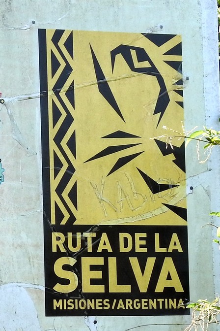
Well, yahoo, we made it to the paved Ruta 2 known as the Ruta de la Selva (Forest Route)
 and heaved a sigh of relief; at this point that drive becomes an adventure we went on instead of a mistake!
We arrived at the park just after 4 pm figuring we’d just check to make sure there were boats for the next day and learn the prices and hours. We drove right through the entrance gates which were unmanned. We parked and walked over to the Visitor’s Centre to learn that after 3 pm the entry is free! (it’s only just over $4 each anyway). Also we were told it was still possible to do the boat ride this afternoon at 4:45 and we’d probably be the only ones on it. The ranger suggested we change into long pants and closed toed shoes after paying for the boat ticket. That boat ticket cost us about $12 each. We did as suggested and drove the one kilometre down to the boat launch area.
The zodiac was ready to go, we got life jackets and away we sped. Now we really weren’t sure what to expect as we did not know all the information we’ll give you below. All we knew was that there were some falls in the river and you needed a boat to see them.


The boat ride lasts about 20 minutes return and goes about 2 km up the river. As soon as we took off, we began seeing waterfalls and they just didn’t stop! We kept being amazing and couldn’t stop smiling! We were getting wet and Fran had to keep hiding the camera (no one told us we’d actually get wet!) as the zodiac goes right alongside the falls and at times, drives perpendicular so that you experience the power of the water.
The falls sit in the Uruguay River on the border of Argentina and Brazil about 300 km south of Iguazú but not on the same river. They are the product of a geological fault and are up to 10 m high and run for three, yes three kilometres. The unique thing about these falls is that they are not traverse to the course of the river like most falls, but are longitudinal. The channel on the fault line is quite deep (in some places 170 m). This is the ONLY place in the world with such waterfalls – again we do no understand why this attraction is not on the tourist route.
You can only view the falls by boat as there is no lookout that looks over them (but you could fly over them….). And to make it more interesting, they are only visible about 150 days a year when the water level is not very high otherwise they are submerged.
The name Moconá means “he who swallows everything” in Guarani.
We were thoroughly pleased with this outing and continue to be amazed how well we’d time our visit here; right season, enough water and perfect weather plus the bonus of arriving in time to get into the park free!
We walked back to Tigger and drove about 9 km back down the road to a mirador where other overlanders had camped previously.
We got parked and Doug began to air the tires back up and Fran cleaned off the shovel and got Tigger ready for the night. Just before finishing the tires, two large overlander rigs arrived from France. They were related; one contained a family of three: Eric, Anna-Laure and their 6 year old son, Gabriel and the other smaller one contained Eric’s parents, Xavier and Danielle. They are in South America for a year. We chatted for awhile, compared rigs and then joined them all later in Eric’s rig for happy hour.
We all spent a very quiet, cool night with no traffic (no one comes down this road except to get to the falls) and the next morning wished them well on their boat ride as we turned westward.
Today we were headed to the Jesuit missions of Argentina but it was going to be a long drive again so we broke it up by stopping in the small city of Oberá for the night at a Shell station that takes overlanders. Enroute we stopped a few times for views of the Uruguay River.


After a reasonably quiet night at a truck stop, we moved on towards the missions.
This International Jesuit Mission route covers Paraguay, Argentina and Brazil and contains 30 sites; we have not found a decent response to our question about why the Bolivian missions are not included on this “route”. Seven of these sites have received UNESCO status. The first were built beginning in 1609 and by 1732 contained a total of 141,182 inhabitants. After the expulsion of the Jesuits, the sites were destroyed by the Portuguese and Paraguayans between 1816 and 1819.
The layout of these “cities” began with a cross formation marking the centre of each mission and the heart of the main plaza. On one side would be the cathedral as well as the residences of the priests with schools and workshops. The “residence of widows” and the cemetery were located on the other side. Large housing units were built in sections around around the aforementioned buildings and included a town hall and agricultural areas.
First stop was Santa Ana built in 1633 in Brazil and moved here after invasions by the Portuguese. Here there are a few partially restored buildings:

There was a cemetery which was rather creepy. Most of these cemeteries are pretty empty but this one had been used well into the 20th century. There were graves and crypts. Some of the graves had been emptied and some of the crypts and trees growing in them and others had open coffins!


After about an hour there, we moved on to Loreto which we knew didn’t have a lot to offer but the ticket you buy covers all four missions for fifteen days so we made the stop. This was a lot of walking. At both these missions we opted to see the sites without a guide and the ranger that told us how to get around the place kinda sent us on a long walk through the woods. They have set up a 1500 m “passion walk” here – it’s sort of like the Stations of the Cross but it covers the entire lifeline of Christ – there are 39 stations from birth to resurrection. It’s a nice concrete path but really is not what we came to see. Anyway, we did get a lot of steps today.


Finally we found the ruins part of the site and other than lots of “piles of rocks” as our friend Mark is fond of saying, there were two partially restored sites: a latrine (yes a latrine)

And a chapel

You could also wander through the remains of the main temple/church.

We returned to the truck on some path that was not correct as there is NO directional signage on the site (Doug did let them know they were lacking in that regard) and made our way to the small town of San Ignacio which is supposed to have the best preserved ruins.
We parked at a hostel that takes overlanders, went to find some lunch. Wenjoyed some pool time on the property. We’ll stay here at least two nights (and get some laundry done) so we’ll visit the mission itself tomorrow in the morning when it’s cooler. The temperatures are rising again but so far, no humidity has joined it and the nights are comfortable.
Friday morning after dropping our laundry at the front desk (they offer a three hour t urn around service at a good price) we walked over to the most restored missions in Argentina, San Ignacio Mini. The ticket we’d purchased covers all four missions and you have fifteen days within which to use it.
This mission was founded in 1610. It was definitely more interesting because of the restoration work done in the 1940’s. It’s well maintained and the museum had some interesting pieces.


We stopped at a bakery on the way back to the hostel and picked up a couple of alfajores and spent the afternoon at the hostel online, reading and by the pool. Well, our laundry took six hours, not three, but it’s all done and nicely folded.
Saturday and Sunday were chill days – no chores and lots of down time in the sunshine and by the pool. It’s getting hot again but so far the nights have been comfortable but it looks like that will change this weekend. It’s been sunny since Tuesday but the clouds are moving in this afternoon.
Sunday is Election Day here in Argentina so we weren’t sure what to expect. As we did our walks in the morning, we saw at least three polling stations. It is expected that there will be a change in government here reverting back to “Peronism” and only time will tell how that will change the country.


