
We put in a complete map of our route here – if you want a “clickable” one, please go to our home page under “Where We’ve Been”.
May 19th
INTRODUCTION: Iceland is a small island nation; but it is about twice the size of Denmark or about the same size as the state of Kentucky. Its population is about 338,000 and is ranked as the least populated country in Europe. (Iceland is not part of the EU.)
This island country is a baby in geological terms; formed around 20 million years ago. It was first written about in 330BC by a Greek explorer who wrote about an island six days sailing north of Britain. Irish monks seeking isolation were the next to stumble upon the island after centuries of myths and tales of fierce storms and barbaric dog-headed peoples roaming the island in around the year 700. They wrote of a land where there was no daylight in winter and no darkness in summer. Many of these monks fled when the Norseman began to arrive in the 9th century.
These Norwegians began the “Age of Settlement”. Credit for the first permanent settlement is given to Ingolfur Arnarson who landed in the year 874. History says he landed on the south side of the island at Ingolfshodi and spent the first winter there. It is said he threw his pillars into the sea and where they landed on shore was where a permanent settlement would be made. These pillars were found ashore in what is now known as Reykjavik. Reykjavik means “smoky bay” which makes sense as he would have seen many geothermal springs. (You can see these “pillars” on the coat of arms of the city.) During these early years, much deforestation took place.

Iceland was the first country to have a “parliament”. It began when Ingolfur’s son was an adult. The entire island was a scattering of farms and people felt the need for some sort of government. They felt a large scale district assembly would be an improvement over the oppressive system they had left behind in Norway. The first such assembly was held near Reykjavik and then moved to what is now Thingvellir National Park.
Naturally, as is human nature, there were squabbles arose over the choice of leaders but the system in general was a success and it held annual meetings. A decisive moment was in the year 1000 when Christianity battled against the Viking paganism but the leader at the time ruled that Iceland should become Christian but that practice of paganism in private should be tolerated. Much of Iceland is now Lutheran which now allows same sex marriage.
At this point in history, the annual national assembly became the social event of the year as all free men could attend; marriages were contracted, business deals were finalized, duels and executions were held and the Appeals Court handed down judgements on matters unresolved in the lower courts.
By the end of the 12th century, the Saga Age had begun and epic tales of early settlement, family struggles, romance and tragic characters were recorded by historians and writers in two weighty volumes. The “Book of Iceland” traces family histories and is used to this day for genealogy (as Iceland is a small place, you want to make sure you are not dating your first cousin!). This was also the time when Iceland was absorbed by Norway. By the end of the 14th century Scandinavia was formed and as part of this treaty, Iceland came under Denmark’s rule.
At the beginning of the 17th century, the “Turkish Abductions” took place when Barbary pirates raid parts of Iceland taking hundreds of prisoners and killing resistors. In the middle of the 18th century the Laki crater erupts killing 25% of the population of Iceland and 50% of its livestock.
In the early 20th century Iceland becomes an independent state within the Kingdom of Denmark. During WWII the Brits invade and occupy neutral Iceland and a US base is established later in the war at Keflavik (now the country’s main airport). The military base closed in 2006. Before the end of the war, Icelanders vote for complete independence and becomes the Republic of Iceland. In 1980 Iceland becomes the first country in the world to have a female elected as head of state.
After the worldwide financial crisis in 2008 Iceland suffered particularly hard and in 2009 applied for entry into the EU. This is a contentious issue in the country and after a few delays, the application was abandoned in 2014. In 2009 Iceland had the first world leader who was openly gay. 2013 sees the beginning of the tourism explosion with over 800,000 visitors – this number rose to over 2.5 million in 2018. This boom is posing its own issues of sustainability – as there are less than 350,000 people on the island this influx of tourists makes a huge environmental strain not to mention the strain on the country’s infrastructure. Talks of proposed visitor fees and caps have been mentioned in recent times.
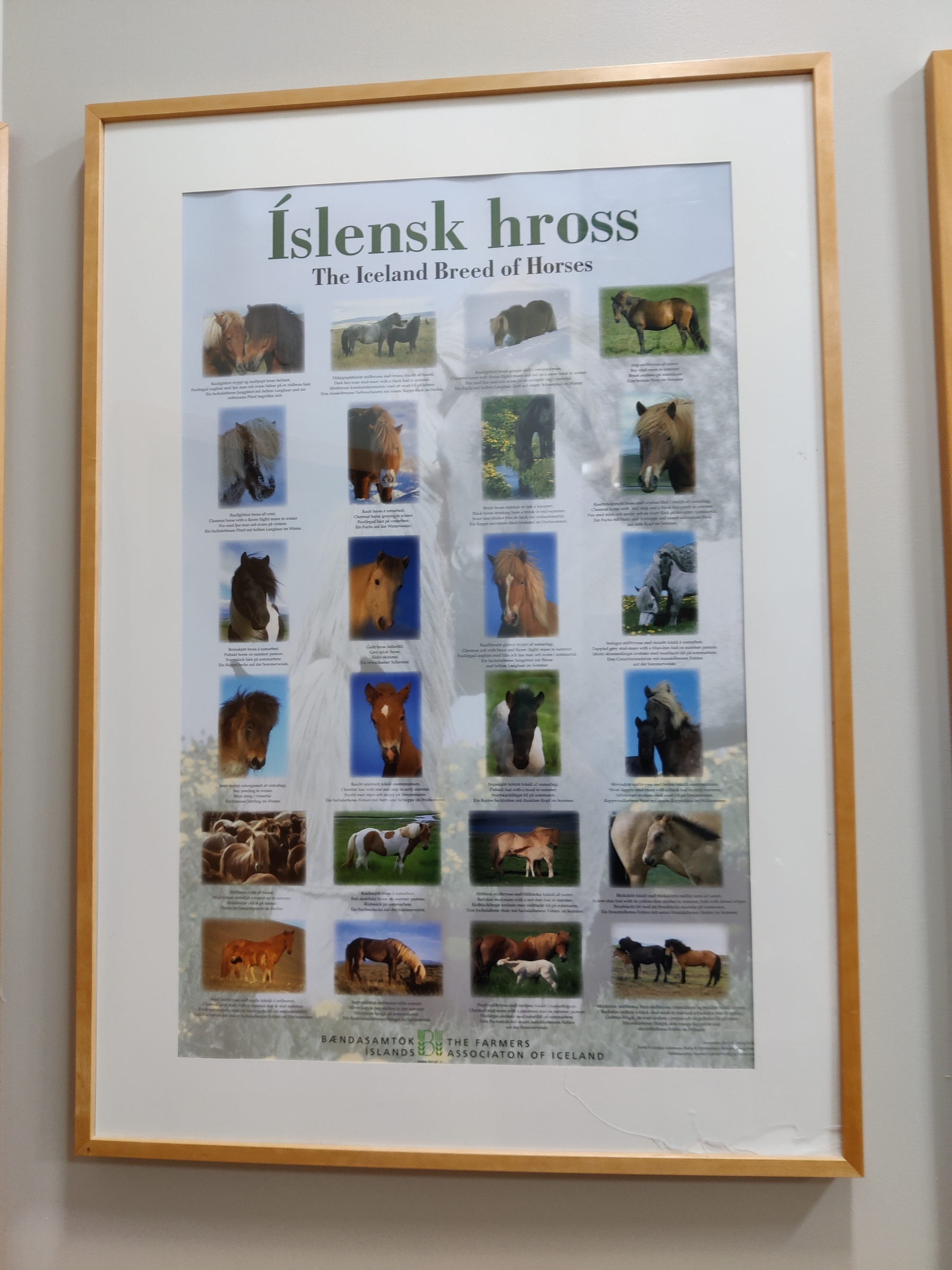
NATURAL WONDERS: Iceland is a land of volcanoes, glaciers, geysers, springs, fumaroles, ice and snow. As for wildlife, this is a land of sheep and horses. The only indigenous land mammal is the arctic fox and although there are smalls herds of reindeer (Cariboo) in the east , these were introduced from Norway. On very rare occasions, polar bears float in on the ice but farmers make sure they don’t last long. Iceland is rich in marine life, particularly whales as well as birdlife.
Being a land of geysers, springs and fumaroles, geothermal and hydroelectric power seems limitless. Icelanders use more energy per capita than any other country. Due to this cheap energy source, many countries send raw materials to Iceland for processing (such as aluminum) as the power for these processes is much less expensive even accounting for the shipping costs.
THE SPIRITUAL HISTORY – when you consider how isolated the country was during the early centuries of its growth, add in the barren landscapes with lava formations, it is not a surprise that many believed in “hidden people”: ghosts, gnomes, elves, dwarves and the like. There are many legends and much folklore on this topic which we won’t go into here but some are mentioned during our travels (check for purple text).
____________________________
Diesel price during our visit (we mention diesel as that is what our rental car took – gas is even more expensive): averaged about 221.9 Krona per litre which converts to about $7 a gallon. Lucky for us the car we had was pretty fuel efficient giving us 6.76 litres per 100 km or 35 mpg
Beer – national beers include Kaldi Blonde, Pils, Gull, Viking
Icelanders apparently drink more coke per capita than other countries and they LOVE their coffee
Iceland’s currency is the Icelandic Krona which at the time of our visit converted as:
- 120 ISK to a USD;
- 100 ISK to CAD
- 147 ISK to EU
____________________________
Before we begin this blog, we want to say our decision to fly to Iceland came after much thought and discussion. For us an important factor in deciding to go was the role that vaccinated visitors can play in supporting a struggling economy including small businesses that may be on the verge of failing. We cannot do anything to vaccinate Icelanders but once as we are vaccinated we can support them in other ways by travelling and spending our money there. Keeping this in mind, we must travel in a way that’s respectful of local regulations and mindful of local communities to minimize any impact we have. Iceland has a total of less than 7,000 cases and vaccination was nearly at 2/3 having received their first shot (note: many people have received the J&J shot so only one needed).
____________________________
Note: We have made references to Game of Thrones (GOT) sites below – this is not because we set out to find these, but found out either at the site or afterwards about them.
____________________________
Our flight from JFK to Iceland the evening of May 18th, was only about one quarter full which meant we could find a row of three seats to lie down and try and sleep (but of course neither of us did).


We saw sun rising from the plane window as we approached our destination:

We landed a bit early and got into the various line ups:
- First was to ensure we could prove full vaccination and a green post it note was placed in our passport (it should be noted that we had to register with Iceland’s Health Department before entering the country and were given a bar code to present) at this point
- Second was immigration itself
- Third was for the COVID testing. This was our very FIRST EVER COVID test and we both agree, not a comfortable thing. After being tested we were advised results would be sent to us within 24 hours and usually in 5 to 6 hours. This would come via a text message. We were allowed to proceed to our hotel, pick up car rentals etc. but no close contact with others until we received our results.
Next in order to walk out of the airport, you must pass through Duty Free where we stocked up on beer as we’d read it was the cheapest place to buy any alcohol in the country. And yes, you can purchase on your way INTO the country!

A noteworthy poster at the airport:

Before embarking on this trip, Fran ordered a Sim card for her old phone so we’d have data around the country (her T-Mobile Sim worked most places too but not as strong and no free calling in Iceland). We spent some time getting this set up before leaving the airport. We had purchased a 10GB for two week plan but for whatever reason we were given 20GB (and 200 minutes calling to anywhere) so we’re all set. This came in handy for booking and looking up things online while on the road but we have to say how good the Wi-Fi was in 90% of the places we stayed at – and gas stations all have good strong free Wi-Fi as well. Cell signal seems to be available in about 96% of the country (often 4G) and we never felt “disconnected” for very long.
We had arranged a 4×4 car rental for one o’clock and by the time all of the above was completed it wasn’t even eight am so we decided rather than hang around the airport (which seemed to be frowned upon and there are few facilities) we’d see about getting the car early. It was short eight minute walk over to the car rental place and our car was ready and we were told no extra charge for picking it up early. 🙂
Blue Car Rental gave us a 4×4 Duster made by Dacia. It was a used car so we paid a little less but we had no issue with that. We got a 4×4 in order to drive what are called “F roads” in Iceland; these are unpaved rougher roads to mostly inland sights that are not open year round due to snow and ice. Unfortunately, we learned that this year the F roads will not be open until June 1st due to a colder than normal spring but there are other roads which we for which we felt 4×4 could be handy for (as well as any possible bad weather). With the car rental came a chip on the key ring to give us a 5 krona per litre discount at certain gas stations.

For this trip we have not booked any accommodation in advance; seems most places are open for tourists and we want to be able to have as much freedom as possible (too used to overlanding!) and be able to stop when WE want. We did consider renting a camper but as our wants included a toilet and shower, the price gets pretty high, and that type can’t go as many places and more importantly, it’s cold at night this time of year! We did see a good number renter camper vans and some small motor homes – as well as a few mostly German overlanders. Tourisms is alive but quiet due to COVID and it seemed like most accommodation was open. We used booking.com each day and found a place to stay each night at a reasonable price with the amenities we wanted.
So now we packed our luggage in the car and set off to begin touring the volcanic Reykjanes peninsula on which the airport is located as we figured (and correctly) that as all these sites were outdoors (it was quite windy and cold to us maybe 6C / 43F) and it was both early enough in the day and in the season, that the chance of meeting others was slim. We were right.
The first thing we see without even going very far from the airport as we head around the head of the peninsula, is a huge iceberg out at sea:
Over the course of the morning we made several stops at totally empty of tourist sites.
The Bridge between two continents *
The bridge between the continents lies across a canyon that was formed due to the movements of the North American and Eurasian tectonic plates. The peninsula here lies on the boundary between them – they are continually drifting apart. The rift manifests itself on the surface as canyons or crevices. They are thought to drift about 2 cm a year (or 2 m over 100 years). The North American plate is drifting westwards widening the Atlantic Ocean. The bridge itself is 18 m long and stretches across this canyon.


This was the highlight of the day if not the trip for Doug – geology is a huge passion for him. He is quite looking forwarding to our snorkel in the rift near the end of our trip.
*text highlighted in red are what we considered to be highlights of our trip
As you can see from the video above, the land is barren and populated mostly by lava rocks in piles, crevices and strewn all over.
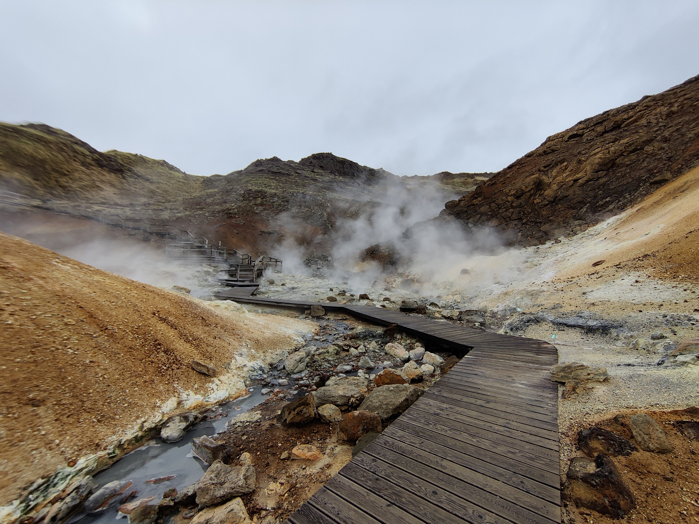
Gunnuhver – Iceland’s largest mud pot
These mud pots are named after a female ghost that was laid here. They form where steam from the boiling geothermal reservoir water emanates and condenses while mixing with surface water. It is twenty metres wide but you cannot really make it out due to the amount of steam.
It is said that a woman called Gunna lived on a farm near here about 400 years ago. One day she was unable to pay her rent to the landlord and he took her only cooking pot as payment. She was furious and told him she’d starve herself until he gave it back. As he did not relent, she died of hunger. When her coffin was being carried to her grave, those holding it noticed it became very light and a whisper was heard saying “no need to dig deep, I have no plans to lie long”. Later that day the body of her landlord was found mutilated. People believed the ghost had taken vengeance not only on him but on his wife and began to haunt the peninsula.
The people reached out to a visiting priest named Eirikur to help end the hauntings. He took a ball of yarn and gave it to the locals and left one end where Gunna was known to haunt. He told them to take the ball to the local hot springs and toss it in. As they walked towards the spring, Gunna grabbed the end and followed them. When the ball was tossed into the spring, her spirit went with it. It is said you can see her trying to escape through the mists of the hot springs.

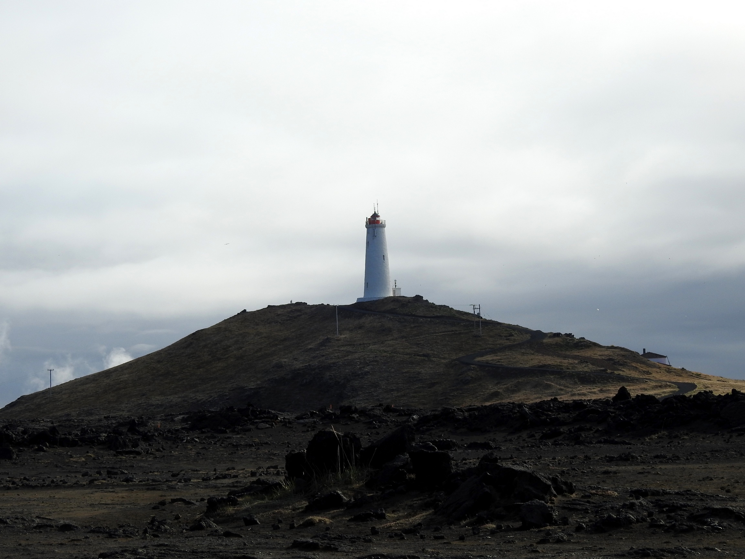
Valahnukur – a seaside spot with a lighthouse and bird sculpture by a local artist, Todd McGrain
There were a few cliffs here with some sea birds but at this point we didn’t see more than what we thought were seagulls

Great Auk Memorial

We stopped at a roadside info board about the Stampar Crater Row where we took a short hike – here two volcanic fissures form a row of craters The oldest dates back 2000 years ago and the youngest dates back to the 13th century. The row is about 4km / 2.8 mi long.


We did manage to spot some whooper swans: (they are ALL over Iceland)

We stopped in Grindavik after receiving our test results where we aired up the tires (amazing how low they were for a rental) and decided to try an Icelandic hot dog. We did not enjoy them much; mustard was not to our liking and the meat was not what we are used to. (We learned later they are made with lamb so we tried another one later in the trip that was wrapped in bacon which made it tastier but not healthier!) We had been told by friends that black licorice here is very good so we treated ourselves to some of that – it was excellent.
We then headed inland a bit to the Seltun geothermal springs. This was the first time we encountered another person – he was actually leaving as we began our walk along the boardwalk to see the springs.
The next three planned stops took us onto the famous Ring Road of Iceland.
The Ring Road of Iceland is Route 1 that runs around the island and connects most of the inhabited parts of the country. Its total length is 1322 km / 821 mi. The road was completed in 1974 which coincided with the country’s 1100th anniversary of the country’s settlement. It is mostly a two lane highway with few traffic lights, mostly roundabouts in the towns. In Reykjavik there is a four lane section.

In this area, we tried to visit three sites which were unfortunately all closed due to COVID – a lava tube (tour), a geothermal park and a geothermal plant. Guess we’ll have to come back one day…..
Kerid Crater is a water filled crater that probably looks way better in the sunlight. This crater was formed 6500 years ago. The oval is 270 m long, 170 m wide and 55 m deep. We did the hike around the top.

The first two main attractions are actually off the ring road but on good highway, Route 35; the first being a geothermal area of mud pots and geysers. The famous one, Geysir , no longer erupts but it is still noteworthy as it was the first geyser ever described in print and the first known to modern Europe.

However, the Stokkur geyser still erupts pretty regularly ever 7 -10 minutes and we managed to catch it a few times.
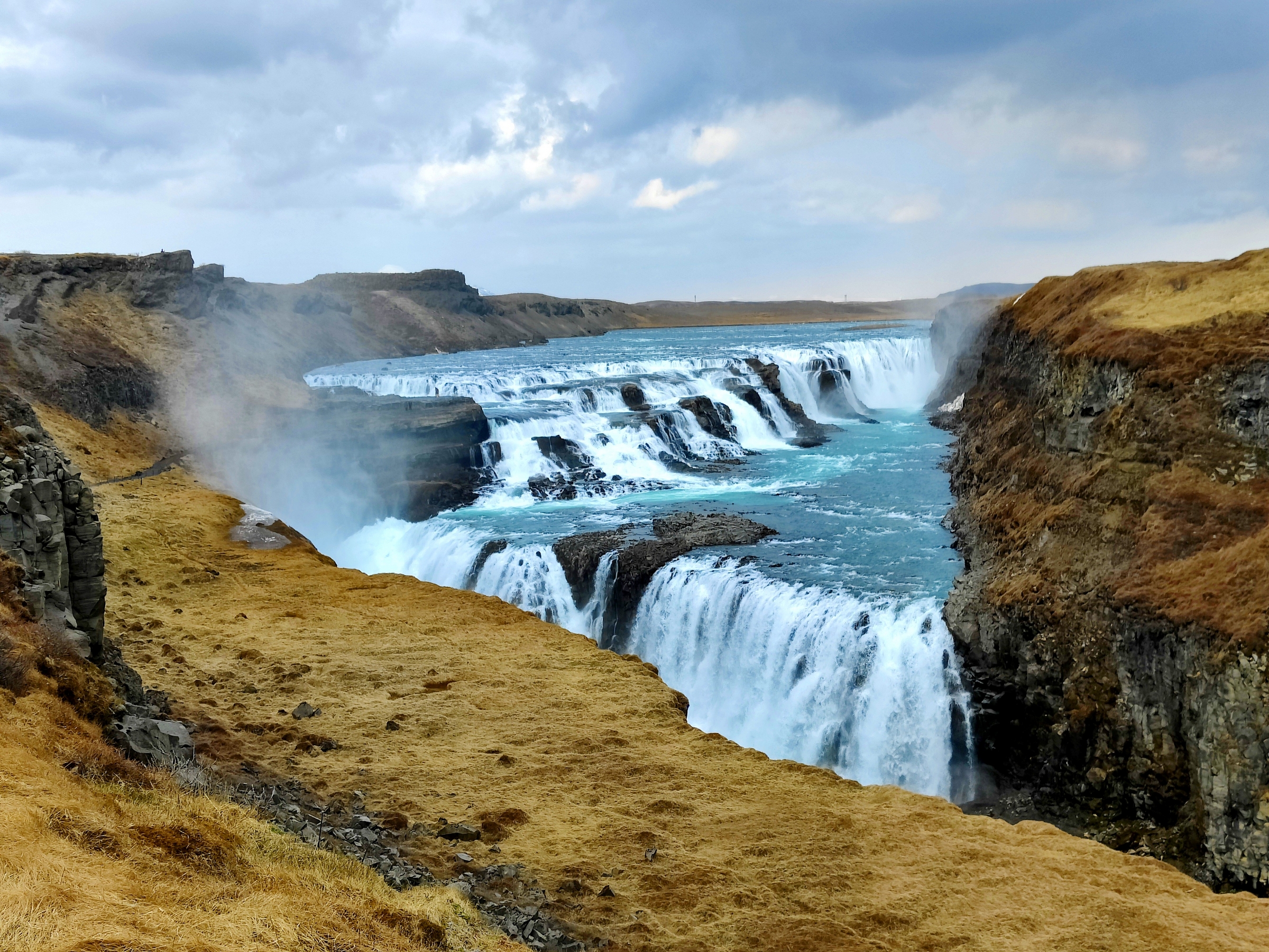
Our final stop of the day was in the late afternoon was another famous site: Gulfoss.
Before reaching it, we spent some time online to find a place for the night. We booked a room in a guesthouse in Fludir, some 40km / 30 mi south of the falls.
Gulfoss, which means “golden waterfalls”, flows from the north along the Hvita River which makes a sharp right hand turn flowing down into a wide curved three step “staircase” into a narrow canyon. The “steps” are 11m / 36’, 21m / 69’ and 32m / 105’ tall. The average water flow is 141 c metres // 5000 cu ft per second in summer.
It was still cloudy and drizzling now but we managed to do the hike to the various lookout spots and saw this powerful, beautiful waterfall.
Lower part:

Upper portion:
It began to rain harder and we were feeling jet lagged so we made our way towards Fludir. Before checking in, we were able to find a small grocery store to stock up for a few days. We are not foodies and eating out in this country is very, very expensive so since our plan was to stay in guesthouses/hostels, we knew we’d have access to kitchen facilities each night. So we’ll eat simply and as healthy as we can. Fresh fruit and veg are readily available and we can get milk in tetra boxes. We don’t have a cooler but after a few days we starting freezing empty bottles to help keep things colder in a box we were given at a grocery store – no bags at most. We should have brought a cloth bag or two for shopping but didn’t. We ended up using two boxes to store our groceries. As it doesn’t get too warm here this time of year, we managed just fine. Recycling is pretty big here too and you see separating bins everywhere for tins, bottles and paper.
We arrived at our accommodation and there was a bit of confusion about an included breakfast (it was not) but we collapsed early. The guesthouse had six bedrooms and two bathrooms. There seemed to be a least one other guy there that night but we all kept our distance.

Most of the accommodation we got in Iceland was twin beds, pushed together sometimes and sometimes not. They all came with a fitted sheet and pillow and a folded up duvet – no top sheet – and sometimes a small throw blanket at the end. So each night you unfold your duvet and by the way, even on a pushed together or queen bed, each person gets a separate duvet! Fran likes this idea – no blanket hogging! Pillows varied in softness so we got into the habit of requesting extras.

Weather today – mix of sun, cloud and rain
May 20th
So being jet lagged, sleep deprived and not used to sleeping where it never gets dark (!), we slept just okay – definitely need eye shades this time of year if you want to sleep well.
We had made some tea, had a bowl of cereal with bananas and set out once again.
Today’s stops started with us going further inland on Route 26 and were again at mostly empty sites.
First stop: a waterfall: Hjalparfoss. This was cool as it was two streams coming together with lava walls and a pretty side area.
Our drive to Gjain and Stong took us on gravel roads part of which were covered in fresh snow! Thank goodness for the 4×4. The sun had come out and it all looked so pretty.
We stopped at Gjain– what Fran deemed a little “fairy land” enroute – a breathtakingly beautiful oasis of waterfalls, creeks, twisting lava, caves and small foot bridges. We hiked down into the little valley and wandered the paths.


GOT FANS: this was where they filmed the Water Dance between Arya and the Hound.
Then it was on down the roughish road to Stong.
Stong is the location of a Viking longhouse still under archeological excavation and restoration. This ancient farm was buried under volcanic ash back in 1104. Excavation began in 1939 and was Iceland’s first proper archeological site. Restoration began in 1974. Here we hiked up to the site and explored inside. Instead the usual turf roof, they have covered it in corrugated steel to protect the site.


GOT fans: The Wildlings attack on the village was shot here, where all the inhabitants of the farm were killed by the Wildlings, apart from the small boy, Olly.
Next we drove further inland to visit Haifoss – (means “high waterfall”), parked and took the short trail to the view point. It was a freshly covered snow covered path; kinda made us feel like the first people ever here.
Haifoss is 122 m / 400′ tall. It has a “sister” waterfall called “Granni” which means neighbour.

We returned to the main road and headed eastward in the hopes that the F road into the national park was open.
Nope, the F road was closed.

So we turned around and made our way back to the main highway and then southward.
By this time the clouds had begun to move in especially over the mountains.
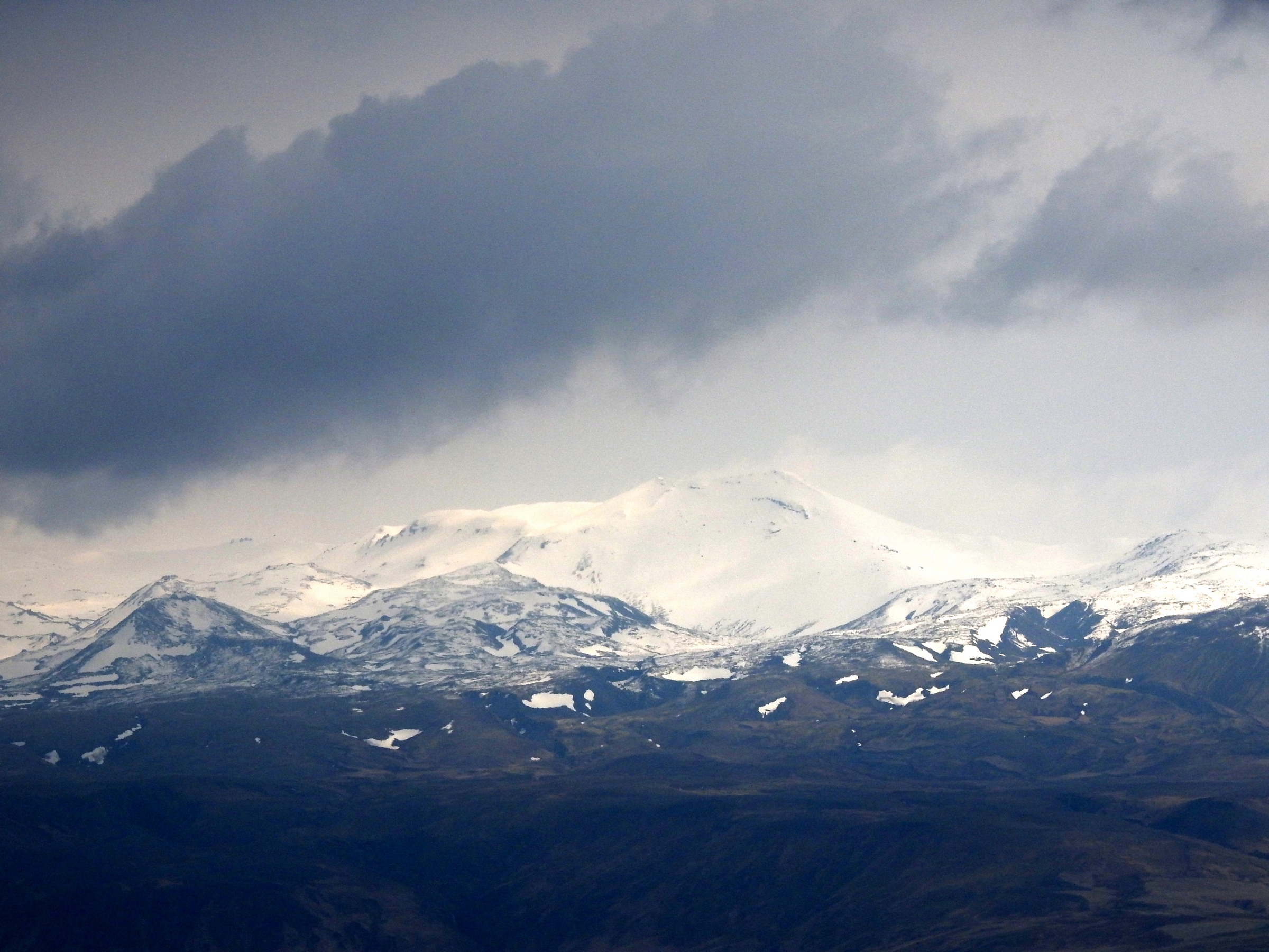
We stopped at a view point to see the most famous and active volcano in Iceland: Hekla. It means the “Hooded One”. It has had 15 major eruptions since 1104 and the one in 1300 was the most devastating covering more than 83,000 sq. km!
Then it was off to a very small cluster of turf farm buildings called Keldur. The farmhouse buildings are of the oldest preserved type of turf construction. Most of the buildings dated back to the 19th century although they include timber from much older structures.


There was also a tunnel which leads down to the brook which is believed to have been built for defensive purposes

The farmhouse was inhabited until 1949 when it became a national historic building.
Heading back towards the sea we stopped at the Gluggafoss waterfall next; it had windows in it! The upper half of the cliff is palagonite or tuff rock and the lower half is basalt. The river has formed tunnels and grooves through the upper softer rock which has, over time, created the windows.

From here we tried to take a short cut road across the river to the next stop but the bridge was closed:

Driving south, from our side of the river, we could see the 3 waterfalls we wanted to visit next:

By this time it was getting on in the afternoon and we found a guesthouse to stay at. It meant passing the waterfalls so we’ll come back this way in the morning to explore them more. This place was on the Stori-Mork farm (as many guest houses outside the cities tend to be).
The Stori-Mork farmland:

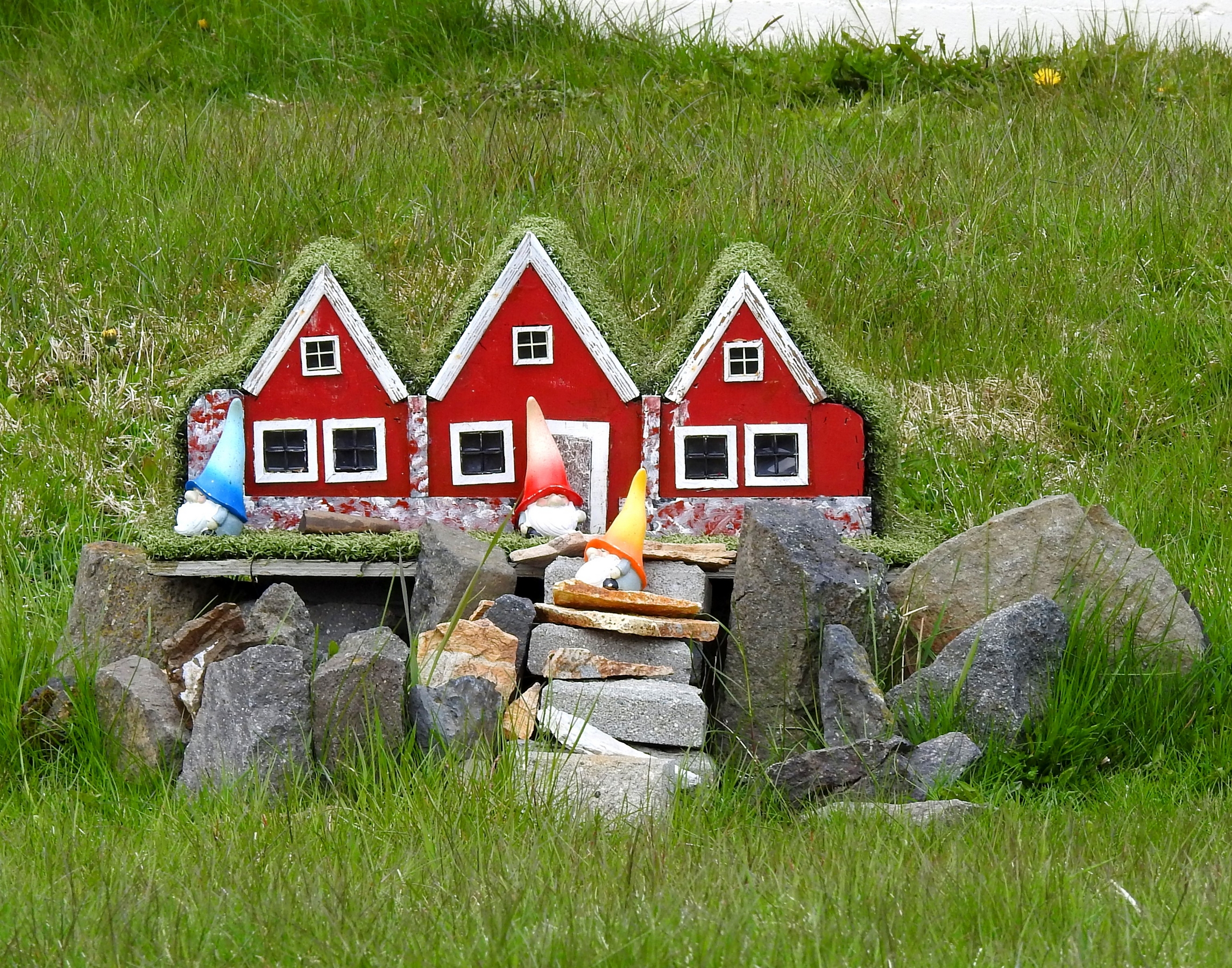
The lawn ornament below is a very common one we’ve begun to see and there was one out front of the guesthouse:
From our guesthouse we could see the Hvannadalshnukur volcano/glacier.

Weather today – Sunny morning, then a mix of sun, cloud and rain
May 21st
After breakfast we made our way back towards the coast to check out the 3 waterfalls.
The large one is the famous one: Seljalandsfoss and then there’s a middle one (actually two) that is smaller and the one furthest north was Gljufrabui.
Seljalandsfoss:

Doug did the walk behind the falls:

Middle falls:

The last waterfall is quite cool because it like, Gluggafoss has a window!

This was the first site we’ve been to where we had to pay anything to see the attraction – it was just a parking fee but the attraction itself was free. We never encountered this again the rest of the trip until we did the hike to the erupting volcano and in the national park later in the trip – no entry fee, just parking fees. There was a machine here to pay and you just use your credit card.
Speaking of credit cards, we were told you had to have a credit card with a chip AND a pin number but that if it didn’t have a PIN, you may or may not be able to use it. There are very few American credit cards (except Amex – which we don’t have) that meet those criteria. We naturally brought our debit cards and when we encountered this (which was rare) we used that. Sometimes instead of a PIN you can just click enter once or twice and it processes.
Along our drive to our next waterfall, we stopped at a roadside viewpoint of Eyjafljallajokul volcano/glacier. We all remember its eruption, but few can pronounce it, back in 2010 when it halted flights in and out of Europe.

As our waterfall viewing day continues, we visited Skogafoss which is the first in a string of 22 waterfalls you can visit doing a long hike of 23 km which at this time of year was not recommended due to mud and snow conditions. It also did not look that scenic to us (feel free to contradict us should you know otherwise). We did view this from the bottom:

And then climbed a long staircase to the top to see this;

GOT FANS: this was where Jon Snow rode a dragon.
After this waterfall it was a hike to our first glacier finger; this was an 11 km / 7 mi long finger called Solheimajokul which comes off the Myrdalsjokull glacier near the Katla volcano – another very active volcano in Iceland. The finger retreated between 1930 and 1969 but began to advance again until 1995. The ice chunks were quite full of sediment.


We continued along the south coast on the ring road to the nature reserve called Dyrholaey. This is a small promontory not far from the town of Vik. This is the southernmost point of mainland Iceland. The peninsula was given its name, Dyrholaey – which means “door hill island” – because of a large lava outcropping with arches it it. Being a sunny day, we had spectacular views.
Eastward:


Westward:

We looked for birds and although didn’t see a puffin, we did see a nesting bird in a small indentation in the grass (maybe an eider), a few eider ducks down below on the black sand beach and later several petrels in the parking lot. We did a short hike along the cliffs and then took a 4×4 road up to the light house to see the arches.


The black sand beach here stretches quite a distance and at the other end (which we drove to) you find Halsanefshellier – a very dangerous beach for its notorious rogue waves. This was not on our radar but we met an American couple at the lighthouse who told us they’d see a puffin down by the cave yesterday. The draw here is the basalt columns and the cave. Sadly we only saw the corpse of a puffin here on the rocky beach.


Looking back at Dyrholaey:

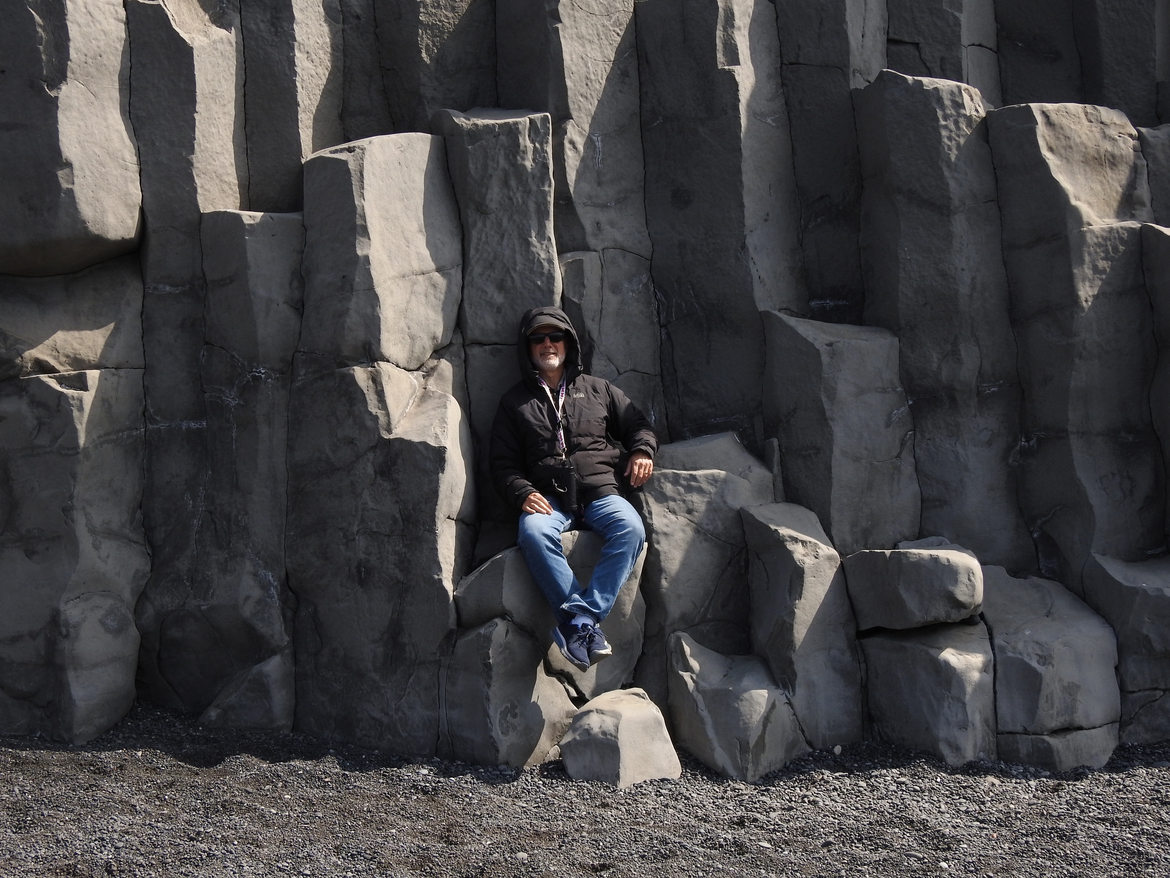
After lava solidifies the rock continues to cool for a considerable time forming columns that are frequently hexagonal. Such columns always lie at right angles to the cooling surface and therefore are vertical in lava layers and horizontal in intrusions (dikes. When the tallest columns are slightly curved at the top, it indicates that the lava was still slightly molten wen the columns began to form.
At this point on the beach you see sea stacks.
 According to local folklore, the two towers of one of these sea stocks are all that is left of a pair of trolls, who when trying to pull a boat into shore, were caught in the light of the rising sun and turned to stone.
GOT FANS; the beach here and these sea stacks are the location in Season 7 of Eastwatch by the Sea.
We then drove on to Vik to stock up on groceries and drinks before a long stretch of driving. Along this route we passed through some pretty barren lands knowns as Myrdalstander with pseudo craters.

We then stopped in the town of Kirkjubaejarklaustur to visit the Systrafoss (sister falls). We found the trailhead just outside town and got to the viewing platform but couldn’t see anything except large trees (the tallest trees in the country grow here). We hiked up the marked path then hoping to reach the falls. There were a few “creatures” along the route to protect us.


While we did reach the “sister lakes” (where nuns used to bathe) we didn’t see any waterfalls. As we walked around along the cliffs we found a small bridge that water must flow out of when the lake waters are high and figured that must be where the waterfalls start but at present, no water.

Further down the ring road was a site that is now closed to the public except by appointment: Nupsstadur – a small farm community with one of the last turf churches in Iceland. We stopped at the gate to see what we could see and managed to spot this through the ultra-zoom on Fran’s camera: (we know not very clear)

Nearby is the palisade of cliffs called Lomagnupur. It’s 767m / 2516’ tall and quite impressive. It is said to be full of legends (but we don’t know of any).

A few days ago Fran reached out via email to a website that showed the possibility of a tour we are interested in doing. The website itself did not offer it and we read about it in our guide book. Turns out they forwarded her request to a company that does the tours and they got in touch with us today – we had hoped for a tour tomorrow and lo and behold they offer one! We booked online and are set for tomorrow morning – here’s hoping we see puffins!
We made a pit stop at a road side rest area and while there read the sign boards about a glacial flood back in 1996. It washed away the bridge across the glacial plains. It rose quickly at a rate of 20,000 m2/s in fifteen hours and subsided over two days. Huge icebergs (as big as 2,000 tons) were swept downstream which created a great deal of damage including the destruction of the 176 m / 577’long Gigjukvisl Bridge. A few remaining pieces of steel are seen here as a reminder of the forces of nature at work.

The day was getting on so we decided to try and find a place to spend the night. Booking.com wasn’t very useful in this region so we decided to just try driving and check places out that were indicated along the highway by the by symbol of a bed. We found a few but they were either closed or super pricey, so we did something we hate doing: backtracked. We booked online and checked in to find it was almost empty. We drove back about 20 km / 12 mi to the hostel that was off the highway but reasonably priced.


We only saw one other couple during our night here and they seemed to be in a different wing than we were. We put our cold stuff in the fridge, made some dinner and enjoyed some down time.
Because it never actually gets dark we could hear ducks and geese squawking really early in the morning at the pond by the parking area.

Weather today – Sunny until late afternoon then a mix of clouds and rain
May 22nd
Today we awoke to cloudy skies with sprinkles. After breakfast we began the drive towards Ingolfshofdi where our tour was located but felt we had enough time for a stop enroute.
Now for another glacier finger; this time Svinafellsjokull. We arrived at the turnoff and the road was signed closed; there were 3 vehicles sitting on the side of the road we joined them and instead of a 800m hike, the sign said it was a 2 km hike down the road. To our annoyance, it turned out to be a 2 mi hike and when we arrived at the real parking lot, there were half a dozen vehicles down there! (When we returned we saw that they must have picked up the middle sign, driven through and replaced the sign.) So we were at a small lagoon with chunks of very dirty glacier.


GOT FANS: this was the location of the land known as” North of the Wall”.
We return to our rental car and make our way back to the coast for our tour.
At Ingolfshofdi (which is privately owned) there is 76 m / 250’ promontory that rises from a flat black sand beach. In order to get to this promontory, you naturally, need to book a tour. As we had arranged that, we arrived at the meeting point and checked in. Only one other couple joined us on the tour, a couple from Colorado, Sanny and Dennis. A unique part of this adventure is that the meeting place is across the beach is 8 km / 5 mi from the site. In order to get there you all pile into the back of a farm tractor:

Our ticket which is actually a postcard with an amazing photo taken by our guide:

Our ride:

As there were only four of us, we had plenty of room to distance. This was a cool ride across the streams and black sands.
Our guide Einar, drove us across the beach in less than a half hour. This gave us time to not only enjoy the ride but chat with our tour mates.
Upon arriving we were given a brief talk about the history of this part of the country (first settlor, his family history and natural disasters that have occurred here). He was full of tales of survival and perseverance through floods and eruptions and how so many left but his family remained and the land passed down through the generations. Einar called himself the “sand king” as much of the land is covered in the black sand.
We then did a short hike up the sandy slope to the cliff top.

Einar explained what types of birds live and/or nest here and the only mammal is the arctic fox. While he pointed out foot prints in the sand, we did not see one. But here’s what they look like (taken from his FB page):

They can be quite a nuisance as they eat the eggs and chicks of the birds. His family has hired a local to track down the fox and remove him from the area (we hope that doesn’t mean kill it…).
We spent the next hour observing birds of many kinds:
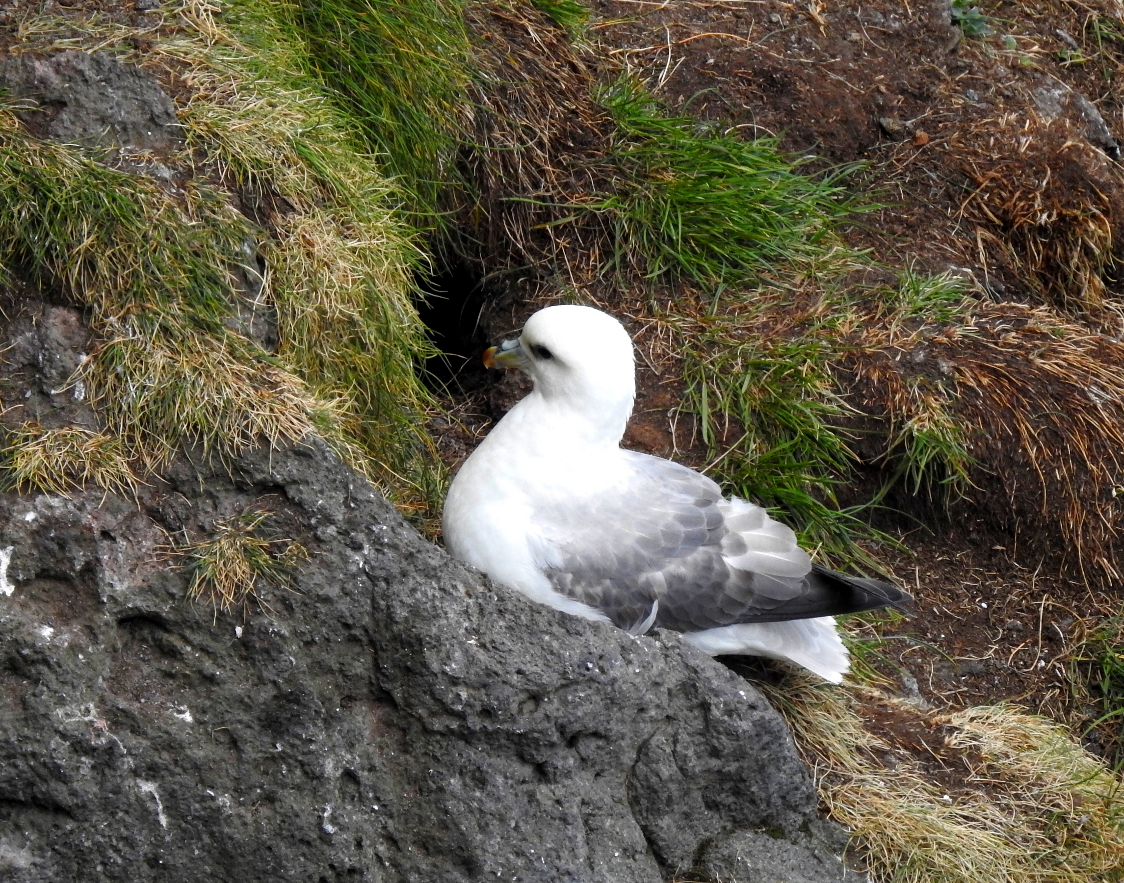
Fulmars:
Guillemots:

Northern gannets flying by:

Skuas:

And of course: puffins:


We were able to catch a few on video whipping by us standing on the edge of the cliff:
Einar was an excellent guide; over the years he has come to recognize and know the returning puffins. At times they seemed to recognize him.
Puffin facts
- There are four species of puffins. The one breeding in Iceland is the Atlantic puffin; the other species are the Horned puffin, Tufted puffin and Rhinoceros Auklet.
- The word puffin is thought to be derived from the word ‘puff’ which refers to swollen. And it is the puffin chick that contributes best to this name because of its round, puffed look resulting from its dense cover of down feathers – an adaptation for retaining body heat while the parent is off fishing. Indeed, they resemble little puff balls with beak and feet. Puffins have also been called “clowns of the ocean” and “sea parrots” because of their clown-like facial markings and colorful beak (more like that of toucans).
- Adult puffins mostly eat small fish, such as sand eels, herring, hake and capelin. The young puffins are usually fed fish by their parents. Parents carry fish in their bills and either drop them on the burrow floor or pass them to the chick. Some puffins have been known to carry as many as 12 fish in their beaks at once!
- Sixty percent of the world’s puffins breed in Iceland.
- A puffin’s beak (or bill) changes colour during the year. They only possess Technicolor beaks – and their matching orange feet – during the spring breeding season. Just before winter sets in, they shed the colourful outer beak, leaving a noticeably smaller and duller-coloured beak.
- Puffins spend most of their lives out at sea, resting on the waves when not swimming.
- Puffins mate for life.
- Puffins don’t make nests; they dig burrows which can be up to a metre deep.
- The female puffin only lays one egg each spring.
- Puffins live a long life, up to twenty years.
- The puffin is not the Icelandic national bird.
- Puffins are smaller than you think; they only measure about 30 cm / 12” from the tip of their beak to the end of their tail and stand at about 20 cm / 8”.
- The puffin is a poor flier. The puffin struggles to get in the air, beating its wings 300-400 times a minute just to stay in flight! They also have trouble landing, often crashing into the water or rolling onto the grass, tumbling into any other puffins that may be in their way. A puffin can fly 77 to 88 km/hr (48 to 55 mph).
- The puffin is an excellent swimmer. They use their wings to ‘fly’ underwater while using their feet to control direction. Puffins are incredible divers and can reach depths of 60 meters on their journeys to look for food.
- Puffins may chatter up a storm at their breeding colonies, but they remain perfectly silent while at sea.
- Puffins cannot fly unless they have a view of the ocean.
- They learn not to be afraid of humans if they have not experienced being hunted by them.
It was an amazing experience and even if we’d only see one puffin, Fran would have been happy. We saw puffins before on a sailing trip to see icebergs in Newfoundland in 1999 but they were on an island and we could not get so close to them (nor did we have a good zoom on our camera).
After our tractor ride back, we made ourselves some sandwiches for lunch and began our drive once again.
Here are some great shots taken by our guide:


We then made our way to two more glacier fingers:
First Fjallsarlon which while quite large, did not have a lot of chunks in its lagoon:

And then the famous Glacier Lagoon (aka Diamond Beach). We knew where the parking area was (and where you can take zodiac tours from) but we found a spot shortly before arriving there (before crossing the bridge) where we had better views as we were at the centre of the lagoon, not at one end of it. We were alone there.
This as a nice spot but to be honest, having been to Antarctica it was not as amazing to us; we’d done the zodiac thing and the ice bergs were much cleaner and bluer down there. Not to take anything away from this spot, but it was not new to us. You should do this lagoon especially if you only do one in Iceland.


As it was getting on in the afternoon and the next stop was quite a ways away, we booked a guest house and pushed on as far as the small harbour city of Hofn.

view of town from our room:

We made our dinner, made a birthday toast to Fran’s Dad and had a quiet evening. We’ve taken to wearing eye shades now and sleep is coming easier and longer though we still wake up pretty darn early.
Weather today – cloudy with sprinkles
We have many many more photos – check out the day by day Iceland galleries in our “Pics” section.