September 30th, 2025
GAS: in UT ranged from $3.15 to $3.55
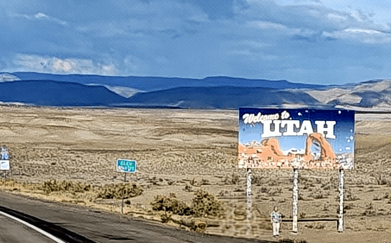
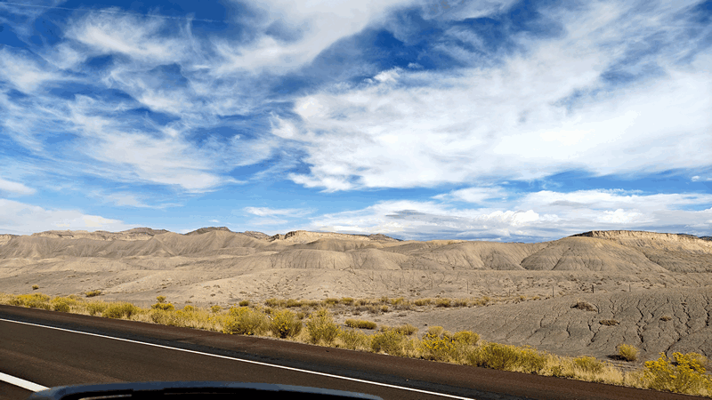
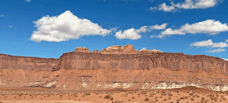
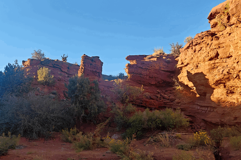
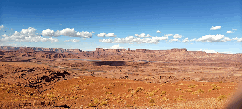
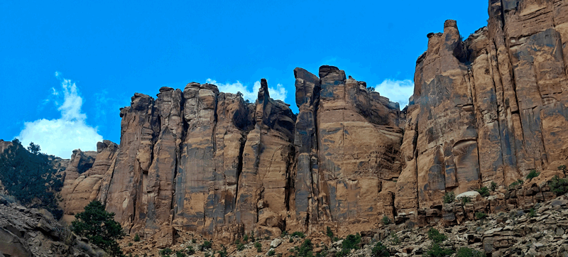
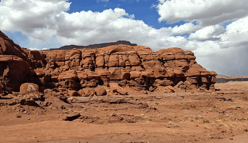
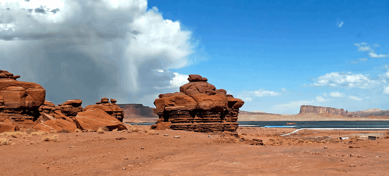
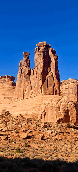
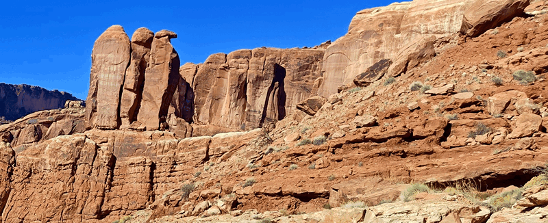
We crossed into Utah the landscape changes:

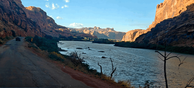
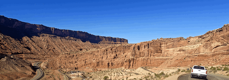
We turned off the I70 and went south on the UT191 towards Moab. We had planned to camp down Willow Springs Road where we’d stayed many times before but it seems that entire area has been turned into the Utahraptor State Park and you cannot access the area without a $15 day pass. However that does allow you to access Arches National Park on the back side which is worth considering as the park now has timed entry like Rocky Mountain did. We drove over to the Scenic Route 128 highway where we know that that were cheap BLM campgrounds along the Colorado River but although the second one about 5km / 3mi up the road had spots, there was NO cell reception – not our cup of tea as you know!
So we headed back up the 191 and got a site with excellent cell reception on Klondike Bluffs Road. A little further from town than we’d like but it’s free and has good cell signal. We got unhitched and as it’s after lunch time now, we headed into town in the truck, found a place that serves breakfast till 2 and had a filling meal before heading over to the library to use some Wi-Fi and returning to the trailer where we chilled and only had a light dinner.
Click here for miscellaneous pictures of our drive of the changing scenery from Grand Junction and Moab.
Wednesday morning, we were up before the sun (6:30) and got out the door after packing a lunch and cold drinks for the day and made our way into Canyonlands (all the national parks in Utah are remaining open despite the Federal Government shut down that began today).

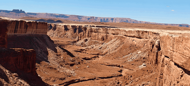
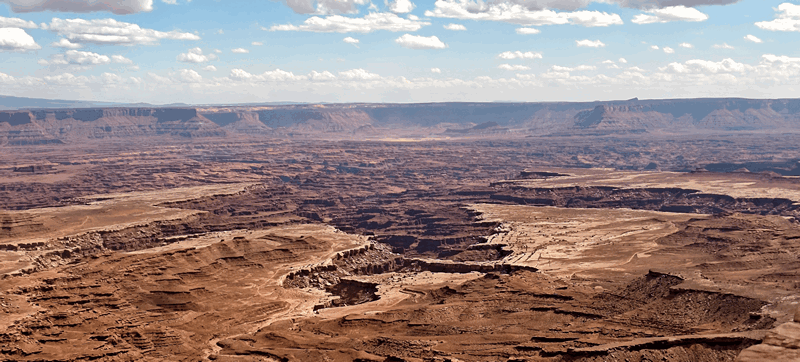
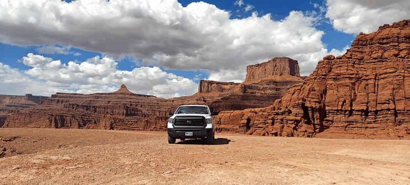
The White Rim Road is an unpaved four-wheel drive road that traverses the top of the white rim sandstone formation below the Island in the Sky mesa of Canyonlands National Park.
A brief description of the road:
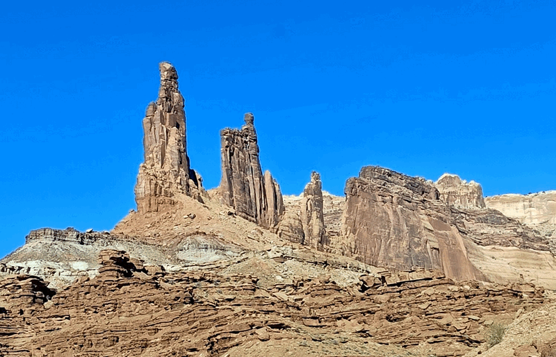
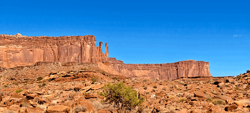
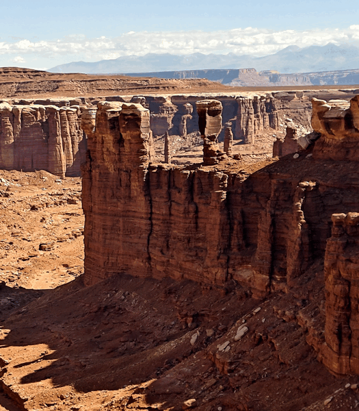
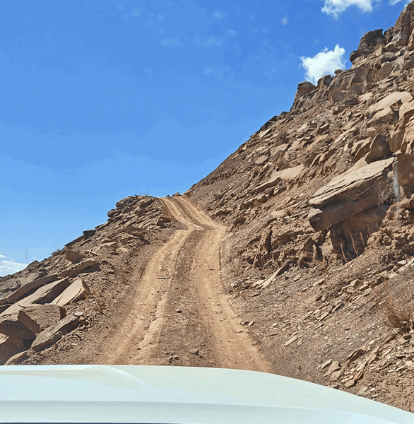
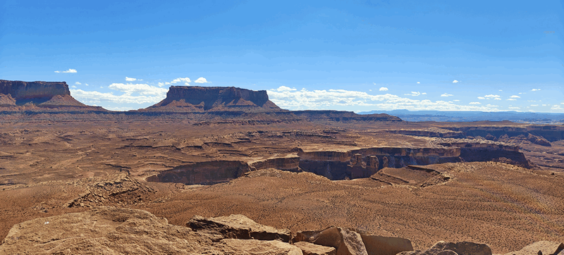
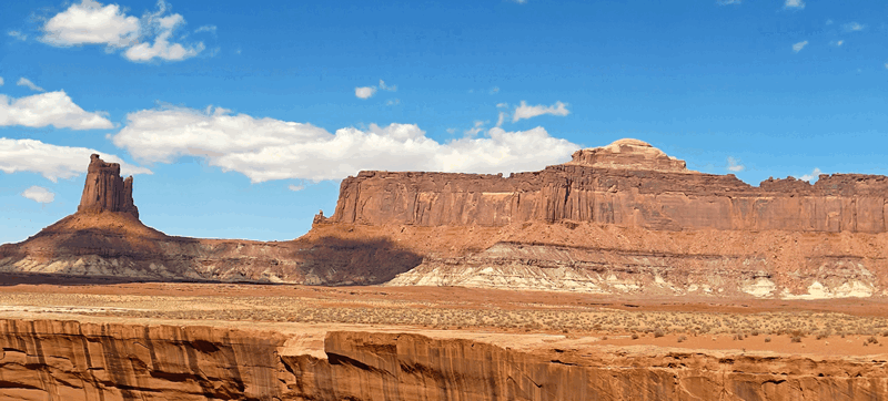
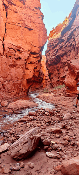
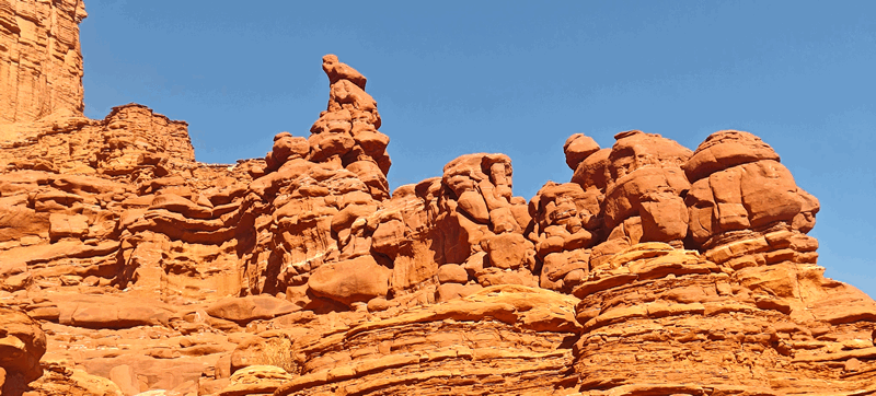
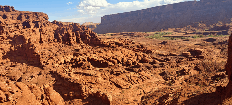
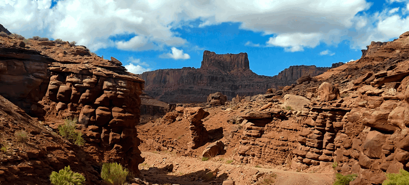
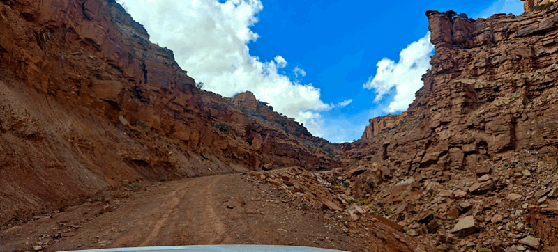
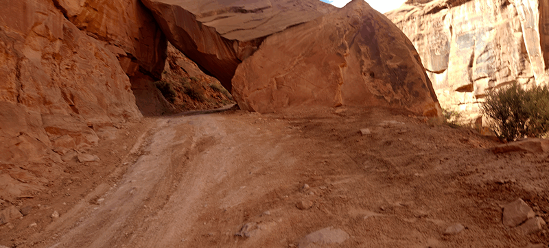
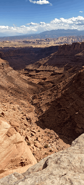
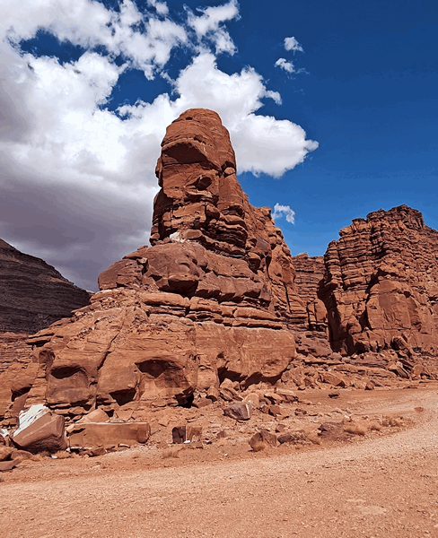
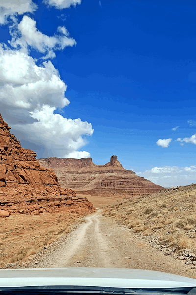
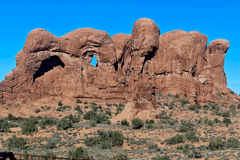
Starting on Shafer Trail from the Island in the Sky mesa, you start with hairpin turns, steep grades and cliffs with no guardrails. After a short distance along relatively flat terrain at the base of the mesa, you reach the turn for the White Rim Road at the junction with Shafer Trail/Potash Road. It’s here that the sites begin: including Musselman Arch, Airport Tower Butte, Monster Tower, Washer Woman, visible from the road. Continuing on, one passes Buck Canyon, Gooseberry Canyon and Monument Basin with its rock pinnacles. The next challenge occurs at the steep Murphy Hogback which marks the approximate halfway point on the road. Candlestick Tower and Upheaval Dome are visible near Soda Creek Springs. After crossing sandy dry washes, or arroyos, the White Rim Road ends just outside the national park boundary at the junction with Mineral Bottom Road and its hairpin turns leading one back up to the Island in the Sky.
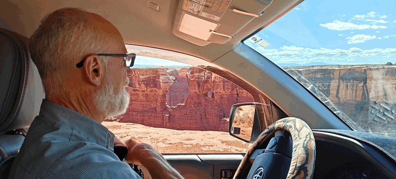
We had our permit and did not need to stop and check in anywhere and we started at the Shafer trail road down into the canyon – always a spectacular drive.
For those who are not aware, there is a rating system for the roads on public lands: 1-10 in difficulty and 1-10 in scenery. The White Rim road is rated a 4 in difficulty and a 10 for its scenery – and a road we’ve done a few times before, sometimes just in part and at least twice before in full. We love this park – it’s our favourite of ALL the national parks in the US and one of the few places in the world, we continue to return to.
We began the road about 7:45 am (took us about 15 minutes to get to the start from the main highway down the switchbacks with stops for views). The weather was perfect, clear skies, temps only reach about 27 C / 81 F today and the road was 99% dry.
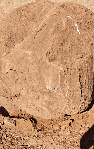
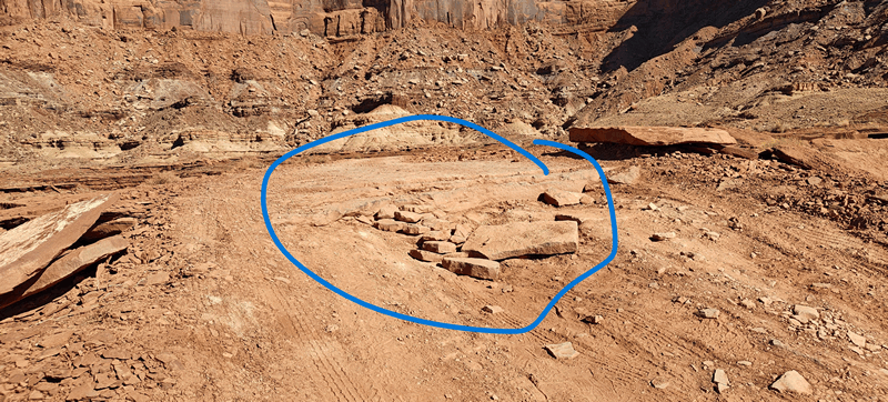
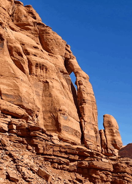
First stop: Musselman’s Arch – you used to be able to walk across it, but no longer:
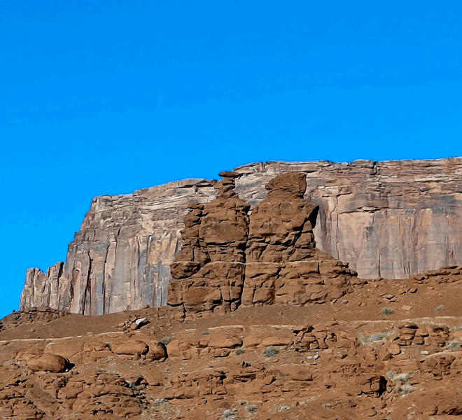
A little while later we begin to see the Washerwoman Arch and Monster Tower in the distance in amoungst all the other rock formations – you cannot drive up close to it though and it is visible from Canyonlands at the Mesa Arch lookout.
We later stopped at Monument Valley:
We carry on and head up the shelf road to drive along Murphy’s Hogback:
We had lunch atop the Murphy’s Hogback with this view looking back where we came from:
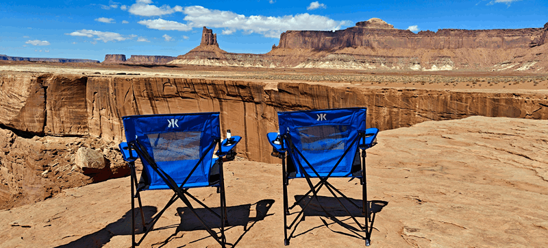
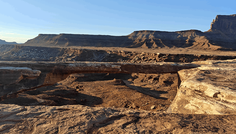
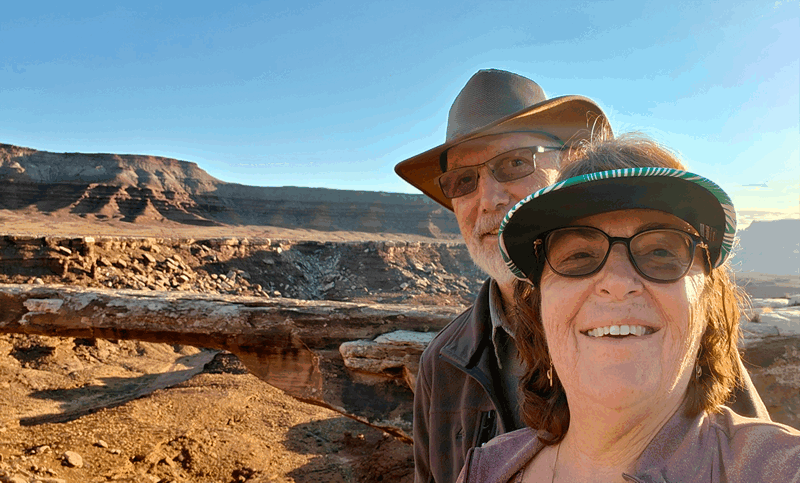
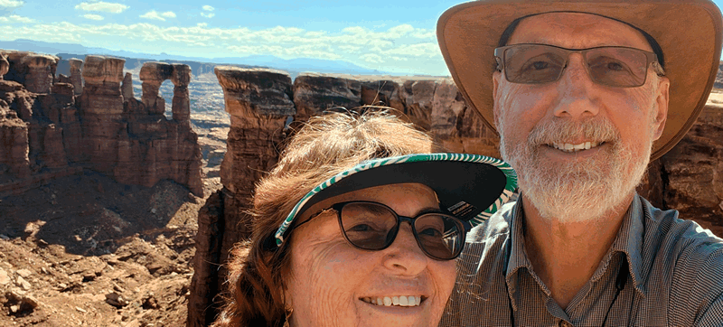
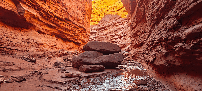
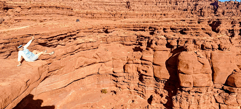
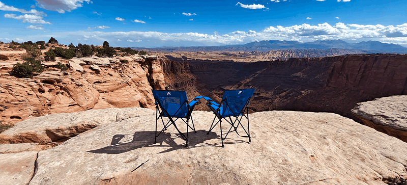
We stopped for our traditional beer on a canyon edge at Soda Springs – see photo at the top of this post and these were our views:
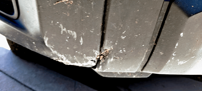
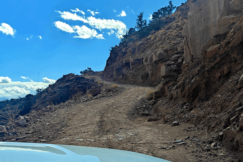
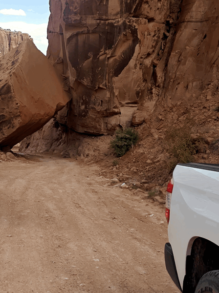
Up to this point, the road was fairly easy on the truck, a couple of scrapes to the side railings. Then when we left Soda Springs we misjudged a rock and there’s a tiny bit of damage on the front bumper and the rock!
We continued along the road.
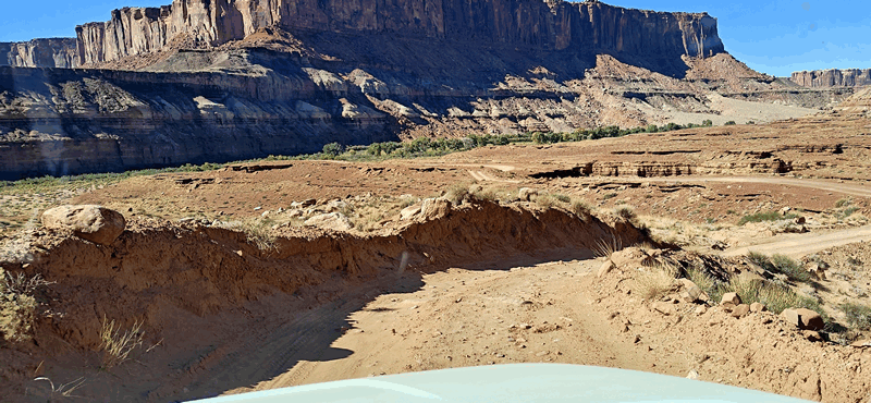
Upon hitting an area on the way down to the Green River where we had to build road to get through a ‘step’ area but still managed to scrape the side railings.
This pushed up the passenger side railing and caused the door to jam a bit when opening but Doug jumped on the railing and pushed it down.
We then hit an uphill section a little later (about 13 km / 8 mi from the end) that was a narrow shelf road; while it was wide, it had two very rocky sections that the Tundra managed but not without us both feeling quite anxious! Doug had to use the 4×4 a few times, mostly high 4 but this spot and a few climbs up the roads needed low. Fran was too nervous to take photos or video!
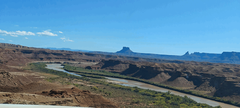
We began to see the Green River:
We reached the end of the White Rim Road around 4 and made our way back up the switch backs of Mineral Bottom Road and felt we deserved happy hour and dinner in town. We went to the Trailhead Pub and enjoyed some drinks and dinner before returning to our wild camp.
This is the link to LOTS more pics of the drive along the White Rim Road. Fran always takes way too many and culling can be a bit of a chore!
It was not so windy tonight but definitely warmer than last night and the weekend is going to warm up before it cools off again.
We took it easy on Thursday doing chores, organizing before having a bit of an early lunch and then we headed into town for showers at the Rec Centre ($6 pp) and then the library for a couple of hours to get online. Around 2:30, we packed in it, got a couple of groceries and filled the gas tank before returning “home”.
Fran’s face has turned red now, on the 4th day of the skin treatment prescribed for her face and after consulting with the dermatologist via their portal chat option, she will now stop using it. She must take care to avoid as much sun on her face as possible under the redness goes away. It’s not very sore but there’s a bit of a burning sensation at times.
We got out a few things for tomorrow’s hike before bed as we wanted to get an early start so as to be done before the heat of the day.
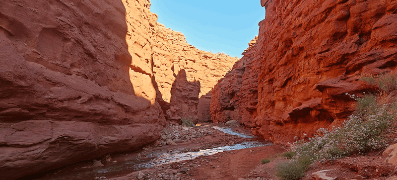
We were up and out the door on Friday before 7 and drove the 54 km / 33 mi to the start of the Professor Valley Hike to Mary Jane Canyon which ends at Slytherin Falls. There were a few cars in the lot but we met very few on the trail until the return hike. It did seem like we were the only ones without a dog or two though.
This is an approximately 13 km / 8 mi hike return and mostly level. You cross the stream (they say…) 122 times before finishing – now we did not count but it was a lot! It was a sunny day that promised to get pretty warm and we were glad we started early. Much of the first quarter of the hike is out in the open and once we reached the canyon it was mostly in shade although that changed some by the time we turned around at the waterfalls, and got back to the truck. It took us about four hours total.
Here are many shots along the way both there and back:

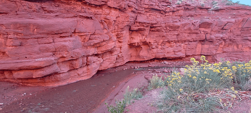
There were a few side slot canyons, water in the creek the entire way (never more than ankle deep) and lots of cool rocks. The canyon got narrower as we went but never really narrow.
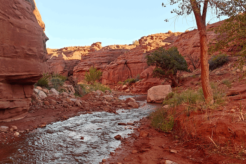

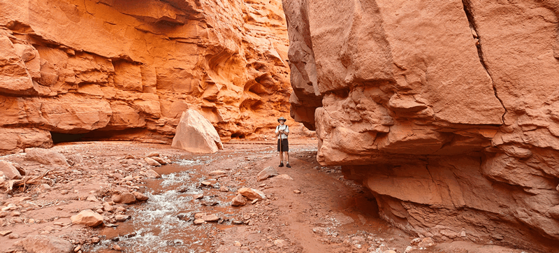
This wasn’t a hard hike – call it moderate due to the stream crossings and the rocks around. The water was never more than ankle deep and there was some muddy sections.
If you click here you will see all our photos from this hike.
Upon completing the hike we went back to the trailer via the wonderfully scenic UT128 – one of our fave scenic drives.
Check out these videos of snippets on the drive :
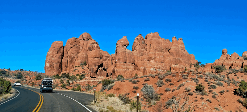
In order to get back to our trailer, we pass by the entrance to Arches National Park; we figure it’s the park with the grandest entrance:
We got changed and went into town to the library after lunch for a couple of hours. That night someone had an open StarLink connection at our camp spot that were were able to use the next few days – thanks whoever you are!
That night it did rain a bit during the night and again the next morning – not for long and it’s so dry here the earth just sucks it right up quite quickly. We headed out to do a couple more off road trails.
First was the Hurrah Pass trail to the Chicken Corners one. We’d one this back in 2021 the last time and it’s very scenic going along Kane Creek on the south side of Moab and west into the wilderness.
We got to the top of the pass (the road is rated a 2 but really should have been a 3.5 or 4 as there were rough sections) and the view was spectacular:
As the next road was rated a 4 and we decided we’d been jostled enough today so we opted to skip it as we’d been jostled enough and headed back into town to do two other roads.
For all the Hurrah Pass photos, check it out here.
We drove along the UT279 to the Long Canyon Pass with the highlight being “Pucker Pass” – this is a short road that is mostly uphill, with part along a shelf road that is a bit rough but not as nearly as bad as the previous one.
When you reach the turn off, you can see Jug Handle Arch:
and then you begin the 4×4 road.
We reached the pucker point and Fran got out to video tape the drive under the rock:
pic on other side
As it was still morning, and we’d packed a lunch, at the top we stopped at a former favourite wild camp of ours which now prohibits camping to have lunch.
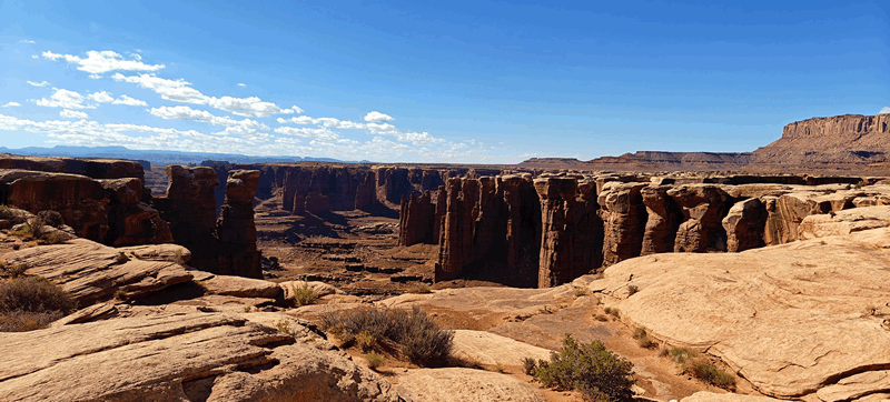
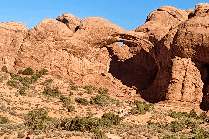
Then it was on back to a paved road to get into Canyonlands again where we headed down to the Mesa Arch viewpoint. We’d seen the arch the other day while traveling the White Rim Road and wanted to the White Rim from it.
The shutdown that started on the 1st means no park pass is needed (which doesn’t affect us really, as Fran has the lifetime senior one) and we passed the entry booth (which was closed) and the visitor’s centre (which was in fact open) and went straight to the viewpoint where where we did the circular loop hike – we were not alone here at the arch.
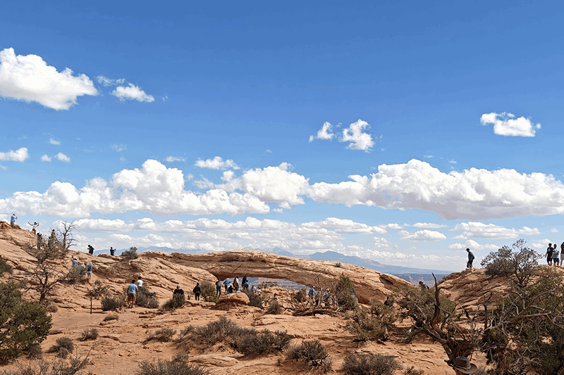
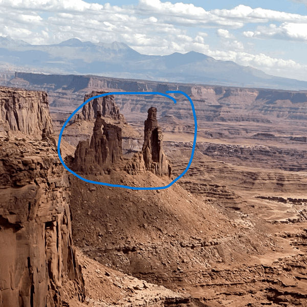
Through the arch you can see the not only the White Rim Road but the Washer Woman and the Monster features that we drove nearby.
This link will bring you to the gallery of photos from the Long Canyon Road & our visit to the Mesa Arch in Canyonlands.
Upon returning to the truck we did one more road – the complete Shafer Trail that we’d started to reach the White Rim on Wednesday and that turns into Potash Road. This is another very scenic route and that had a few rougher patches as well. We’ve decided we are now at this point in our lives, more about the scenery than the road challenges!
Here are some views along the road:
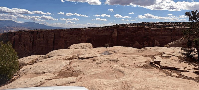
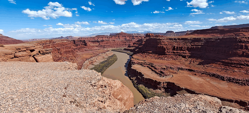
We stopped at the Colorado River Overlook and a little later at “Thelma & Louise” point where the scene where they go over the edge of the Grand Canyon was shot. (A few years ago when we were here, there was a BBC film crew reenacting that scene to explain how it was done – with a sling shot type device. We have camped right at this spot a few times in the past as well – remember, Christine J.?)
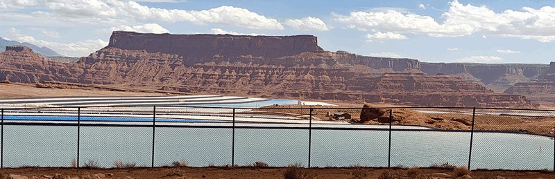
Then it was on to the potash ponds which are various shades of blue:
If you click here, you will find all the photos from this drive along the complete Shafer Trail from the switchbacks through to the end of Potash Road.
We finished the road and went into town for a drink – only to be reminded we were in Utah and cannot just order a drink at a table only at the bar and as we wanted to sit on the patio we were forced to order food. So we ordered a large pizza with our drinks (it was only 3pm) and only ate one slice each, asking for a box to take the rest back with us for actual dinner.
We had another quiet night at our wild camp with the free StarLink wifi. It was much cooler today, with highs only reach around 20C / 70F compared to yesterday’s 31C / 88 F.
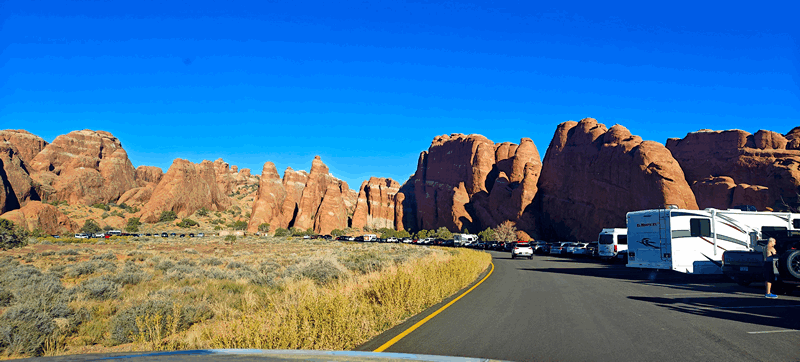
Sunday, after Doug’s attempted long run (he’s been struggling lately after doing a marathon walk in Rapid City followed by the half marathon a few days later in Boulder) we decided to hit Arches National Park. We were told at the Visitor’s Centre in Moab yesterday that the timed entry business is on hold during the shutdown so we figured we should go early to avoid crowds.
That was the right move – we’d been here several times before but it’s been years. We drove straight to the end of the main park road to get out ahead of others as well. We didn’t stop at all the pullouts nor did we do any hikes (we’ve done them all included a guided hike in the “fiery furnace” area.
Views on the drive up:
Upon turning around at the end, we did stop at Sand Arch:


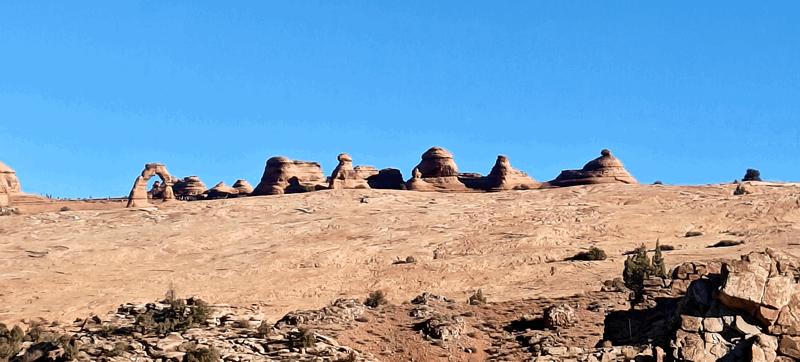
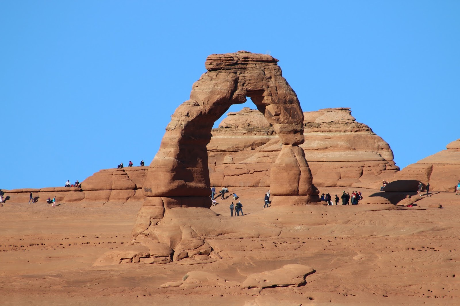
then the Delicate Arch Look out (we’ve done the hike out to the Arch twice before)
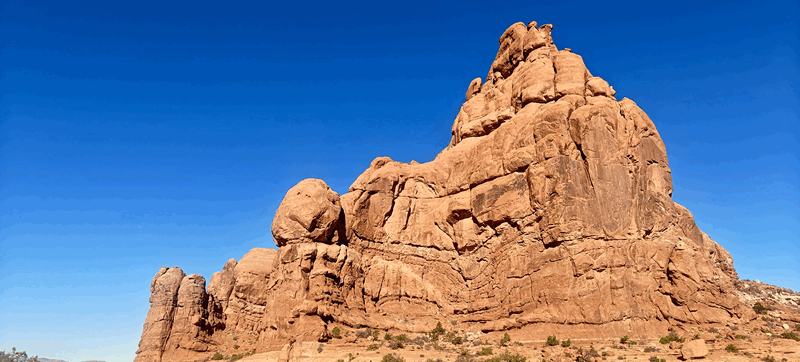
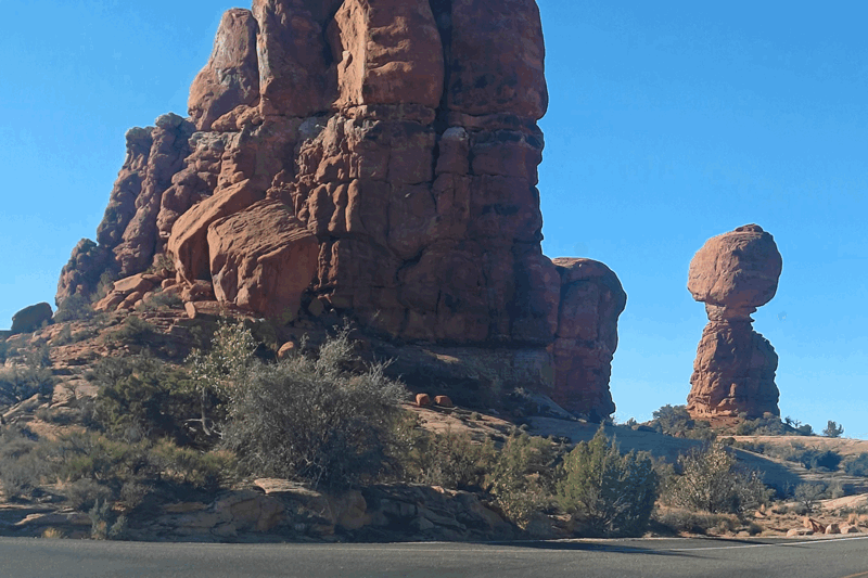
followed by the road to the Double Arch, Windows, Turret Arch, Pothole Arch and the Balanced Rock.
We planned to stop and do the hike Park Avenue trail but the parking lot is way too small with no free spaces – we’ve done that hike many times as well but here’s shots of the area:
Final stop was at the Moab Fault sign where there are great views of that as well as the only entry area which is fantastic:
All our photos from Arches NP can be found here.
We spent just over two hours here and it was a great little trip. Next we drove into town for showers again only to realize enroute the rec centre does not open until 11 on Sundays (and it was only around 10) so Fran found another place just past the centre of town a couple of blocks that turned out to be a campground/General Store that also offers showers for $6 each. While that does sound a bit pricey for a shower, remember we’ve had to pay for camping for six nights so that doesn’t hurt much at all.
These showers were better than the rec centre and we’ll remember this place next time we come through. Here you get an actual stall with hooks and a bench where you can change unlike the rec centre where the shower is a stall, but the drying and changing area is out in the open.
We returned to the trailer, had a video chat with Serena and chilled the rest of the day making plans for the next few days further south. Doug got the truck hitched up and sorted everything to do with that while Fran cleaned up some inside (lots of sand got blown in through the screens while here). We’ve lasted quite well on our fresh water – just have to make it to tomorrow. Going out to have showers saves about 8 gallons so that’s helpful when there’s a place to get them.
Monday was a chilly one; temp dropped to 8C / 46F but warmed up a lot as we drove into Moab. Doug dropped Fran at the grocery store while he went to dump the tanks, fill the water and the gas tank. He picked her up and we left Moab – it was a great week here.

It was fun reading place names and watching for photos of places we are familiar with. I have come up from the river at Mineral Bottom after floating from Green River and it is a spooky climb. When you can get away from the crowds, it is a magical place, Moab.