September 13, 2024
Happy 34th birthday to Serena!
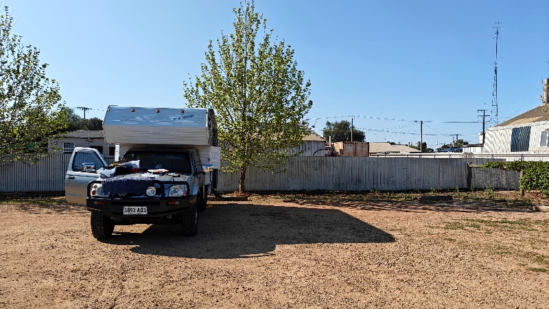
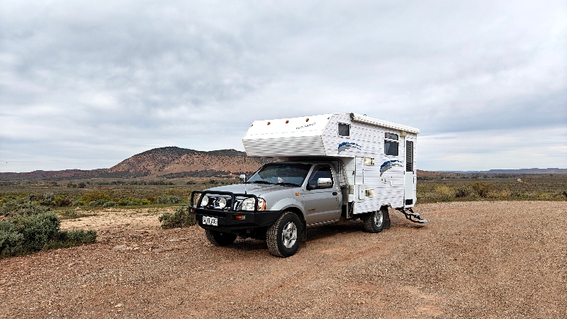
Well, after a decent night’s sleep in Matilda (we slept in the east west bed and managed okay), we were up and gone from John & Pam’s by 7:30. We had a few stops to make before leaving Adelaide. We had said our goodbyes last night as we are earlier risers than they are.
First, it was to the hardware store (Bunnings – it’s huge – bigger than Home Depot as it has two floors and it’s the big hardware chain in the country) to get a railing/conduit to hide the wires Doug installed to get the 240V power to the other side of Matilda. Done
Next was the shop where Doug had purchased all the solar panel equipment and more to return a few items; this store (4WD Supa Centre) does not give refunds so we had to get store credit less a 10% restocking fee!!!!) and we chose a few items using the credit.
Third stop was the RV accessory shop where Doug bought the water cap the other day, to return that as it was the wrong type. We did buy something in there was well.
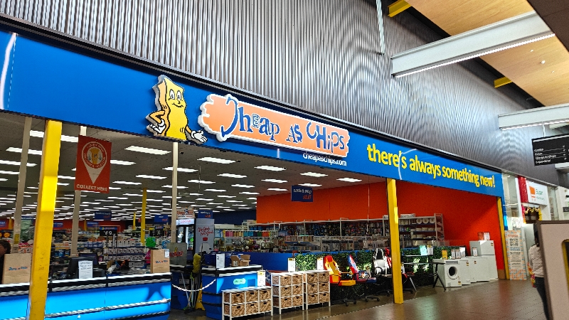
Finally, since we couldn’t get everything we wanted at the above stores, we stopped at a mall where there is a “Cheap as Chips” shop – this is like a bargain shop (not quite a dollar store) where we found a few more items we needed and what we couldn’t find, Fran found at the Kmart next door.
So now finally, we are headed out of Adelaide and made our way north. We stopped for fuel once at $1.69 a litre (AUD) and then made our way to Port Pirie to a pub/hotel that allows free overnighting if you are self-contained. We spent a couple of hours getting things done with our purchases. We did a few things around Matilda and around 5 went over for a drink or two.
Enroute we stopped in the small village of Lochiel – where we saw the Australian version of the Loch Ness monster! We were fortunate to be visiting at a time when there was actually water in the lake!
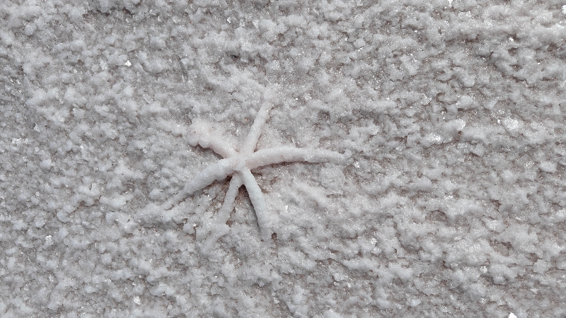
Lake Bumbunga is known for its pink hues earning it the title of “pink lake”. The colour is caused by a chemical known as carotene which is produced by the combination of halo bacteria and dunalialla salina, the latter of which is commonly used as a natural food colour and antioxidant. While the bacteria are a hive of microscopic activity, not much else can live in this environment.
And there is a large “eel like” monster at one end. It dries up annually but we were here a few months before that happens. It was a fun spot to walk on the salt and see the salty crusting pieces on the surface.


Today we had sun all day and it was nearly 20C / 70F but in places where we stopped there was a great deal of wind.
Pam called to say that we should have stayed one day longer; our debit cards had arrived (we’d been told two weeks!) and the cheque from the government for the refund on Tassie’s registration had also arrived (we’d been told 4-6 weeks!). The only thing missing was Fran’s Woolworth’s card so we’ll wait a few days before having Pam send them off to Alice Springs where Fran has set up a post office pick up spot (you can change this at any time to any city) and we can receive mail.
It was our one and only day of travel so far in Australia where we encountered NO vehicle problems!
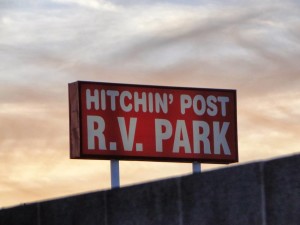
We spent the night behind the pub in Port Pirie where you have to call ahead to ensure there’s room and all they ask is you buy a drink at the bar.
Saturday morning after exercise, we showered and discovered a new issue: the hot water tank although it heated the water for Fran’s shower, ran out of not only hot water but water in general for Doug’s shower!
After shutting down, we drove over to the town’s dump site and water filling and about half way through filling, water began to leak out in two places: the hot water tank and somewhere under the filling receptacle. Doug thought it looked like the relief valve on the hot water tank wasn’t working so Fran looked online and lo and behold this small city actually had an RV parts store which closed in one hour (noon on Saturdays) so over we went immediately.
The fellow behind the counter was most helpful, knew what we needed and to confirm the part, he sent a young man out to take a look. We drove across the road to the parking lot at Cheap as Chips to work on that and Doug decided we should get a new anode rod as well. Then we needed a tool to remove the old one which the shop had and then he realized it needed something to turn it with so they lent us a long screw driver and that did the trick. So kind and we managed to get all this done before they closed!
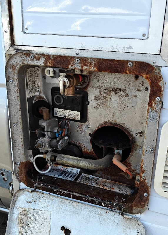
We then returned to the water point and refilled the tank but still water seemed to start coming out at a certain point so we’re not sure if there’s an overflow valve or what but at least the hot water tank is no longer leaking.
Approaching Port Augusta, we saw a huge bright light.
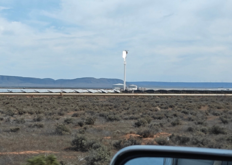
After googling “what is the bright light near Port Augusta, Fran found out this:
The giant light is a receiver; it sits among a sea of mirrors which beam the sun onto it, producing intense heat that creates steam, turns a turbine, and makes electricity. It’s known as concentrating solar thermal, a new breed of energy. Nearby, a chimney is visible in the distance across the salt pans.
When we stopped on the roadside to take a “pee” we saw water leaking from near the door once again. We were parked on an angle and hoped it was the grey hose that is wound under the vehicle and does not drain straight down…..
We stopped for petrol again today to top up because as we head to the Oodnadatta Trail, the price goes up exorbitantly. We are testing Matilda’s fuel economy and it’s coming in at around 15mpg.
We then pulled into a rest area on that highway, called The Outback Highway for the night. The fresh water tank in this vehicle does not tell you how much is left in the tank but there’s a weird reading of what you have used in the tank. We were pretty sure we filled up but this device said we had used 15L already…. This is so strange.
Other small problem we are having is that the radio in the truck requires a “code” to turn it on and we do not have that code. We tried a few tricks from Google and YouTube to no avail, we we’ll have to call Nissan next week.
It was quite windy here near Hawker but it was dry. We had a cell signal and had a quiet night despite the wind.
So we continued along the Outback Highway (we love this name!) and stopped a few times. The terrain is mostly flat with brush but you can see mountains (the Flinders Range) for a good part of the drive. There are sheep and cattle ranches, sometimes with fences, sometimes not.
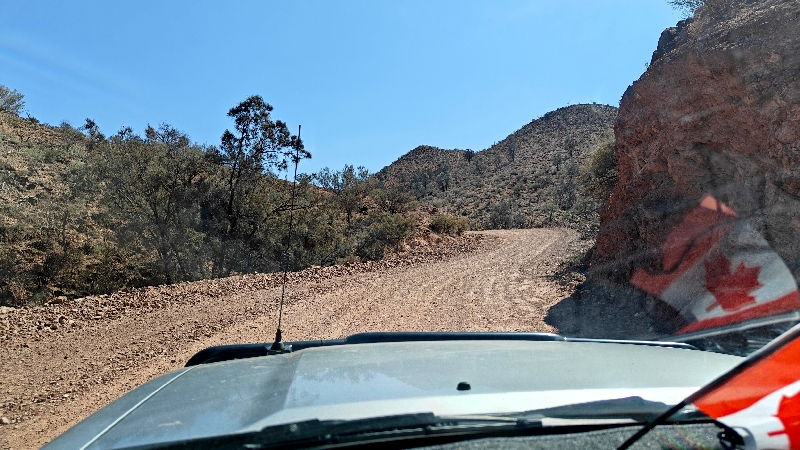
Aroona Dam which is located 4 km / 2.8 mi south of the small town of Leigh Creek, where back in the day, a huge coal mining operation took place. This was our first non paved road.
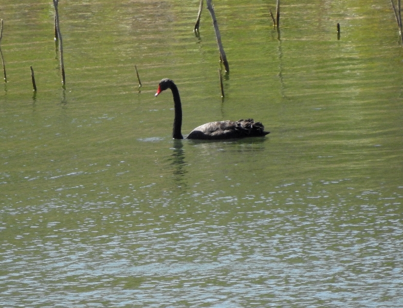
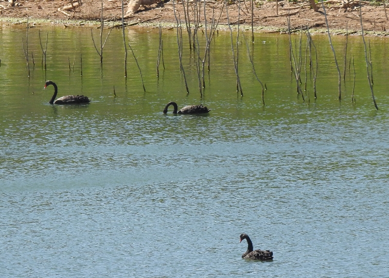
It was once the key water source for the town. The dam is no longer used as a water supply and is not a recreation space and has become quite a bird habitat with over 68 species of birds making this their home. We saw lots of flying small birds and more interesting were the black swans in the water (see above).
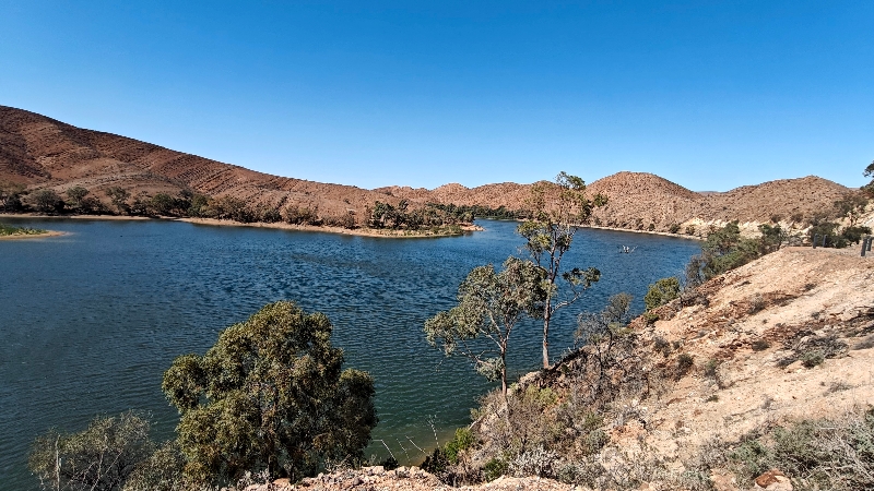
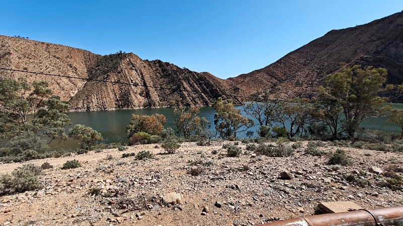
Aroona comes from the aboriginal word “arrunha awi” meaning “running water that looks like grey hair”. They believe this location is where the two serpents of creation set out southward on their journey.
Next quick stop was the Ochre Pits.
These cliffs of colour tell a story that began with time itself and they are an important part of the country’s history and the culture of the first people to this land, the Yantruwanta . The main ochre diggings at Lyndhurst are extensive and spread for more than a square kilometre with the ochre seams spreading over an area many times the size of the mine site. Ochre pits have been used by Aboriginal people for thousands of years. They traded the ochre with other tribes by foot over vast distances and in every direction of the continent. Ochre was an extremely valuable and spiritual item.

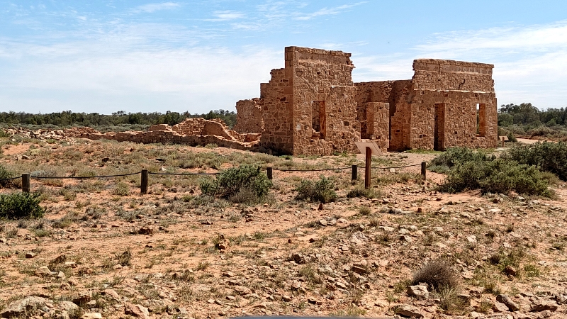
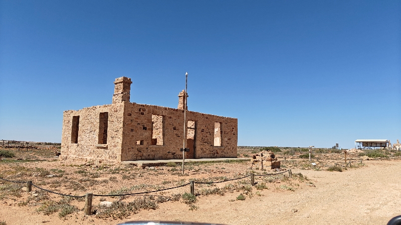
We made a short stop in Farina to see the remains of this once wheat producing town that died and all that’s really left is a bakery that still bakes bread and is run by volunteers.
During the wet years of the 1880s, plans were laid out for a town with 432 quarter-acre (0.10 hectares) blocks. It was believed that the area would be good for growing wheat and barley, but normal rainfall proved to be nowhere near enough for that. Several silver and copper mines were opened in the surrounding area.
Farina grew to reach a peak population of about 600 in the late 19th century. In its heyday, the town had two hotels (the Transcontinental and the Exchange), an underground bakery, a bank, two breweries, a general store, an Anglican church, five blacksmiths, a school (1879–1957) and a brothel.
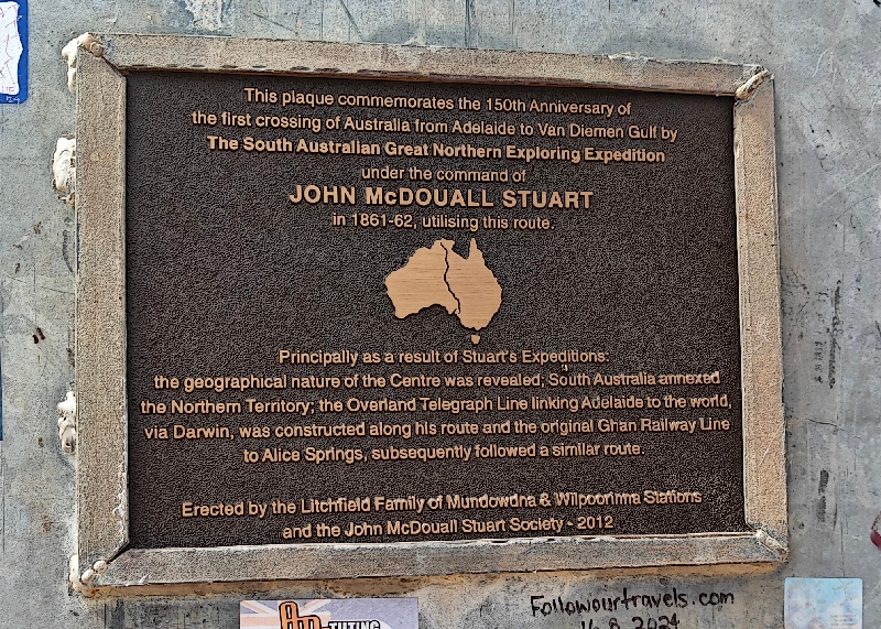
Final stop before Marree, was the inukshuk like memorial to John Macdouall Stuart, a major explorer of central Australia.

We arrived in Marree (the starting off point for the Oodnadatta Track) and before heading to the camp spot Fran had found, we visited the cemetery which dates back to the 1870’s and is divided into three sections: European, Aboriginal and Afghan. On the road to the cemetery, we saw more emus that were closer to take photos.
The first Afghans (this term was used for all Muslims) who migrated to Australia arrived mid nineteenth century as cameleers. Over subsequent decades, they played a crucial role in facilitating British exploration of the country’s desert centre.
Australian camels are introduced populations of dromedary, or one-humped, camel from North Africa, the Middle East and the Indian Subcontinent). Imported as valuable beasts of burden from British India and Afghanistan during the 19th century (for transport and sustenance during the exploration and colonization of the Red Centre), many were casually released into the wild after motorized transport negated the use of camels in the early 20th century.
From the 1860s onward small groups of mainly Muslim cameleers were shipped in and out of Australia at three-year intervals, to service South Australia’s inland pastoral industry. Carting goods and transporting wool bales by camel was a lucrative livelihood for them. As their knowledge of the Australian outback and economy increased, the cameleers began their own businesses, importing and running camel trains. By 1890 the camel business was dominated by the mostly Muslim merchants and brokers, commonly referred to as “Afghans” or “Ghans”, despite their origin often being British India, as well as Afghanistan and Egypt and Turkey. At least 15,000 camels with their handlers are estimated to have come to Australia between 1870 and 1900. Most of these camels were dromedaries, especially from India, including the Bikaneri war camel from Rajasthan who used riding camels sourced from the Dervish wars in British Somaliland, and lowland Indian camels for heavy work. Other dromedaries included the Bishari riding camel of Somalia and Arabia. A bull camel could be expected to carry up to 600 kilograms (1,300 lb), and camel strings could cover more than 40 kilometres (25 mi) per day.

The Marree Hotel as a camping area in the back and by agreeing to a meal in the bar/restaurant you can camp free with use of toilets and hot showers.
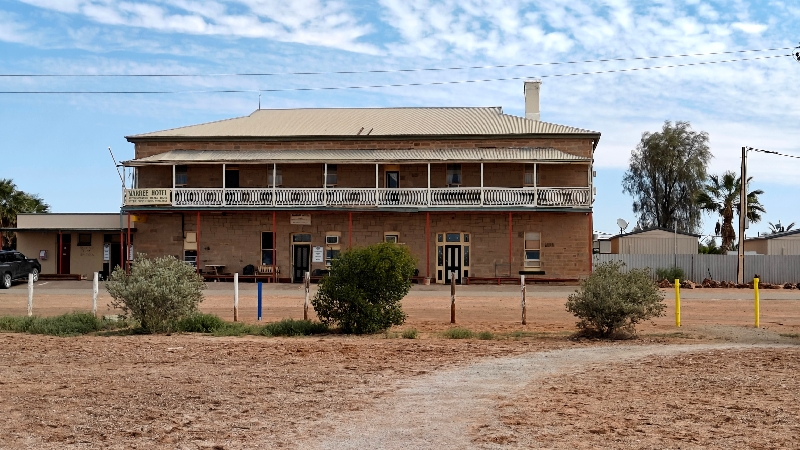
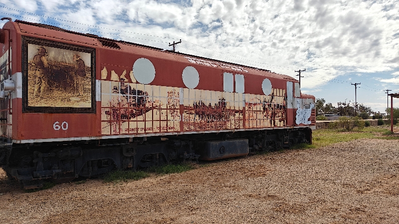
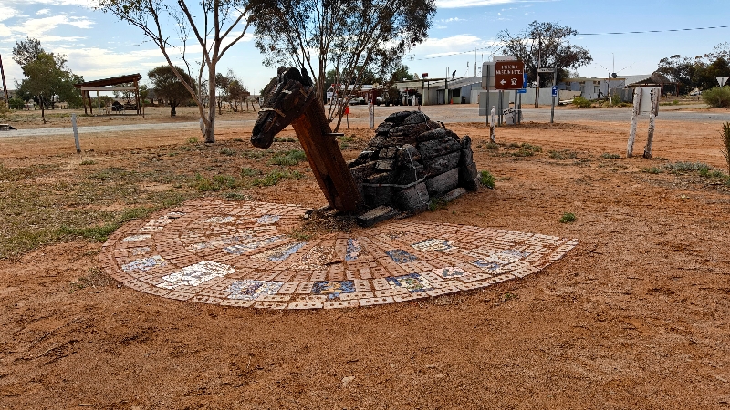
We got parked, Fran got us registered in and then we went for a walk to see the “sights”. There is a very small railway museum, a few train engines, a camel sundial and a section cordoned off where a section of the Afghan part of town had a mosque.

We then went to check out the one store in town, the Roadhouse (which also sells diesel at 2.90 a litre!) and walked the shop. The only thing we bought was a 10L box of spring water, just in case. Matilda still seems to be losing water somehow and we’d hate to run out!
We got back to Matilda and tried to get the wiper fluid sprayer working on the passenger side to no avail. Then Doug began trying to understand the solar controller as some things were not making sense; how could the battery be at 57% but still have 12.7V?
We spent some time online as we will most likely NOT have any cell signal on the Oodnadatta Track over the next two or three days (not sure how long it will take us really). Australia reminds of us of Canada with regard to cell service; it’s a big country with lots of wide open spaces of nothing and reception can be spotty while you can easily get 5G in large cities and at least 4G in smaller cities; towns, well that’s hit and miss!
Sidebar: there are A LOT of flies in Australia and if it’s not windy, out they become quite pesky! Someone told Fran we need to get fly nets!
We had our monthly KEGS meeting at 5:30 and by 6:45 we walked over to the bar to have dinner. Prices were somewhat high so we ordered drinks then an appie and a main to share. It was pretty good but the food took a long time to come out.
While we were eating the couple beside us began chatting with us. They are from outside Melbourne and have travelled a great deal with his work. They actually invited us to come to their home even if they weren’t there as they have two driveways and we’d have a place to park. They are going to Italy for much of the Australian summer season so there’s a chance they won’t be there when we get there but our itinerary keeps changing, so who knows!
During dinner, there was a video telling the story of a mail carrier who took the track from here to Birdsville:
Esmond Gerald “Tom” Kruse (28 August 1914 – 30 June 2011) was a mail carrier on the Birdsville Track in the border area between South Australia and Queensland. He became known nationally as the result of John Heyer’s 1954 film The Back of Beyond. He was appointed Member of the Order of the British Empire (MBE) in the 1955 New Year Honours, “for services to the community in the outback”.
Kruse worked the Birdsville Track mail run from 1936 to 1957, driving his Leyland Badger truck. He delivered mail and other supplies including general stores, fuel and medicine to remote stations from Maree in north-west South Australia to Birdsville in far western Queensland, some 325 miles (523 kilometres) away. Each trip would take two weeks and Tom regularly had to manage break-downs, flooding creeks and rivers, and getting bogged in desert dunes.
Doug has decided to try sleeping in the hallway instead of up on the bed and climbing over Fran. He took the bench cushion and all his blankets and our spare ones down there to sleep tonight. He said he was warm enough but the cushion is too narrow.
Wildlife count today: lots of dead “roos” and 21 emus total
Check out more photos of the above part of this post, here.
Monday morning after exercising and taking advantage of nice very, hot showers, we hit the road around 8:30 stopping to fill up the tank at $2.90 AUD per litre! This is equivalent to $7.39 US per gallon. Apparently it’s worse farther down the Track. Doug aired down the tires before we left the campground too.
The Oodnadatta Track is an unsealed 614 km / 382 mi outback road in the Australian state of South Australia, connecting Marree in the south east to Marla in the north-west. Along the way, the track passes the settlements of Oodnadatta and William Creek, the southern lake of the Kati Thanda-Lake Eyre National Park, and mound springs known as Freeling Springs, Strangways Springs, and The Bubbler and Blanche Cup (Wabma Kadarbu Mound Springs).
The track follows a traditional trading route. Along the track are numerous springs feeding water from the Great Artesian Basin, the most accessible examples being the mound springs near Coward Springs, now in the Wabma Kadarbu Mound Springs Conservation Park. Later, because of the availability of water, the route was chosen for the steam-train powered Central Australia Railway, the original route of famous Ghan train route.
It was also the route taken by the explorer John McDouall Stuart on his third expedition in 1859. Remnants of the many railway sidings and bridges, the ruins of railway buildings, and Overland Telegraph Line repeater stations are located along the track.
We noticed we lost cell reception completely within 6km / 3 mi and much of the drive (when it wasn’t corrugated) felt like the Dempster Highway in northern Canada. Doug did air down twice more within 10 km / 6 mi until the ride got better and driving between 60 and 80 kmph seemed to help except where the corrugation was really bad.
There were a few things to stop and take a look at as we drove through Australia’s outback.
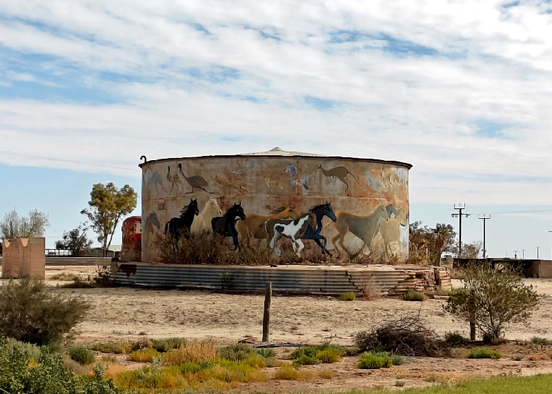
First “drive by” sight was the Callanna Siding Water tank:
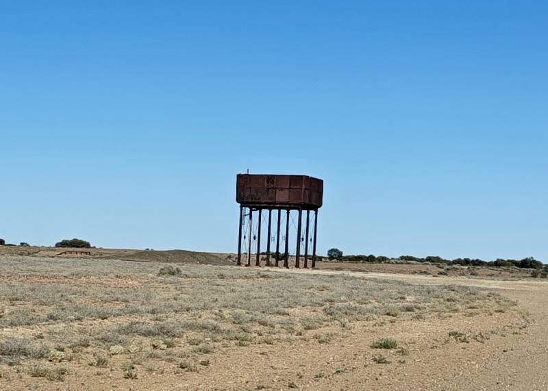
There are many, many of these along the track as before there was this track, it was the Ghan Railway.
During the cool months of 1923, the South Australian Railways decided to shorten the time taken by trains for passengers and perishable freight between Adelaide and Oodnadatta. Before this time, trains had stopped overnight at stations enroute, including Quorn. After 1923, a sleeping car was provided and the train rescheduled to continue without stabling overnight. Through passengers could leave Adelaide a day later, on Thursday mornings, and return a day earlier than under the previous timetable.
On 30 August 1923, the inaugural through passenger train, which included the Alberga sleeping car, left Terowie for Oodnadatta. It was on this trip that the name ‘The Ghan’ had its origin. A large crowd of local people gathered at the Quorn station to witness the arrival of the new train with its sleeping car.
According to the timetable, it was 8.40pm when the train pulled into Quorn yard. An Afghan passenger wasted no time in getting off the train and sprinting to a quiet corner of the yard, where he could kneel to face Mecca and recite his ritual evening prayers. A railwayman made the joking remark that, if he was the only passenger on the train, “We’ll have to call it the Afghan Express”.
The name proved popular and was adopted immediately, later being shortened to the ‘Ghan Express’, and then to ‘The Ghan’, by which name the train was known to local railwaymen for several years prior to the takeover by the Commonwealth Railways in 1926.
There are many versions of how ‘The Ghan’ received its name, including the official Commonwealth Railways explanation that the train was named in honour of pioneer Afghan cameleers, but local opinion is the name was bestowed in 1923 when the first sleeping car train worked on the Great Northern Railway. Others suggest the name is derived from an observation that ‘The Ghan’, when extended to Alice Springs, superseded the Afghans and their strings of camels. However, this explanation, and the commemorative plaque unveiled at the Alice Springs Railway Station in October 1980, contradict historical fact – that the famous ‘Ghan’ derived it’s name from an event in Quorn when the first sleeping car service was introduced between Terowie and Oodnadatta—six years before a train steamed into Alice Springs.
‘The Ghan’ ran from Port Augusta to Alice Springs via Quorn until 13 August 1956 and then operated via the new standard gauge line west of the Flinders Ranges (to Copley initially) to Marree, where there was a break of gauge and passengers changed trains back on to the narrow gauge line to continue to Alice Springs.
‘The Ghan’ continued to run on narrow gauge tracks from Marree to Alice Springs via Oodnadatta and Finke until 28 November 1980.
The first all standard gauge ‘Ghan’ to Alice Springs via Port Augusta and Tarcoola departed Adelaide on 4 December 1980 and continues to operate as a very successful tourist attraction.
It is fitting that ‘the Ghan’ name should serve to perpetuate the memory of that hardy band of gentle but tough men who supplied and provisioned the outback with their camel teams in the early years.

The next stop, also quite short was a “Dingo Fence” – yes a dog fence; the longest fence in the world. This was built in 1941 to stop the dingoes from going south into South Australia’s sheep country. It’s over 5400 km / 3366 mi long stretching across New South Wales to the coast.


Right at the fence is a cattle grate and as you cross it an alarm sounds – not sure who hears that alarm except you crossing it but maybe it scares the dingoes?
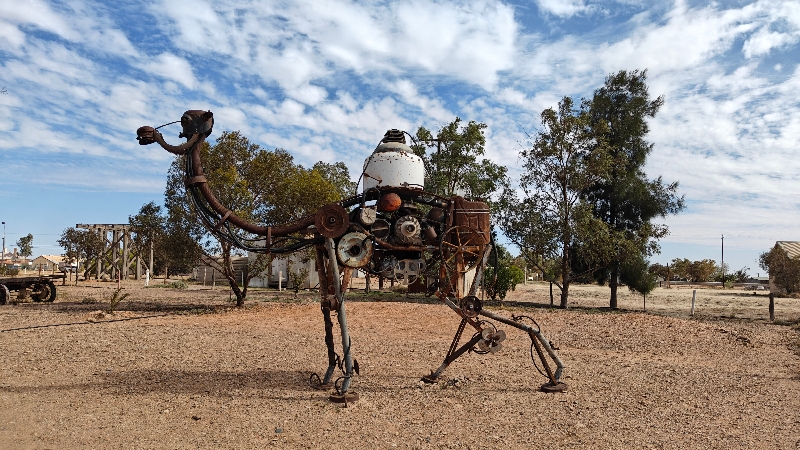
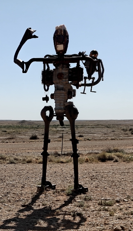
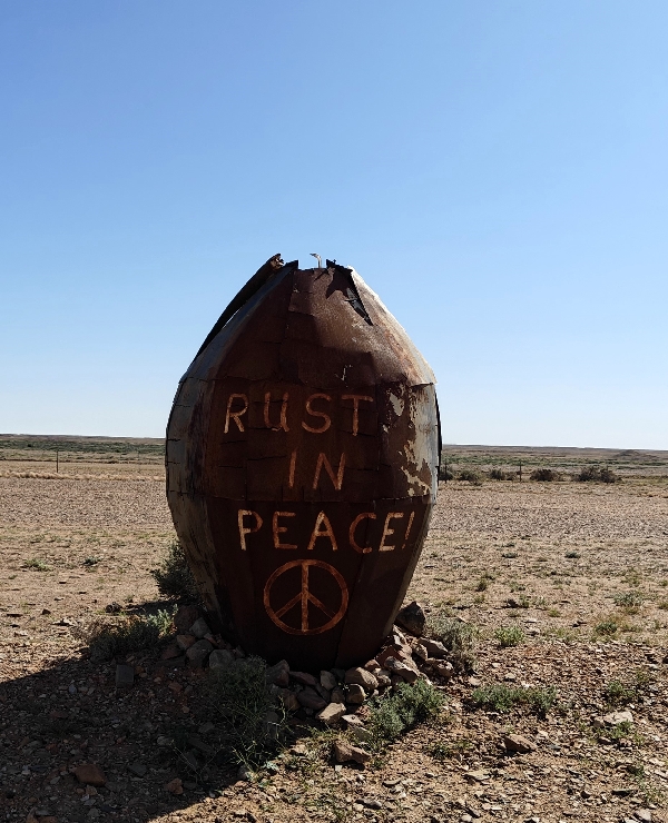
A bit further down the Track was the Finnis Creek Waste Sculpture Park where strange items have been turned into sculptures:


As seems usual in Australia, the wind does not stop blowing and the flies just keep on flying; however, the stronger the wind, the less the flies bother you!
It’s still not all that warm; days are hitting 20C maybe / 70F but dropping into the single digits C at night.
The next stop was the viewpoint of the South Lake Eyre.
Lake Eyre, officially known as Kati Thanda–Lake Eyre is an endorheic lake. The shallow lake is the depocentre of the vast endorheic Lake Eyre basin, and contains the lowest natural point in Australia, at approximately 15 m / 49’ below sea level. On the rare occasions that it fills completely, it is the largest lake in Australia, covering an area of up to 9,500 km2 /3,668 sq mi. When the lake is full, it has the same salinity as seawater, but becomes hypersaline as the lake dries up and the water evaporates.
The lake was named in honour of Edward John Eyre, the first European to see it in 1840. It was officially renamed in December 2012 to include its Aboriginal name, Kati Thanda, in accordance with a policy of dual naming.


This was followed by a short stop at Curdimurka siding – this was a site where rail line workers would live and maintain the rails.


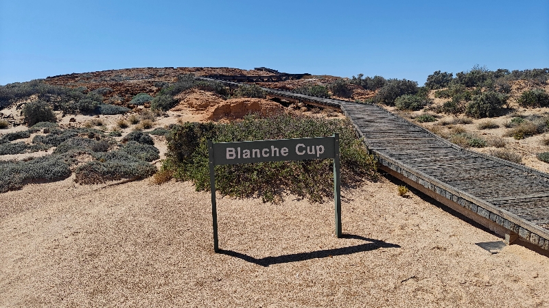
The coolest stop of the day came next: the mound springs. There were two close to each other: Blanche Cup and The Bubbler. The water for these springs come from the Great Artesian Basin.
The Great Artesian Basin of Australia is the largest and deepest artesian basin in the world, extending over 1,700,000 square km / 660,000 sq mi. The basin provides the only source of fresh water through much of inland Australia.
The basin underlies 22% of the Australian continent, including most of Queensland, the south-east corner of the Northern Territory, north-eastern South Australia, and northern New South Wales. It is 3000 m / 9800 feet’ deep in places and is estimated to contain 64,900 cubic kilometres (15,600 cubic miles) of groundwater.
Prior to the arrival of Europeans, waters of the Great Artesian Basin discharged through mound springs, many in arid South Australia. These springs supported extensive Aboriginal communities and trade routes. After the arrival of Europeans, the springs facilitated exploration. The Great Artesian Basin became an important water supply for cattle stations, irrigation and livestock and domestic purposes and is a vital life line for rural Australia. To tap it, boreholes are drilled down to a suitable rock layer, and the pressure of the water often forces it up without the need for pumps.
The discovery and use of the water in the Great Artesian Basin allowed the settlement of thousands of square kilometres of country away from rivers in inland New South Wales, Queensland, and South Australia, that would otherwise have been unavailable for pastoral activities.
First we stopped at Blanche Cup where you take a boardwalk up to the spring and you get views all around you.


Then at The Bubbler after doing the same we made our brunch and Doug worked on trying to tighten the side mirrors on the truck which were rattling away on the road (as were we!).


This spring was actually bubbling and we shot this video:
Then it was pretty much a straight non-stop drive to William Creek but we noted that we as we drove in this area, we saw signs for not only Australia’s largest cattle station but the largest in the world: Anna Creek, which sprawls over 23,000 square kilometres / 8880 square miles near Lake Eyre. This Outback titan stands as a testament to the grandeur of Australian agriculture.
At William Creek, we had to decide if we were going to stay northbound on the Track or head west to the Stuart Highway. We did some research and it seems that most of the sights to see were on the section we just did and it was 400 km / 250 mi more of dirt road – we have to say we don’t seem to enjoy this off road driving as much when we’re driving our “home” – it’s like when we drove Tigger through the Americas – we were always concerned about damage etc., not like back in our days of driving a Jeep in Utah.
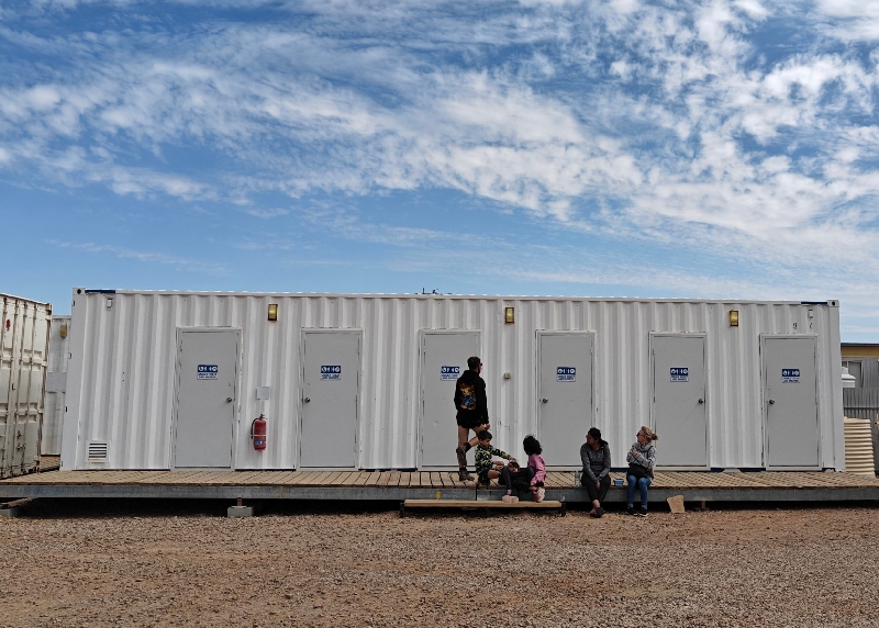
So we decided to call it and it was already 2:30 and it was 166 km / 103 mi to the highway so we called it a day. There was a campground for $28 a night with hot showers and toilets with a dump right outside it. As there was cell reception here in this tiny town and no real wild camps, we decided to stay there. Doug went to pay for a night at the hotel/pub and we parked in the non-powered section (it was $40 a night for power). It was just a large open area behind a line of trees. The bathrooms and showers were in a nearby building and there was a kitchen hut too.


After parking, Doug went looking for some Allen key wrenches as both mirrors were shaking on the dirt roads and he wanted to tighten them. No shop had them but a fellow in a nearby camper lent him some tools and he got it sorted.
We had a quiet night that was not quite as cold as it has been. Doug tried just sleeping on the floor tonight with no cushion but it was rather cool; tonight he’ll try sleeping on Fran’s yoga mat for some insulation.
So Tuesday morning after showers, we left about 8:30 once again and headed west to Coober Pedy.
Here’s the link to more photos.