December 23rd, 2024
We left Adelaide just after noon and made it as far as Port Augusta today – about 40% of the way to our campground for Christmas and tomorrow we will make a stop or two and arrive hopefully by early afternoon to Coffin Bay National Park.
Today the sun is out in full force but it’s quite breezy; temps will reach low to mid 20’s C / mid to high 70’s and the wind will keep away the flies!
We are parked at the Port Augusta Motorhome park which is really just a large parking lot outside a cricket oval but it has water, a dump station and rubbish bin as well as 5G cell reception, so they charge $10 at the bar in the club house to spend the night. It was pretty windy until about bed time but otherwise very quiet.
We both slept well and after our usual morning, we dumped our cassette and were able to fill out water which was pretty empty! It was a clear blue sky sunny day again after stopping for a couple of things at Woollie’s in Port Augusta and filling the tank just outside town we began the drive down the Eyre Peninsula.
We drove past the silo art in Cowell:

Then stopped in Tumby Bay to check out their murals:


and have lunch parked at the sea:

then drove down to Port Lincoln, (the “Tuna Capital of the World”) to fill up again as we’d done 300 km and the price just goes up from here along the coast. Here we paid $1.79 a litre.
We drove through the town of Coffin Bay into the national park of the same name to where we’d booked a campsite at Yangie Bay. The camping fee covers your park entrance and the campground doesn’t offer much other than pit toilets. When we booked the only sites we could get for two consecutive nights were one or two so we are camped in Site 2 arriving just past 2 o’clock.


After parking, we started to see a lot of bees! We put out an empty coke can with sugar water in it and by morning it was half full of dead bees and our grey water bucket had a few dozen drowned bees in it too. Apparently this time of year, they crave water.
We walked down to the shoreline which is not conducive to sitting on the beach at all but is a kayak put in point and the earth is muddy looking or hard so now way to get an umbrella into the ground easily. Too bad. There is a beach 6km away so we may drive over there to spend the day tomorrow.
The weather is quite pleasant, mid 20’s C / high 70’s F and there’s a slight breeze – supposed to be hotter tomorrow so the beach could be welcome!
Sidebar: seasons in Australia are calendar based unlike in North America. Summer starts December 1st, Autumn March 1st, Winter June 1st and spring September 1st. So at this point we’ve been in summer a few weeks already!
After a warmish night, we awoke on Christmas morning to bright sunshine and a forecasted high of 30c / 86 F. Here’s the extent of our Christmas decorations – a string of christmas tree lights and these letters stuck on the dining table window facing outward:


Once we were up dressed, had done shores and made tea, we sat down to open our gifts. We’d opted not to buy each too many nor do stockings. The kids/grandkids had sent a few to Pam and John’s:


After opening gifts and checking emailed ones, we had a pleasant morning. The kids gave us a beach umbrella and pool noodles so we are looking forward to trying them out.
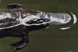
Today we had a couple of visitor’s at our campsite too:


Around the camp there are plenty of birds: cockatoos, parrots and galahs.
In the late morning we packed up and took ourselves about 8 km /5 mi away to Alamonta Beach not knowing what to expect but were pleasantly surprised to find this:

We returned to the parking area (300 m / 984′) and got our chairs etc. from Matilda, changed into our suits, got drinks and kindles as well as chairs, our new umbrella and our pool noodles (the surf was too rough to use them tho).

Well the wind was quite strong and after 15 minutes we gave up staying on the shoreline and moved back closer to the dunes where the umbrella didn’t feel like it was going to get ripped out of the ground!
Fran tested the water and it was cold! There were a few brave souls in the water but not many! After sitting and reading and the temperature rising and rising, we went over and got in as far as her knees. Then Doug did.


After we got hot again we both ventured in a couple more times but never too deep. Fourth time Fran squatted down to get her shoulders went and Doug got his torso wet by a rogue wave! It sure felt good being wet but boy, do you dry fast!
We had a lovely afternoon until it got too hot and we ran out of drinks. It was very dehydrating being on the white, white sand in full sun with a wind in 31C / 88 F weather.
We returned to the campsite by 5 stopping to see a few views on the way back of other beaches (no where near as nice):


The wind was pretty much non-existent at the campground so it was hot! We sat outside in the shade of Matilda until dinner and then while inside used our fans. When the sun set it didn’t cool down much until about 5am and Boxing Day the high was 19C / 68F. What topsy turvy weather we’ve had since being back from Vietnam.
After exercising, we packed up and we had another visitor – this time you could see her Joey. (see photo above) She was not shy at all and did not run away, just stood there watching Fran about 2m away.
We left the campground and went into the town of Coffin Bay to dump and get water. We found the dump but before filling we showered as before getting here we weren’t sure there was potable water. After asking a local for confirmation, we proceeded.
All the photos from our Christmas visit to Coffin Bay are here.
Today we drove about 150 km / 93 mi to Elliston further along the coast. There we got to the town golf course up on a hill with an amazing sea and town view:

There are no services here but you can spent the night for $10 paying an honesty box and the only thing offered is rubbish bins and the cell signal is strong. Done. We are trying not to have to drive as far as we did the two days we did from Adelaide everyday.
It was really windy here but bearable and we had a quiet afternoon/night. It did rain a bit in the early evening and the early morning but cleared up with mostly sunny skies.
We continued along the Flinders Highway towards the town of Streaky Bay. It’s the next largest town on the Eyre Peninsula after Port Lincoln. We made three stops enroute to see some natural sites.
First it was the Woolshed Cave and the Talia pools. We looked for the latter but maybe it was much further up the beach or the tide was too high.
The Cave was quite large with some birds but no bats in it and it was quite photogenic looking out towards the sea.


Fran got a selfie stick for Christmas so we tried it out:

The area right at the shore was quite pretty with coloured rock and lots of wave action.


Further up the road were the Murphy’s Haystacks – weird granite rocks poking out of the flat land.
Murphy’s Haystacks are inselberg rock formations. They are of a ‘tumulus’ form of weathered granite outcrop. They are made of a pink, massive, coarsely equigranular rock consisting mostly of quartz and orthoclases. Their appearance may be due to a combination of erosion by underground rainwater and then by subsequent weathering after they were exposed. Most of the pillars emerge without a break from the underlying granite.
They obtained their name because a traveler in a coach saw the formation in the distance. He asked how a farmer could produce so much hay. As the farm was on a property owned by a man called Murphy, the rocks became known as Murphy’s Haystacks.
There were about two dozen of them and you could walk around the large site. We’d read it was a “gold coin donation” which means a one or two dollar coin but upon reaching the gate it was $4 each which we didn’t have correct bills or change for, so we left the gold coin donation only.


This was about a 20 minute stroll taking in the cool formations and rocks, some covered in lichen.


Then we continued northward and veered off at the turn off to Cape Bauer. On this road we found the “Whistling Rocks” and blowholes turn off. It had a long boardwalk/stairs out to three view points. The first on the left led you to an overlook where when the waves crashed in the water entered small holes in the rocks and made a sound which we wouldn’t call a whistle – more like a fog horn but it was cool. We took a few videos and here’s the best one:


We then wandered over to the further blow hole lookout but the tide must not have been right as we saw only waves, no blowing.


A few kilometres further you reach the point and we took a walk along the cliff edges viewing the ocean, the rocks and the crashing waves – it was spectacular on such a sunny day.


We finished the Cape Bauer loop in Streaky Bay where we topped up the tank a bit (at$1.87 per litre) and stopped for a few groceries. Tomorrow we will pass through a quarantine check point and can have very little in the way of produce with us. There is one general store beyond it but we have no idea how well stocked it will be so we bought a few things to tide us over for about four days of no fresh produce meals.
We then found a dump point to empty our cassette and having just passed a sign for car wash headed there next. It wasn’t as good as the last one we’d done but Matilda looks pretty clean.

Then we decided we’d gone far enough today (nearly 200 km / 125mi) and after looking at options (no good free ones) we opted to stay in town here at the community RV park next to the sports oval. It’s on an honesty system and you leave $15 in the box with your plate number and for this you get pit toilets and rubbish bins on a large mostly grassed mostly level field. There is 5G cell reception too.
We both went for walks; Fran to check out the local beach – not great:

Doug to find an ATM. Today the temps are around 20C / 70 F but still windy – don’t think we’ve encountered too many places in this country that aren’t! There were about 15 other campers with us in the campground and it was pretty quiet.
Saturday morning was mostly overcast and after Doug’s long run and our usual morning routine, we left Streaky Bay around 9 am stopping to dump again and hoping to get water but no luck. We stopped once more after getting diesel but it was not potable.
We had read there was a quarantine checkpoint right after Ceduna in both directions so yesterday we had finished all our produce – turned out to be only for those heading east – darn. Oh well there’s a general store in Penong.
We drove about 130 km and stopped for gas – this time at $1.79. We are watching the prices as it will get pricey, pricey over the next few days.

Today was not about seeing any sights but just making some distance. After nearly 200 km / 125 mi we decided that due to lack of ability to get water in the foreseeable future, we’d do a campground tonight where not only could we get water but we’d be able to shower and it turns out the one in Penong had laundry (with dryers) to so another reason to stop.
For $36 we got a site with power and water, there’s a dump point, a laundry and showers/toilets as well as a kitchen. There’s no Wi-Fi but we were able to use cell although it was not the greatest.
The area around Penong is pretty barren; we saw a few sheep enroute but nothing else. We are now in what is known as the Nullarbor Plain (Nullarbor means “no trees”). It starts back in Ceduna, South Australia (where we got gas for $1.77 earlier today) and ends in Norseman, Western Australia. It’s a 1200 km / 745 mi stretch of treeless plains. Its know for its dramatic cliffs and miles and miles of the same featureless landscape. Towns are rare and petrol is dear! There are no hydro lines or telephone poles; the roadhouses along the highway are powered by 24/7 diesel generators! Cell reception is spotty along the highway but good near the few towns and roadhouses.
We got settled, Fran started the laundry and made oatmeal. We found the cell signal weak where we were parked and asked to move closer to the front with no problem.
Fran went for a walk after the laundry was done and went to check out the general store. The woman at the campground had reminded us about no produce crossing into Western Australia so we just wanted a couple of things. The store was closed. Fran remembered that the woman said something about the restaurant not being open until 6 so as it appears to be attached to the general store, maybe it too opens late.
Penong is home to Australia’s largest windmill and it it located in the town’s Windmill Museum.

It is also the location of Hole 3 on the Nullarbor Links Golf Course.

Nullarbor Links is an 18-hole par 72 golf course, said to be the world’s longest, situated along 1,365 kilometres of the Eyre Highway along the southern coast of Australia in two states: South Australia and Western Australia, notably crossing the Nullarbor Plain. The idea for the course came from Alf Caputo and Bob Bongiorno, both active in the Eyre Highway Operators Association, over a bottle of red wine at the Balladonia Roadhouse. The course was seen as a way of breaking up the long drive across the Nullarbor, reducing the dangers of driver fatigue, and increasing revenue for the roadhouses enroute.
A feasibility study was completed in September 2006, and public play began in August 2009. The course officially opened on 22 October 2009. As of 2022, more than 20,000 travelers had officially played it, and bought a scorecard for stamping at the roadhouses en route. Course officials have estimated that nearly as many travellers had played the course without paying any fee. The course begins and ends (depending on the direction of crossing) in the gold mining town of Kalgoorlie, WS and the coastal town of Ceduna, SA.
The purposely constructed holes have tees and greens that use artificial grass, with natural desert land between. The average distance between holes is 66 km / 41 mi, with the largest gap being almost 200 km / 120 mi.

In the late afternoon there was a huge clatter going on and it was hundreds of galahs gathering and moving around.
It was hard to take photos but here’s an idea:

We enjoyed a popcorn night trying different toppings to “try” and get away from butter. Nothing is quite as good but Fran liked the coconut oil and Doug was okay with olive oil – salt, of course, is a no brainer!
We left the campground on the early side after showering, dumping and filling as we hoped to make some miles today as we did not have too many stops and crossing the state line was our goal. This meant over 400 km / 250 mi but the road is good, traffic is light and the speed limit is 110 kmph / 65 mph but we tend to stick to around 100 kmph / 60 mph for better fuel consumption.
Speaking of traffic, we’d guess 80% of the vehicles are RV’s of some sort (with “caravans” – trailers being the most popular). It’s now school holidays in Australia so kids are out till about the end of January. There’s been a few cars/SUV’s (some with camping gear) and very few “road trains” like we encountered on the Stuart Highway into the Red Centre.
Sidebar: We have mentioned before that the ocean along Australia’s south coast being called the “southern ocean”. Well we learned today that it’s not really – it’s the Indian Ocean. Now there is a Southern Ocean but it’s the alternate name for the Antarctic Ocean and it does not begin until 60° below the equator and along this coast, we are no where near that!
One stop we did make was to check out the visitor’s centre at the Head of the Bight. This area is a prime southern right whale viewing area but not this time of year. We did want to see the cliffs along the coast of the Nullarbor.
The Great Australian Bight is a large oceanic bight, or open bay, off the central and western portions of the southern coast of the country.
There are two definitions for its extent—one by the International Hydro-graphic Organization (IHO) and another by the Australian Hydro-graphic Service (AHS). The bight is generally considered part of the Indian Ocean, although the AHS classifies it as part of the Southern Ocean (usually defined as near Antarctica). Its coastline is characterized by cliff faces and rocky capes, making it an ideal location for whale-watching.

This oceanic feature was first encountered by European explorers in 1627, and was accurately charted by English navigator Matthew Flinders in 1802.
The Great Australian Bight came into existence about 50 million years ago when the super continent Gondwanaland broke apart, separating Antarctica from Australia. The Bight’s waters are highly bio-diverse, especially in zooplankton, due to specific ocean currents. It is a major mating grounds for whales, especially the southern right whale.

There is an entry fee here of $7 per senior and you walk out from the centre along a series of boardwalks towards the sea and there are two lookouts.

The left one goes out to view the dunes east of this spot:

The right takes you out to see the cliffs to the west:

It’s quite something and we were glad to have stopped.
We also stopped at what was called “Scenic Lookout No 1” to view the Bunda Cliffs looking east (back towards the Bight) – it was sort of like looking at the Cliffs of Moher without the fog!

Before leaving the parking lot, we made some brekkie as it was nearly noon.
Other then fuel stops ($1.86 and then $1.93 so we could make it further) we did not stop again until the border. There is an entire “village” here with a roadhouse, motel, shop, cafe, gas station and caravan park. But the reason we stopped was to see Rooey:

After taking a bathroom break and wandering in the shop where we bought this sign for our camper:

We crossed the state line from South Australia into Western Australia.

Here there is a quarantine check for produce etc. and the agent asked questions about what we might have and then went inside to look in the cupboards and our fridge. Bee products are apparently banned so we declared we had a small amount left in a contained and they took it. (Luckily the didn’t see the full container of creamed honey we’d brought back from Tasmania!)
For more photos of our drive across the Nullarbor in South Australia, check this out.
Crossing the border also meant a time change of, get this: TWO AND A HALF HOURS! We’ve never experienced this before. It will take us a couple of days to used to that! But after parking we found this out about this area:
Central Western Time is 45 minutes ahead of Perth and is often referred to as “Eucla Time. The technology wasn’t able to transmit the full distance from Perth to Adelaide so they built a telegraph station in Eucla. They would receive the message, pass it to the operator on the opposite side and they would then transmit the message again. They needed a time so they split the difference and created Eucla time.
So it’s 45 minutes before South Australia time and as Western Australia does not do daylight savings, our phones automatically switched to Western Australia time but our GPS knew about “Eucla Time”.
So upon arriving at our camp spot for the night, it was not even noon here in WA!
We had found a large abandoned gravel pit to spend the night and we had a quiet afternoon with no services but a few overflowing rubbish bins and a 4G signal – good enough for us. We ate dinner early since our bodies were on SA time and we went to bed on the early side too.

Next morning, dawn came very early!