March 31st, 2025
Monday morning, the sky was once again clear and promised to be a nice day here in Bundaberg – we just hoped it carried out 100 km east to Lady Elliot!
We left the campground around 7 and made our way into the city to get to the Bundaberg Airport. If you recall we had the windshield replaced on Saturday and when Doug open the hood later that day, he saw that a tool had been left inside so enroute to the airport, we swung by O’Brien’s and dropped it off.
We got to the airport by 7:30 and had to wait longer than expected. We were supposed to check in at 8:10 but the plane was delayed leaving Hervey Bay (we didn’t know this at the time) and around 8:30 we checked in, dropped our bags and waited another 15 minutes for the pilot to come get us. We left at 9:07 instead of 8:40 but it was all good.
The plane was full – about a dozen passengers (3 workers included – they work 10 days on 4 off on the island) and the flight was just over 20 minutes. It was our first time landing on a grass runway.

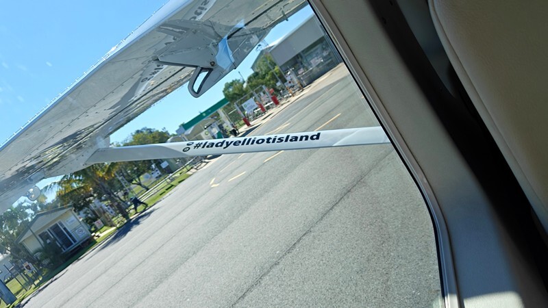


Lady Elliot Island is the southernmost coral cay of the Great Barrier Reef, Australia. The island lies 85 km / 53 mi north-east of Bundaberg and covers an area of approximately 110 acres. It is owned by the Commonwealth of Australia. The island is home to a small eco resort and an airstrip, which is serviced daily by flights and is limited to 150 overnight guests and 100 day visitors on the Island at one time.
Lady Elliot Island first appeared above sea level around 1500 BC as a coral rubble spit. It developed into a mature coral cay over the next 3,000 years. Lady Elliot had endured because bird droppings have hardened together with beach sediments into beach-rock. The existence of concentric shingle ridges across the island provides evidence of its formation by pro gradation over several millennia as deposits were laid down during episodic storms.
Lady Elliot Island is located within the ‘Green Zone’ of the Great Barrier Reef Marine Park, which is the highest possible classification designated by the Great Barrier Reef Marine Park Authority. Marine National Park Green Zones protect the biodiversity within the Great Barrier Reef Marine Park by protecting important breeding and nursery areas such as seagrass beds, mangrove communities, deep water shoals and reefs.
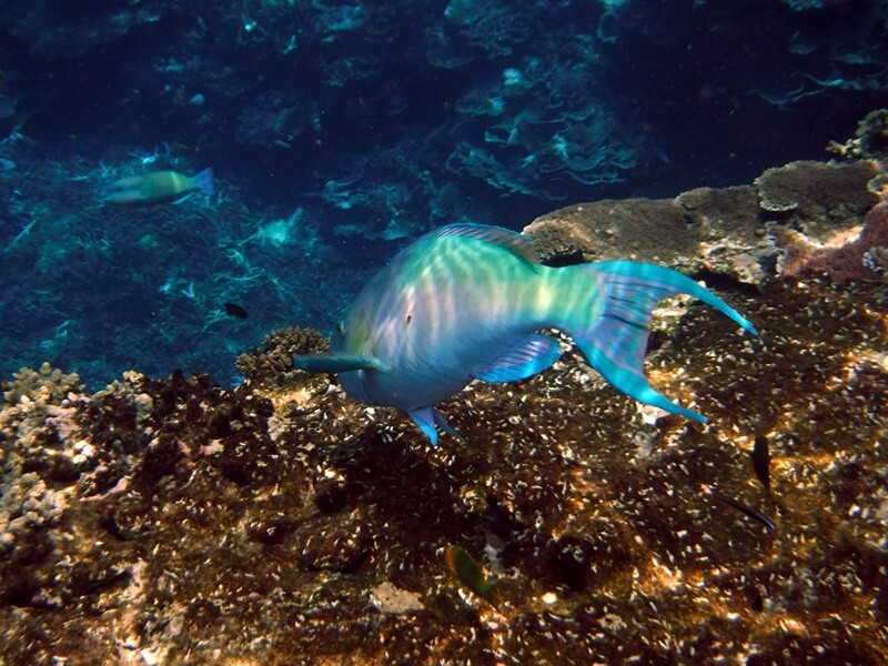
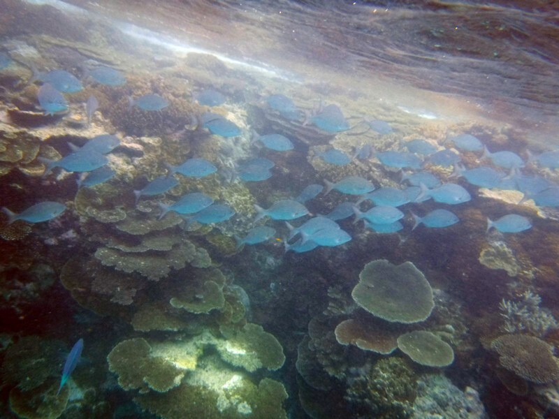
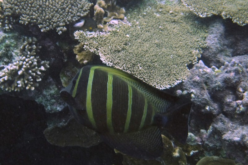
The island is particularly renowned for its scuba diving and snorkeling, as its location far offshore at the southern end of the Great Barrier Reef results in excellent water clarity.
The waters surrounding the island are particularly rich in sea-life because of a total ban on fishing or taking anything from the surrounding waters. Manta rays are abundant, attracted to the plankton around the island.
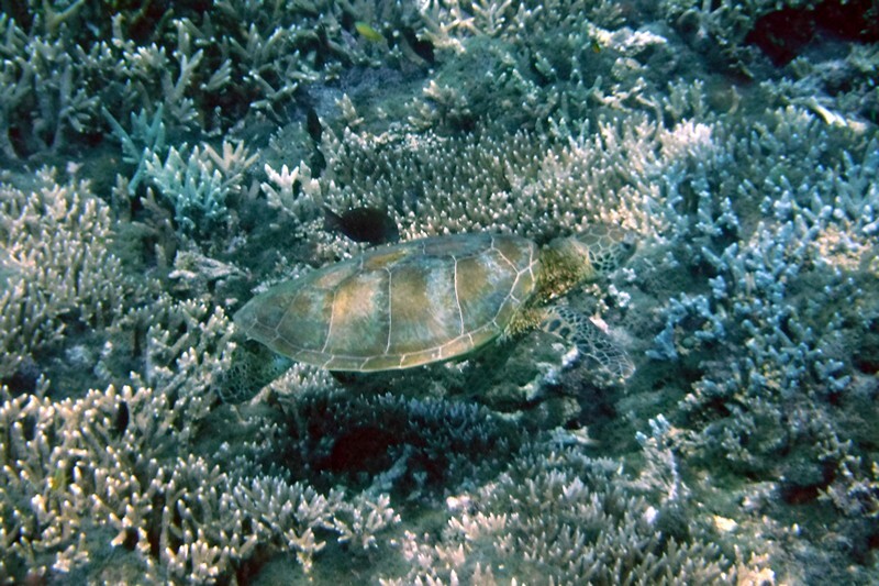
The Great Barrier Reef is one of the most important sea turtle habitats in the world, with Lady Elliot Island being a key part of that habitat. Every year between November and March the green and loggerhead turtles lumber up the same beach on which they were born more than 50 years ago. These turtles nest on Lady Elliot Island up to nine times in a season, laying between 80 and 120 eggs per clutch. About eight to twelve weeks later, young hatchlings leave their nests and head towards the ocean (January to April).

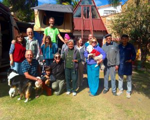
The sunny weather came with us and upon landing, our bags were taken to a luggage room and we were given a tour of the main facilities by Ashley. After that we checked in with the Dive Centre to see about whether we should take the included glass bottomed boat tour today or tomorrow and they said today looked better and if we could be ready in 20 minutes, we could join that tour. We got fitted for fins etc. and went over to get our snorkel clothing from our bags. There were bathrooms/showers right across the path and we were changed and Fran put her contacts in so we could head back to the Dive Centre. They provide anti fog spray and sunscreen which we used before boarding the transport to the boat. There was one other family with us with two small children so it was a nice small group.

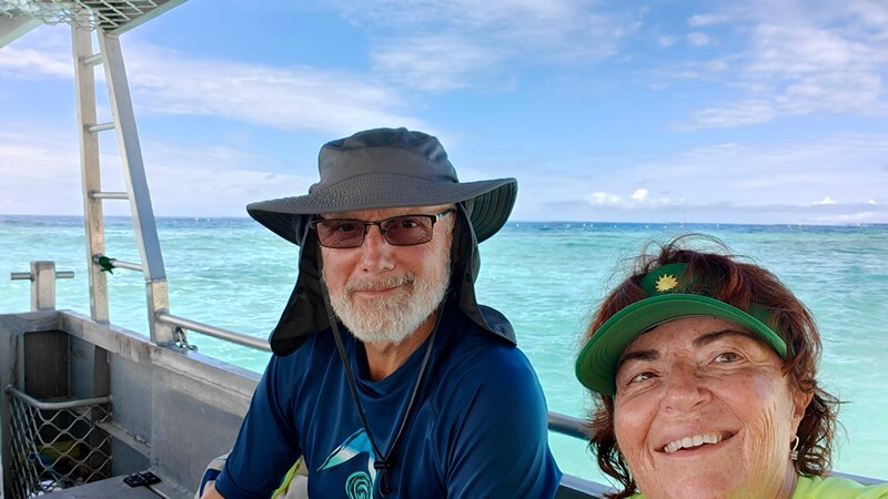
After boarding, we had about 15 minutes of viewing time through the boat bottom and explanations about the reef and coral were given. The view was not that great despite clear water (it’s very tinted) so we were glad we were going to be able to get in the water.

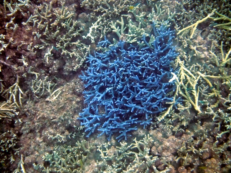
Did you know coral is part plant, part animal and part stone? We also learned that healthy coral is not often brightly coloured but the most common colours are brown, green and grey. We always thought that the grey and brown stuff was dead so now we know and the coral we saw in Raja Ampat was actually not that bad at all. The difference here is the consistent clarity of the water – it was some of the best visibility we’ve every experienced and NO garbage!
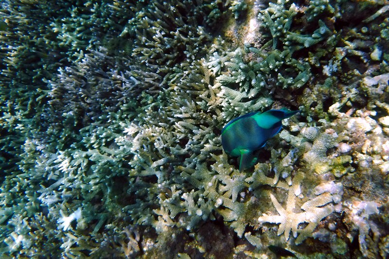
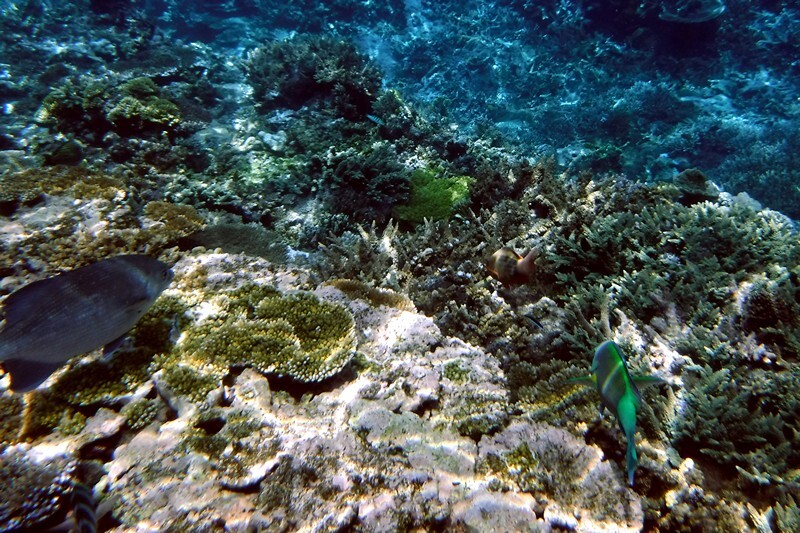
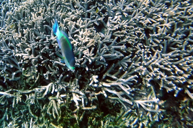
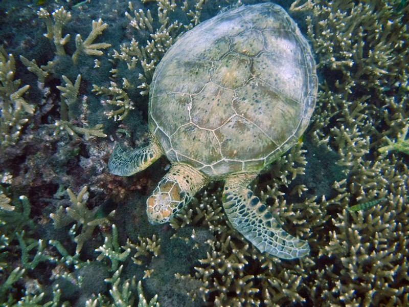
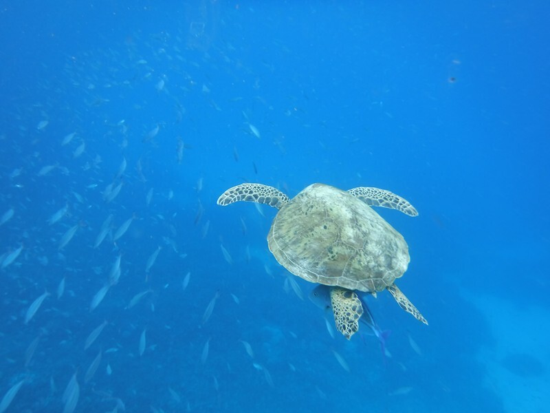
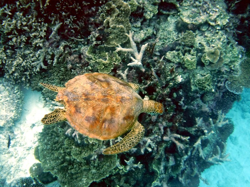
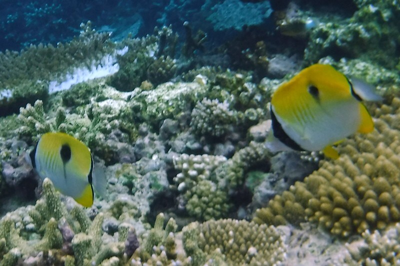
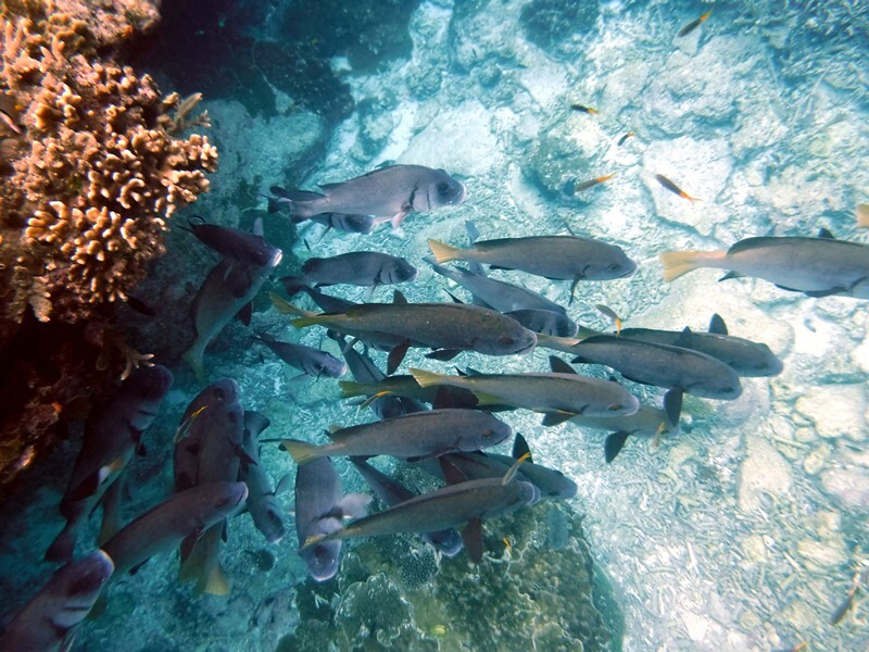
After the viewing time, we anchored and were given 45 minutes of snorkel time – this was amazing! Not so much that we saw that much different but that the visibility was so good you could see so far and the variety of hard corals was fantastic. There were also plenty of fish; we saw 4 turtles (maybe the same one twice but who knows for sure) and a black tipped shark. The 45 minutes went by far too quickly and we so impressed with the experience – we can’t wait to go again!


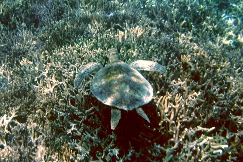


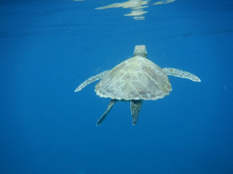
And another turtle!
There are 3 snorkeling “regions” on Lady Elliot. The “Green” Zone is the lagoon on the east side of the island and can only be accessed at high tide and is considered beginner snorkeling. Today the lagoon was only open until noon so we’ll do that one tomorrow maybe.
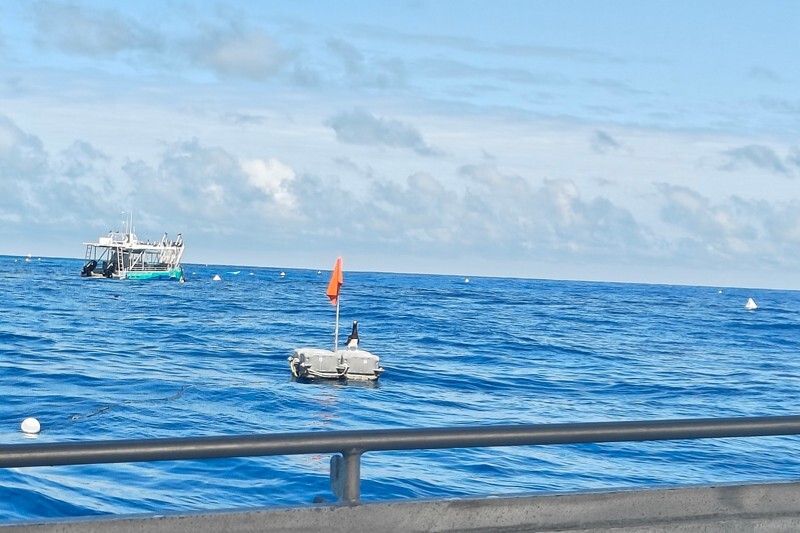
There is a “Yellow Zone” called Coral Gardens and a “Blue Zone” called the Lighthouse on the west side that border each other. Our boat trip this morning was at the south end of the Yellow Zone as the Blue Zone was closed this morning as barges were anchored – they come every 3 months to collect the garbage.
Upon returning to reception, we were able to check into our room and we purchased 1GB of data for our stay here as there is no cell service (and the data only works in certain areas not including rooms). Our bags had been taken to our Garden Unit #18 and we went over there and changed for lunch.


We had to purchase lunch today as it is not included for overnight guests on the first day. We ate too much as is often the case with a buffet but we were hungry after snorkeling and it was well past noon.

After lunch we joined the 1:15 walking tour about the running of the island. It’s took 45 minutes and we learned about how they desalinate the water, their solar power, how they deal with waste water and garbage (they do a lot of composting). That was pretty interesting.
Out of 100 litres of salt water they can get 47 litres of fresh. The equipment is expensive but not nearly as big as we had expected. The filters cost $4K each but last 3-4 years.
 The battery banks are HUGE and they have back up diesel generators if they don’t get enough sun to keep them topped up.
 They even had a condensation system for creating more fresh water – it takes in moisture and each bank makes about 5L of water a day that is ready to drink – there’s even a fountain on one end!
 We noticed at the beginning of the tour, that a big bank of black clouds was moving in and about half way through the tour, it began to rain. It lasted about an hour and we returned to our room after the tour. We had brought some canned drinks with us (we do have a small fridge in the room and a kettle). Fran went over to get some ice from the bar and we sat on our little deck listening to the rain and reading.
Around 3:30 Fran suggested going for a walk as it had stopped raining for a while and we headed to the lagoon to walk around the north end of the island.


There is coral everywhere and the tide was waaaaaaay out. No wonder you couldn’t swim there this afternoon!
We walked past where the turtles nest and hoped to catch see some hatchlings during our time here but no luck.

Upon arriving at the north of Coral Gardens we walked out along between the coral to the waters edge and saw many sea cucumbers and a couple of star fish.


Do you know that sea cucumbers take in the sand and then eat the nutrients attached to the grains and “poop” out the sand – this helps keep the beach clean and healthy.
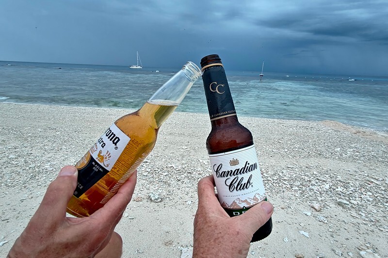
We returned to our room for a while before heading out for sunset (we had pre-ordered our drinks to be over at the Lighthouse Beach on the west side after 5).
The island has many birds and we saw frigates in the air, lots of white capped noddies and buff banded rails, and on the boat tour spotted brown boobies (photo was above)! Fran did not bring her big camera along so we only have phone shots.


Sunset was a bust; no sun and no colour – we just sat near the water’s edge, enjoyed our drinks and watched the worst of a storm go by:

 We returned to the resort and went for dinner. All meals here are buffet style and there are vegan and vegetarian options. It began to rain enroute to dinner and continued for quite a while. We went to the ranger talk afterwards about watching turtle hatchlings and then went to the beach for a bit to try and spot them. They give you a special flashlight when you check in as this time of year the eggs are hatching. We didn’t last long as the rain was pretty hard. We’ll try again tomorrow night.
For lots more photos of our first day in the Great Barrier Reef, click here.
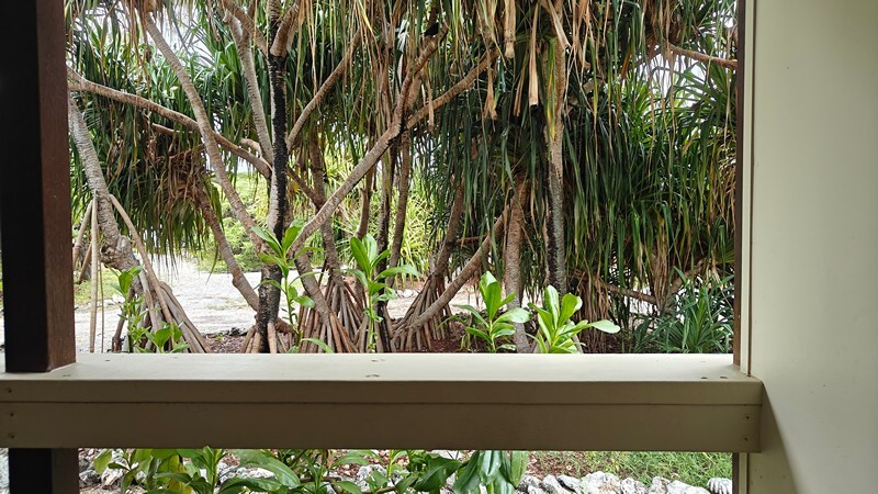
We had a very quiet night; rooms here have no AC but do have a pretty good ceiling fan – however, the humidity never quite dissipates fully; nothing dries completely but there is HOT fresh water for showers (unlike the last snorkeling trip we did!) and we have a nice outside area to sit outside and get whatever breeze is passing by.
Tuesday morning, we awoke to continued cloudy skies. Doug managed to get his run in on this tiny island and then we went for brekkie and a bit of internet before changing to go snorkeling on the west side of the island. The Yellow Zone was open but quite rough the sign said so we went to the Blue Zone. It was raining on and off and after getting into the water finally after struggling to get our fins on in the waves, we lasted about ten minutes; it was no fun, waves kept filling up our snorkels and the water was rough and too stirred up to be clear. We gave up and decided to try the east side where the Green Zone is and that was way better; hardly any swell, the coral was good, plenty of fish and the water was pretty clear once you got away from the shore. We snorkeled for about an hour while the rain came down on and off.
Fran saw a turtle, Doug saw a white tipped shark and a huge sea urchin.


We got out about 11:20, walked back to our room to shower and change and get water shoes on to go over and watch the Fish Feeding. It wasn’t that we wanted to see fish being fed but more wanted to hear the information the ranger would provide. It only lasted about ten minutes and we managed to get this video:
Now it’s lunchtime and we went over to the dining room to get online and then had some lunch. We checked the boards after lunch and all 3 snorkeling spots were closed – west side due to swell and east side due to low tide.
After a brief relax in our room, we joined the guided Reef Walk in the Lagoon (Green Zone). It’s low tide and you walk amongst the coral and the guide gives information and points out creatures and types of coral. We also got to hold a starfish and a spiny sea cucumber. It’s really hard to take photos as the water is constantly moving so here are a few short videos:


The walk was about 45 minutes long and very informative. We then walked over to the dive centre to see if the west side of the island had reopened to snorkeling and it had. Fran wanted to go so she changed and Doug stayed on shore watching her to make sure she didn’t get into danger/trouble. She went in at the south end of the Blue Zone as the current was going north and snorkeled all along the snorkel trail more or less to the far end of the Yellow Zone. Since it was overcast, the lighting was not as good as yesterday and it was a bit murky but she quite enjoyed the snorkel. She saw 6 different turtles, 3 squid and lots of fish and coral of course.
She didn’t take as many pictures due to the lighting situation but here are a few. Later, at the office, we purchased a 16GB USB stick with 120 photos of the island on it as a keepsake – the pics are of course, better than ours and there are shots of things we couldn’t get with our little Fuji.


After showering and another relax we went over to the bar – we are taking this trip as an early anniversary trip – 44 years next month – so we went to have a celebratory drink. After dinner it wasn’t raining so we grabbed our special flashlight and walked the beach looking for hatchlings but again had no luck (the info board at the restaurant showed no one had seen any for a few days).
We awoke on Wednesday to pretty clear skies but by mid morning the clouds had moved in and the rain began once again.
You can check our day two pics right here.
We went over for brekkie at 6:30, changed and grabbed our snorkel gear for one last snorkel. We checked the dive centre for the current direction and headed off to the Yellow Zone to swim south to the Blue Zone to get out. (fran carried our water shoes in her shorts!) We spent over an hour in the water and saw so many turtles we lost count – there were at least 8. As part of our snorkel, we also ventured in the Outer Reef (Orange Zone) for a bit but the water was murkier out there.


We spotted two “shoals” of squid, one with about six and one with more than a dozen – the latter were darker in colour.

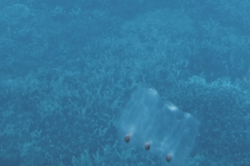
We also felt that we were being stung by jellyfish. We could see these transparent rectangular shaped things in the water but upon asking at the dive centre when we returned, we were told they were salp which is not a jellyfish and does not sting. So we’re not sure what was going on as they said there were not jellyfish in this area but we have been stung before and know what it feels like.
A salp is a barrel-shaped, planktonic tunicate which moves by contracting, thereby pumping water through its gelatinous body; it is one of the most efficient examples of jet propulsion in the animal kingdom. The salp strains the pumped water through its internal feeding filters, feeding on phytoplankton.

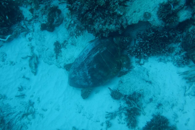
Near the end of the swim we saw a loggerhead turtle resting on the sand between the coral – that was pretty darn cool – our first of that species. All the other turtles we’ve seen here were green turtles.
The deeper out we went, the murkier the water got and in the Orange Zone. This was mostly where we were getting stung so not pleasant and we went back towards the shore and it got better but every time we ventured near the snorkel trail line, it got worse and the water got murkier. In the shallower water it was much clearer and the visibility was much better.
All in all it was a good end to our little early anniversary trip and we have been quite pleased; awesome snorkeling, no garbage, nice rooms with hot water, good staff, good food, fair amount of things to participate in and we enjoyed it all but the rain although even walking in that when you’re already wet, is not so bad as it’s a warm rain of course.
We checked out of our room at ten as directed and paid our “extras” bill. Then we sat using the rest of our purchased data in the outer area of the dining hall. Doug had put our snorkeling clothes in the guest laundry but they hadn’t dried much by the time we had to pack them and leave our bags in the Departure Lounge.
This is the link to day three’s photos.
Here’s the link to the stock photos we purchased on a USB stick from the gift shop just in case ours did not turn out.
Our flight left in the rain and on time and we were in Bundaberg in no time; very different take off to the landing we’d made on Monday! In the pouring rain and nothing to see enroute. But we made it safely and Matilda was waiting for us where we left her.

After leaving the parking lot, we drove over to get another package of tiles at K-Mart and then headed south. We made it about 200 km / 125 mi to Rainbow Beach outside Great Sandy National Park. Unfortunately it was STILL raining on and off so we decided to stay two nights in the hope that the weather might give us a window tomorrow to go up to the viewpoint to see the dunes and beach. Here we paid $45 for a night with power, water, Wi-Fi, bathrooms and a pool (which we didn’t use in this wet weather).
We took a short walk to check out the beach while it sprinkled.

Naturally, when we woke up Thursday morning, the sun tried to come out and there were blue patches out over the beach but it didn’t last. It sprinkled a little bit in the morning but by afternoon, it was completely overcast and although the rain was supposed to start at noon, it didn’t really until..
After our morning exercise and routine, we began to work on tiling the back-splash and after that Doug had to do the silicone caulking of the seams.
Planning next steps is getting tricky. Easter school holidays start this coming weekend and many places have 3 night minimums and charge more than we’ve gotten used to paying. If the darn humidity would just go away, we could get back to free camping!
Fran walked on the beach this morning and got this shots:


It was a pretty wet afternoon but it seemed to stop overnight. We awoke to overcast skies but the morning was mostly dry with a few light misty sprinkles.
Before leaving town, we drove over to the nearby Great Sandy National Park (which is huge and extends south quite a ways) to walk up to the dune viewing area; we were expecting to see tree covered dunes but there was a section at the lookout called the Sandblow that was wide open sand:


 We left there and headed north to the tip of the Inskip road where the ferry takes you over to Fraser Island – the world’s largest sand island. We did not take the ferry as we did not want to take Matilda in the wet sand but just stopped to take some pics:


Then it was on to the city of Gympie to do some shopping before making our way further south along the coast to Noosa Heads to meet back up with Sandra and Thomas for a night. This campground was $53 a night with all the amenities including fast Wi-Fi – turns out we were parked beside the router so that helped!
The afternoon stayed mostly dry and the sun tried a few times to peek out with no success. After getting parked up in the campground we worked on the edging for the counter and Doug fixed the basket support in the cupboard that cracked yesterday.
 Thomas and Sandra arrived mid afternoon and after catching up a bit, we let them settle in and went for walks.


We all met up for happy hour before dinner. They will be staying here another day and we will move further south tomorrow.
On Saturday morning we awoke to glorious blue skies and sunshine – finally; after all we are now at the north end of Australia’s “Sunshine Coast”. It’s been too long! It lasted all day in the end. We left the campground before ten and began the drive along the coast first stopping to see the beach and town of Noosa Heads. We were camped in the north part of town – 10km / 6 mi inland.


It’s definitely a tourist town and we lucked out finding a parking space in one of the two free lots near the beach access. The beach here is lovely and there were a lot of people enjoying the break in the weather:

We took a stroll for about ten minutes along the beach and back to the parking lot along the main street.
If you click here you’ll be taken to a link for more photos from Rainbow Beach to Noosa Heads.
Next we headed along Sunshine Beach which stretches for nearly 20 km / 12 mi from the south side of Noosa Heads to Coolum Beach and after an inlet the beaches begin again.

We stopped at one point to see the beach as mostly the road is raised up above the beach and there are dunes and trees between the road and the shore so you can’t see it most of the time. We found roadside parking near a path down to the beach and went for a stroll for about 15 minutes down the beach and back. It was a fantastic beach, long and sloping with lovely soft golden sand.
 Upon returning to Matilda, we decided we wanted to have lunch with a beach view and Fran found a place on Coolum Beach that fit the bill. As we’ve found in other beach towns, there is a surfing/life guard club with a bar/restaurant and this place open at 11:30 for lunch but the bar opened at 11. Since it 11:20 we managed to snag a table on the deck right at the railing and ordered a couple of beers then ordered lunch at 11:30 when the menu allowed (it’s one of those stupid QR code menu places).


After lunch we headed to the campground Fran booked for tonight in the town of Beerwah which was the closet to the Glass House Mountains National Park where we want to go tomorrow. Here we paid $50 for a slabbed power site with water access, bathrooms and not much else. We had a quiet afternoon reading at our site (haven’t done this a lot due to the weather) and the weather held. It’s not so hot and humid but it doesn’t cool cool off enough at night to not want AC. Today it reached 28C / 28 F and only dropped to 22C / 72F or the low.
Note: This is Steven Irwin Country – here his family run the “Australian Zoo” nearby. It’s quite pricey to get in ($75) so we passed but the road into town is called Steven Irwin Drive.
After getting settled, we finishing the caulking on the countertop and that project is completely done now.
We left the Beerwah Caravan Park early so as to get to the Glass House Mountains NP to do a hike while it was still on the cool site. We did the Mt Ngungun hike which is 2.8 km return with about 200 m of elevation gain; there was a fair bit of stair climbing but the first third was just a few steps then a flat section before a few more steps. The middle to ¾ section was a lot of stone steps but it was worth the views up top. Unfortunately, it was not a clear sky morning but the cloud ceiling was not low so the tops of these (small) mountains were visible.
The Glass House Mountains are one of southeast Queensland’s most impressive landmarks. They are situated 65–75 kilometres (40–47 mi) north of Brisbane and are a group of steep sided plugs of trachyte and rhyolite, once within volcanoes active in the early Tertiary Period. They have been exposed by wind and water erosion of the softer material of the cones and surrounding area and now rise dramatically from the flat coastal plain.
The mountains are central to the creation myths of the region and their spiritual and social importance and links to Indigenous People continues to this day.
Mount Ngungun 253 m / 830’ is composed of alkali rhyolite. This mountain also has good examples of vertical columnar jointing and has caves. There is evidence of early 1950s quarrying activities.
The hike took us about an hour and the weather stayed overcast but it made it more comfy.


After finishing the hike in under an hour, we then drove eastward a bit to climb the steep 700 m path up to Wild Horse Mountain Lookout to get a view of all the peaks in the distance from a fire tower lookout.


Next it was a drive southward through Brisbane; we didn’t see anything in our guidebook or online that gave us pause to stop in Brisbane (and as you know, we are not usually fans of big cities in an RV) so we headed from the Sunshine Coast north of the city to the Gold Coast to the south.
It’s now school holidays so campground rates are in high season mode but Fran found a small one in Miami Beach that was a mere $75AUD a night rather than a hundred or more and we took a site for two nights. There’s no pool or Wi-Fi BUT it’s right across from the amazing Gold Coast beach.


After setting up and having lunch, we went for a stroll all the beach from our Life Guard post #21 over to 24 and then turned around. We put our bag on the beach and went into the water to play in the waves. Both the water temp and the air temperature were about perfect and we had a blast.
We returned to Matilda, sat outside and read for awhile before going in to get a few things done online. Sunset was at 5:38 pm o we took a couple of cold drinks down to the beach but really, we are facing east and we saw only a tinge of pink – didn’t even take a photo!
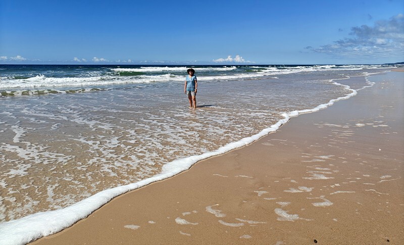
We hadn’t needed AC during the day but after it got dark the breeze died and we turned it on at bedtime so as to sleep more comfortably. We were up before 7 and turned it off, opened the windows and Fran went for a wonderful beach walk:


Doug stayed behind to do a few chores and when Fran returned we chatted with Serena for a while before he went for his walk and Fran did a few things and then went over to the grocery store. It’s been SO nice to have a few days without rain – we hope going forward we get the more “usual” Australian weather that we have become accustomed too! Fingers crossed.
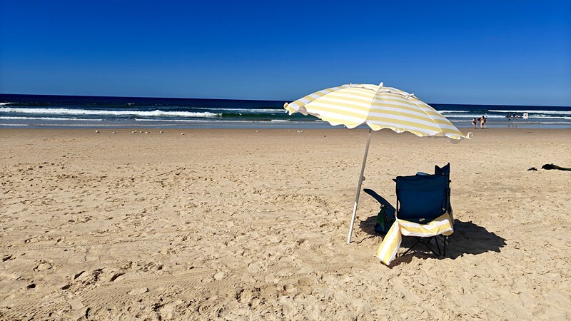
After an early lunch we changed and took ourselves, our chairs and our umbrella over to the beach for a few hours of relaxation, reading and swimming. It got windier as the afternoon went on and around 3 we headed back. It will be hard to leave this beach tomorrow.

We said so long to Miami Beach and continued southward. Today we will cross our final state line back into New South Wales – our journey is nearing its end. The sun continues to shine and we are happy campers.
This link will take you to the gallery of photos from the Sunshine Coast through to the Glass House Mountains NP.