
 September 21st, 2024
After seeing “Fooluru”, we spotted the real thing about twenty-six kilometres before we reached the town of Yulara.
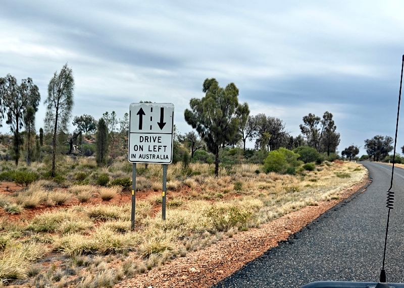
On this the Lassiter Highway, and in several spots in this part of the Outback, we saw signs like this – seems a bit late to be saying this now….
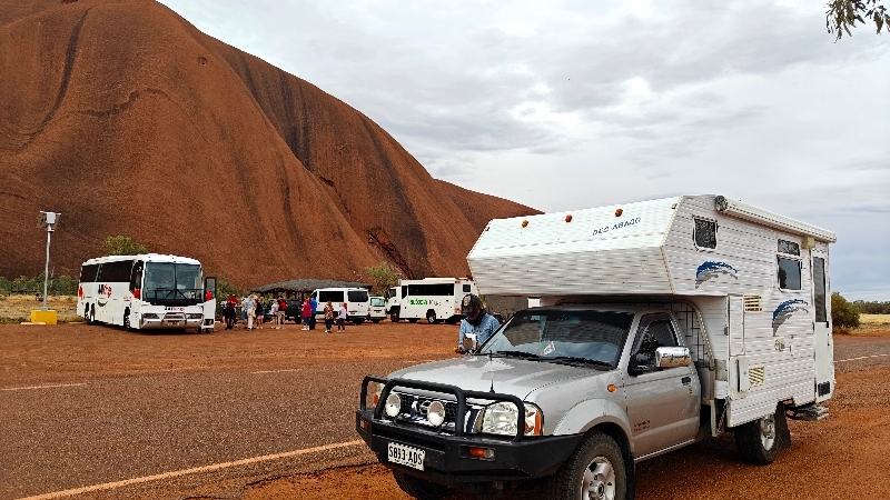
We pulled into Yulara, the town closest to the national park, (which is really just a big resort town centered on Uluru tourism and now run by the Aboriginals) and we filled up our petrol tank as it’s now the cheapest place since Marla ($2.69 AUD here). It was now about 3:30 and we headed out to the National Park (we’d bought our tickets online – they cost $38 AUD and are good for 3 days). We took many photos enroute to the circle (well almost circle; about 95% of a circle then you have to turn around) drive around the sacred rock.
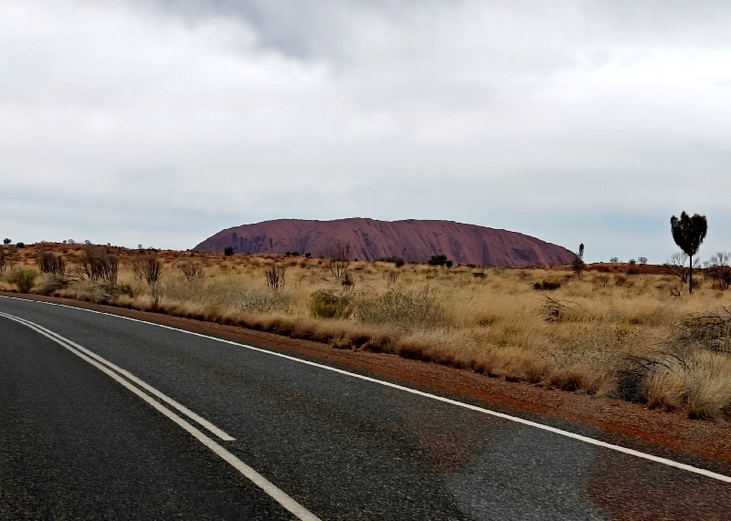
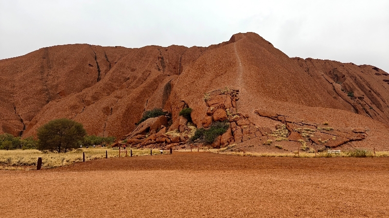
Uluru, also known as Ayers Rock, is a large sandstone monolith. It outcrops near the centre of Australia in the southern part of the Northern Territory, 335 km / 208 mi south-west of Alice Springs.
Uluru is sacred to the Pitjantjatjara, the Aboriginal people of the area, known as the Aṉangu. The area around the formation is home to an abundance of springs, waterholes, rock caves and ancient paintings. Uluru is listed as a UNESCO World Heritage Site.
Uluru is one of Australia’s most recognizable natural landmarks and has been a popular destination for tourists since the late 1930s. It is also one of the most important indigenous sites in Australia. The local Aṉangu, the Pitjantjatjara people, call the landmark Uluṟu. This word is a proper noun, with no further particular meaning in the Pitjantjatjara dialect, although it is used as a local family name by the senior traditional owners of Uluru.
On 19 July 1873, the surveyor, William Gosse, sighted the landmark and named it Ayers Rock in honour of the then Chief Secretary of South Australia, Sir Henry Ayers.
In 1993, a dual naming policy was adopted in Australia that allowed official names to consist of both the traditional Aboriginal name and the English name. On 15 December 1993, it was renamed “Ayers Rock / Uluru” and became the first official dual-named feature in the Northern Territory. The order of the dual names was officially reversed to “Uluru / Ayers Rock” on 6 November 2002 following a request from the Regional Tourism Association in Alice Springs.
The sandstone formation stands 348 m / 1,142’ high, rising 863 m / 2,831’ above sea level with most of its bulk lying underground, and has a total perimeter of 9.4 km / 5.8 mi. Uluru is notable for appearing to change colour at different times of the day and year, most notably when it glows red at dawn and sunset. The reddish colour in the rock derives from iron oxide in the sandstone.
Archaeological findings to the east and west indicate that humans settled in the area more than 10,000 years ago.
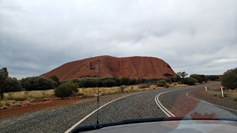

You start on the south side of Uluru and can drive clockwise around until you almost complete your circle, then have to turn around.
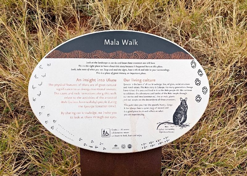
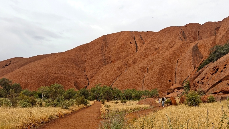
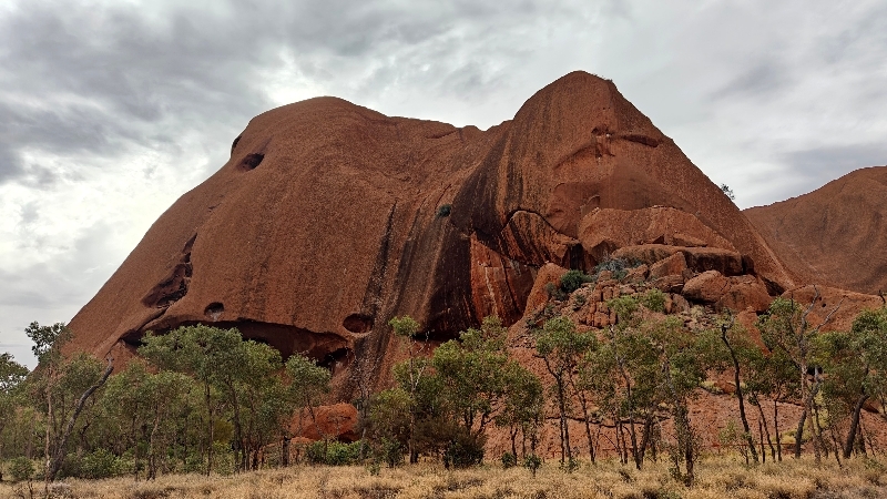
We stopped first at Mala Walk to get out and take a short walk to get up close:


Here we were grateful for our fly nets as they were relentless – at least the nets keep them on your face and eyeglasses where they seem to love to land! We believe the only thing there are more of than flies in Australia is ants!
Then we carried on around the rock to the end of the route where again we got out and walked up closer.


Then we returned to the beginning going counterclockwise and Fran was now on the correct side of the vehicle to take video:
This was pretty cool – the iconic spot of Australia! We couldn’t stop reflecting on where we’d managed to get to on this journey around Australia and how soon we’d done it. Just three months ago Fran was dipping her feet in the Arctic Ocean! The reason we came so soon on this trip, was twofold: first, the weather and the second, tourist seasons. It’s now early spring and the days get quite warm but the nights still cool off nicely – summer can be really hot and winter is high season here. But as it turned out today was quite overcast by the time we got here and it was much cooler than it had been and it will be the same for the next few days so heat-wise, we lucked out; sunset wise – we did not.
We arrived at the sunset viewing parking area on the east side of Uluru around 5:15 as we’d been told to get there at least an hour ahead to get a spot and we had no trouble finding parking – not a lot of people expected the sun to come out let alone see it set today. We got our chairs out and read for a while. The wind had picked up and that was keeping the flies away, thankfully.
So as expected we saw no colour that night but really, it was more about being here.

No camping is allowed in this park and there was no free camping in the village (there are two large campgrounds: one powered, one not but they are very expensive for what you get – $65 for an unpowered site!). Fran had found a rest area on iOverlander and the same one on WikiCamps (another camping app we use here in OZ) on the north side of the village about 12 km away and we went there. It was quite large and there was only one van parked there so we got parked in the dark and luckily, did not hit any wildlife getting here after dark.
By morning there were four other vehicles but we are all quite spread out. We had a touch of rain overnight but not much. We drove back into town for better cell reception, had a video chat with Josh and the grandkids and then a call with Serena who had found the bank card we’d mailed to her. However, this turned out to be a bust because at no time during her inserting the card and accessing our account was she asked to verify Doug’s phone which was the entire point of the process. Fran has mailed her her card and we expect the same result but we can only hope! So if that’s a bust too, the entire point of opening an account with Wells Fargo has been for nothing. We did get some cash from an ATM using our regular Schwab card as buying those tires yesterday, pretty much wiped us out as he gave us a discount for paying cash.
While sitting in the vehicle chatting, we were entertained by a few galahs:


The galah is an Australian species of cockatoo and is endemic to Australia. It is one of the country’s most abundant and widespread birds.
Click here to see all our photos of Uluru.
Aftwards, we headed into the other section of the Kata-Tjuta National Park covered by our pass. This was formerly known as the “Olgas”. It’s about 50 km / 30 mi from Yulara. It was still a most overcast day.
Kata Tjuṯa (means ‘many heads’), also known as The Olgas and is a group of large, domed rock formations or bornhards located about 360 km / 220 mi southwest of Alice Springs.
The 36 domes that make up Kata Tjuṯa / Mount Olga cover an area of 21.68 km2 / 8.37 sq mi are composed of conglomerate, a sedimentary rock cemented by a matrix of coarse sandstone. The highest dome, Mount Olga, is 1,066 m / 3,497’ above sea level.
The other name, The Olgas, comes from the tallest peak, Mount Olga. At the behest of Baron von Mueller, Mount Olga was named in 1872 by Ernest Giles, in honour of Queen Olga of Wurttemberg (born Grand Duchess Olga of Russia, daughter of Tsar Nicholas). She and her husband, King Charles I, had marked their 25th wedding anniversary the previous year by, among other things, naming Mueller a Freiherr (baron), making him Ferdinand von Mueller. The naming was his way of repaying the compliment.
On 15 December 1993, under the dual naming policy it was renamed Mount Olga / Kata Tjuṯa. On 6 November 2002, following a request from the Regional Tourism Association, the order of the dual names was officially reversed, to Kata Tjuṯa / Mount Olga.
Before reaching the actual sight of the park, you reach what is called a “dune lookout” where we stopped for some views:


Looking east you could actually see Uluru on the horizon:

Then we continued into park itself.


Here we took a drive around one side (you can’t drive around) and couldn’t find parking at the first hiking spot with the longer walk as it was over full so we drove to the other lot and did the short walk into the Walpa Gorge.


It was still overcast but stayed dry for this visit.
It’s pretty spectacular as well but a different kind of rock – more conglomerate than sandstone like Uluru. We love the red colour in the dirt and the rocks.

We returned to Yulara to top up the tank once more before heading north as it’s much more expensive as we go to our next destination which is more remote.
This is the link to all the photos of The Olgas.
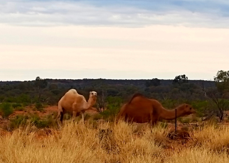
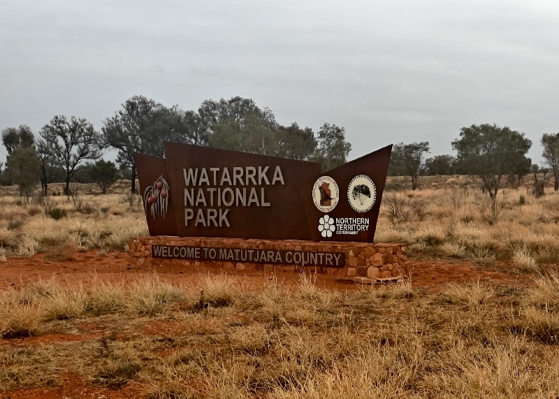
Kings Canyon is a famous area in the outback to hike in Watarrka National Park. We arrived nearby at a rest area to camp for the night after stopping at the King’s Creek Station (station = ranch in AU) resort/fuel station to inquire about propane. Our fridge was not getting cold enough. Yesterday our first bottle depleted and the spare one was having issues – there didn’t seem to be a lot of pressure. No luck, they had no propane to purchase or swap out bottles.
They did have a few camels and we saw some from our campsite that evening walking the field and there was a dead one in the rest area!
We purchased ice and used our bucket to keep the important things cold, you know, like beer, pop and dairy.
Turns out the gas bottle did work for the stove the next morning so we’re not completely out of gas, it just doesn’t seem to work for the fridge. We did notice two nights ago that the fridge didn’t seem to work when we had power at the campground either but it did work on gas the next night. It is supposed to be a 3 way fridge but it never has worked on DC either from the coach or truck batteries so we will look into that.
Fran tried to book a ferry to Tasmania and when she did get one for October 20th to November 7th, our darn credit card got “declined” as it often does with large purchases (this was for over $1300 AUD) and by the time we got the message from the bank asking if this was us, the dates were gone! We’ll have to try calling tomorrow as they only open during business hours. We want to do Tasmania before their high season which runs December to February.
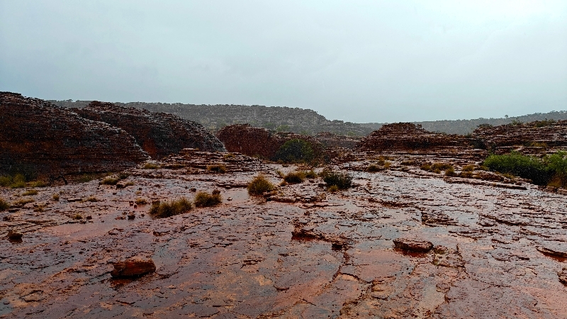
It started to rain during dinnertime and it rained most of the night. This did not make for perfect conditions to hike in Kings Canyon.
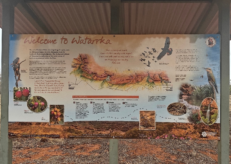
Kings Canyon, also known as Watarrka, is a canyon in the Northern Territory of Australia located at the western end of the George Gill Range about 321 kilometres / 199 mi southwest of Alice within the Watarrka National Park. Luritja people have inhabited the area for at least 20,000 years
Kings Creek runs along the bottom of the canyon, and gives it its name.
We had tea and decided to hike anyway but still wanted to find out road conditions for the next leg of our journey, the Mereenie Track, which was not a paved road – it was the shorter and more scenic route to Alice Springs from here. We drove over to the Kings Canyon Resort first and learned the latter was not recommended after rain; someone actually said it could be a “nightmare” and it was going to rain much of today as well so we’ll have to change our route. They also advised that the do have propane, but their fellow that takes care of that, will not be back until after lunch.
There are two other ways to reach Alice Springs but the shorter one also entails 100 km / 60 mi of dirt road and the other, taking paved roads, was 200 km / 120 mi longer and over an hour longer. We hope to learn about other road later today.
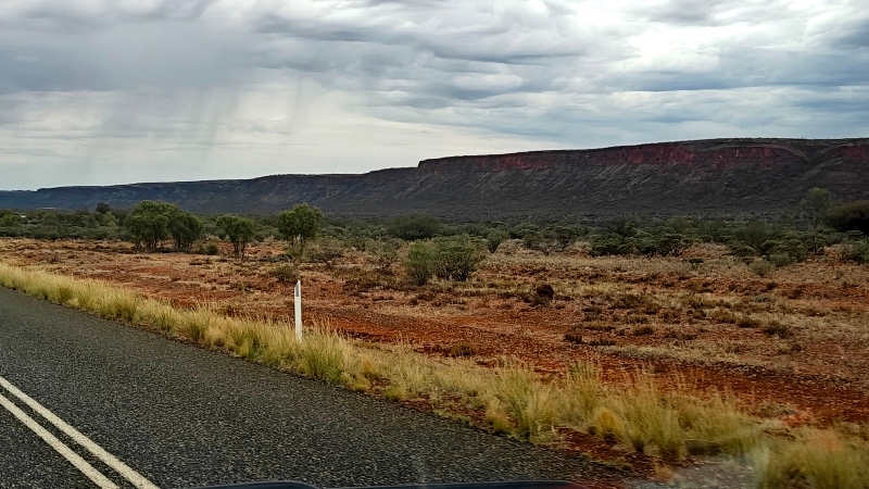
The landscape in this area is much lusher than we expected with lots of trees, brush and grass. In some sections you could see evidence of past fires as the trunks were all black.
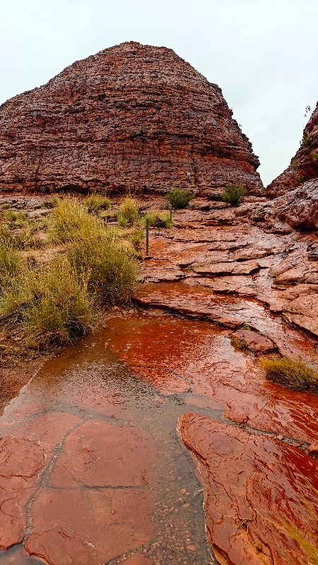
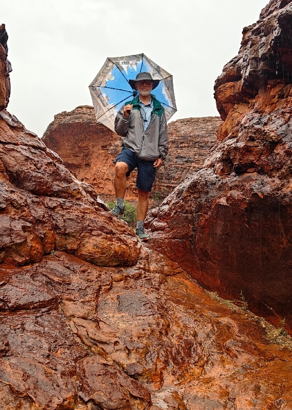
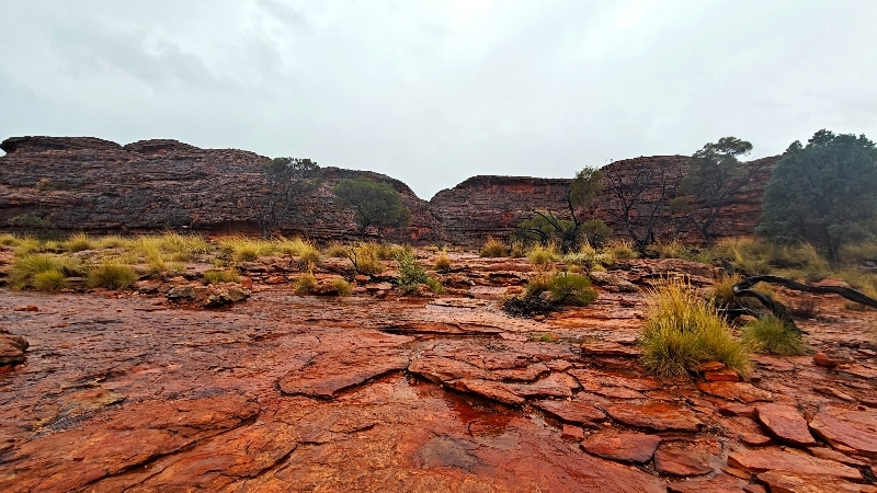
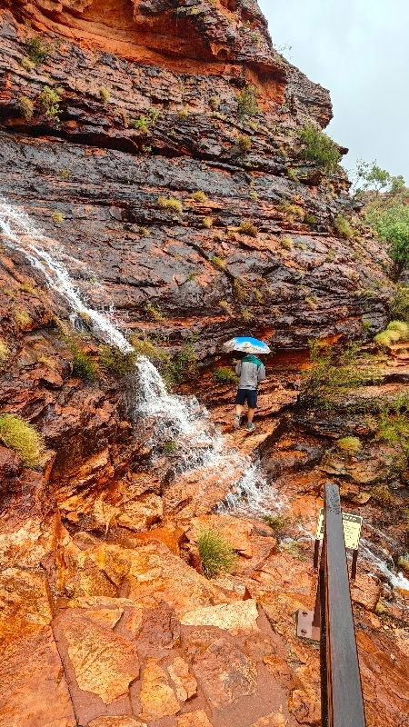
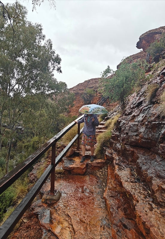
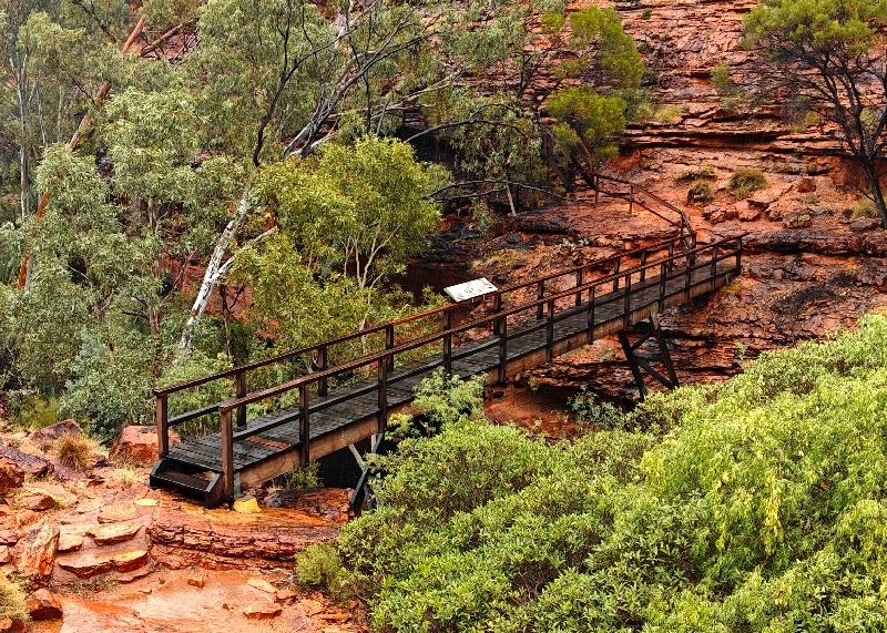
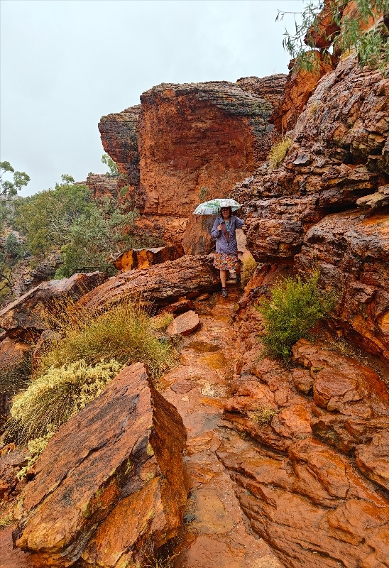
We backtracked over to the King’s Canyon turnoff and got to the parking area where we got ready for the 7km return hike called the “Rim Walk”. It starts with a steep uphill climb on stone stairs and then it’s mostly flattish until the end when you have to come down but that’s nowhere as steep as the first section.
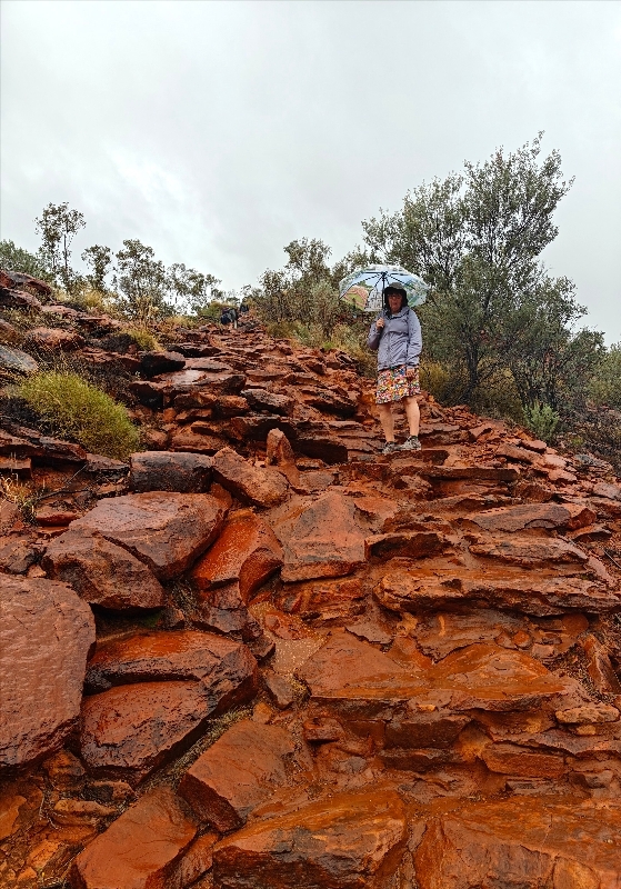
 It rained 90% of the time during our hike, sometimes hard and the wind was super vicious at the top. We wore rain jackets and carried umbrellas much of the way. There were lots of puddles and at times we had to walk through fresh running waterfalls. Near the turning point to get to the other rim, there are actual staircases.
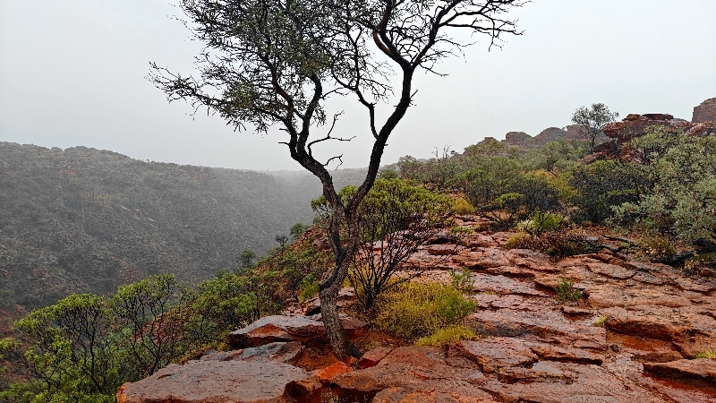

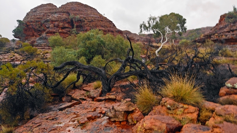
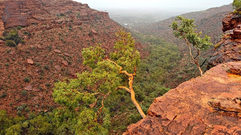


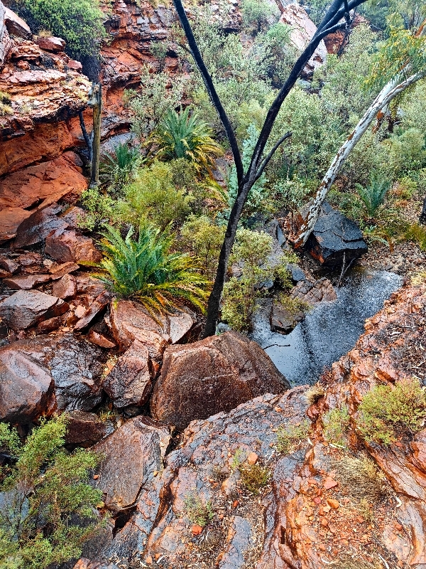


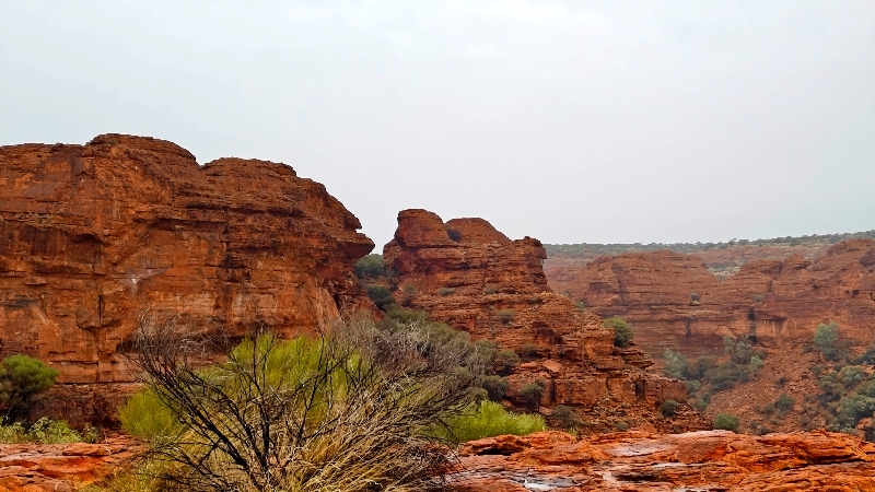
While it was an interesting hike, we have to say being from North America and having seen much of the US southwest, this was not that different: red rock, red dirt, petrified sand dunes and canyons/gorges. We’re sure it’s more spectacular in better weather too.
The hike took us 2.5 hours (they said 3-4) and maybe if it was nicer, we may have dawdled more but before half way, we were pretty much soaked through despite rain gear because at a certain point they don’t help when it’s all dripping down on you! and just wanted to “get ‘er done” – at least it was a warm rain.
Check out more photos here.
Upon returning to Matilda, we changed our clothes and hung our wet stuff around as best we could, changed shoes and headed back east for Alice Springs. We stopped at King’s Creek Station to check on road conditions and were told it was going to be better and smarter to take the long route as the Ernest Giles Road shorter route was sand and corrugation and with the continuing rain, would be awful. Oh well, the long route it is – better safe than stuck in the red mud in the rain.
Being the outback desert, flash flooding is not uncommon and we so often saw signs before even the slightest dips in the road warning of such and there will be indicators at the low point indicating the water levels IF there is water.
So off we went back tracking most of our route from the Stuart highway via the Lassiter Highway (the main north south route from Adelaide to Darwin through Alice Springs). Upon reaching the Stuart, we stopped again looking for propane and air for the tires – found neither so we just bought more ice. We carried on north to a truck stop at Stuarts Well that allows campers and they too, had neither but that was far enough for one day. As we have no working fridge, we had dinner at the roadhouse and got more ice for our few items that need to stay cold.
Sidebar: The term “outback” derives from the adverbial phrase referring to the back yard of a house, and came to be used colloquially in the late 1800s to describe the vast sparsely settled regions of Australia behind the cities and towns.


