January 4th, 2019
After our little screw up regarding the route, we continued through Puerto Montt along the coast – there was a sea wall and it was very reminiscent of Vancouver. We had not visited this side of the city previously.

Once you leave downtown Puerto Montt you are on the Ruta 7 better known as the Carretera Austral.
Carretera Austral is the name given to the Route 7 in Chile. The highway runs about 1,240 kilometers (770 mi) from Puerto Montt to Villa O’Higgins through rural Chilean Patagonia.
These areas are sparsely populated and despite its length, Carretera Austral provides access to only about 100,000 people. South of the highway’s start in Puerto Montt, Coyhaique (population 44,850) is the largest city along it.
Construction of the highway was commenced in 1976 in order to connect a number of remote communities. It was constructed by the Chilean army’s engineering command and more than 10,000 soldiers worked on it. Before that, in the 1950s and 1970s, there had been unsuccessful attempts to build access roads in the region.It is among the most ambitious infrastructure projects developed in Chile during the 20th century.
Carretera Austral has a strategic meaning due to the difficult access by land to a significant portion of Chile’s southern territory. This area is characterized by thick forests, fjords, glaciers, canals and steep mountains. Access by sea and air is also a complex task due to extreme winter weather conditions. For decades, most of the land transportation had to cross the border to Argentina in order to reach again Chile’s Patagonia.
The highway opened to traffic in 1988, and by 2000 the last 100 kilometers (62 mi) to Villa O’Higgins.

There are two ferries that run the route we want to take and on our way south, we stopped at the office of Transporte Austral to check out making a reservation for the next day. Now there was space on the 9 am but they wanted a small fortune for this privilege and we declined after she told us that we could get earlier in the day and get on the standby list for an afternoon ferry at a reduced price. We had also read that the other ferry company was cheaper as it goes a different route then you drive a further 10 km / 6 mi and catch a short free ferry ride to end up at the same place. We’ll take our chances without reservations.
We got to the short first ferry – it was a half hour voyage and we must missed one by seconds but they run every 15 minutes so it was not a long wait – the cost was the same as the ferry we took to Chiloé. Next was about 60 km / 37 mi to the big ferry ride which we did not have a reservation for – there was road construction and what should have been less than a 45 minute drive was double that and we arrived at the ferry dock to spend the night around 9pm – very, very late for us to arrive at a camp spot. Fran was beginning to come down with a cold and didn’t feel great nor had any appetite so Doug snacked for dinner and we crashed by 10:30.
We were up early Saturday morning with the intent that Doug would wait outside the cheaper ferry office to see about getting on. They were supposed to open at 8 but because someone showed up at 8:30 who didn’t have the key, it did not open until 8:45. They were fully booked so we got number 6 on their standby list and the man in line behind Doug said they can usually take 5-10 extra vehicles per sailing.
He returned to Tigger, we had breakfast and the wait began. We saw the 9 am expensive ferry load and leave and then Somarco ferry docked and began loading for the 10:30 voyage.
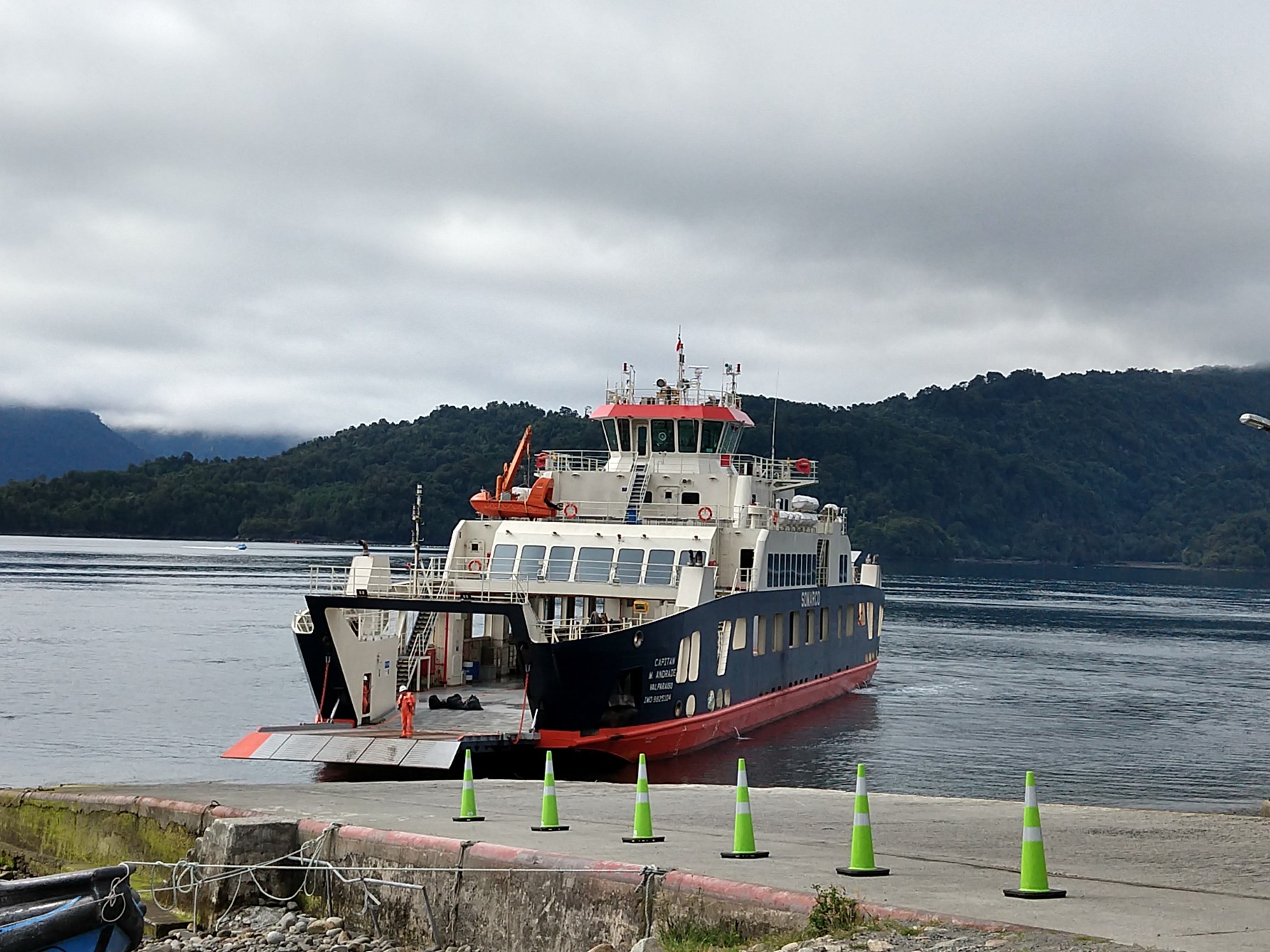
Turned out they did take 10 extra vehicles and we were on! Since we didn’t have tickets, we had to pay on board and the price was about one third of the original ferry we’d looked into so we were pleased.
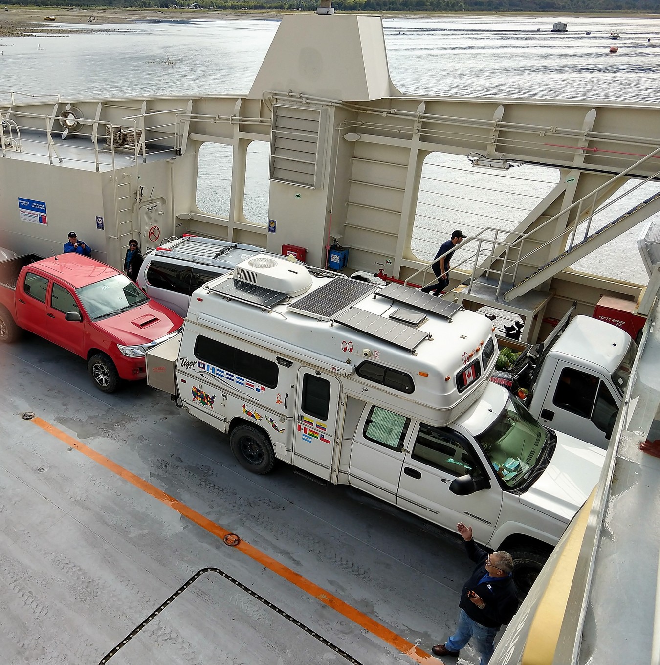
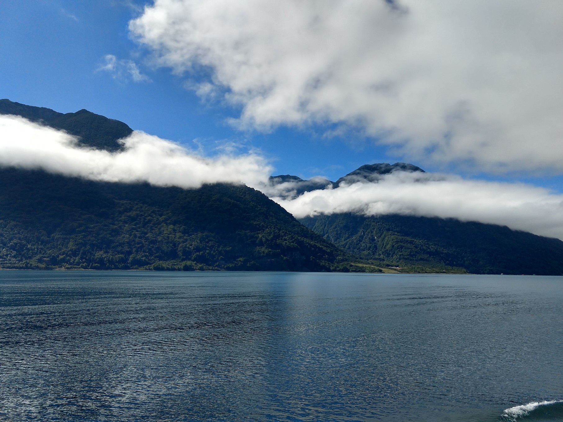
It was a partly cloudy day to start but cleared the further south we got. Reminded us a bit of the Inside Passage without the huge glaciers. There were some small glaciers to see, lots of waterfalls and we passed many fjords.


The first ferry took 3.5 hours, then the 10 km / 6 km drive took 15 minutes to the free ferry to Caleta Gonzales which took about 40 minutes. We stopped after getting off to replace our spare tire on the front (if we’d been charged by the metre as we’d been led to believe, that tire adds a metre) and we picked up a young couple British backpacking in the direction we were going. Polly and Adam thought there’d be a local bus to take them through Pumalin Park but nope. We got to our camp spot for the night, they did the hike across the road while we set up and watched their stuff and then we sat and enjoyed a couple of beers in the sun.

We had a quiet night and it was SO dark – it began raining after midnight and rained well int the next day on and off, soft and hard – well, we are in a rain forest.
Douglas Tompkins (of North Face fame) was an American conservationist, outdoorsman, philanthropist, filmmaker, agriculturalist, and businessman who assembled and preserved the land which became the largest gift of private land to government in South America in Chile. He passed away in 2015.
He began the creation of Pumalín in 1992 by buying large tracts of land to protect the region’s pristine temperate rainforests. Today Pumalín encompasses 994,000 acres—larger than Yosemite National Park—including almost 725,000 acres donated by Tompkins Conservation. The park stretches from the heart of the Andes Mountains to the fjords of the Pacific Coast and harbors the endangered Alerce (Fitzroya cupressoides), some of the oldest living trees on the planet. Located on the scenic Carretera Austral, Pumalín welcomes visitors from Chile and around the world to experience its natural wonders via the extensive network of trails, campgrounds, cabins, and other facilities.
After breakfast, we took the short 30 minute hike across the road from us to see the 3000 year old trees which are a type of Patagonian Cypress called alcerces.


Then we opted not to do the Laguna hike we’d planned to do due to the fog and rain so we headed to the Cascadas de Escondidas hike – where you see several waterfalls in the rain forest. It was misty rain pretty much the entire 1.5 hours and it could be slippery at times so we went a bit slower than usual and Fran was really beginning to feel her cold today.


We read a bit more about the next hike we were going to do and since it was wet, we opted again, to skip it for the conditions are not good when wet – we were to see a hanging glacier on this one and in this weather, it could be totally socked in anyway.
We drove on into the small town of Chaiten, gassed up, found free internet and spent the night on the square. Turns out five other RV’s had the same idea as us, however, after the sun set at nearly ten o’clock, the police came over (we were parked on the side of the square where their station is located) and asked us all to move to different side of the square, that we were not to park here. Why they waited until that late, we’ll never know but it was easy to move since we were hooked up to anything.
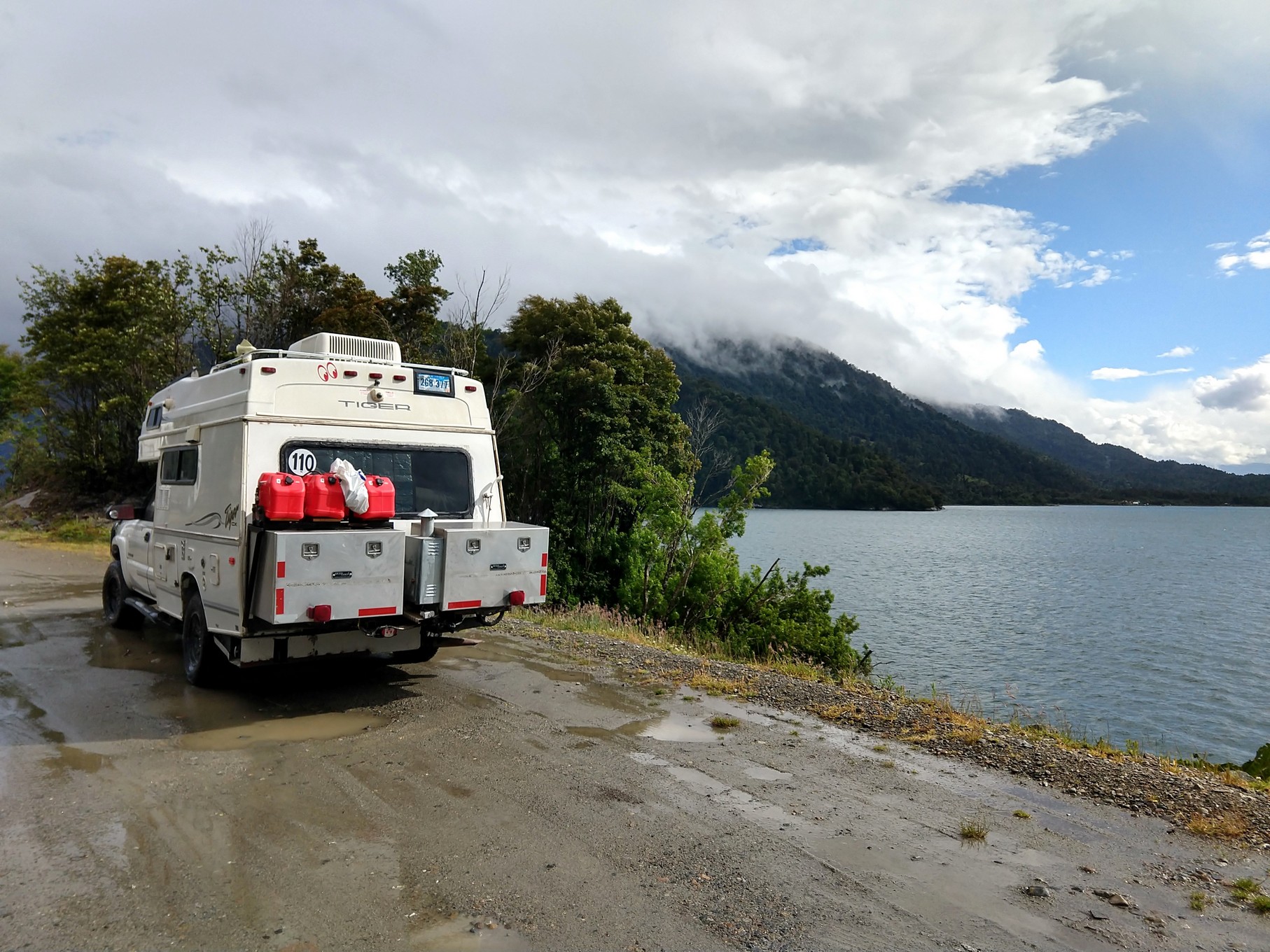
Next morning, it was still raining so we pushed on south. Fran was not feeling great at all so she was happy to just sit and be a passenger. The paved road ended shortly after we left town and became “ripio” (gravel/dirt) but it was for the most part good road with a few rougher sections. It turned to pavement again at times and reverted back.
We drove to a point past Puyuhuapi to a spot on iOverlander where people said they saw lovely sunsets and dolphins to boot. Well it rained on and off, more on than off, all afternoon and through the night and neither the sun nor the dolphins showed their faces. We were joined overnight by three other campers who must have hoped for the same thing.

We continued south on Tuesday and made our way to the largest city in Coyhaique through what was probably lovely scenery but for the fog and rain.
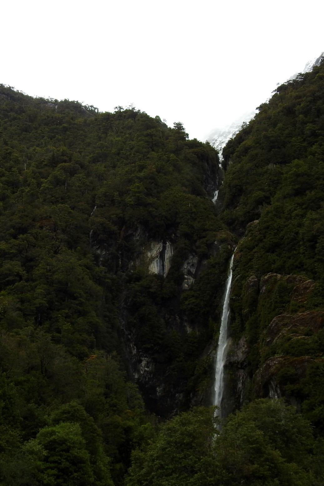
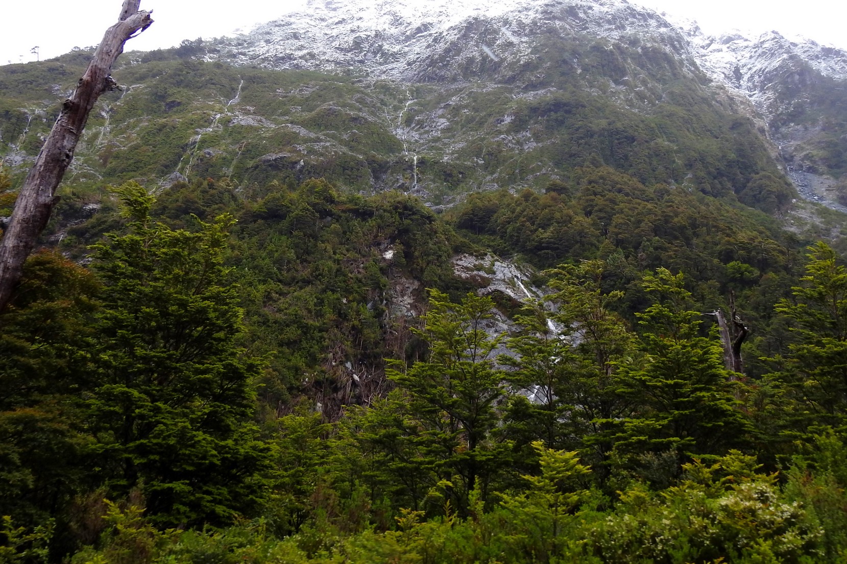
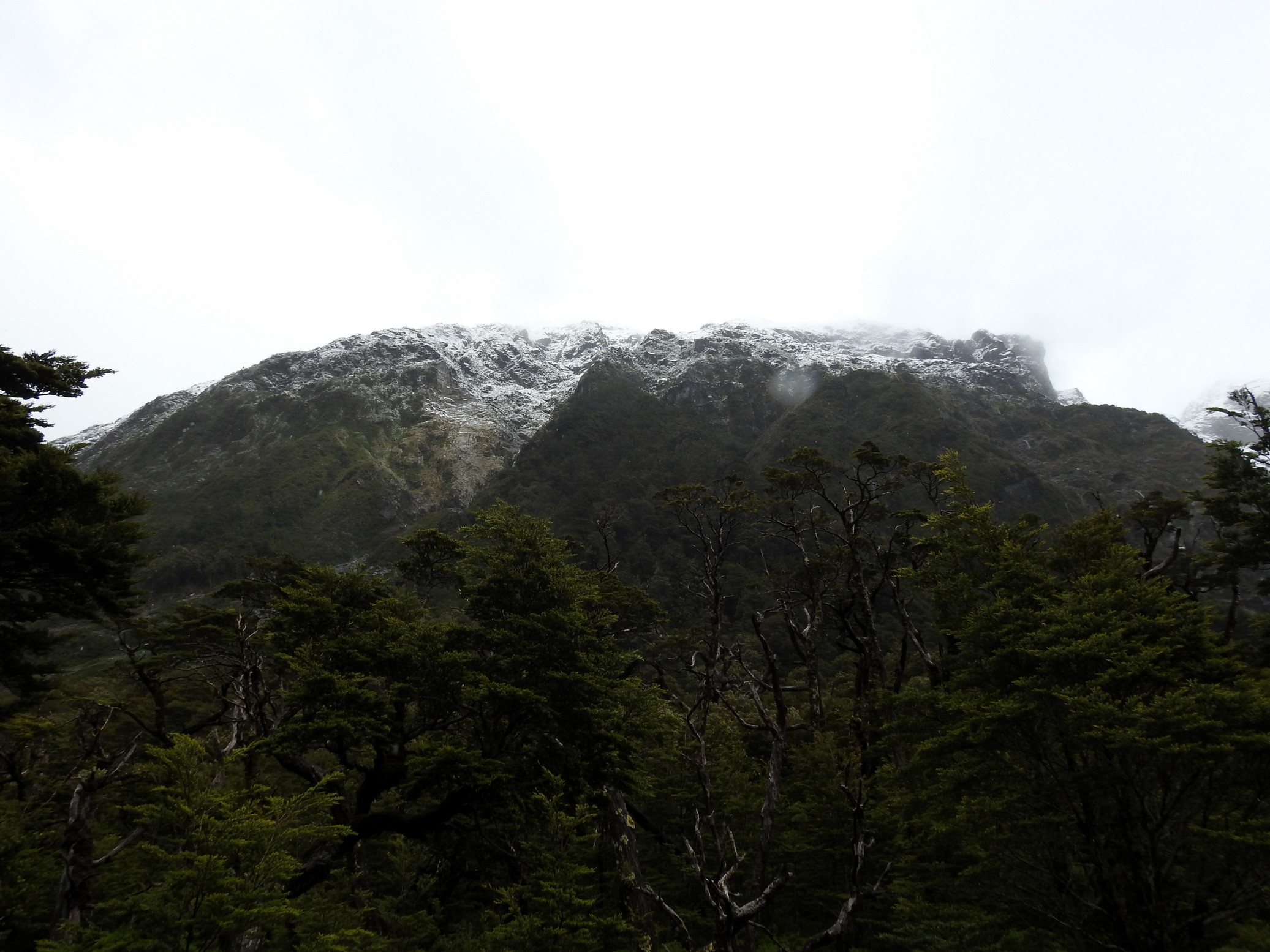
We did see snowy peaks at times and lots and lots of waterfalls on the cliff faces.

We arrived in the city around 3 and made our way to a mechanic for an oil change and a “check up”before we venture further into Patagonia. They replaced our O2 sensor (we had the part) and then we made an appointment to return the next day for the actual oil change and check up.
The rain let up a great deal overnight and by 9 am Wednesday morning, the sun appeared and hung around the whole day. Doug made his way to the mechanic while Fran stayed back to do laundry and online stuff. Turned out mechanic needed more time as more than an oil change was needed so we’re hanging here another day. WiFi is quite good so not a hardship. It was decided that the front and rear brakes needed work and we’d been having a misfire issue so Doug spent the day getting that all sorted as well so we spent a third night in Coyhaique.
Friday morning, we took our time and made our way from the campsite and began heading out of town. Then….the brakes didn’t feel right. We messaged Sergio, the mechanic, and he said he could fit us in at three so after we said we were trying to leave town he said come in an hour. Instead, we told him we’d head over and just wait. It rained on and off all day today.
We were finally out of there around 4 pm and finally got out of town and made our way to Villa Cerro Castillo where after speaking with the police, parked ourselves on their little quiet town square and spent the night. The weather was overcast and cool but not raining.
this one’s for you Lindy!:
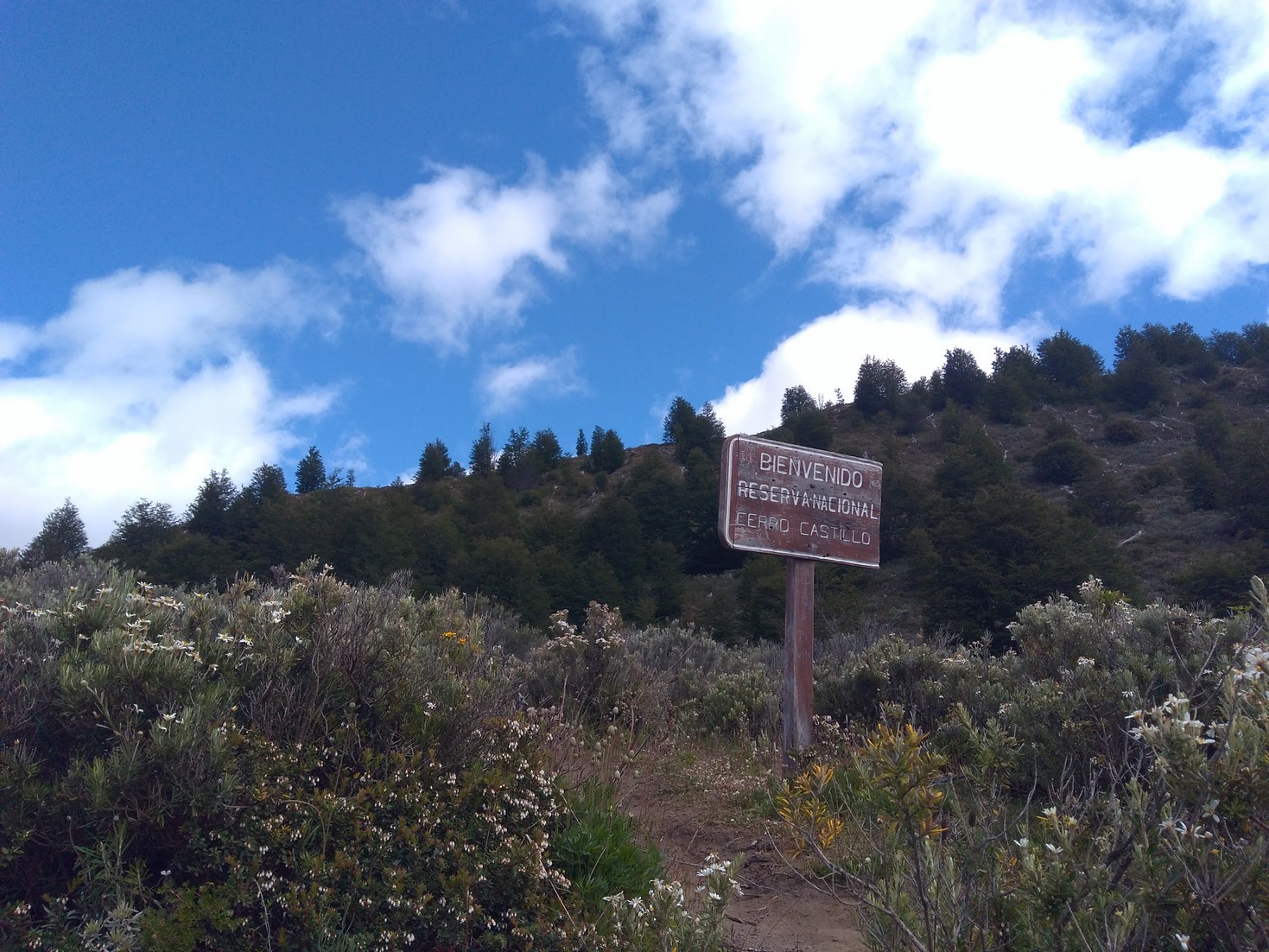
We awoke Saturday to clear skies and the Cerro Castillo (mountain) showed itself in all its glory right there from our camp spot.

We had breakfast and got ready to do a 14 km hike (round trip) up to the mountain’s crater lake. Many of our overlanding friends before us had done this hike and it looked amazing. It’d didn’t look easy with 1000 m / 3200’ of elevation gain so Fran was not looking forward to that part but she wanted to do it anyway.
We drove to the trail-head about 1 km away, parked, grabbed our gear and paid our entrance fee. Seniors price is at 60 here in Chile and the ticket attendant did ask how old we were and was kind enough to give us that discounted price despite not being actually 60 so that saved us a bit. We began at 9:15 am.
 The walk begins through some fields,

then forest,

then you hit gravel and it goes up up and up!

This part was a hard slog for Fran and Doug kept telling her “pole pole” which was the phrase used when he climbed Kilimanjaro meaning, “slow, slow”. She had two hiking sticks and made her way up to the lake in about 3.5 hours – no record but good for her.

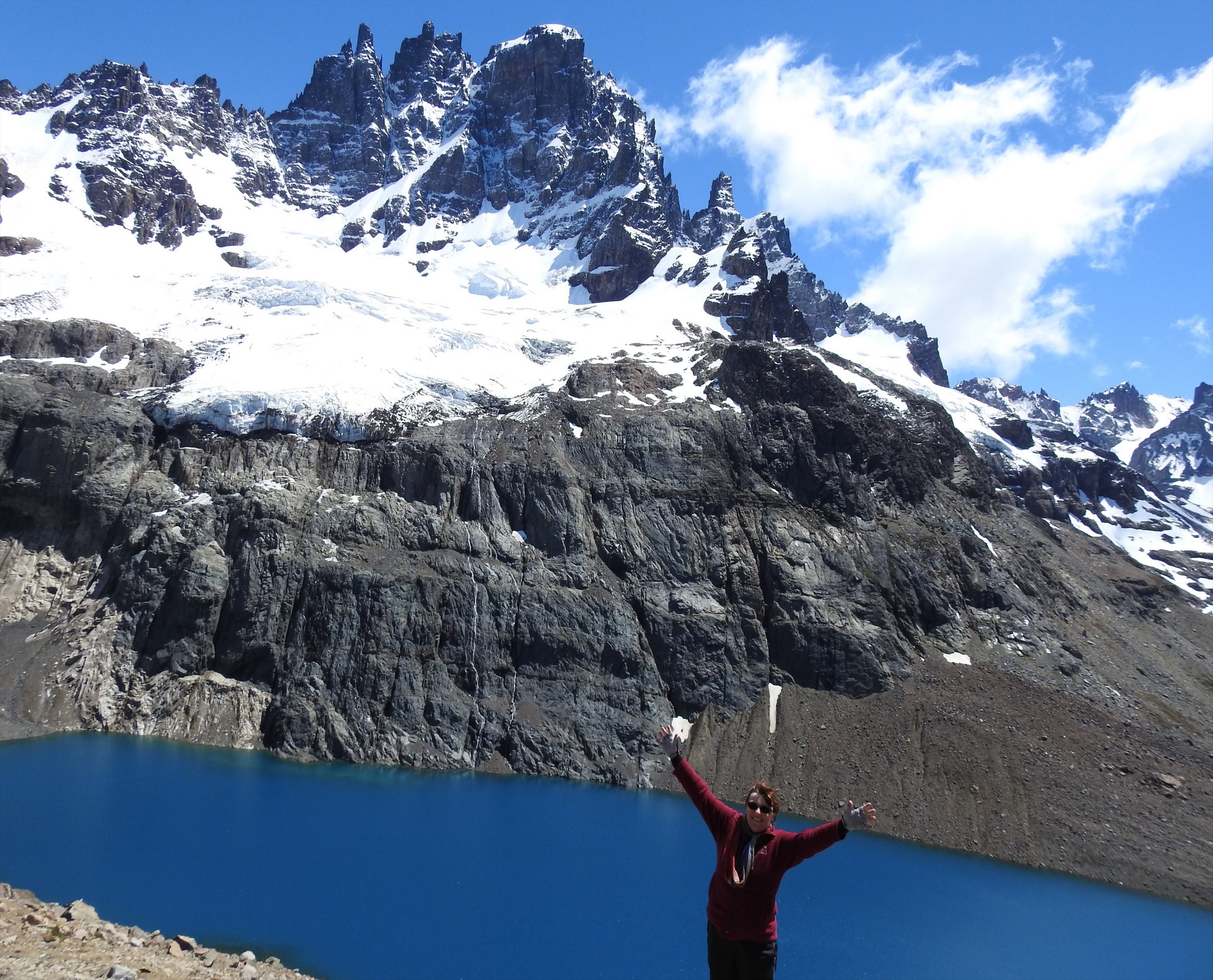

It was darn cold up there and we didn’t stay long despite wanting to enjoy the view longer. We were back at Tigger in just over 3 hours (going down is slow for Fran’s knees!). As it was still only mid-afternoon we decided to make our way towards our next port of call, Puerto Rio Tranquilo. After we left Villa Cerro Castillo, in about 25-30 km the road turned to gravel/dirt and it was pretty much like that the entire rest of the Carretera Austral except when near or in a town. As we don’t lake to drive late in the day, we made our way partway to a wild camp spot on a beautiful glacier fed river and spend a super quiet but cold night. We did have some company: a few cyclists down the shore from us.
So Sunday morning we drove the rest of the way to Puerto Rio Tranquilo where it was again an perfect sunny day and today we did the Marble Caves tour. The drive here was all dirt road but as we approached Lago General Carrera (the largest lake in Chile and second largest on the continent), the colour was spectacular – a lovely turquoise.

![]()
Upon arriving in the village, we topped up the gas tank (travelling the Carretera Austral means gas stations are far apart and don’t always have gas so we are carrying three Jerry cans worth and topping up every time we come across a station).
While at the station, Fran saw a camper across the road with Alberta plates and she went over to investigate. Cathy and Derek are on a two year overlanding trip and heading the same way we are. We chatted a bit; they’d just done the tour and we still had to book ours so maybe we’ll meet down the road.
We took a stroll around town after booking our tour

You board a small launcha that holds about a dozen people and it takes about 20 minutes to reach the first site.

It was a short tour (it seemed a bit rushed to us) but we really enjoyed the sites and the colours. Having the sun shine off the water made the colours so much more vivid.


![]()


(we took SO many more photos so please check out the Marble Caves gallery)
After returning to Tigger, we hit the road again trying to make Cochrane today and maybe catching up with Cathy and Derek. We pick up a couple of young Chilean guys backpacking and they were grateful for the ride as it was over 120 km to Cochrane with nothing in between. Roberto and his buddy were nice young men and every time we stopped to take photos they were happy that they could too.
This was the most spectacular part of the Carretera – from Rio Tranquillo to Cochrane: mountains, rivers, glaciers, waterfalls, lakes and perfect weather for the slow drive along the dirt/gravel/wash board roads.


Rio Baker (the longest river in Chile)
The confluence of the Baker & Neff

We arrived in Cochrane around 5, dropped off the boys at the gas station where we filled up again and made our way to the town square where we knew there’d be free WiFi and we could park for the night. The temperatures were much more civilized here, into the mid 20’s C / 70’s F but it did get cold over night.
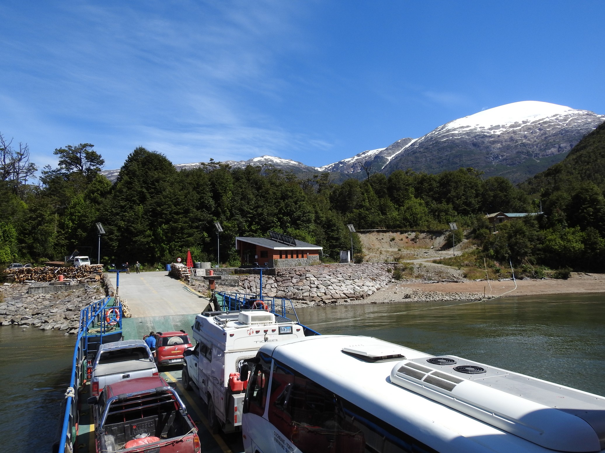
Monday morning we were up on the early side, exercised, ate and left Cochrane with Fran driving this time – since she’s been sick, she’s not driven the Carretera at all and wanted to experience it. We left around 8:30 hoping to catch the noon ferry across the lake from Puerto Yungay to Rio Bravo. This is like in the north, where part of the Carretera is over water. But this ferry was free and we weren’t sure how big it would be.
The weather was still amazing but this part of the trip didn’t have the same jaw dropping scenery; still lots of glaciers and snow capped peaks but it did not match yesterday’s drive at all. There is much evidence of previous logging and some small farmlands. Some of the lands are swampy and there are many river views and tons of waterfalls coming off the mountains from melting glaciers.
Currently we are finding this part of our adventure a bit out of our usual style with us having to drive every day and not hang around in places very often. The distances between things are long with often not a lot to see; all part of being in a long, thin country. We expect the same in the Argentinian Patagonia as well.
Rio Tigre


We did make the noon ferry at Puerto Yungay, backed right on and it took under an hour to reach the other side.


Then it was another 100 km / 60 m to Villa O’Higgins, the town at the end of the Carretera.


We drove right through town to the spot another 8.5 kms down the dirt highway to the official end of the Carretera Austral – 1247 kms which we have done from km zero in Puerto Montt. We are now at 48.5 degrees below the equator. Sooke, BC – where we went to high school outside Victoria is at 48.5 north! We are a long way down. The lake here is a beautiful glacial green and it is here you can catch a passenger ferry to Argentina if you are so inclined. Because we have a vehicle, we will have to drive north again just past Cochrane and then head east to the border where we will visit a few places before returning to Chile further south to see the rest of the country.

Then we walked the final 800 m / .5 mi to the actual end of the bad service road to the dam just to have bragging rights that we made it as afar as the road goes; we were glad we did not drive as it was narrow, had low hanging branches and a couple of 4×4 parts that if we’d had to back back down, would have been quite challenging.
What the actual end of that road looked like:

Upon returning to the town of O’Higgins, we gassed up again, parked on the square, hit a store for bread and bananas but only found the former and then went to the library to use the internet. We can get a 3 G signal here and all the campsites have slow WiFi (probably using that same signal) so we didn’t want to pay for camping if we couldn’t get better WiFi – camping here in Chile is a little pricey and here in O’Higgins, is a even a bit dearer. There are actually very few “tourists” in town which surprised us as there is trekking and glacier hiking to do in the area and lots of parkland. We were not overly impressed with O’Higgins and it’s not a must see but if you want to hit the end of the Ruta 7 – Carretera Austral you end up here.
The library closed at six, so Fran hung out there sorting a few things out on line while Doug returned to Tigger to sort a few things out there too. The engine had just begun running a bit rough just before we got here but we both got all our issues sorted out (GPS died, loose spark plugs, loose air filter, bent solar panel leg, stuck coach door and the battery had also come loose).


We did not see ANY overlanders in town and there’s not a lot to do here unless you’re going to pay big bucks for a tour to see glaciers, hike or fly over them, so we decided to treat ourselves to dinner out and then find a wild camp north of town for the night.
Our guide book and two people we asked said Entre Patagonica was the best restaurant in town. Around 6:30 we headed over there and confirmed it didn’t open until 7:30 so we hung out in the parking lot doing some stuff in Tigger.
Turned our we were the only people in the restaurant when it opened. It was quite nice looking with linen table cloths and a nice bar area.

The waiter took our drink orders and told us the daily menu choices; we each chose an appie and a main course. The appies were delicious but we chose the wrong main courses: beef dish – it was way over cooked and too much meat over all. We finished the meal with some fresh cherries and called it a night. We drove out of town about 10 km / 6 mi and found a spot to camp on Lago Cisnes and spent a super dark, quiet night.


We awoke to light rain which we’d expected after reading the forecast and made our way back to the ferry terminal at Rio Bravo – the first ferry was at 11 and we wanted to make sure to be on it – since it only holds about a dozen cars, we were glad we got there early (well before ten) as not everyone made it on. The one thing about rain that is good on this road is it means less dust!

The crossing was rather dreary with grey skies and rain and then we went a bit west to the small logging town of Caleta Tortel. It is very unique in that it is on a bay and has NO streets. There are quite a few homes and small businesses (shops, restaurants and hotels/hostels) and they are all connected by cypress walkways. Someone told us there was a total of up 20 km / 13 mi but that seemed a bit of an exaggeration to us. At the entrance to the town there is a small bricked parking lot and a brick road where we had been told it can be hard to get a spot so get there before dinner time to get a spot. There were a few places left when we arrived around 12:30 and we nabbed one and went for a walk thru the village. The bay is quite pretty but the light rain persisted.


police “vehicle”
fire “boat”
After less than an hour we returned to Tigger and due to the weather we decided that since we’d seen the town we’d push on back towards Cochrane. We drove over half way by 5 pm and found a wild camp spot on a ridge away from the road for the night. It had pretty much stopped raining around 3 and it was dry at the spot we’d chose. There were still rain clouds in the sky so that could change overnight.
So Wednesday we awoke a little chilly and after breakfast, made our way back to Cochrane to get laundry done, clean and get some internet. After getting some gas, we dropped off the laundry at a small campground off the town square (that we may or may not have fit into but she did tell us we could have hot showers for a price tomorrow) and returned to park on the square where there is WiFi. We’ll stay here a night or two depending how much we get done and shower tomorrow.
This afternoon we met a Belgian couple, Raymond & Ursula, who are also travelling in a rented camper on holiday. They currently live in Croatia and take one month long trips in different places renting campers. We invited them to come back around happy hour and have a beer.
After picking up our laundry we received a message from Will & Cate, that they’d seen our rig and were in town but staying at a campground on the outskirts. We invited them for a beer and they stayed about ¾ of a hour before returning to their campsite for the night. Right after they left Ursula and Raymond came bearing wine and we enjoyed an hour chatting with them for a second happy hour.
Thursday morning the weather was still quite nice and Fran caught up on photos and blogging in the morning and then we went for showers and began our drive to the border via Parque Patagonia – the newest national park in Chile (land donated by Douglas Tompkins foundation and turned over to Chile in the past year).
The park is quite beautiful and we saw many small herds of guanacos.


Upon arriving at the visitor’s centre, it was occupied by quite a large herd.


 The Info centre was closed but at the high end restaurant, we were able to obtain the info we wanted on a hike we were interested in doing to Lago Chico.
We carried on along the X-83 road through the park.


We arrived at the campground near the trailhead (the park has three official campgrounds all with tables, fire pits and bathroom blocks with supposedly hot showers but are expensive for what you get). There is no however, no park entrance fee.
We continued out the campground to a small parking area as we’d read that the road after this point is supposed to be 4×4 only (and there was a sign to that effect). The lot only holds TWO cars so we parked off to the side as there was no room for us. We walked the remaining 3km to the actual trailhead. By this time it was after 4 and the sky was more cloudy than clear; As the hike takes up to 4 hours to do the loop, we opted to just do the final 250m to the Douglas Tompkins mirador. It was spectacular:


It overlooks Lago Cochrane and there are snow capped peaks in the distance and a huge glacier on the other side of the border.
We walked back down to Tigger, drove out of the campground and found a wild camp spot that others had stayed at the at the east end of the park for the night.
The days now are so much longer this far south. The sun is setting just before 10pm and it’s up around 6 am.
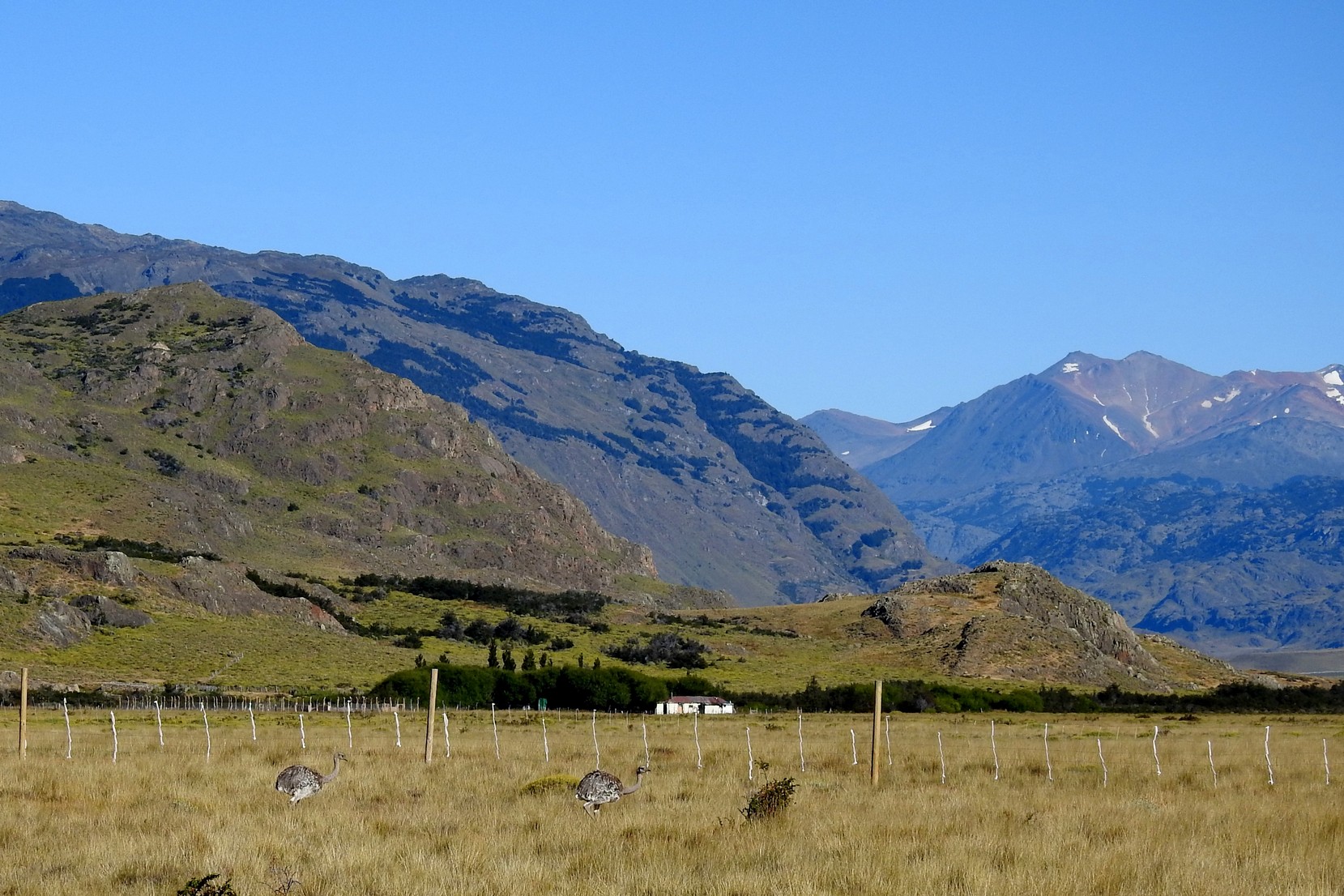
Friday morning, after breakfast we headed to the border at Paso Roballos; enroute we saw more guanacos, a couple of rabbits


and then over a dozen rheas!


We also saw some geese and ducks:


and it took five minutes to exit Chile and a couple of kilometres down the road, out of sight of the border offices of both countries (as it’s 11 km / 6 mi to the Argentinian one), we hid a few food items that might not be allowed into the country (popcorn, nuts, ham, milk) and made our way to the other side. The scenery continues to be so beautiful.