July 15th, 2022
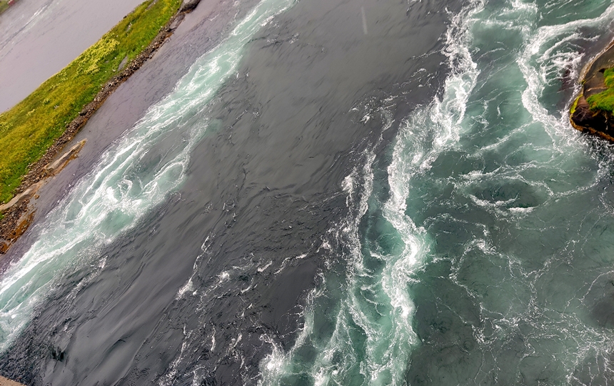
So we left the campground after hot showers once again in the rain . We had hung around for the morning to use the free Wi-Fi and today we continued north towards the end of the scenic (albeit wet) highway at Boda. We made one stop before arriving there at the Saltstraumen Maelstrom:
Saltstraumen is a small strait with one of the strongest tidal currents in the world. Up to 400 million cubic metres (110 billion US gallons) of seawater forces its way through a 3-kilometre (1.9 mi) long and 150-metre (490 ft) wide strait every six hours. Vortices known as whirlpools or maelstroms up to 10 metres (33 ft) in diameter and 5 metres (16 ft) in depth are formed when the current is at its strongest. At this point, one source claims that the tidal current can reach 40 kilometres per hour (25 mph). Saltstraumen has existed for about two to three thousand years. The current is created when the tide tries to fill Skjerstad Fjord. The height difference between the sea level and the fjord inside can be up to 1 metre (3 ft 3 in). When the current turns, there is a period when the strait is navigable.
We drove into Bodo straight to the ferry terminal and found the ferry terminal where we got in line for our longest ferry ride in Norway. We are heading to the scenic Lofoten Islands which we hear are also very crowded this time of year. We see SO many other campers/motorhomes/vans as we travel – this is definitely the busy season.
Now it seems you can actually reserve a spot by for that privilege you pay about $50 USD and they only reserve 2/3 of the ship anyway, so we thought we’d take our chances; if worse came to worse we could catch the later one but that would suck as we’d have to eat dinner onboard as you are not allowed to stay in your vehicle. Well we lucked out and were one of the last on board! The ferry left at 3 as scheduled and docked about 7:40. We took one of the first available road side pullouts and made dinner. Since the islands are small there’s not much traffic so that wasn’t an issue. All of the main islands are all connected by bridge so no ferries required unless you plan to visit a smaller one which we didn’t.
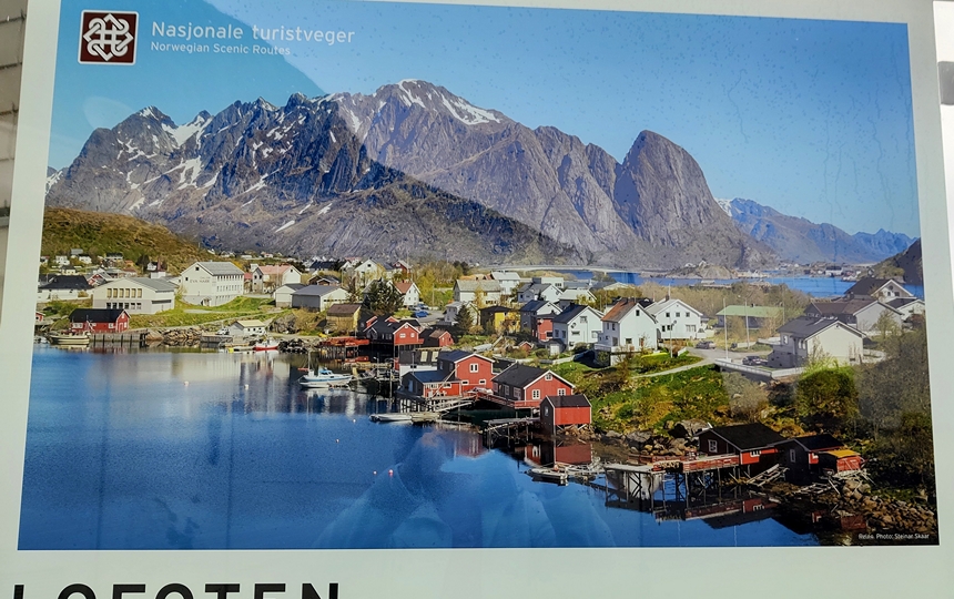
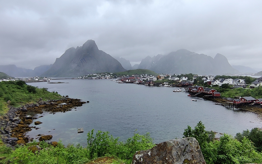
Lofoten is an archipelago and a traditional district in the county of Nordland, Norway. Lofoten has distinctive scenery with dramatic mountains and peaks, open sea and sheltered bays, beaches and untouched lands. The archipelago experiences one of the world’s largest elevated temperature anomalies relative to its high latitude.
There is evidence of human settlement extending back at least 11,000 years in Lofoten and iron Age agriculture, livestock, and significant human habitation can be traced back to c. 250 BC.
The islands have for more than 1,000 years been the centre of great cod fisheries, especially in winter, when the cod migrate south from the Barents Sea and gather in Lofoten to spawn.
Daily tallies: 7 tunnels with only one ferry, no moose!
The rain pretty much continued overnight and by morning the cloud ceiling was still rather low. We enjoyed the drive regardless as it is very scenic. The E10 highway is about 200 km / 125 miles long and passes through a number of fishing villages and one large town, Svolvaer, with a population of about 4700 and it sits about 169 km / 105 mi north of the Arctic Circle (or 2420 km / 1500 mi away from the North Pole!).
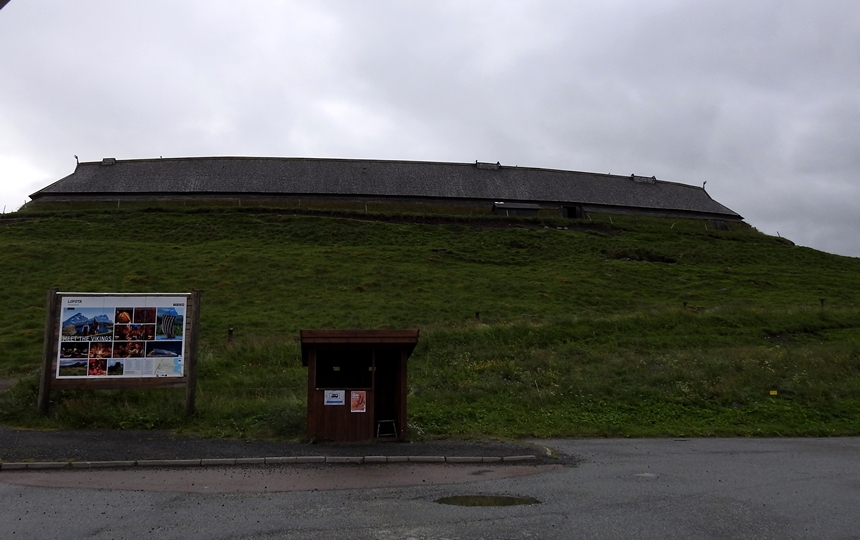
We came upon a Viking Museum with a reconstructed 83-metre-long longhouse but we’d visited those in Iceland last year so we didn’t go inside – we’ve done that in Iceland and Newfoundland.
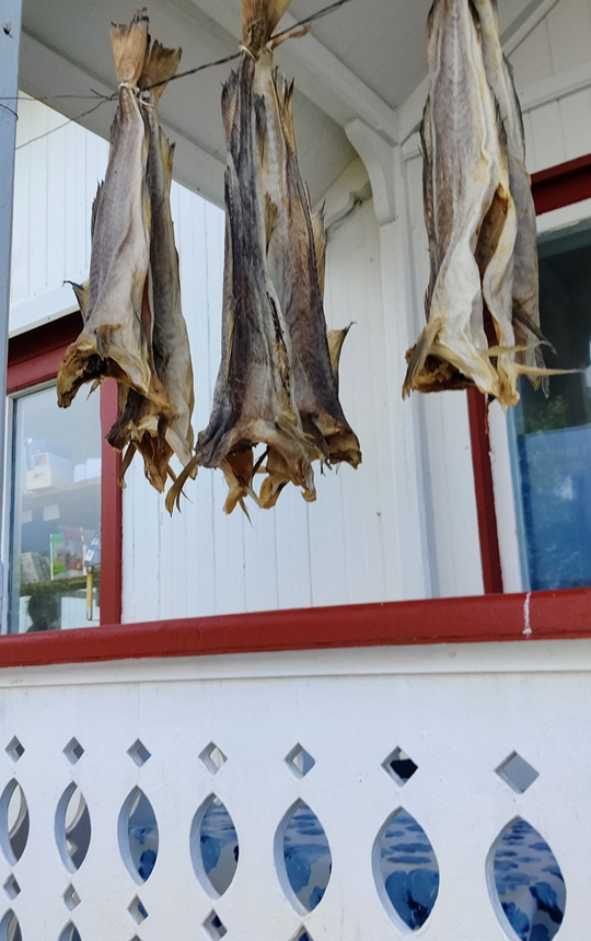
Driving through the first couple of islands we kept seeing these racks:
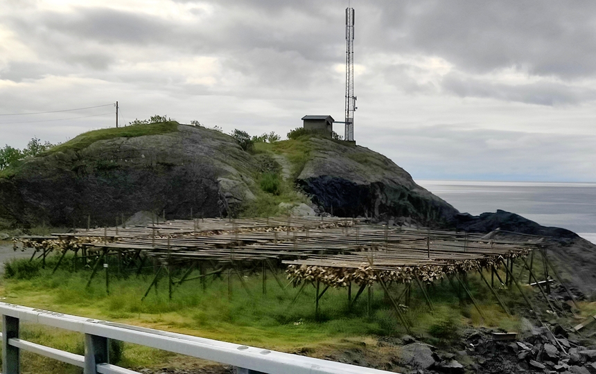
Then when we saw some of the racks further down the road they had fish heads hanging of them.

Seems they dry them out and ship them to Africa (in particular Nigeria) where they are used in certain recipes – who knew that there was a market for fish heads?!
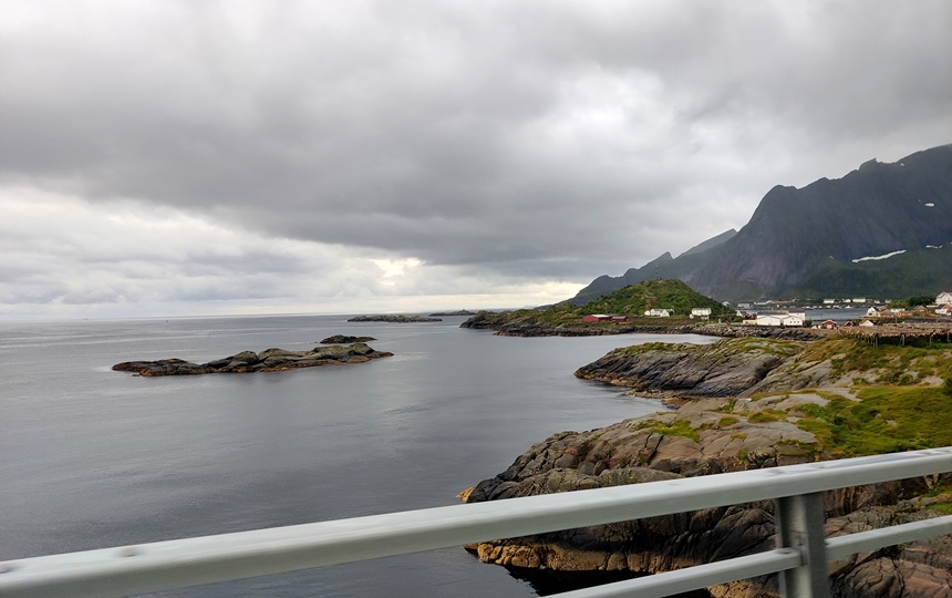
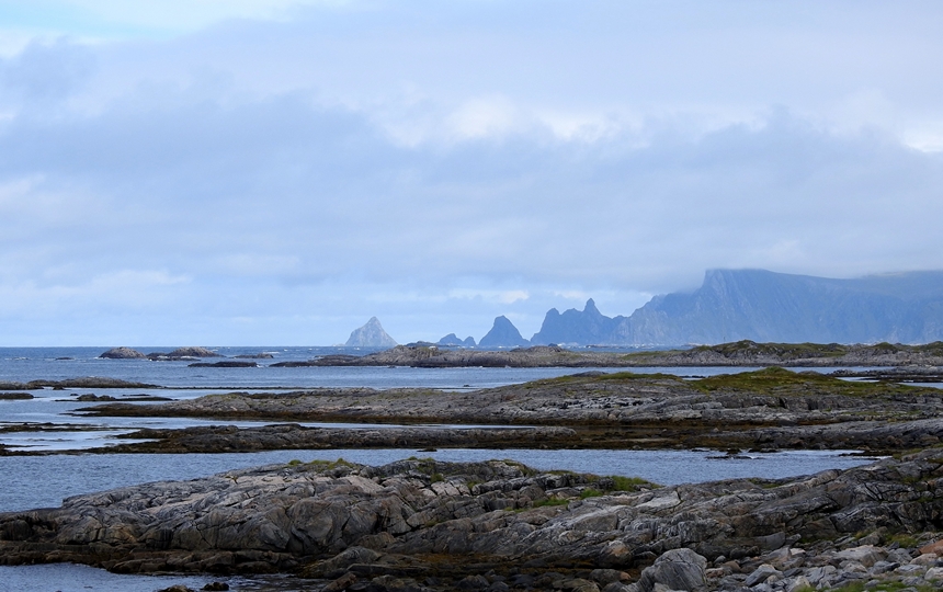
We made several stops at scenic view points despite the rain and were lucky at some that the rain held off to a mist.

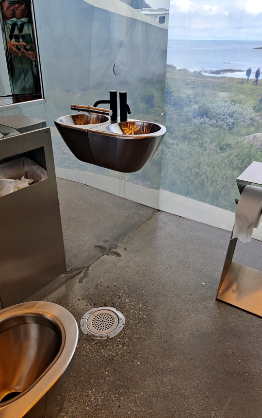
We did come to this rest stop with cool bathrooms (our second interesting bathrooms in Norway). We decided to use them before going on the little hike out to the water and that’s when we saw this:
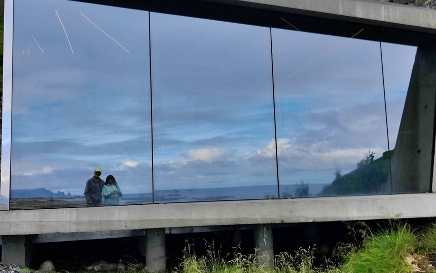
You can see out and enjoy the view while those outside cannot see in – the glass is mirrored and this is what it looks like outside:
We did the short walk and continue to look for whales:
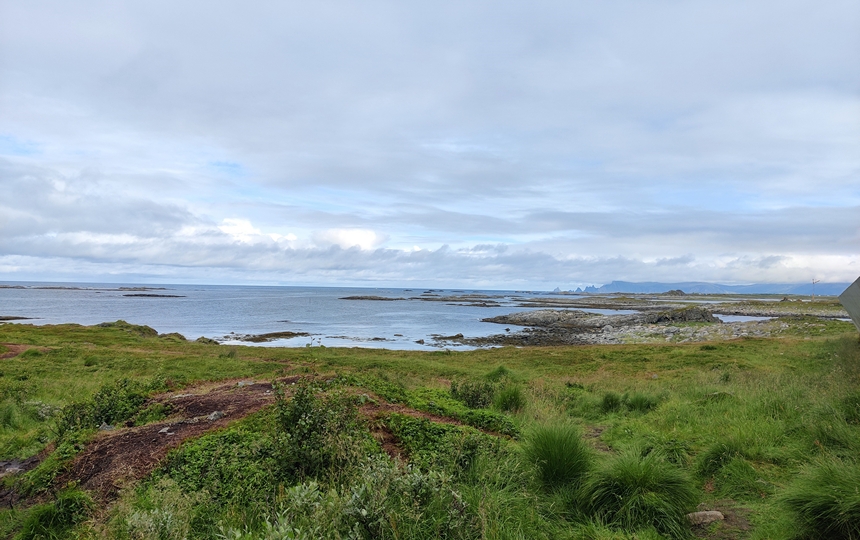
As the weather continued to “suck” we kept driving and made our way northward to Andoya Island which had a scenic drive on the western side. By the time we reached that coast, the sky was clearing and sunny periods met us. It was a beautiful drive but sadly we saw no whales despite July being a good time to see them.
The good weather lasted all afternoon and we so loved it. We took this route in order to save some driving miles northward and to see some of the Senja Island which is supposed to be equally scenic to Lofoten but less crowded. Luckily we had read a few days ago that most of that road is closed due to reconstruction (started like 3 weeks ago) so we know we have to go across the island instead of around the fjords but it’s still shorter. We had a while to wait for the ferry so we took a walk through the town

By the time the ferry left, the sky was getting darker but it didn’t rain. We got parked in a large layby just off the main road with a couple of other vehicles and had a super quiet night. It began to rain before we went to bed and lasted all night. The forecast was for a really wet day with a possible lull in the afternoon but no sun.
Daily tallies: 21 tunnels, 1 ferry and again NO moose.
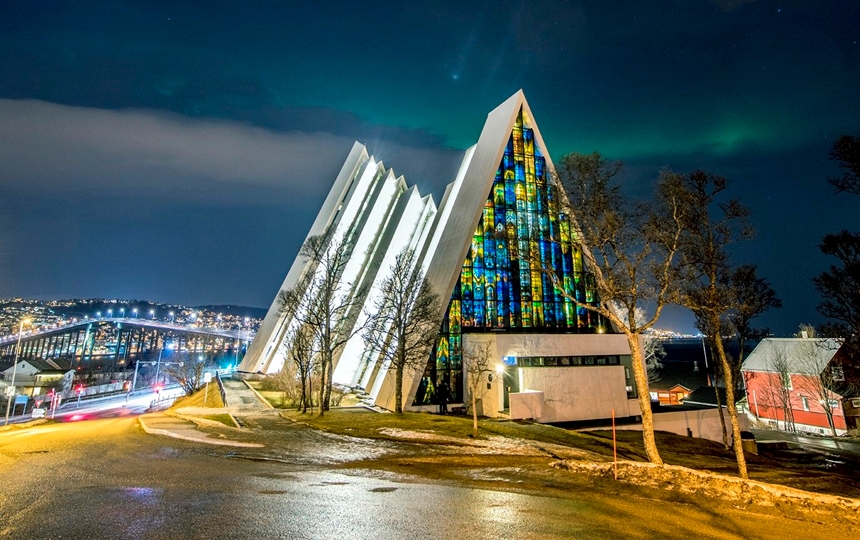
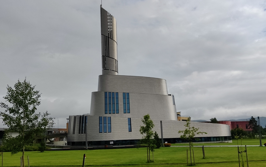
We decided to push on to the city of Tromso today, the most northerly large city in Norway. To do that we had to make our way back to the “mainland” and will have no further ferries from this point northward. However, the main part of Tromso is on an island connected by three bridges. Before crossing one of these bridges we saw the fairly recently built Arctic Cathedral.
Tromsdalen Church or the Arctic Cathedral is a parish church The modern concrete and metal church was built in a long church style in 1965 and seats about 600 people. Despite its nickname, it is a parish church and not, in fact, a cathedral as it is commonly called.


We found a parking lot on the park4night app that was free on Sundays (talk about timing for visiting cities!) and as we had driven early in the day, we got a spot. There are actually two lots here, one free on Sundays and the other not. The free one was actually full when we arrived but Doug walked over to ensure that it WAS free (this one was about 50 cents an hour but it was mostly dirt and had puddles) and lo and behold someone left as he was checking the signs and he rushed back to move us over there. He then made breakfast and it stopped raining! We grabbed our jackets and walked into town – we were less than a klick away from the city centre and we visited a few things.
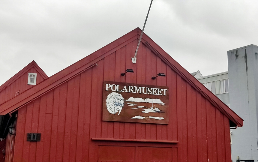
Polar Museum – cost $10 and was not so great as it was mostly all in Norwegian although they give you a brochure in the language of your choice but it didn’t help you read most of the sign boards.

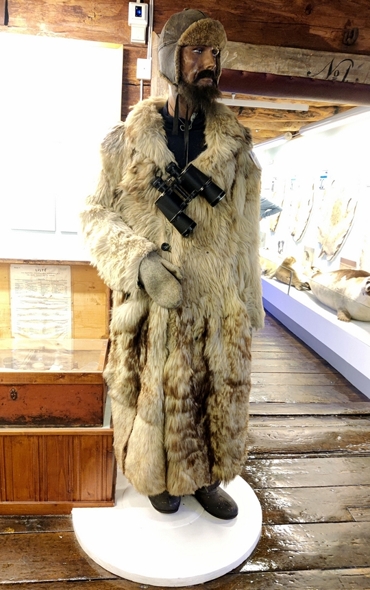
If you recall back in Oslo we visited the Fram Museum which was all about Amundsen’s polar expeditions. Here he is quite beloved because much of his northern journeys began here. There are about 4 statues of him around town and this museum had a lot of information and items related to him and his expeditions.


We then wandered over to the see the Troll Museum but it was rather pricey as was the Polaria (a polar aquarium) so we passed on both. We saw the actual cathedral downtown and then strolled around past the aquarium building which had some interesting sign boards outside. There wasn’t much else to see here (it’s not that big a city and being Sunday, a lot was not open) so we returned to Minou for the afternoon. We had our monthly Kitojo Zoom meeting before dinner and spent the night here.
Today’s tallies: 2 tunnels and 4 man made ones 2 of which were for animal crossings no ferries first dirt roads in Norway but they were due to road construction, The worst roads we’ve experienced in Norway were on the morning drive today.
We left Tromso under continued cloudy skies before our free parking time ran out and made it to Alta – about 380km away.

Enroute we saw some glaciers:
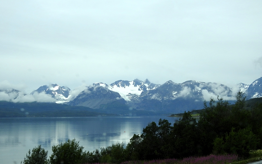

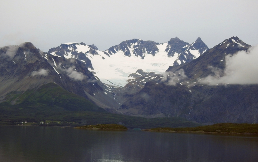
and stopped at a panoramic viewpoint:
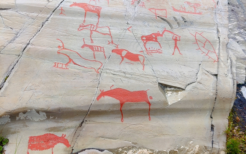
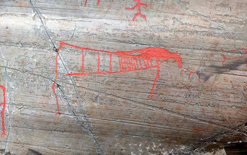
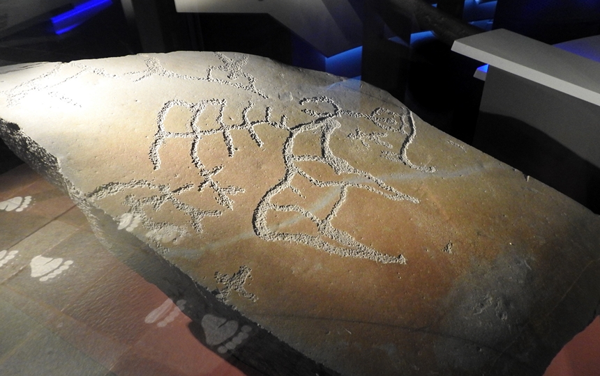
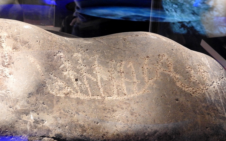
We arrived just outside of Alta and visited the Alta Museum where Northern Europe’s oldest rock art is found and which is a UNESCO World Heritage site. Alta has more rock art than anywhere else in Europe.
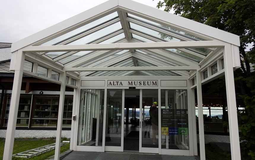
It was discovered in the 1960/70’s and there are about 6000 figures that range from 2000 – 7000 years old. There are five areas of which the open air museum is the largest and the only one accessible to the public.
The carvings in this area were originally made on the smooth rock surfaces at the shoreline. Because of the rising of the land after the last ice age, the oldest carvings are now the highest up in this terrain. These carvings/paintings suggest that Alta was an important place in the Stone Age.
Upon paying our entry fee, it was suggested to us that we do the walks along the trails first as the sky threatened rain. Unfortunately for us, right after we started, the clouds opened up dropping a little more than a misty rain and we got wet. Hence we only did the White Trail as it began to get heavier as we returned back towards the museum itself to meet the Red Trail. However, this section is the easier section to spot the paintings as they are the red ones not just carvings.

We returned to the reception building and visited the small museum inside.
We drove into town stopping to see the northern lights cathedral here at which point the rain stopped and the sun poked out periodically.
There was parking there for motorhomes in a large lot out front but it was pricey and Fran found a much cheaper lot near the ferry terminal/harbour. $4 for 24 hours with bathrooms and Wi-Fi! We got parked and Doug went to check out the RV dealership next door as he’s been looking for a few parts. They sent him to a different RV dealership (imagine this small city having not only one, but two RV dealers!). At the second one he found all but one thing he was looking for and that one was not urgent.
Fran spent the afternoon working on our new website (hope you’re enjoying it) and by late afternoon the sun was gone again and the rain began on and off. It was still raining in the morning but we are heading to the tip of Norway: Nordkapp where the weather looks great and that’s only 236 km / 146 mi away.
We left early that Tuesday morning and had rain about half the way and then just cloudy skies until about 9am.
For a country with a sparse population (5M) there are people spread out over vast regions; you don’t go far without seeing a house. We are now up at 69.9º in the land of no darkness from late May to late July.
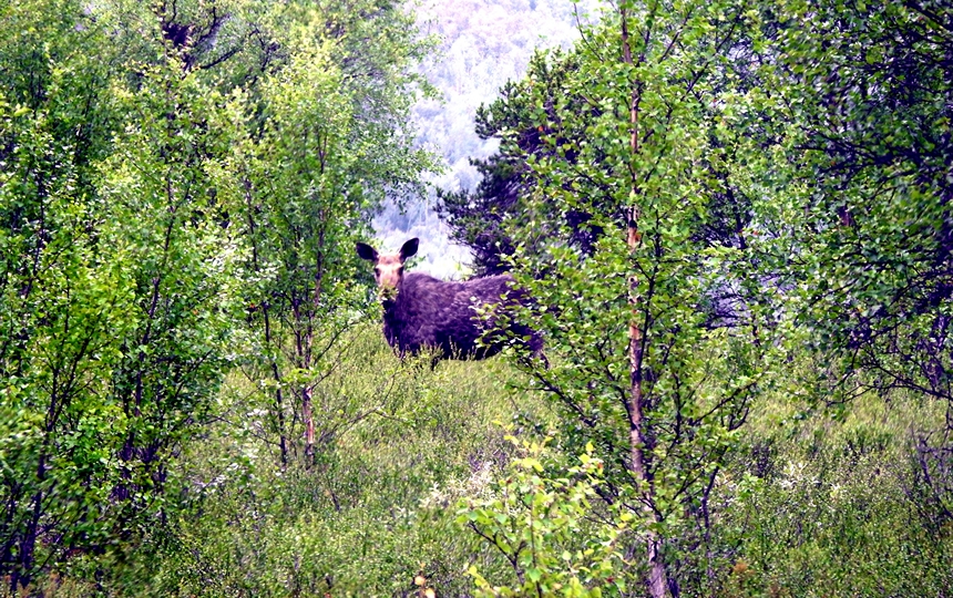
Today we did 14 tunnels and repeated those 4 bridge/tunnels we did yesterday but had no ferry trips. We still saw no moose but did see 3 cariboo (no pics – should see more northward).
Next morning we awoke to overcast skies once again but then it cleared up beautifully pretty quickly which made the water front highway drive spectacular!

There are fewer and fewer trees as we go north and at times = crossing “mountain” passes, there are none.
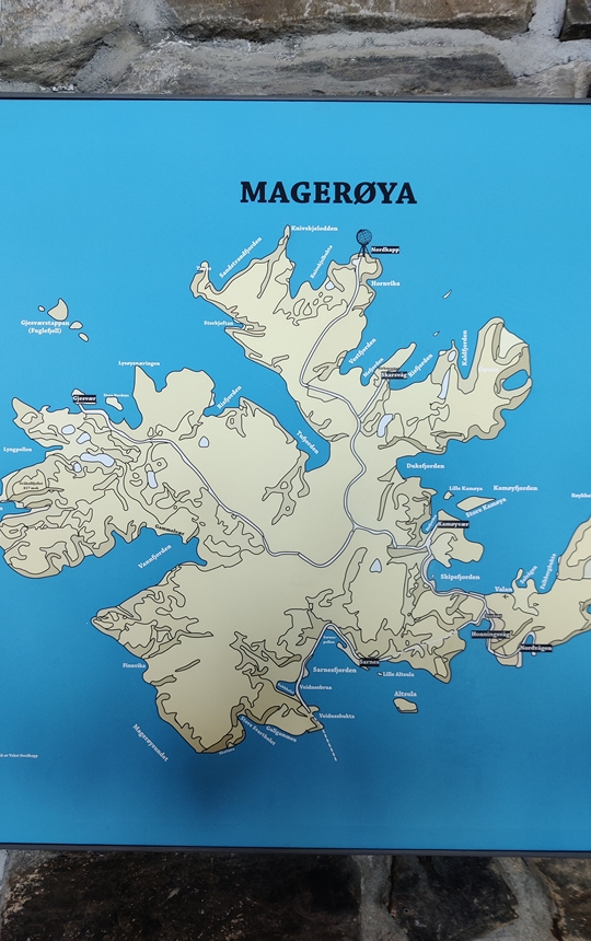
After the final tunnel to the most northerly island of mainland Norway, Mageroya, we saw no more trees and this island is mostly mountainous with windy roads.
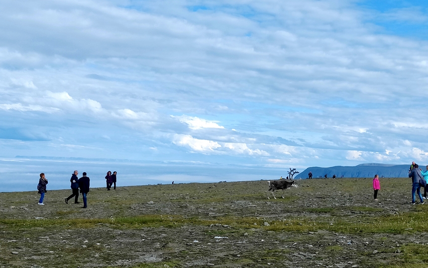
Upon arriving at Nordkapp itself, we were 7th in line at the entry gate but couldn’t understand why there is a gate at all when entry into the site and parking are free BUT at the booth they try to up sell you to purchase tickets at $30 an adult tickets to the “buildings” (which include a restaurant and a souvenir shop not just the visitor’s centre museum) so it takes a while for each vehicle to get through. We opted to go the free route and got parked after about a twenty minute wait. There are LOTS of RV/campers here and a half dozen tour buses but the site is so large, it does not feel crowded (yet).
After parking, Doug made breakfast and then we took a walk around.

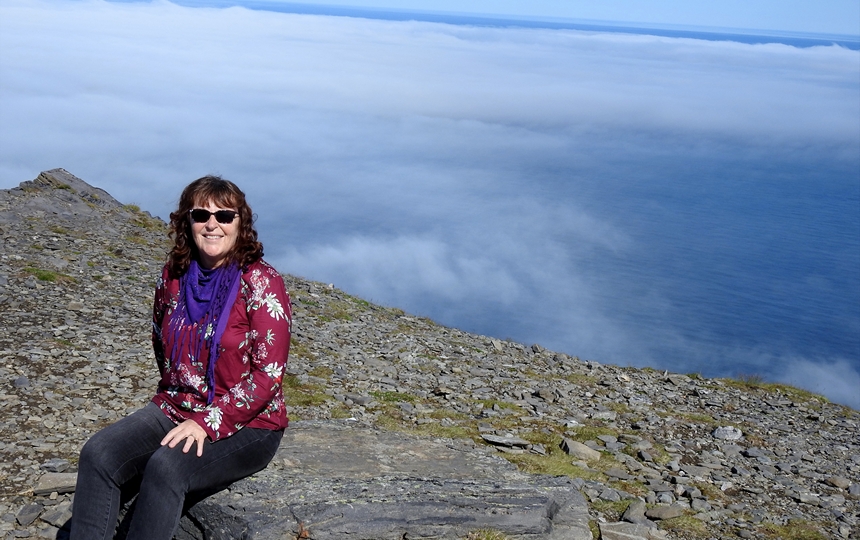
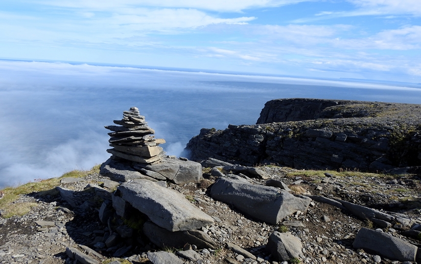

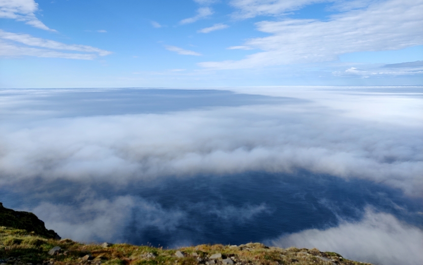
The clouds were sitting below us (we are only at 300 m / 1000’) on the sea and the views out across the Arctic Ocean were amazing. If you recall when we went to Antarctica, Fran did a polar dip and hoped that Doug could do one here – well we are on cliffs so there is no beach access so he lucked out as he was not keen on doing it at all! 😉
The most northerly part of the site is 71.1709 degrees N – considered the most northerly point of mainland Europe. We are so much further north here than we ever went north in Alaska OR south in Argentina. The temperature is about 14C / 57F and there’s no windy so it’s rather nice.
We returned to Minou around 2 and Doug did some work on her while Fran did some website stuff. The fog rolled in over us and then was gone by about 3:30 and we had blue skies once again.

Today’s totals: 6 tunnels (one 7 km long and 212 m / 695’ below sea level! ), no ferries, 1 dirt road stretch (again due to construction), no moose but we saw 5 reindeer on the road
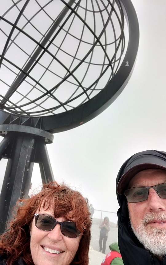
Our plan to celebrate making it so far north had been to enjoy the “sort of sunset” of the midnight sun but by early evening the fog had rolled back in and it just got thicker, got windier and colder. Around 9pm we did walk back over to the “globe” but a couple of bus loads had arrived and it was rather busy, windy and the view was non-existent. So we cancelled our plan and went to bed at the usual time. We did notice the parking lot was now nearly full and there had to be between 100 and 200 RV’s/motorhomes/campers of some sort.
The fog seemed to have hung around all night as everything was went in the morning and it was still hard to see very far. We decided to leave early so that we wouldn’t be in a long queue of vehicles heading back crawling due to low visibility.
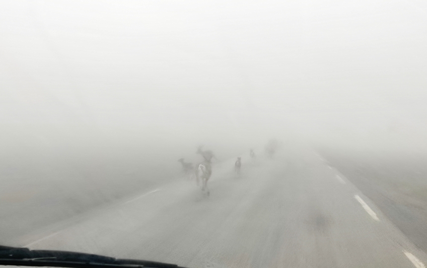
We had to go pretty slow to start but once we got lower, it was better then, we climbed and then we got out of it before leaving the island. We did manage to spot a herd of caribou in the fog just off the road:
The cloud ceiling was higher than “usual” as we made our way south to a rest area to dump and get water but the latter was a bust as the tap wasn’t working.
We drove to a small town just this side of the Finnish board and since we’d already done 260 km / 161 mi, we decided to call it a day driving wise and got parked. The sun came out and Doug continued to try and work on the grey pipe issue; we have with a small leak with not much success. We made breakfast and went for our walks. There is a Sami Museum here but we plan to visit the one in Finland tomorrow but below is a pic of the entrance to it and a statue honouring the Sami ski culture.


By early afternoon it clouded over once again but the temperature was around 20C / 72F and quite comfortable for a change.
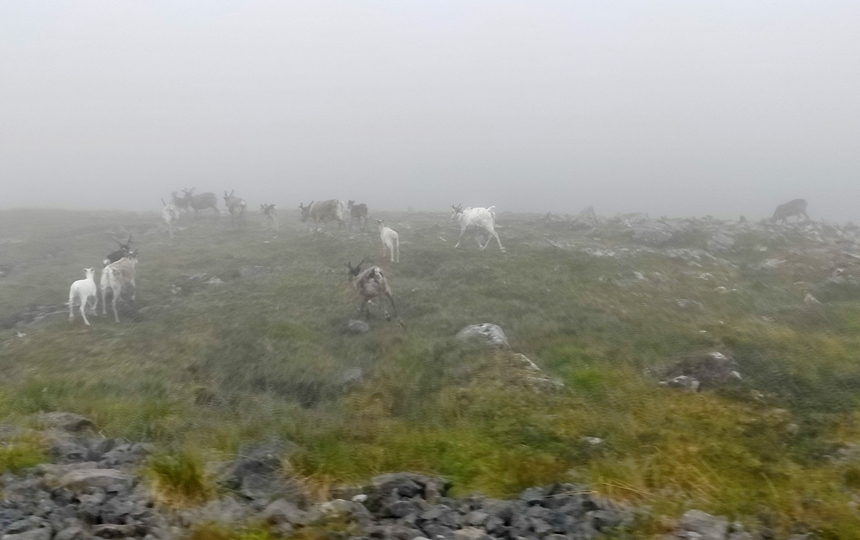
Today’s transportation tally: 6 tunnels (all duplicates of yesterday’s); no ferries; lots of reindeer especially in the morning in the dense fog and FINALLY 1 moose! Oh and the bugs are starting to get bad away from the sea.
Total mileage in Norway: 5232 km / 3251 miles
Fun facts:
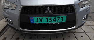
- 2 license plates in Norway: a white one for regular vehicles and a green one for vehicles that cannot take passengers (ie commercial vans etc.)

- Over 1245 tunnels and counting in Norway (we’ll have done about 10% of the tunnels)
- The world’s most remote island is a Norwegian territory; administered by Norway since 1929, Bouvet Island in the South Atlantic Ocean is Planet Earth’s most remote island.
- 16,971 bridges in Norway
- Over 100 ferries
- Saw summer husky training going on
- Norway introduced sushi to Japan!
- Skiing was invented in Norway
- Norway is the most successful country at the winter Olympics
- A Norwegian invented the cheese slicer
- Despite oil and gas powering it’s economy, around 98% of Norway’s domestic power usage is drawn from hydroelectric powerplants
- To say thank you for their help during World War II, the city of Oslo sends Britain a tree every Christmas. The tall Norwegian spruce from the Oslo forest is placed prominently in Trafalgar Square
- Norway shares a 193 km / 120 mile border with Russia