December 4th, 2018
We landed on Easter Island this fine Tuesday, nearly 4000 km / 2500 mi from Santiago. We were not sure if our hotel included airport pick up and after surveying the signs in the arrivals area, figured it didn’t but the hotel was only 1.5 km away so we opted to walk which felt good after sitting for five hours.
Upon finding Tekena Hostel & Inn, we learned that there had been someone there to pick us up but we reckon he arrived after we left; no harm no foul. We were given fresh flower leis to welcome us:

and shown to our room. We have a private room with both a queen and twin bed with our own bathroom. It’s located right on the main street with lots of shops and restaurants within walking distance. It’s not the most modern hotel, but it’s owned and run by locals, it’s clean and offers breakfast – and it turned out to be surprisingly quiet for its location.
It’s a bit surreal to think about where we are: the most remote island in the world!

This map triangulates Hawaii, Easter Island and New Zealand:

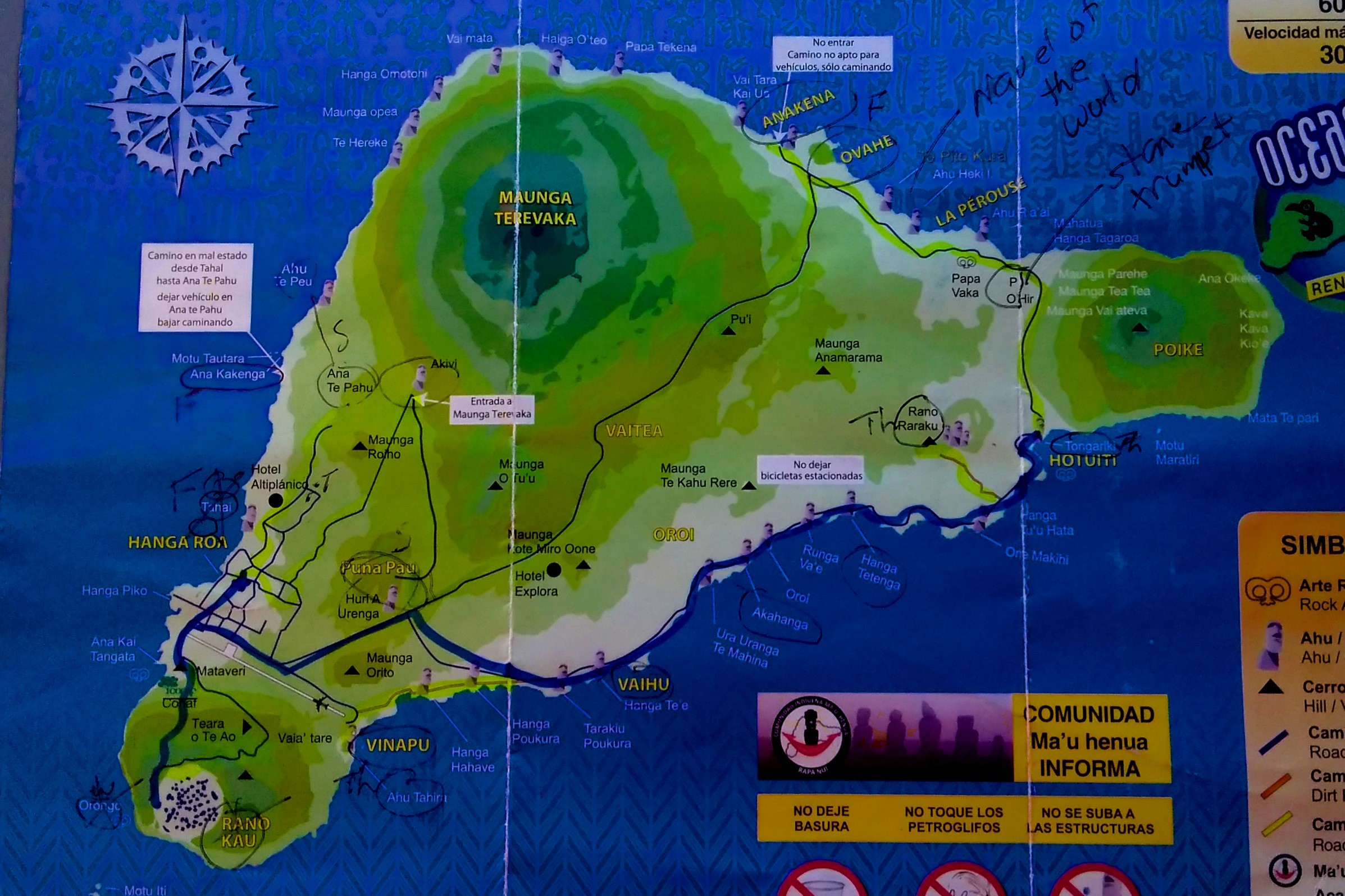
Easter Island was created by three volcanoes and is considered one of the most remote places on the planet being over 2000 km from the nearest inhabited part of the world. Three million years ago, Poike Volcano was an island unto itself; a few hundred thousand years later, Volcano Rano Kau emerged followed by Volcan Terevaka and the three created the island know today as Isla Pascua, Rapa Nui or Easter Island. The island covers only 163 square kilometers and is loosely shaped like a triangle with its “bottom side” being approximately 24 km long. Much of the island is national park land and upon arriving, you purchase a National Park Ticket; it is also a UNESCO World Heritage site. Its current population is around 7,000 and there is only one city on the island: Hanga Roa.
Rapa Nui has a controversial history. The actual date of the beginning of colonization of this island is disputed by many; the consensus is that sometime between the fourth and eighth centuries, villagers from a Polynesian island arrived here and settled. At its peak the island was home to 20-30 thousand inhabitants. Various studies tend to verify this but there is also a belief that contact with South Americans did occur. Much agriculture was carried out. These people held religious beliefs including worshiping ancestors and it manifested into the building of “ahu” and “moai”.
As the population increased, resources were depleted on such a small island (all the trees were cut down) and an intense crisis with internal wars transpired. The centuries before contact with western societies were characterized by overuse of resources, abandonment of moai and a new cult was invented.
On Easter Sunday, 1722 the first Europeans (lead by Dutchman Jadob Roggeveen) arrived and the island received its western name. In 1770, it was claimed by Spain. The introduction of unknown diseases and the capture of natives in Peruvian slave raids, almost completely wiped out the Rapa Nui people in the latter half of the 19th century. The slaves were sent to work in guano mines on the Chincha Islands of the coast of Peru.
In 1888, Easter Island was annexed by Chile and its citizens were given rights as Chilean citizens in 1966.

In 2006, this flag of a white field with a red reimiro (a traditional chest plate sculpted in wood) became representative of the people Rapa Nui. It is a two headed figure that some suggest is a god and perhaps due to is crescent shape, maybe a moon god?
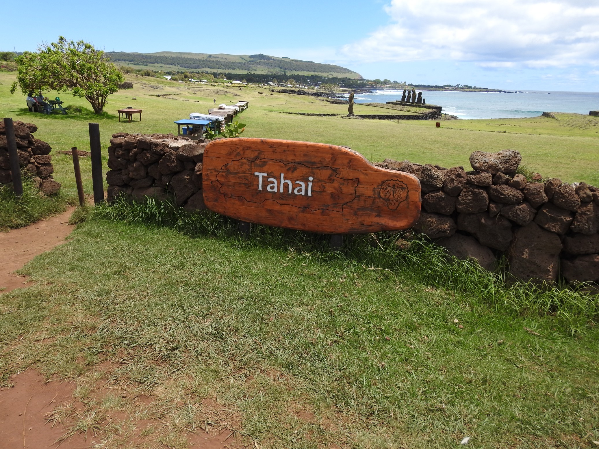
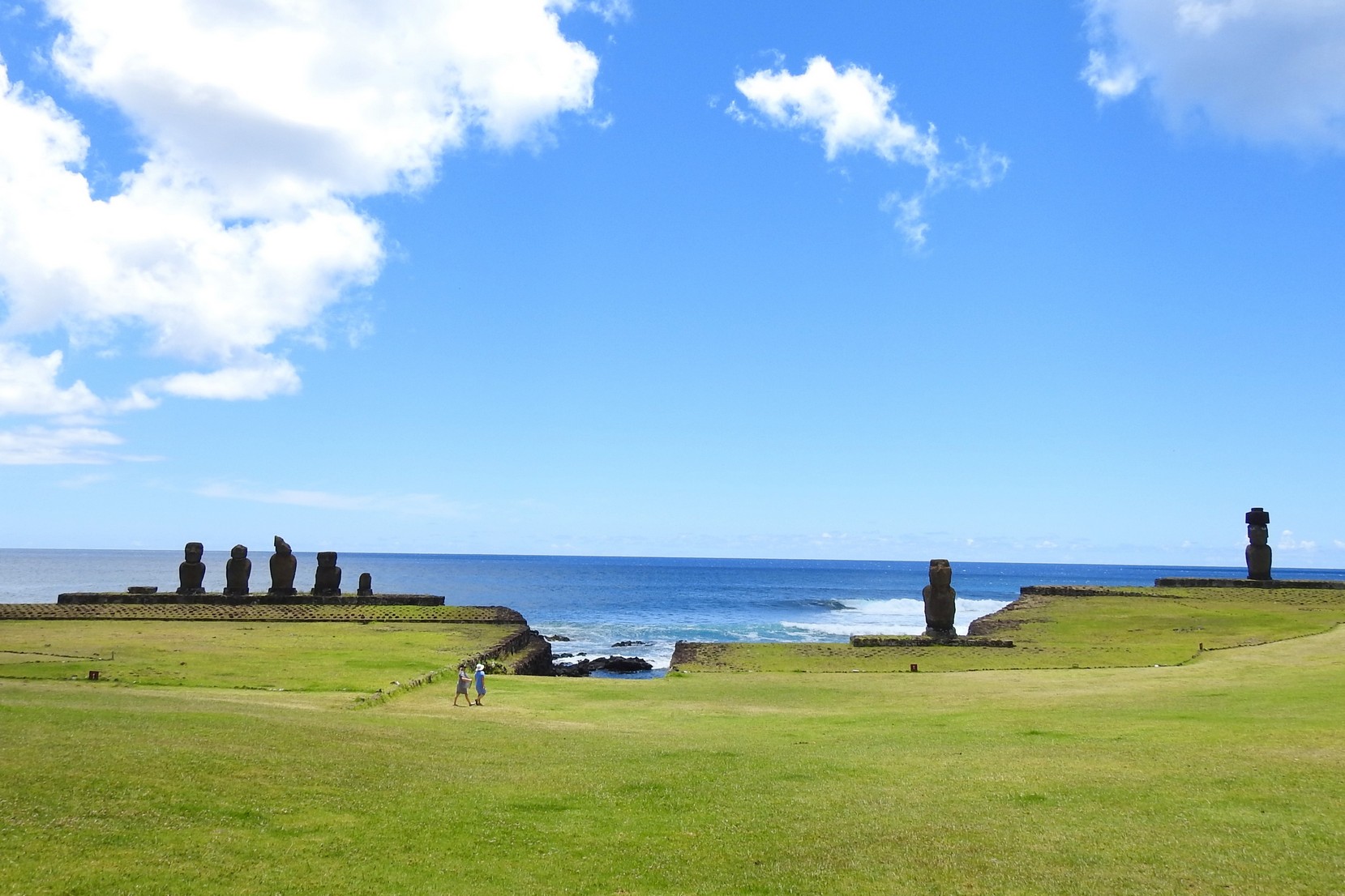
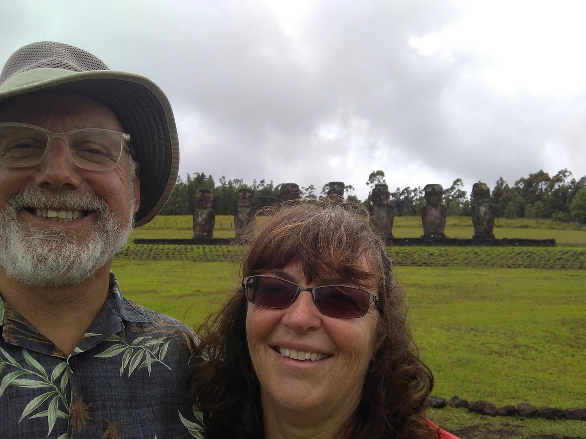
After unpacking some and cooling off a bit (it’s a bit humid here) we decided to walk a bit and grab a bite to east. We are in a different time zone, two hours earlier than Santiago so it felt past lunchtime to us. We walked toward the water; SO lovely to see the Pacific again! And found a small café for lunch watching the ocean. This is the only moai within town limits – it’s near the small harbour.

We returned to the hotel after checking out the tourist info centre and roughly planned out our week. Rather than doing a bunch of different tours (that are quite pricey), we’re going to rent a car for three days and see the sunrise and sunset as well as most of the sights. We found a good deal via a brochure at the visitors centre for a three day rental.
We then decided to walk to the north end of town and check out the Rapa Nui museum and walk back along the coast to view several moai.
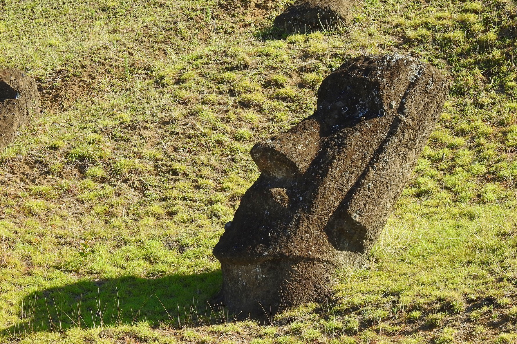
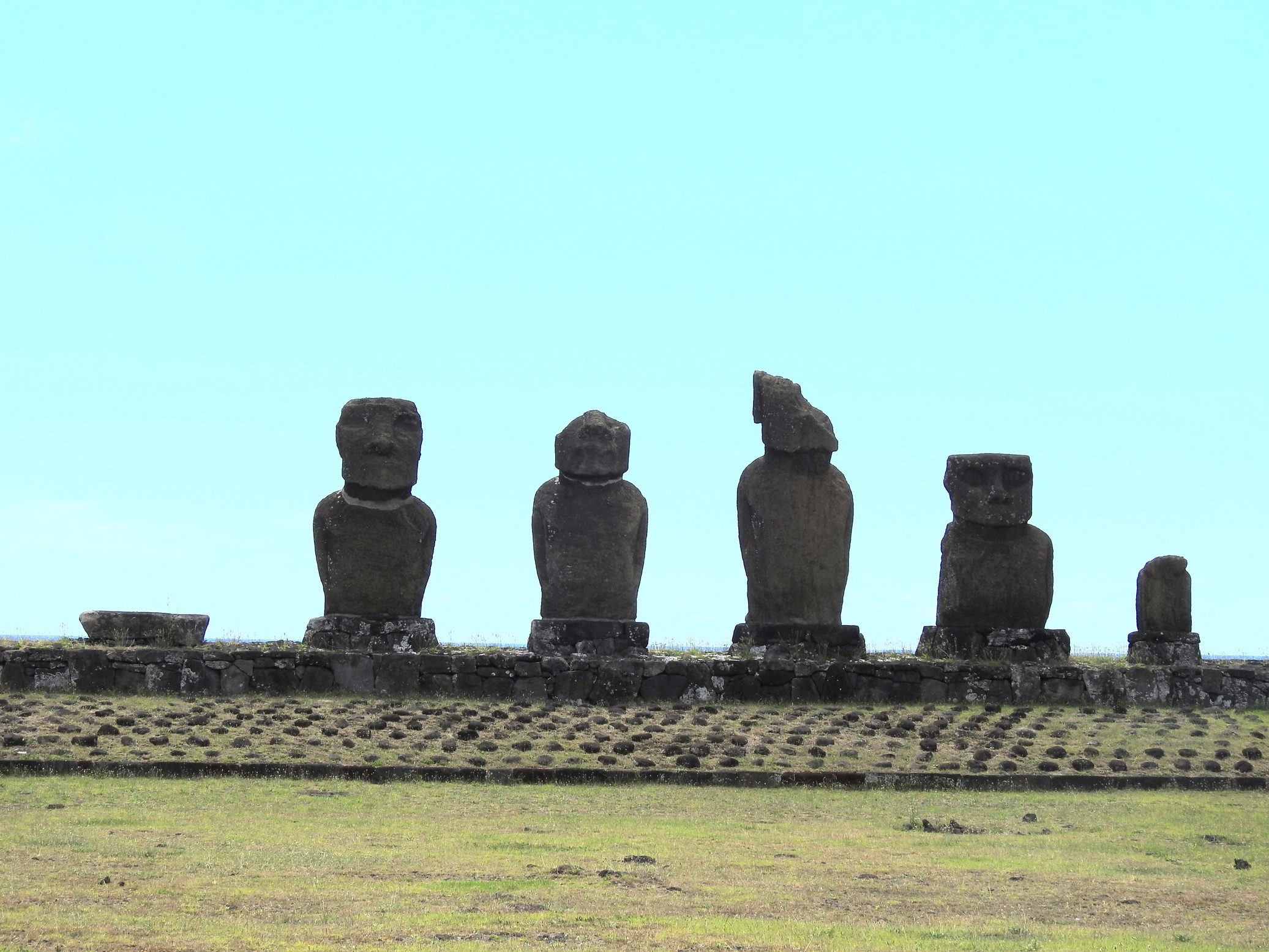
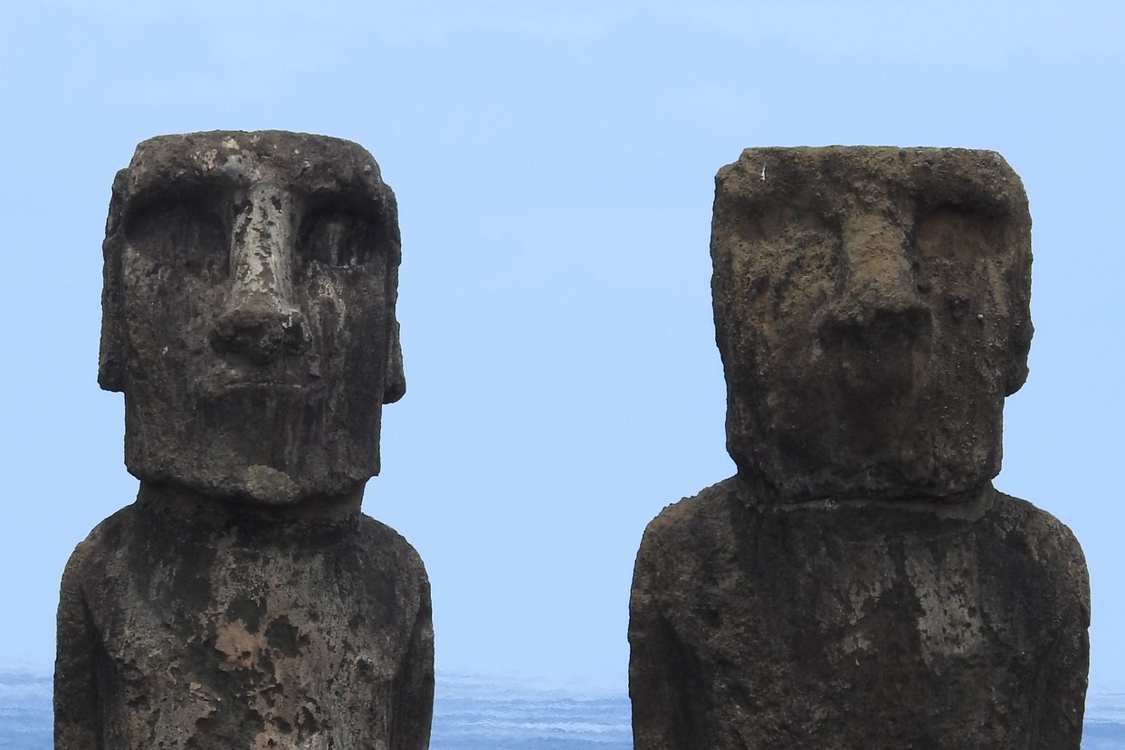
Moai are monolithic human figures carved by the Rapa Nui people in eastern Polynesia between the years 1250 and 1500. Nearly half are still at located at Rano Raraku, the main moai quarry, but hundreds were transported from there and set on stone platforms/altars called “ahu” around the island. Almost all moai have overly large heads three-eighths the size of the whole statue. The moai are chiefly the living faces of deified ancestors. The statues still gazed inland across their clan lands when Europeans first visited the island in 1722, but all of them had fallen by the latter part of the 19th century.
The production and transportation of the more the 887 statues are considered remarkable creative and physical feats. They range in height from 2-10 metres, the tallest of which weighed 82 tons. The heaviest moai erected was a shorter but squatter moai at Ahu Tongariki, weighing 86 tons. One unfinished sculpture, if completed, would have been approximately 21 m (69 ft) tall, with a weight of about 270 tons. All of the moai were toppled in the late 18th and early 19th centuries, possibly as a result of European contact or internecine tribal wars.

Though moai are whole-body statues, they are erroneously referred to as “Easter Island heads” in some popular literature. This is partly because of the disproportionate size of most moai heads, and partly because many of the iconic images for the island showing upright moai are the statues on the slopes of the quarry, many of which are buried to their shoulders. Some of the “heads” at Rano Raraku have been excavated and their bodies seen, and observed to have markings that had been protected from erosion by their burial.
All but 53 of the moai known to date were carved from tuff (a compressed volcanic ash) from Rano Raraku, where 394 moai in varying states of completion are still visible today. There are also 13 moai carved from basalt, 22 from trachyte and 17 from fragile red scoria. At the end of carving, the builders would rub the statue with pumice.
In 1979 it was discovered that the hemispherical or deep elliptical eye sockets were designed to hold coral eyes with either black obsidian or red scoria pupils. The discovery was made by collecting and reassembling broken fragments of white coral that were found at the various sites. Subsequently, previously uncategorized finds in the Easter Island museum were re-examined and recategorized as eye fragments. It is thought that the moai with carved eye sockets were probably allocated to the ahu and ceremonial sites, suggesting that a selective Rapa Nui hierarchy was attributed to the moai design until its demise with the advent of the Birdman religion.
Many archaeologists suggest that statues were symbols of authority and power, both religious and political. To the people who erected and used them, they were actual repositories of sacred spirit. Carved stone and wooden objects in ancient Polynesian religions, when properly fashioned and ritually prepared, were believed to be charged by a magical spiritual essence called “mana”. The moai statues face away from the ocean and towards the villages as if to watch over the people. The exception is the seven Ahu Akivi which face out to sea to help travelers find the island. There is a legend that says there were seven men who waited for their king to arrive
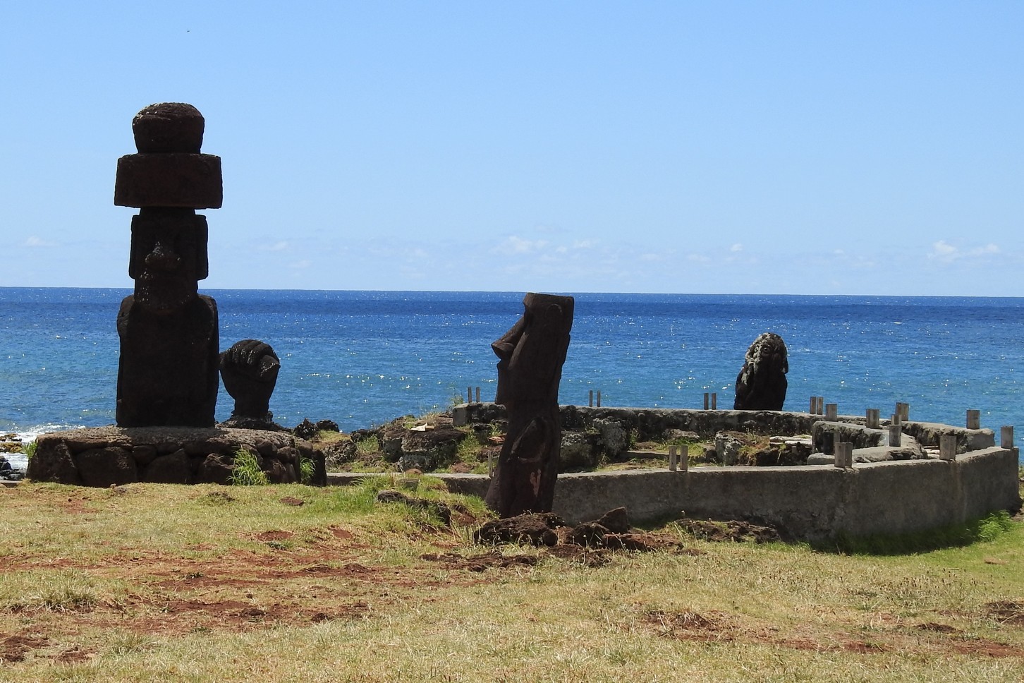
The more recent moai had “putkao” on their heads, which is believed to represent the topknot of the chieftains. According to local tradition, the mana was preserved in the hair. These pukao were carved out of red scoria, a very light rock from a quarry at Puna Pau. Red itself is considered a sacred color in Polynesia.
Since the island was largely treeless by the time the Europeans first visited, the movement of the statues was a mystery for a long time; pollen analysis has now established that the island was almost totally forested until 1200 A.D. The tree pollen disappeared from the record by 1650.
It is not known exactly how the moai were moved across the island. Earlier researchers assumed that the process almost certainly required human energy, ropes, and possibly wooden sledges (sleds) and/or rollers, as well as leveled tracks across the island (the Easter Island roads). Another theory suggests that the moai were placed on top of logs and were rolled to their destinations. If that theory is correct it would take 50-150 people to move the moai. The most recent study demonstrates from the evidence in the archaeological record that the statues were harnessed with ropes from two sides and made to “walk” by tilting them from side to side while pulling forward. They would also use a chant, whilst ‘walking’ the moai. Coordination and cohesion was essential, so they developed a chant in which the rhythm helped them pull at the precise moment necessary.
Oral histories recount how various people used divine power to command the statues to walk. The earliest accounts say a king named Tuu Ku Ihu moved them with the help of the god, Makemake, while later stories tell of a woman who lived alone on the mountain ordering them about at her will. Scholars currently support the theory that the main method was that the moai were “walked” upright (some assume by a rocking process), as laying it prone on a sledge (the method used by the Easter Islanders to move stone in the 1860s) would have required an estimated 1500 people to move the largest moai that had been successfully erected
Recent experimental recreations have proven that it is fully possible that the moai were literally walked from their quarries to their final positions by ingenious use of ropes. Teams of workers would have worked to rock the moai back and forth, creating the walking motion and holding the moai upright. If correct, it can be inferred that the fallen road moai were the result of the teams of balancers being unable to keep the statue upright, and it was presumably not possible to lift the statues again once knocked over. However, the debate continues,
At some point after 1722, all of the moai that had been erected on ahus were toppled with the last standing statues reported in 1838 and no upright statues by 1868, apart from the partially buried ones on the outer slopes of Rano Raraku.
Oral histories include one account of a clan pushing down a single moai in the night but others refer to the “earth shaking” and other indications that at least some of them fell down through earthquakes. Some of the moai toppled forward such that their faces were hidden and often fell in such a way that their necks broke; others fell off of the back of their platforms Today, about 50 moai have been re-erected on their ahus or at museums elsewhere,
Eleven or more moai have been removed from the island and transported to locations around the world, including six out of the thirteen moai that were carved from basalt.
The museum was okay with displays and many information boards with information on the “Birdman Culture” (more details follow), a female moai and a coral eye.


but the walk back along the ocean was quite spectacular with lots of Moai and rocky coastline.
 Upon returning the hotel, we met an American couple from Arkansas also staying there and then went for to our room to try and nap before finding some snacks and cold beer for the evening which we made an early night due to our early wake up today and the time difference. The sun sets around 9 PM! and rises around 7 am. So we’ll try and catch them both near some moai sites for some good pics during our week here.
Wednesday, we had breakfast at the hotel and then went for a walk/hike to the Orongo village site. Breakfast here consists of two white flat rolls, two slices each of both cheese and ham, tea/coffee, fresh juice, some type of fruit and a piece of some kind of coffee cake. The juice, fruit and cake varied each day.
Trail we took to Orongo:

The Village of Orongo was inhabited in the 18th/19th centuries. At this site remain 53 structures inhabited by these people. This culture venerated “Make-Make”. An important element of their culture was a brutal and dangerous annual competition held each winter (July/August) to pick “Tangata Manu” or “Birdman”.
Contestants, all men of importance on the island, were revealed in dreams by prophets (who might be either men or women). Each contestant would then appoint one or sometimes two hopu (other adult men of lesser status) who would actually swim to Motu Nui carrying provisions in a bundle of reeds called a pora under one arm and await the arrival of the sooty terns, hoping to return with the first egg, whilst their tribal sponsors, the contestants, waited at the village.

The race was very dangerous and many hopu were killed by sharks, by drowning, or by falling from cliff faces, though replacements were apparently easily available
Once the first egg was collected, the finder would go to the highest point on Motu Nui and call out to the shore of the main island, announcing his benefactor by that benefactor’s new name and telling him, “Go shave your head, you have got the egg!” The cry would be taken up by listeners at the shoreline who would pass it up the cliff side to the contestants waiting in the stone village. The unsuccessful hopu would then collectively swim back to the main island while the egg-finder would remain on Motu Nui and would fast alone until he swam back, which he would do with the egg secured inside a reed basket tied to his forehead. On his reaching land, he would then climb the steep, rocky cliff face and, if he did not fall, present the egg to his patron, who would have already shaved his head and painted it either white or red. This successful contestant (not the hopu) would then be declared tangata-manu, would take the egg in his hand and lead a procession down the slope of the volcano, Rano Kau. The new tangata-manuwas was entitled to gifts of food and other tributes (including his clan having sole rights to collect that season’s harvest of wild bird eggs and fledglings from Motu Nui), and went into seclusion for a year in a special ceremonial house. Once in residence there he was considered sacred for the next five months of his year-long status, and allowed his nails to grow and wore a headdress of human hair. He would spend his time eating and sleeping, and would be expected to engage in no other activity.

The Birdman cult was suppressed by Christian missionaries in the 1860s.


The walk out there was about 6.7 km / 4.3 mi, about a third of which was uphill but only to 500 m / 800’ but we were glad we went early as when you’re not in the shade of the trees, it gets quite warm (it’s about mid 20’s C here / high 70’s / low 80’s F). The first stop along the hike was the crater Rano Ka lookout:
 and then onto the village site where you not only can see the stone homes but the islands off the coast.

On our walk back, we met an American couple from Portland, OR. Nancy and Eric, who are touring a good portion of Chile and some of Argentina.
After leaving the actual trail we took a different route back to the hotel along the water and then enjoyed a good cleansing shower and rewarded ourselves with treats from one of the local bakeries. We ended up walking a total of 17 km / 11 mi that day. It was a chill afternoon before our rental car is delivered around 6 pm. For dinner we walked down the main drag to a pizza place; we ordered two pizzas but somehow the guy thought we wanted to share one as he never made Doug’s so we shared Fran’s and left. We got in the car and drove up the west side of the island hoping to make it to a cave that was supposed to have two openings and it was suggested to go at sunset but turns out the cave is within national park boundaries, so the access road is closed at six. We then drove back a bit to Tahai where “everyone” goes for sunset and were surprised it was not packed. After parking we found a spot on some rocks and but were somewhat disappointed with the sun’s show tonight. Oh well, we have a few more nights to try again.

We had asked at the hotel if they’d make us up a breakfast to go as we wanted to go out to the east side of the island to catch the sunrise at Ahu Tongariki
 and when we went to leave at 6:20 – it was ready with a thermos of hot water for tea, fruit and sandwiches. We piled our stuff into our little Suzuki Jimny and drove the 17km in the mostly dark to catch the sunrise at 7:15. There were a good number of vehicles parked there but not so many people it seemed and there was plenty of room for viewing.


Once the sun rose, we had our picnic breakfast in the car at the parking lot and waited for everyone else to leave before returning to the site and taking more photos with no one else around.


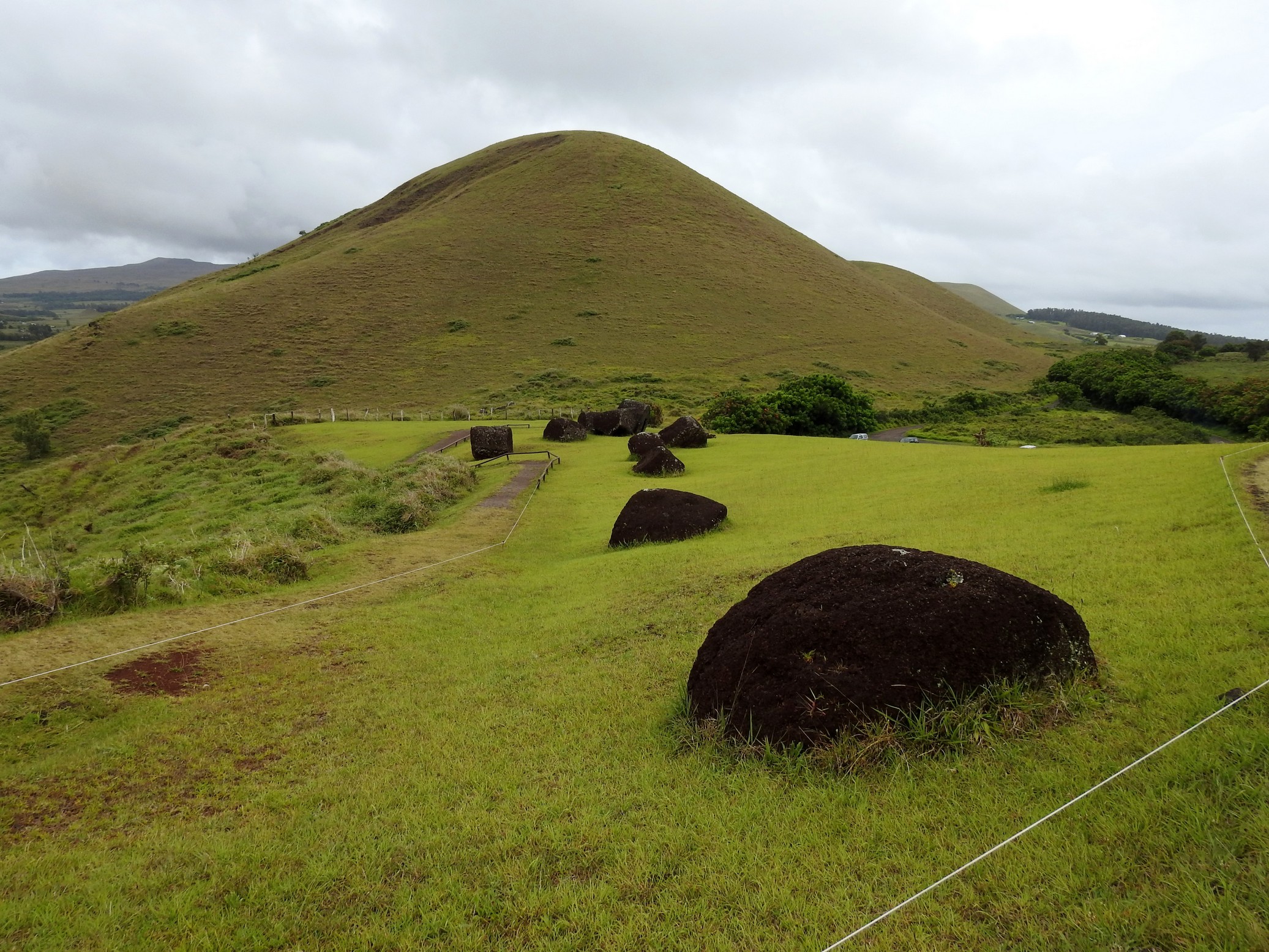
We then drove back west a bit to the entrance of the main moai quarry site: Rano Raraku. Even before arriving you can see the fallen moai on the hillside and the quarry site.

The park opened just after we arrived and while waiting we met an Italian couple, Rickard and Ilsa, who we chatted with on and off during our trek through the quarry.

First stop on the 1.5 km loop is into the crater where there are some moai and lots and lots of wild horses.
 Then you follow the trail through tens of moai, both standing and fallen, some intact, others not.

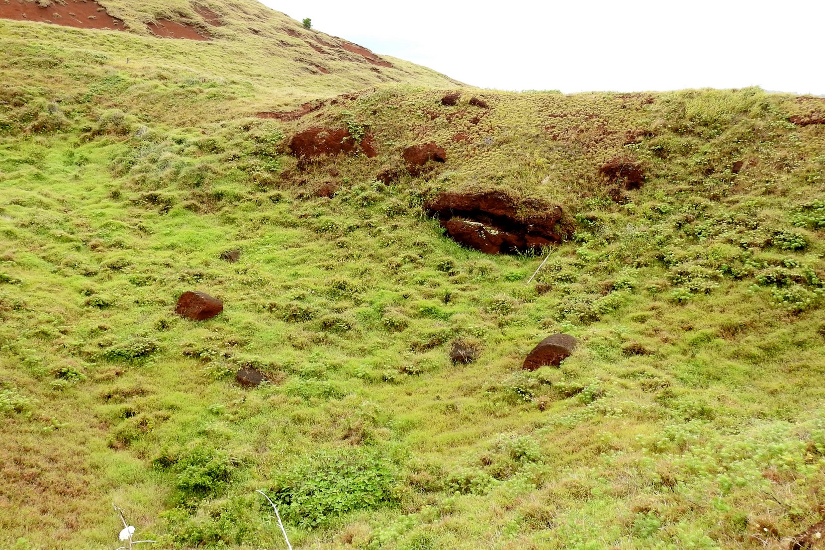
You can actually see where the large slabs were cut from, where some were unfinished like the largest one posted above that was never completed but would have stood 21m tall!
And many that had fallen over and lost their heads. This was by far our favourite site on Easter Island; the moai had not been reconstructed or resituated onto altars (ahu) and it felt quite special to walk amoung them.

Upon leaving the park we made our way slowly back to town stopping at various sites of mostly fallen moai


but some ancient sites with village remains:

Our final stop was at Vinapu where we can see why some archaeologists believe there may have been some South American influences here.
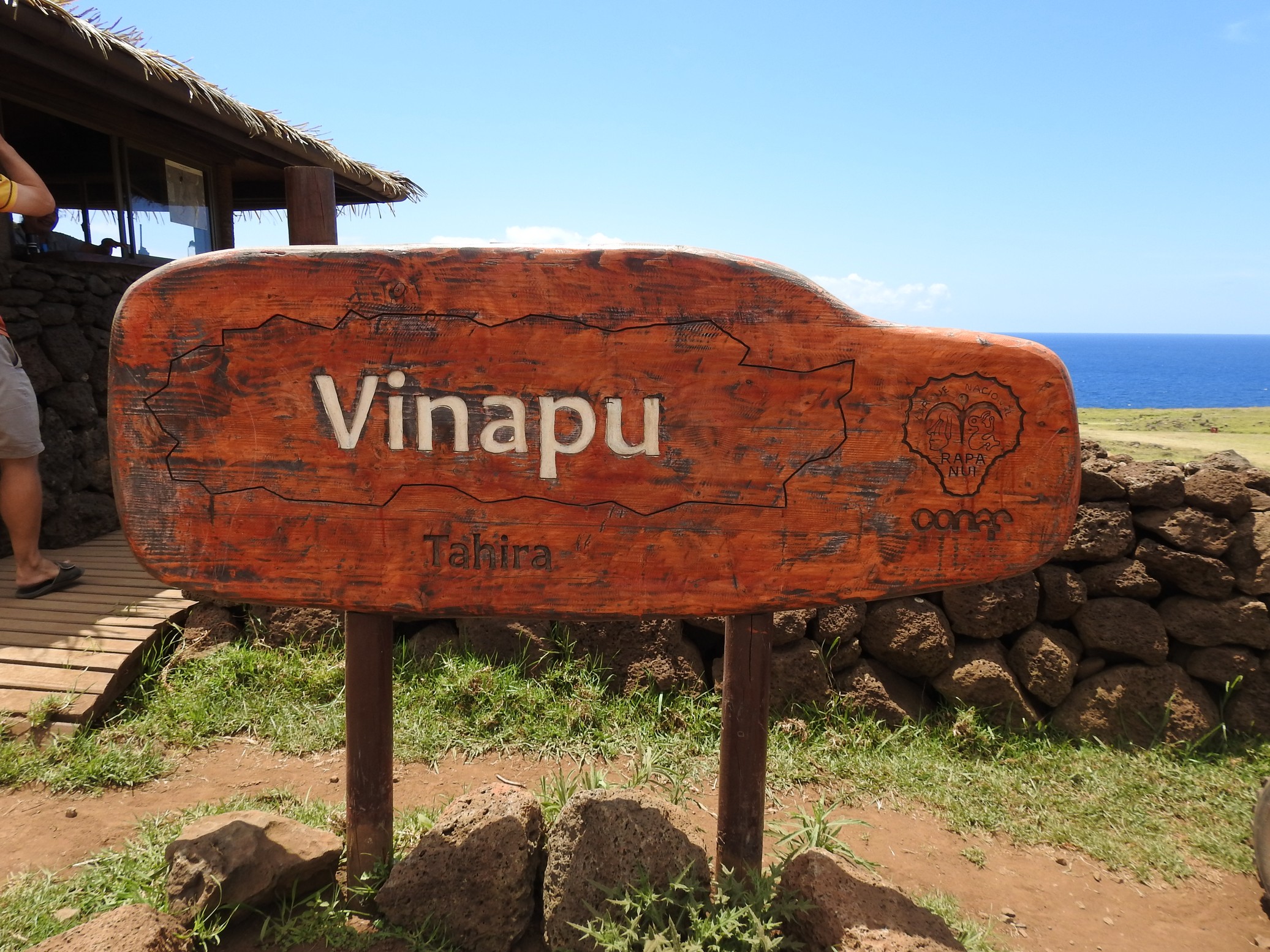
The site contains many large blocks of granite similar to Incan construction which you can see in Cusco Peru at the Sacsayhuaman site.

The whole day was pretty surreal and we had to reminding ourselves where we actually were!
We tried to go to the island’s jail where we understood prisoners made handicrafts but were unsuccessful; we entered the compound in our car, only to find that the building we thought it was in looked closed (in fairness, it was siesta time!) but when we went to leave, the gate was locked! A police officer saw us trying to open it but ignored us so Fran walked to the building he’d entered and he asked her what did we want and how did we get in; after explaining both he said the shop was closed and we should not have entered via this route (okay so why was the gate open then?); anyway, he then opened the gate and we left.
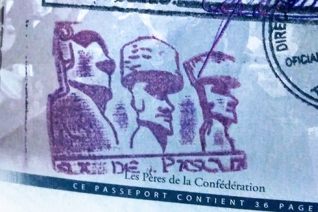
Next stop was the post office where we understand you can get a moai stamp in your passport but it too was closed for lunch so we returned to the hotel and showered before relaxing for the afternoon.
Friday morning we didn’t head out early as our plan was to hit the beach today and we didn’t want to go too early. Before getting into the car, we walked over to the post office and got our Easter Island stamp:
The sky was partly cloudy and it was still mid morning so we made our way to a few sites we wanted to see:
Hiro’s trumpet,

Petroglyphs,

and the navel of the world (a magnetic rock that apparently disrupts compasses but as it’s surrounded by a rock wall you cannot test it).

We arrived at AnaKena beach where there are five moai standing on an ahu and a lone one to its right; there is also the remains of a village on the hillside. This beach it is said, is where the first inhabitants arrived to Rapanui.

The sand here is a nearly perfect white; there are palm trees; the water is about three different shades of blue; light close to shore, turquoise a bit further out and midnight blue in the distance; almost the perfect beach!
 It’s not that large and it’s not common on this island made from volcanos; there is one other sandy beach nearby but the walk there is a little treacherous they say and you shouldn’t swim in the water there.

Now the water was a little colder than we’d like (especially Doug!) but we got in for a while until the clouds thickened and it was not so warm on the wet skin. We sat on the beach under a palm tree on the sand reading for a good while.
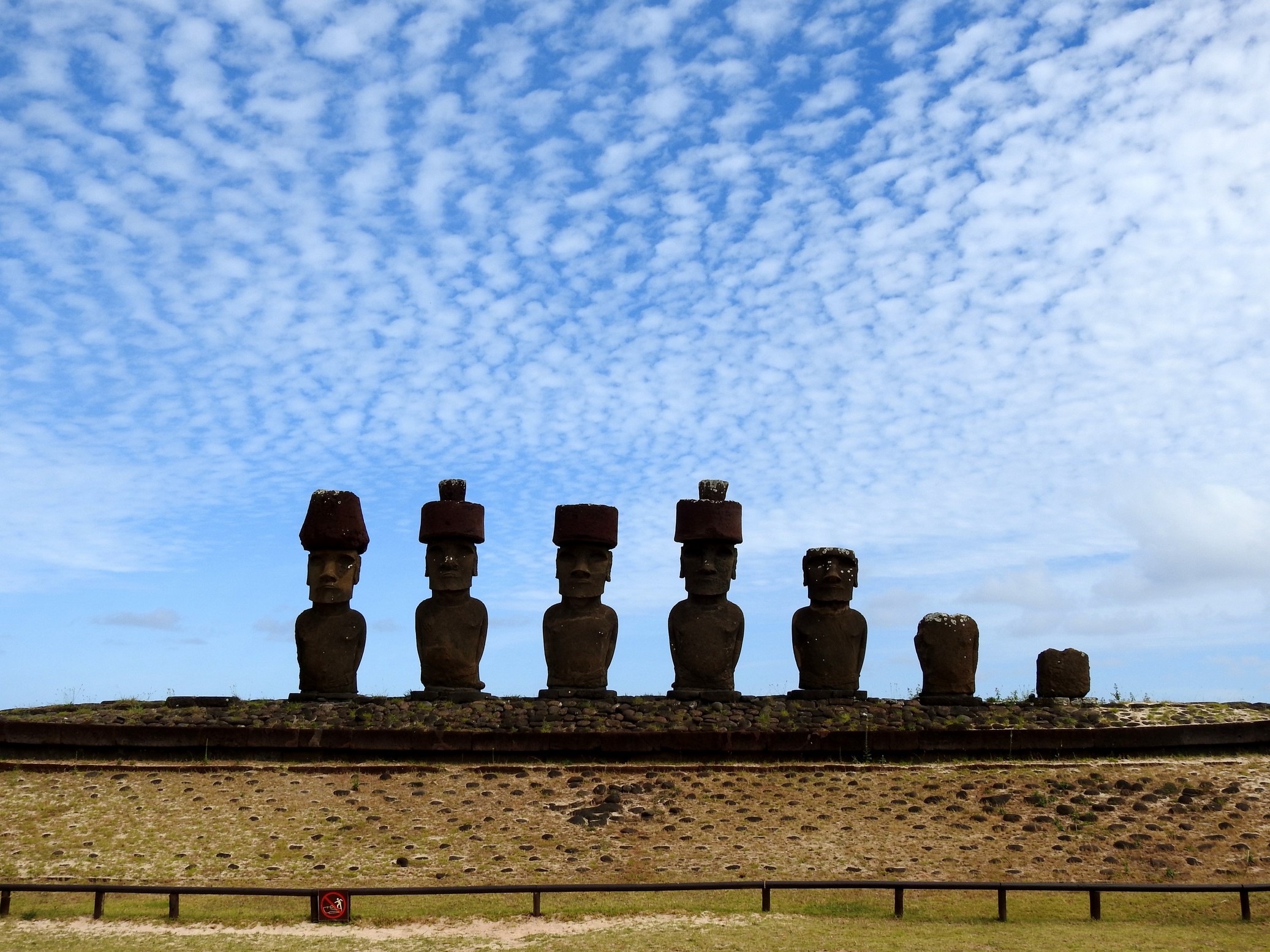
After about two hours of being on the beach, the darker clouds began to gather and the sprinkles came along with them. We decided we’d pack up and leave but enroute to the car wondered if we were being “pussies” as hardly anyone else was leaving. But we left anyway and were glad we did because as we began driving east down the road to where the weather looked better – and to get another look at the 15 moai – it began to rain. It stopped a little while later and it was dry at Tongariki. We did not enter the site but stopped outside by the rock wall fence to view them. There was a large crowd on the grounds (from four buses) but within 5-10 minutes they left and we got some nice shots with views of their faces.


We decided to head back towards town as the west side of the island looked like it was getting a downpour and then Doug suggested we try going back to Orongo hoping we could get a map/pamphlet explaining the numbered sites we’d seen on Wednesday. Turns out their maps are in the process of being made so they had none; we enjoyed the crater and city views again and returned to the hotel after stopping at a supermarket to get some food to make for dinner at the hostel.
We awoke Saturday to POURING rain that continued throughout the morning. We laid in for a while before breakfast and hoped it would lessen by midday.
When we heard a break in the rain, we packed our day packs and headed out. Everything is wet but surprisingly, there was no need for an ark 🙂
We had three spots we wanted to check out today, this our last day with wheels: a cave with two openings to views of the sea, a stand of 7 moai and another rock quarry – this one where they made the “top hats” for the moai.
We drove up the road to the cave only to be stopped again at the same gate as the other night and were told there had been too much rain and the cave was closed along with the road to it. So back towards town we went and then made our way to the Ahu a Kivi site where there are seven moai perched on their ahu – these are the only looking out to sea instead of inland.

We then moved on to the Puna Pau quarry where we saw 20 top hats in vary states, some with petroglyphs. At the top of the trail was a mirador overlooking the city of Hanga Roa.

Yes that’s a cruise ship out there and we did notice a lot more buses on the roads today so there must be a few excursions running from the ship.


Being a wet day, there seemed to actually be fewer people out of the roads. The roads here are in okay shape in general; some more potholed than others and the best road is the one that goes across the island from southwest to north.
It was now early afternoon and the sky was not so dark looking north so we thought we’d head back to the beach side and see about enjoying lunch on one of the picnic tables over there. Upon arriving it all looked too wet so we opted to drive to the south side via the 15 moai (as we called it) for one more look

And then to check out the view at the quarry once more – when you land on the Island, there is a booth where you buy your national park pass that gives you access to all the sites, most of which you can visit as often as you like except for three and this is one of them otherwise we would have visited again!

And have lunch on a rocky shore in the car because by that time it was sprinkling once again.

We returned to the hotel after gassing up the car and relaxed for the rest of the afternoon. The car rental company picked up the car before dinner and we still have two full days to enjoy the island on foot. By this time the rain was pretty much over and the sky began clearing slowly. We are still hoping one of these last three nights to see a good sunset…..
Sunday the weather did improve – no rain, mostly cloudy but comfortable. We went for walks in the morning taking a few last shots:


Fran checked out the church which is a mix of Catholic and Rapa Nui:


Doug found a cave along a dead end path:


And in the afternoon we walked down to a small area with palm trees and a swimming area on the coast and sat on the grass, had a picnic and enjoyed some reading time.

The evening was pretty cloudy so we didn’t try and catch the sun; we have one more chance….
Monday we awoke to pretty clear skies and after walks, felt we had a good chance at sunset tonight. There is a small French restaurant that comes highly recommended by some overlanding friends (thanks Julie & Marcus!) that faces the ocean on the west side of the island that Fran walked by today and made a reservation for this evening. They have tables on an upper level so we’re hopeful.
After finishing up our food items for lunch (in the hostel’s kitchen, we have access to cooking and eating items) we went out again to sit and read watching the ocean.

On our walk back to the hotel we met a young man on a bicycle who dropped his sixpack of beer; one had been pierced and he offered it to Doug to drink right away. We got to chatting and Rasmus, a Swede, who has been sailing from Sweden with his girlfriend, and has spent a month here at Easter Island enroute to Pit Cairn. Sounds like quite the adventure but too much for us!
That evening we treated ourselves to a lovely meal at Au bout de Monde which is owned by a Belgian and his Rapa Nui wife but the chef is Chilean.
 We had read that the chocolate mousse was to die for, so we decided we both wanted to partake of that but didn’t want to be too full for dessert. We shared an appie and then a main course before indulging – it lived up to its reputation – SO yummy!
From the second floor terrace of the restaurant we did watch the sunset over the ocean and although not spectacular, at least tonight there wasn’t a great deal of clouds on the horizon hiding it.

Tuesday morning, Juan, the hotel manager, took us to the airport after his mother, the breakfast cook, gave us necklaces made of shells as a parting gift.
Upon arrival at the airport we noticed a lot of locals dressed in traditional costumes; after the arrival of the plane, they proceeded to the tarmac where a ceremony was performed receiving a few people carrying items and a large wooden box (too short to be a coffin) was unloaded from the plane. A shaman appeared to bless the people and items. It was hard to see through the people and the performers were all facing the other way.

We met up with Nancy and Eric at the airport and shared stories about our week here. Maybe we will catch up one day in Portland!
We couldn’t resist getting a present for Tigger:

Easter Island is part of Chile so we couldn’t get a flag but felt the side trip warranted its own memorial on our rig.
Now we took LOTS Of photos, above are only a scant few so be sure to check our galleries.
Our flight left late but landed early – we contacted Victor and he and his wife picked us up and returned us to Tigger was safe and sound.
We spent Wednesday and Thursday, unpacking and repacking for our trip to Canada/US on Thursday. Victor and Eleanora could not drive us to the airport as this time with twice as much luggage as we are going to cold climates not warm so we Ubered.